ArcGIS Online’s summer update brings new app templates, improved 3D rendering, and new content in the Living Atlas. There are also administrative enhancements and new custom styling capabilities in the Map Viewer. Here are some key features I’m excited to tell you about.
New app templates and widgets
For many of you, capturing and viewing images and videos is a part of your everyday work. If you use attachments when collecting data in Collector for ArcGIS or Survey123 for ArcGIS, the new Attachment Viewer app template is for you. The configurable app can help you to easily review and download features with image and video attachments.
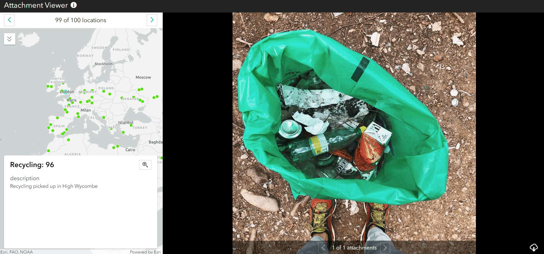
Attachment viewer, latest app template that allows you to review features with images and videos.
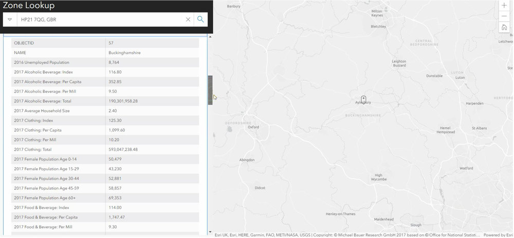
Lookup your area of interest to find relationships in your data.
A handful of Web AppBuilder widgets have been updated in this release. One I’m excited to share provides Business Analyst (BA) capabilities in another area of the ArcGIS Platform (not just within BA). You can now leverage some of the powerful BA tools as a widget in Web AppBuilder, to generate info-graphics and reports (using Esri demographic data which does cost some credits) of your area of interest.
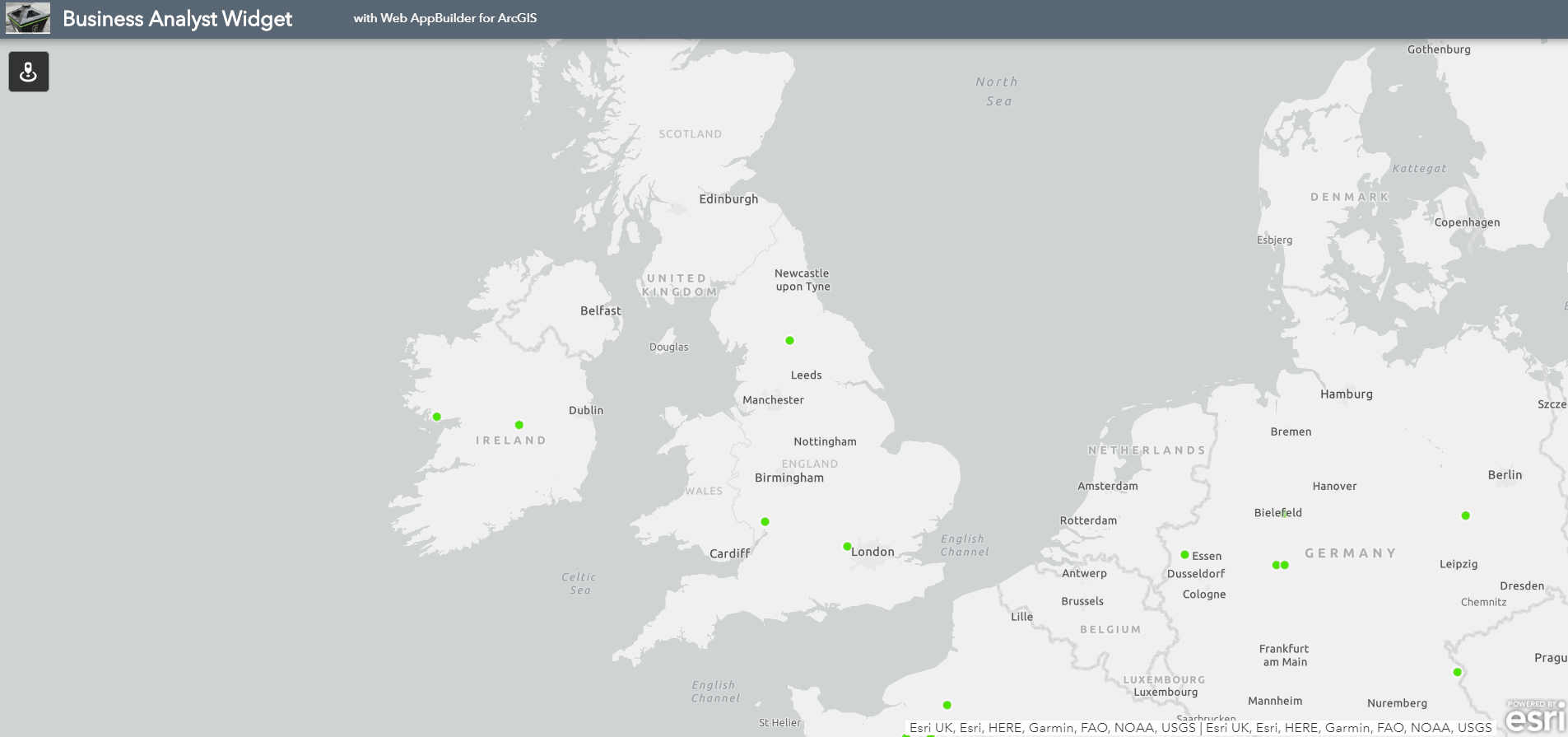
Business Analyst widget in Web AppBuilder - access new capabilities and Esri demographic data.
Integrated vector basemap styling
The ArcGIS Vector Tile Style Editor is a great way to have the freedom to customise your own basemap style and it has now been integrated into ArcGIS Online’s Map Viewer, so it’s even easier to make great maps. If you haven’t come across it yet, or want to know what the buzz about vector basemaps is, read our previous blog. You can now access the editor directly from a vector basemap in the Map Viewer table of contents.
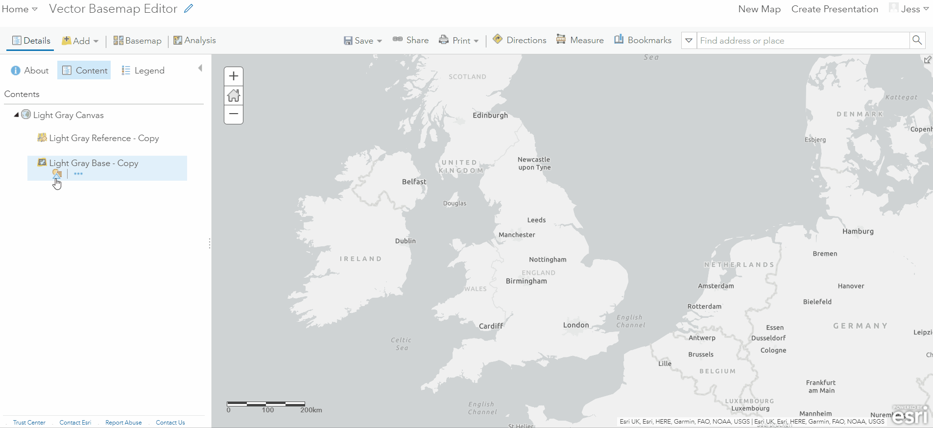
ArcGIS vector tile style editor now integrated within the map view.
Building up 3D
New Smart Mapping Styles have been added to web scenes, which allows you to style lines and polygons. You can now create 3D visualisations directly from 2D polygons, so you can extrude building footprints for example.
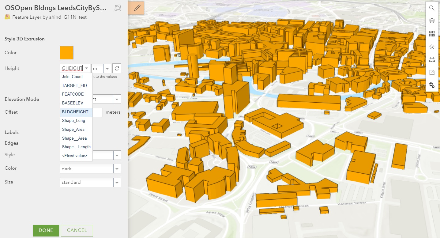
2D polygons extruded by a building height attribute to create a basic 3D urban model.
If you work with underground pipes, 3D has become a lot more interesting. For lines you can now choose a 3D profile - with tubes, strips, and squares - if you work with underground pipes 3D scenes have become a lot more interesting.
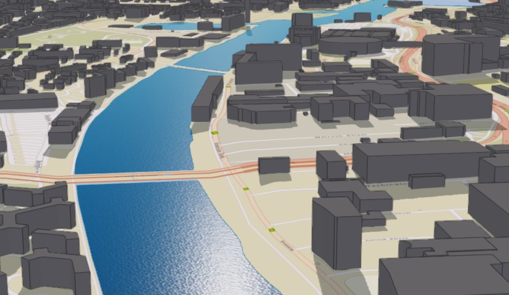
Realistic water rendering.
Ever needed better insight in your BIM models? Now in web scenes, you can interactively isolate each floor of the building to get a closer look with the new Building Explorer tool. You are required to publish your BIM models as a Building Scene Layer from ArcGIS Pro to ArcGIS Online.
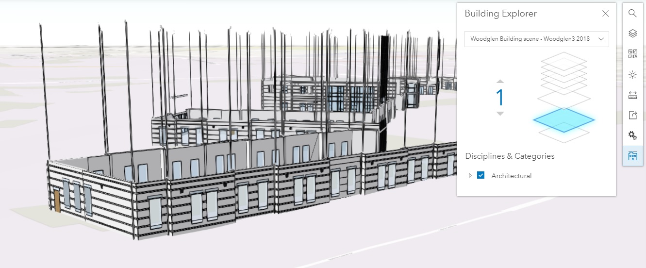
Isolate floors in your BIM models in web scenes.
Living Atlas Content
The Community Basemap Editor (introduced in beta at the last release) allows you to share to the Esri community and enhance the quality of Esri basemaps in your local area. This means you could update a local sport stadium, University, or even improve the detail of your place of work. So what are you waiting for? Find out more in last month’s blog and start leveraging our hosted basemap services today!
Better offline working
Do you work with areas of interest that are linear or diagonal and want to use them to define the area for your offline map? Well, now you can! Simply sketch a polygon to define the area of data included in the map to take offline. This provides you with more control of what you take offline and reduces the data footprint to download on your mobile or tablet. Note: your basemap must be an ArcGIS Online hosted tile layer to a title layer from an ArcGIS Enterprise 10.7.
More help for admins!
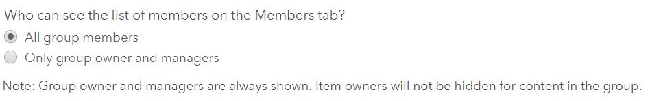
Hide group members.