Donna Lyndsay is undoubtedly one of the foremost visionary thinkers in the geospatial sector today. Currently Strategic Market Lead at Ordnance Survey, her role is to look ahead to the future and explore how the organisation can use its core data sets, its industry expertise and partnerships to solve some of the world’s most pressing challenges. In her career, she has straddled two worlds—cartography and space science—and it is this unique perspective that enables her to see new possibilities and put them into practice.
Bringing two worlds together
Lyndsay initially trained as a traditional cartographer in the days when map-making involved using sapphire scribe tips and scalpels. When she discovered geographic information system (GIS) technology, she embraced it with enthusiasm as it built on her experience of graphic design and appealed to her long-held love of geography. In the early 1990s, she began using GIS to map Exmoor National Park, becoming the organisation’s GIS manager. “Anyone who knows anything about cartography knows that it can be a laborious process,” she says. “When GIS came along, I grabbed it with both hands.”
She became interested in space when her young son decided he wanted to be an astronaut. His interest waned as he got older, but Lyndsay herself was hooked! She took a job as a Regional Ambassador for the European Space Agency, helping businesses to apply for innovation funding. The more she learned about space—and, in particular, about sensors on satellites—the more passionate she became about leveraging space science in her work.
It was clear to her that there was a huge amount of potential that could be realised by combining land-based data and space science in GIS to derive richer location intelligence. “It has long been a personal mission of mine to help bring the two worlds of GIS technology and satellite technology together,” she explains. “To really get the most value from satellite data you have to marry it up with a geographic context—and that’s what I’ve been trying to do for much of my career.”
In 2014, while working for one of Esri UK’s partner organisations, BlueSky, Lyndsay inspired a ground-breaking initiative in the field of air quality monitoring, working in partnership with the University of Leicester. She subsequently co-founded a new company, called EarthSense Systems, that uses geospatial data, including data from the Internet of Things, alongside space data to help people understand air quality in urban areas. “This is basically what I’ve tried to do for my whole career,” observes Lyndsay. “I keep on asking the question, how can we use all the information and devices that are available to us to really help inform our activities on the planet.”
Championing disruptive innovation
After broadening her experience in a variety of roles with several different companies, Lyndsay joined Ordnance Survey in 2020. Her initial remit was to look at disruptive innovation and identify projects that could add value for businesses, society and the planet by mobilising Ordnance Survey’s skills and data. In her current position with the organisation, she drives visionary ideas forwards and promotes thought leadership. In particular, she strives to develop proofs of concept that can be taken forward into commercial products that solve global challenges. Much of her work focuses on the environment and sustainability because, as she puts it, “challenges don’t get much bigger than this.”
There are several examples of projects in which she has combined her skills in space science and geospatial science to address environmental and sustainability issues. She has, for example, worked with the National Centre for Earth Observation and the European Space Agency to explore how local authorities can access thermal sensor data from space to understand urban heat. Her aspiration is for councils to be able to map potential heat hotspots and overlay geographic datasets about the locations of vulnerable people and susceptible building types on their GIS systems, to understand how to protect at-risk groups.
Another of Lyndsay’s innovation projects concerns the health of the world’s peatland environments, which are vital for storing carbon. Collaborative thinking from Ordnance Survey, Space4Climate, Assimila and Durham University has resulted in the creation of the Peatland Health Index which uses satellite sensors and Esri’s ArcGIS technology provide an accurate picture of peatland health. Lyndsay has used the ArcGIS StoryMaps app builder to create a highly informative presentation about this project called ‘Peatland Monitoring from Space.’
In a subsequent and equally valuable project, Lyndsay brought together teams from Ordnance Survey and the business and consulting firm CGI to investigate the role that Earth Observation can play in detecting sewage spills from space. Work on this particular initiative is ongoing, and Lyndsay has created another insightful presentation about it using ArcGIS StoryMaps. Called ‘Monitoring Sewerage from Space’, it sheds light on both the limitations and opportunities presented by using satellite imagery in ArcGIS to better monitor sewerage pollution in the UK.
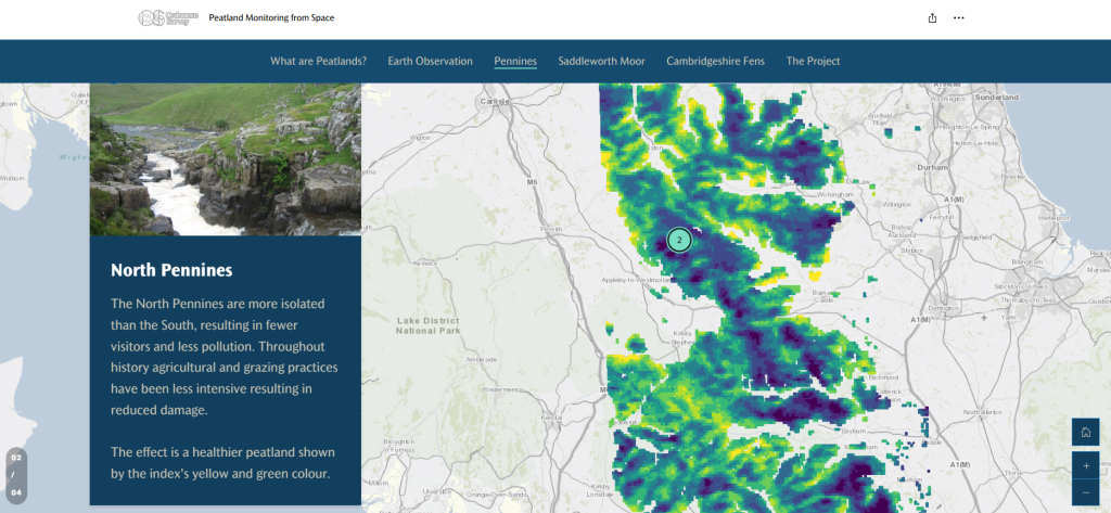 The ArcGIS StoryMap app builder, used to present the results of research into peatland health
Derisking supply chains
In what is perhaps her most ambitious project to date, Lyndsay is currently spearheading a global initiative to help organisations reduce risk in their supply chains. Through her work, she realised that many organisations, especially large multi-national corporations, are hampered by a lack of understanding of exactly where their raw materials and ingredients come from, where they are processed, manufactured and stored on route and which locations they are transported through. This ‘invisibility’ makes it hard for them to understand their exposure to supply chain risks, including climate-related threats such as the increasing prevalence of hurricanes. It is also near-impossible for them to confidently meet legislative requirements relating to deforestation and modern slavery, for example, or verify fair trading standards, as they simply don’t know where they are exposed.
Lyndsay brought together a global partnership of organisations, including Esri UK, with the aim of creating unique identification codes for supply chain locations on a global scale. Called the Supply Chain Data Partnership, this group initially examined the supply chains for palm oil, soy and wood-based packaging. This led to a solid proof of concept for a trusted location insights platform, built on ArcGIS technology. The solution accurately identifies the locations of sites (such as factories, processing plants and ports), verifies that data, creates a ‘golden pin’ on the map and generates a unique location code that the asset owners can then share with anyone who wants to work with them.
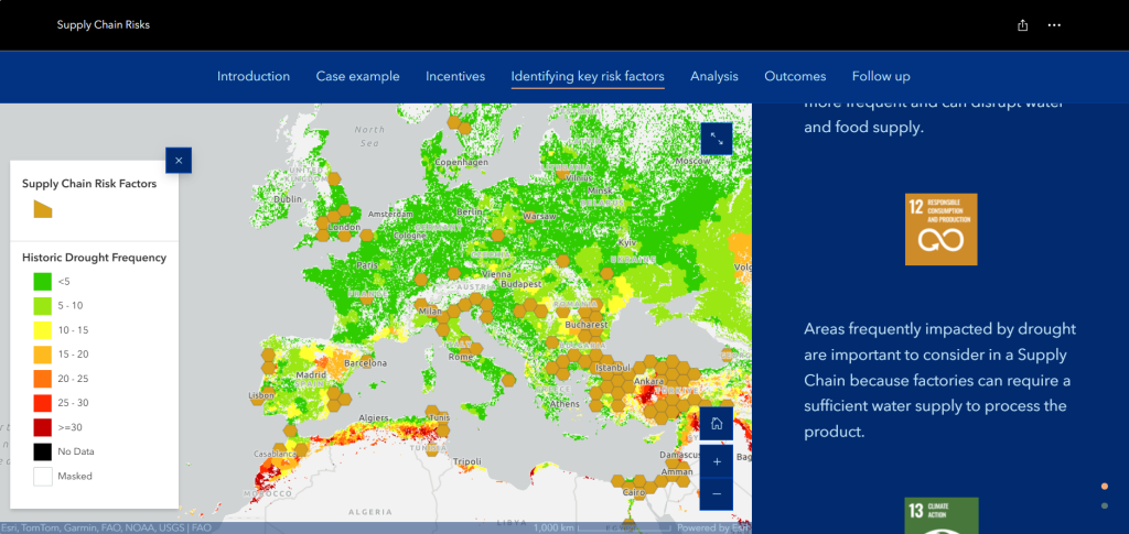 ArcGIS displays supply chain locations (golden pins) in the context of data on drought, enabling organisations to better understand their exposure to climate risks
Once fully operational, this ArcGIS-based supply chain location register will enable organisations with global supply chains to make better decisions when sourcing materials and ingredients and planning supply chain logistics. The will, for example, be able to conduct geospatial analysis to see if they have too many suppliers exposed to the same climate risks and select suppliers in different geographies to derisk their operations. They will also be better able to ensure their selected suppliers uphold their environmental and social standards.
Like Lyndsay’s other innovation projects, the Supply Chain Data Partnership combines space science and GIS. It also builds on advanced techniques in machine learning and mobile data collection to provide the authoritative and trusted supply chain data that has been missing until now. In the long term, Lyndsay hopes that the information that is being collated in ArcGIS will eventually be made available to consumers via QR codes on products, enabling people to make better informed choices about the products they buy in shops.
Working at the cutting edge
Lyndsay is well aware that she is working at the cutting edge of technology. “Even five years ago, the work that the Supply Chain Data Partnership is undertaking would have been really, really hard to do,” she muses. “Geospatial technology, combined with large language models, space data, artificial intelligence and machine learning, now gives us the tools to do things that would have been impossible not that long ago.”
Through Lyndsay’s influence, Ordnance Survey has been the successful incubator for the Supply Chain Data Partnership and for a raft of other innovative projects—and, undoubtedly, more will follow. Lyndsay is still brimming with ideas and will be continuing to work to turn her visionary thinking into practical solutions for the future. “We are living in interesting times,” she says. “We are on the cusp of seeing some quite groundbreaking innovations that will really drive the advancement of geospatial data solutions.”
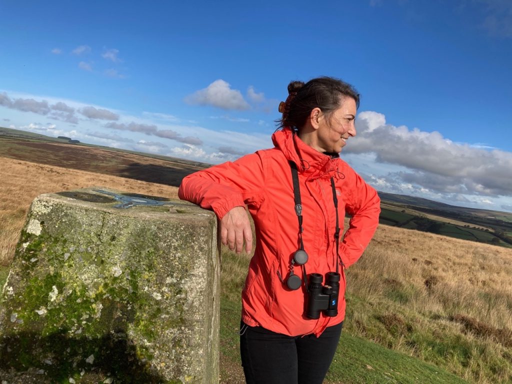
 Donna Lyndsay, Ordnance Survey GB