As night falls a quiet constellation emerges, not in the sky, but on the ground. Millions of street lights flicker to life, forming a glow that stretches from bright city centres to rural lanes. Thanks to the new street light data from the Ordnance Survey (OS) National Geographic Dataset (NGD), we can now map this artificial starlight for Great Britain with remarkable clarity. The dataset consists of over 6.5 million points, each representing a pole-mounted light designed to illuminate roads and paths.

Mapping the glow
Against the backdrop of a deep, dark basemap, the street lights reveal patterns of urban development. I used the Kernel Density tool in ArcGIS Pro, which estimates the density of point features, to visualise areas of concentrated street light illumination. Alongside this layer, I added data for motorways and A roads from OS Open Roads, as well as service and transport buildings from OS OpenMap Local Buildings, both available through the Living Atlas. Together, they reveal human activity after dark.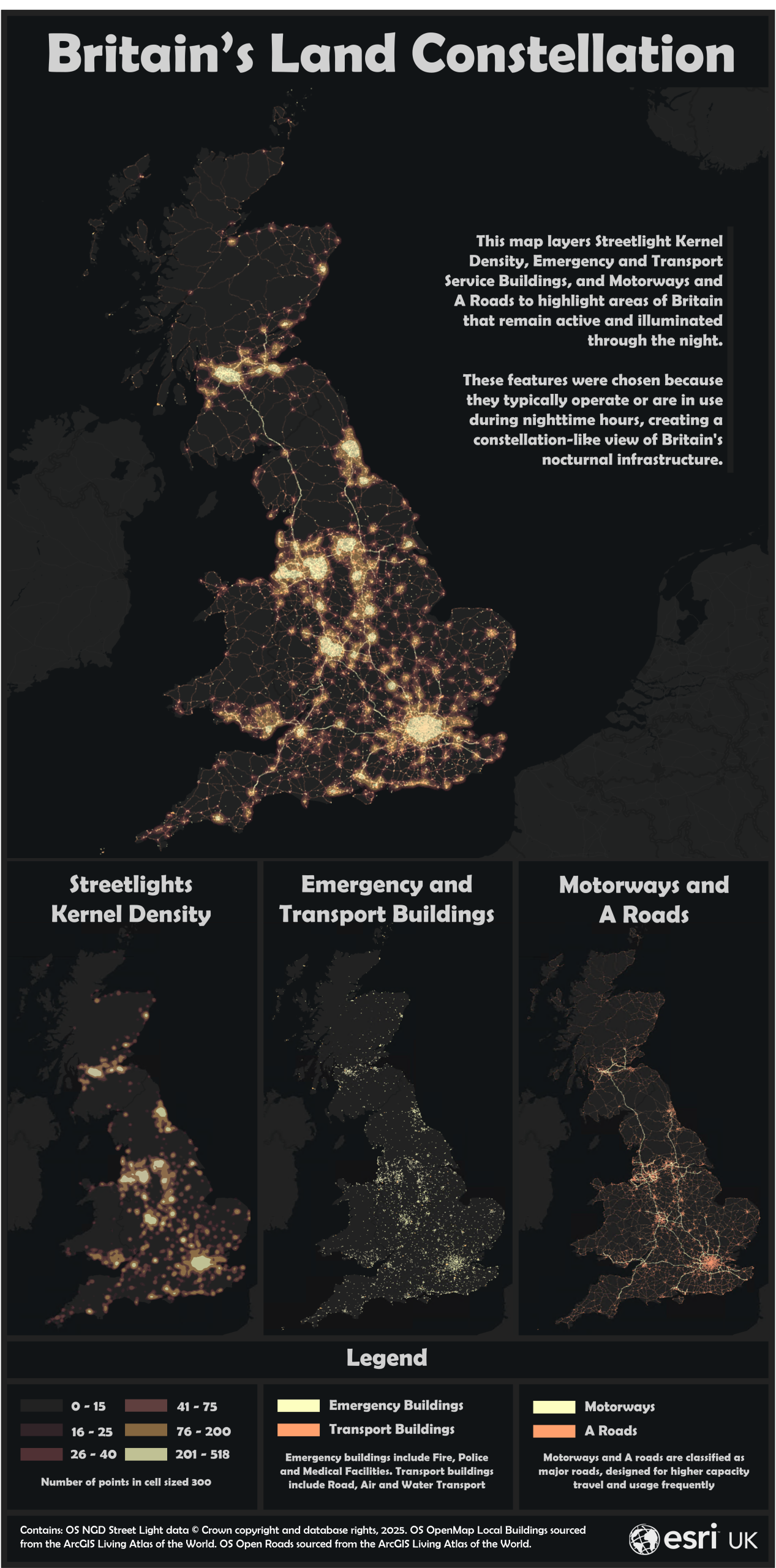
Urban brightness vs natural darkness
But just as this map shows us where light clusters, it also hints at where darkness remains. Areas with low or no street light density become potential windows to the night sky, where light pollution is minimal and the real stars might still be visible. Take Edinburgh and the Scottish Highlands, for instance.
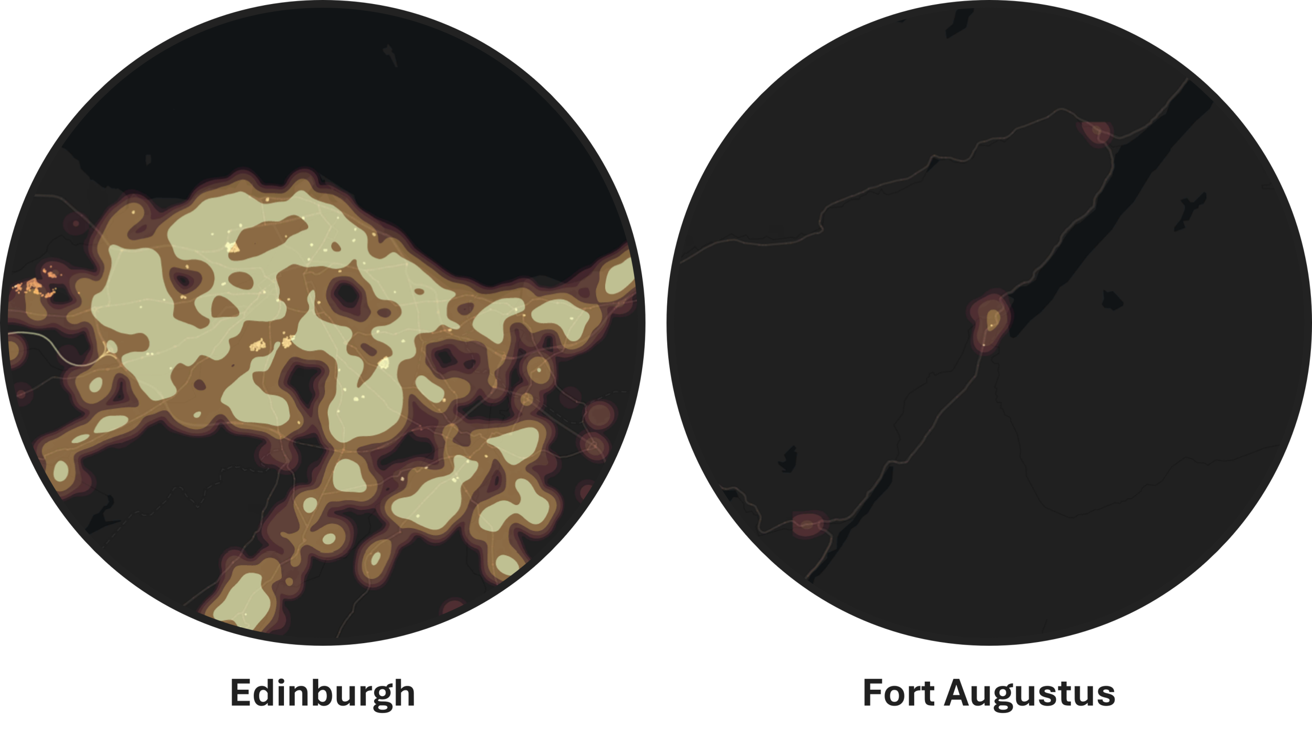
In Edinburgh, the kernel density of street lights is high, producing a bright, continuous glow across the city. By contrast, Fort Augustus has very low light density – perfect for stargazing and, if you’re fortunate, catching a glimpse of the aurora borealis dancing across the sky like I did last November.
Why this dataset matters
As John Kimmance, Chief Customer Officer at Ordnance Survey, puts it:
It is so important to provide well-lit routes for safe walking and cycling to ensure continued access to local amenities and vital services for citizens. The new street light dataset will be a great asset to local councils and service providers in understanding the existing provision of street lights and where there is a need for more to create safer communities.
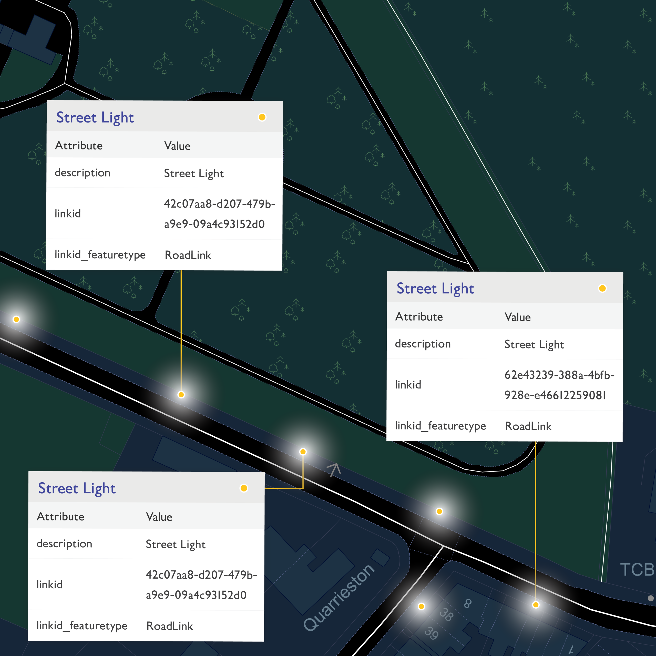
The OS NGD street light dataset provides a detailed view of street-level illumination across Great Britain. Each street light point comes with a globally unique identifier, a timestamp for when it was last updated, a descriptive label, a reference to the associated road or path, and the method used to capture it. Note: only street lights located along publicly accessible road or path links have been captured, while those situated on restricted access roads have been excluded.
Ordnance Survey: © Crown copyright and database rights. Ordnance Survey 2024.
These features were derived from aerial imagery, offering a consistent national view of lighting infrastructure. As with any dataset captured from above, there are limitations. Lights obscured by tree cover, urban shadows, or other overhead obstructions may not be visible and therefore are not included.
Public Sector Geospatial Agreement members can access this data directly from the OS DataHub. For others, please reach out to us for advice.
See Great Britain in a new light
Explore the OS NGD street light dataset and uncover the patterns of illumination that shape our nights. Whether you’re mapping infrastructure, studying light pollution, or simply searching for the stars, this data offers a perspective on the balance between brightness and darkness across Great Britain.