
Improving efficiency on major linear infrastructure projects
Balfour Beatty has used Esri technology to digitise the design and development workflows on some of the UK’s most ambitious power transmission projects, improving efficiency, accuracy and safety.
Integrated digital workflows have boosted efficiency, accuracy and safety
New system provided single source of truth for surveying, planning and engineering
Improved collaboration shortened design and engineering timescales
The Challenge
Balfour Beatty has adopted a new digital approach to the design and development phase of major linear infrastructure projects, using GIS (Geographic Information System) technology from Esri UK. Replacing paper-based and disconnected manual processes, integrated digital workflows have boosted efficiency, accuracy and safety on overhead power line construction projects in some of the most challenging terrain in Scotland.
“As one of the UK’s most ambitious power transmission and distribution schemes, the Skye Reinforcement Project demanded a robust core data environment to support more efficient ways of working and this is what the Esri system provided.”
Alan Mansfield, Project Director, Balfour Beatty
The Solution
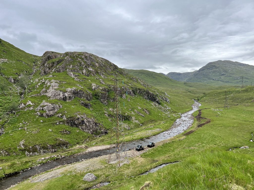
The Esri technology was deployed for the design and development phase between May 2024 and March 2026 on the Skye Reinforcement Project, a 137km overhead power line and 15km of underground cable, linking the Isle of Skye and the Western Isles to mainland Scotland.
Delivered for SSEN (Scottish and Southern Electricity Networks) Transmission, the scheme connects renewable energy from offshore wind farms and secures a reliable electricity supply for thousands of homes and businesses, supporting the UK and Scottish governments’ transition to Net Zero.
Providing a single source of truth for surveying, planning and engineering, the Esri geospatial system created web maps and dashboards that visualised and shared site intelligence across multiple teams, including Operations, Design & Engineering, Safety and Environment & Sustainability. The improved collaboration shortened the design and engineering timescales required for overhead line design, including 437 towers, civil design and temporary works.
Benefits
Streamlined design and development
Aaron Mclean, Construction Manager, Balfour Beatty explained: “The Esri geospatial system acts as a central mission control and single digital thread, for surveys through to construction. From collecting data in the field to developing the technical solutions, the time saved has been significant and the data was more accurate, helping to overcome major areas of engineering complexity to safely deliver the civils, overhead line and underground cabling. The system is rapidly becoming the new standard for how we streamline the design and development of major linear infrastructure projects.”
Improved accuracy
Designed to improve both the accuracy and speed of mobile data collection along the route, the Esri system captured information on watercourses, access points, geology and any environmental constraints. Around 80% of the route has no phone signal due to the remote and mountainous landscape. Survey teams walked the route using an Esri data collection application offline and automatically updated the system when a connection became available.
Accelerating design decisions
The approach enabled Balfour Beatty’s engineers in Glasgow, Derby and Bangalore to access verified, geo-tagged data from surveys the next day – reducing repeat site visits, accelerating design decisions and eliminating manual admin previously needed to transcribe notes, upload data and mark-up maps.
Increased efficiency
Alan Mansfield, Project Director, Balfour Beatty, said: “Balfour Beatty first built the overhead power line in 1978 and is now creating a modern, resilient solution aligned with the UK’s net zero and renewable ambitions. As one of the UK’s most ambitious power transmission and distribution schemes, the Skye Reinforcement Project demanded a robust core data environment to support more efficient ways of working and this is what the Esri system provided.”
Setting new standards
Craig Evenden, Head of Architecture, Engineering, Construction & Transport at Esri UK, commented: “By creating a single, shared view of the project that everyone from surveyors to engineers trusts, Balfour Beatty set a new standard for efficiency, safety and environmental responsibility on critical linear infrastructure. Esri UK is proud to partner with the Balfour Beatty team on such a challenging project that helps to achieve the country's clean power mission.”
The new digital approach has also been implemented on other Balfour Beatty transmission projects, including the East Coast 400kV Upgrade, which involves upgrading overhead lines and substations from Aberdeenshire to Fife, and the Beauly to Blackhillock to New Deer to Peterhead (BBNP) project, a new 400kV overhead line scheme within the Ofgem Accelerated Strategic Transmission Investment (ASTI) framework.
About Balfour Beatty Skye Reinforcement Project
Balfour Beatty was awarded a contract for the detailed design and development phase of a new 137km, 132kV double circuit overhead line and 15km of underground cabling between the existing Fort Augustus and Edinbane substations.
More information on the project can be found here