Everyone’s favourite fantasy drama returns to our screens for its highly anticipated final season. Game of Thrones has enthralled audiences over the past 8 years with its unpredictable plot and outstanding performances. Not to mention its breath-taking scenery…which got us wondering, where are those scenes shot?
To celebrate the final season, we wanted to create a Game of Thrones style and put those filming locations on the map!
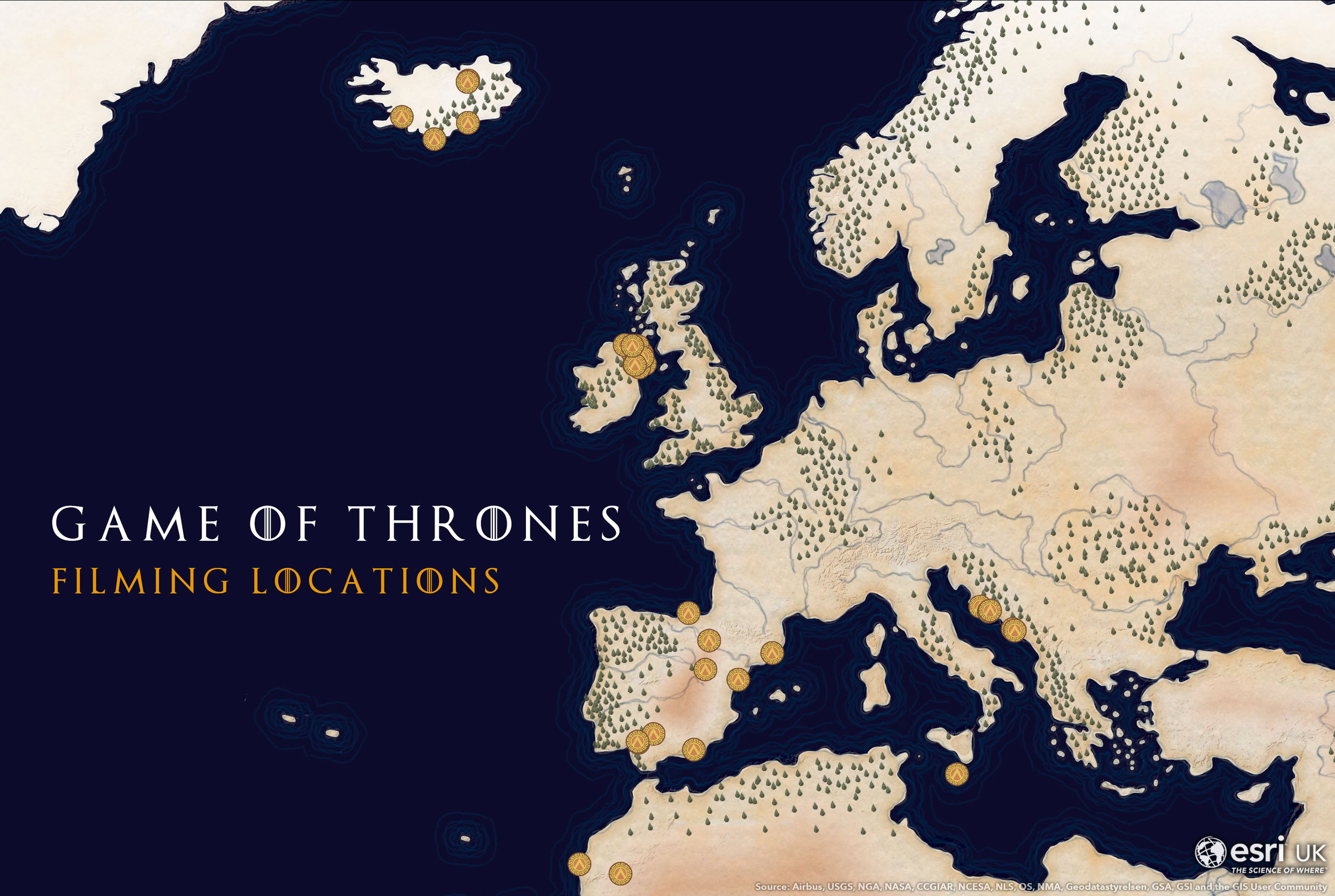
Inspired by John Nelson’s tattered map sandwich style.
We’ve taken a few of our favourite filming locations shown on the map, and accompanied them with some stunning imagery taken directly from our World Imagery Service. Be warned, there are a few major spoilers ahead!
1. Castle Ward, County Down, Northern Ireland
This 1,000-acre site is the main filming location for Winterfell, home of House Stark. The 18th century National Trust property is the backdrop for much of the first season, and its grounds were also used for several army camp scenes.
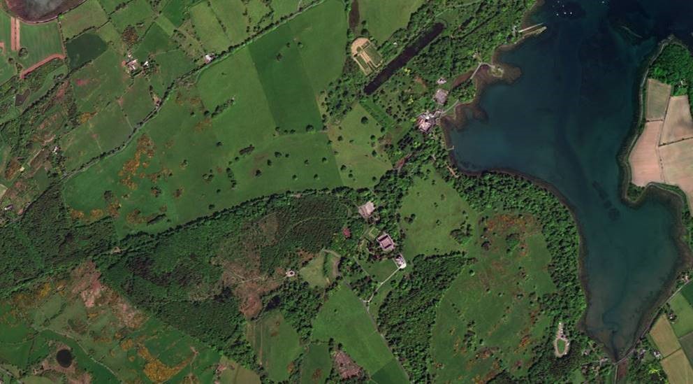
Imagery Credits: Esri, DigitalGlobe, Earthstar Geographics, CNES/Airbus DS, GeoEye, USDA FSA, USGS, Aerogrid, IGN, IGP, and the GIS User Community.
2. Thingvellir National Park, Iceland
A popular tourist destination in Iceland, Thingvellir national park is a culturally and geologically interesting visitor attraction. In the TV series, its rugged cliffs stand in as the pass to the Eyrie, seat of House Arryn. In season 4, a bloody battle between The Hound and Brienne of Tarth takes place here.
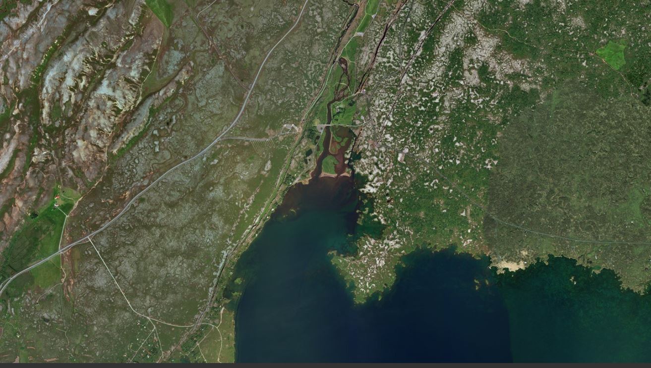
Imagery Credits: Esri, DigitalGlobe, Earthstar Geographics, CNES/Airbus DS, GeoEye, USDA FSA, USGS, Aerogrid, IGN, IGP, and the GIS User Community.
3. Svínafellsjökull, Iceland
Several Icelandic sites are used to represent the harsh lands north of the Wall, where wildlings and white walkers roam. The dramatic black rock and white glaciers found at Svínafellsjökull and other glaciers in Vatnajökull National Park were the site of the Fist of the First Men, where Samwell Tarly finds his obsidian dagger in Season 2.
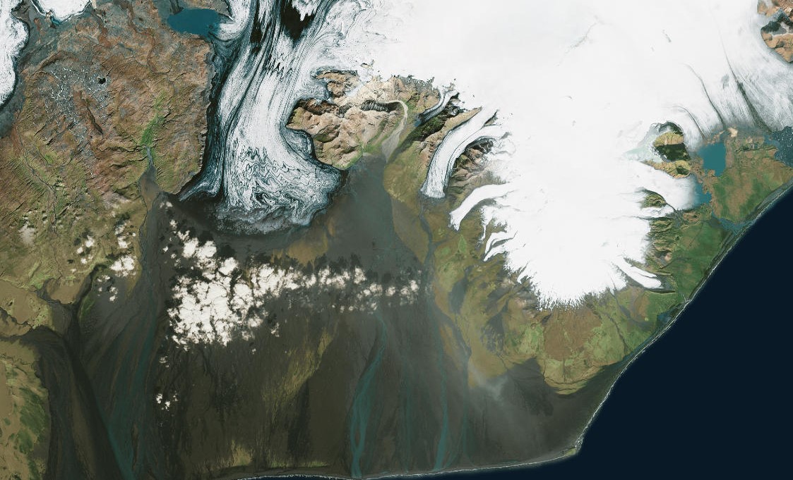
Imagery Credits: Esri, DigitalGlobe, Earthstar Geographics, CNES/Airbus DS, GeoEye, USDA FSA, USGS, Aerogrid, IGN, IGP, and the GIS User Community.
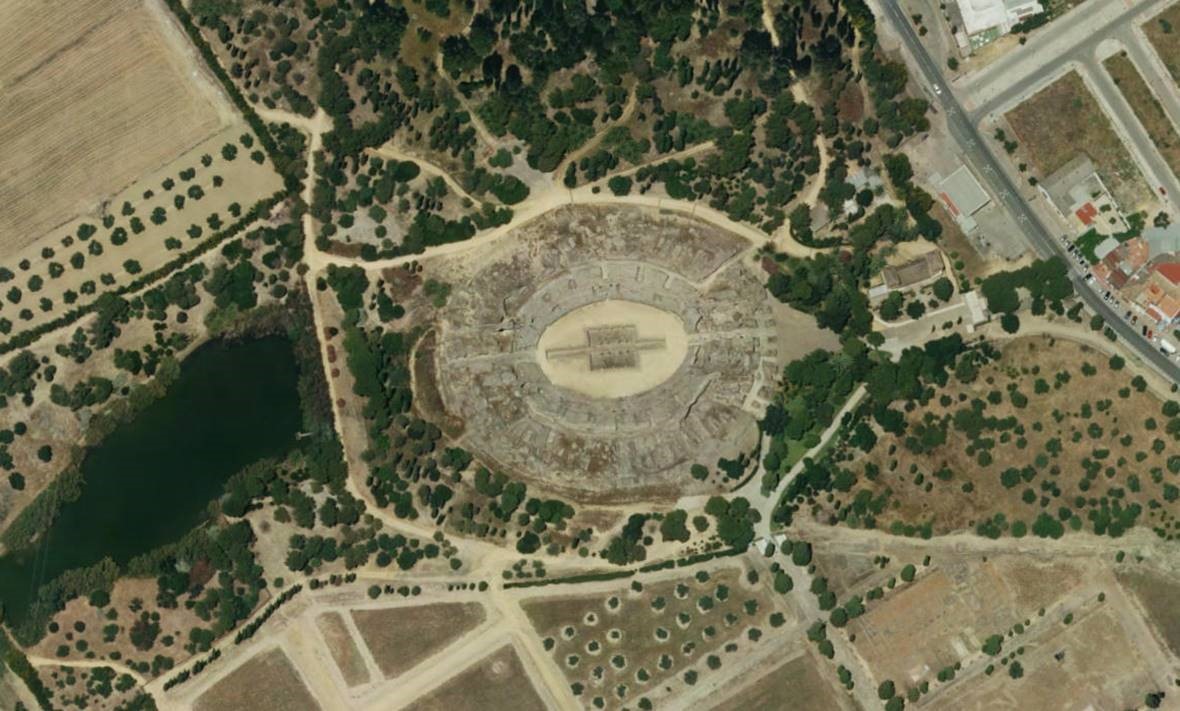
4. The Ruins of Italica, Seville, Spain
This ruined Roman amphitheatre represents Dragonpit, where House Targaryen kept their dragons in King’s Landing. It can be seen in the gripping finale of Season 7, where the Parley is held to discuss the future of the Seven Kingdoms after Daenerys’ invasion.
Imagery Credits: Esri, DigitalGlobe, Earthstar Geographics, CNES/Airbus DS, GeoEye, USDA FSA, USGS, Aerogrid, IGN, IGP, and the GIS User Community.
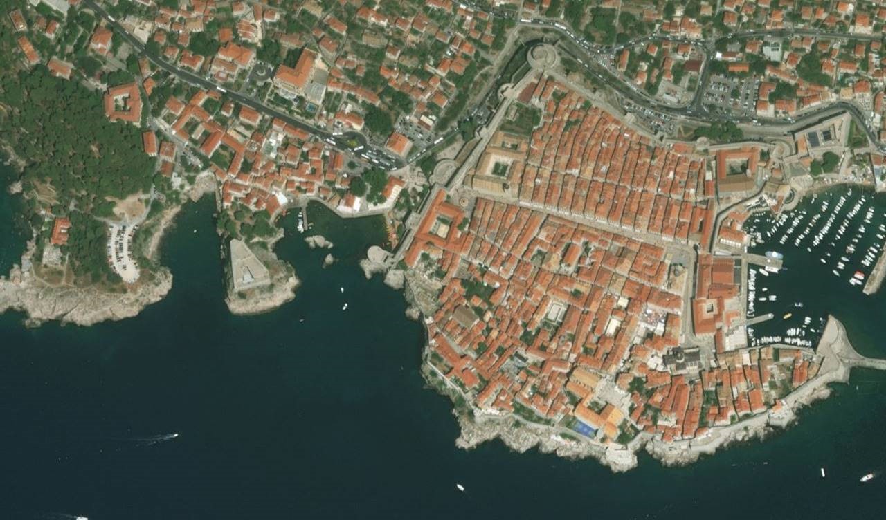
5. City Walls and Gradac Park, Dubrovnik, Croatia
The stunning medieval walls of the city of Dubrovnik are now almost synonymous with King’s Landing, the capital of the Seven Kingdoms. A UNESCO World Heritage site, the walls and iconic red-roofed houses are seen in numerous exterior shots of the city.
The Gradac Park looks over the Old City of Dubrovnik, this is the site of the infamous purple wedding scene where Joffrey meets his end in Season 4.
Imagery Credits: Esri, DigitalGlobe, Earthstar Geographics, CNES/Airbus DS, GeoEye, USDA FSA, USGS, Aerogrid, IGN, IGP, and the GIS User Community.
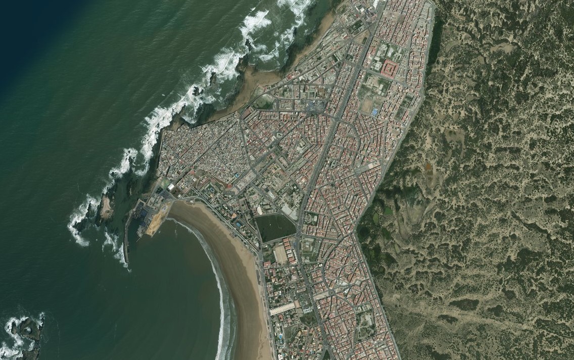
6. Essaouria, Morocco
A port city on Morocco’s Atlantic coast, Essaouria is a filming location for Astapor, where Daenerys first meets her army of the Unsullied.
Imagery Credits: Esri, DigitalGlobe, Earthstar Geographics, CNES/Airbus DS, GeoEye, USDA FSA, USGS, Aerogrid, IGN, IGP, and the GIS User Community.
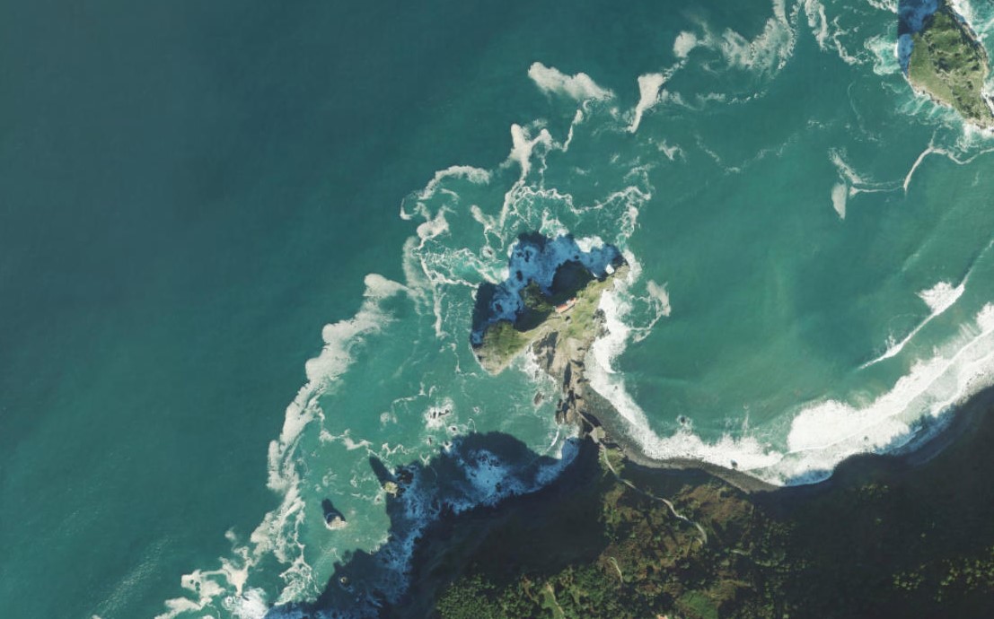
7. San Juan de Gaztelugatxe, Biscay, Spain
From Season 6 onwards, many impressive Spanish castles are used to represent the various ancestral seats in Game of Thrones. The 10th century chapel of San Juan de Gaztelugatxe is used as an outdoor filming location for the imposing Dragonstone Castle. Much of the castle is filled in with CGI in post-production, but the stunning footbridge to the island can be seen clearly when Jon Snow and Daenerys walk along it in Season 7.
Imagery Credits: Esri, DigitalGlobe, Earthstar Geographics, CNES/Airbus DS, GeoEye, USDA FSA, USGS, Aerogrid, IGN, IGP, and the GIS User Community.
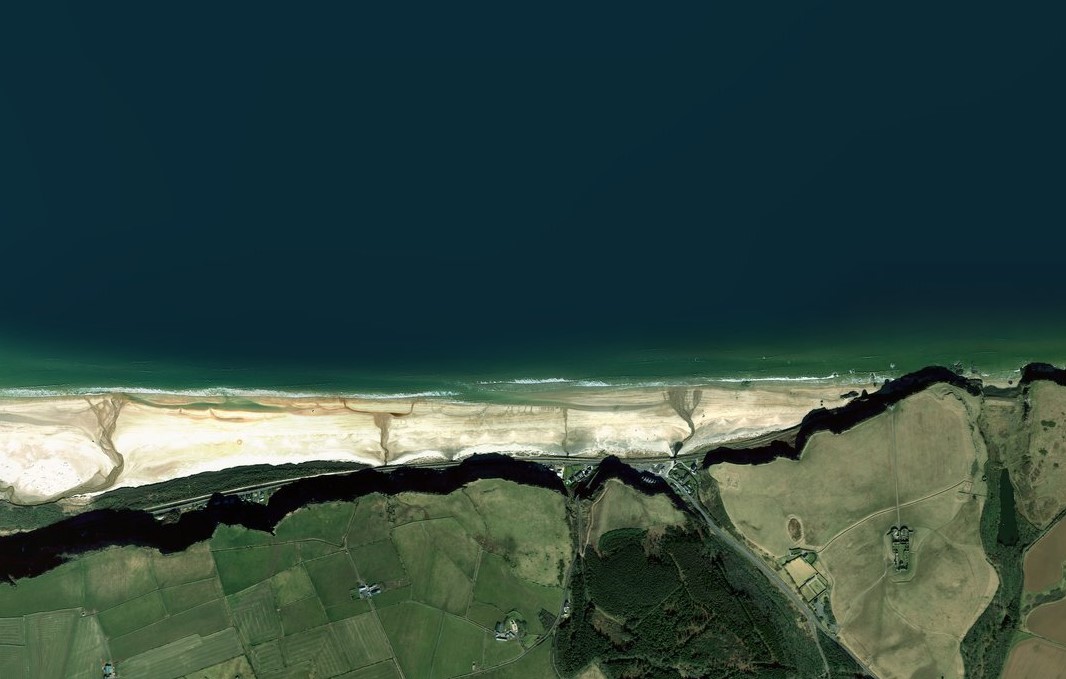
8. Downhill Strand, County Londonderry, Northern Ireland
This 11km stretch of sandy beach is used as the coastline at Dragonstone, seat of House Targaryen, where the Seven Idols of Westeros are burnt by Melisandre and Stannis Baratheon as an offering to the Lord of Light during Season 2.
Imagery Credits: Esri, DigitalGlobe, Earthstar Geographics, CNES/Airbus DS, GeoEye, USDA FSA, USGS, Aerogrid, IGN, IGP, and the GIS User Community.
Why not explore our World Imagery to spot the other filming locations? Or have a go at creating your own map with a free trial?
Who will take the iron throne…?