Since August 2011, Esri UK launched it’s online offering, driven partly by the release of the OpenData stack from The Ordnance Survey in the same year. Based on ArcGIS Server 10.0 and running on Amazon Web Services, the Esri UK Online Services offering a complimentary stack of UK-specific data and services alongside ArcGIS Online.
We have a number of free map services available to maintenance paying customers, though you need to register for an account.
Now, I think it’s best if I talked you through the process of registering, connecting and using these cool services.
Registration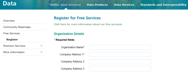 Registration is easy
The above steps will create an account and this identifies the organisation using the service(s) – multiple accounts can then be registered against this account providing unique email addresses are used. This way it provides the maximum amount of flexibility: you can use one shared account for all users or one account per user in your organisation. We want to keep it flexible.
Registered accounts will have their usage tracked under our fair usage policy. The fair usage is determined on the organisational level.
I am registered, show me the data!
Once registered, an email will be sent with a unique user-id and password. Keep this safe! This user id can be used to access the data either via ArcGIS for Desktop or through any of the APIs, example Rest API below:
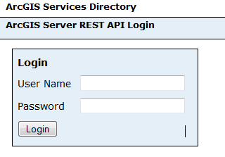 Accessing the data via the REST API Or you can add the details in the connection details for ArcGIS for Desktop:
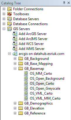 Adding in the Esri UK Free Map Services into ArcCatalog
Either way, you will get a list of map services sorted out into folders. Based on your subscription, the list of map services will be specific to your account. The maps themselves have been designed to be as cartographically pleasing as possible when viewed as a background layer. We chose to have muted and pastel shades in order to allow clients to be able to put their own data on top. So toning down the colours so it would not over-power someone’s map was an important requirement.
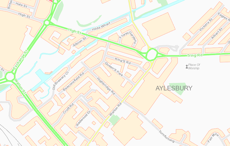
Here’s an example of one of the map services (‘open_carto’) – this is designed using the opendata stack of vector datasets and emphasis has been placed on pleasing cartography, hence the ‘carto’ in the name. Can be used standalone if required but combines well with point data and shaded polygons. It is delivered as 8-bit PNG file format for speed and compatibility. The print quality from this service at the right scales is also quite good – but get a good printer too!
 Open Carto – a map service with emphasis on cartography No prizes for guessing what the next map service: ‘open_greyscale’ delivers! There was a need for a layer that was very unobtrusive but still retained clarity. We also made the decision to remove all annotation to aid in the clarification. The result is a clean map layer perfect for client’s to add a lot of their own detail, either as polygons, points and lines.
 Open Greyscale – a map service with emphasis on clarity
We have all the raster and vector datasets available under the OS OpenData programme. There are other map services and we will be adding more over the next six months, so if anyone has any suggestions, drop Esri UK a line.