Following the launch of LocalView Fusion 4.0 in the summer, I was itching to try out the new integration options between LocalView Fusion (LVF) and ArcGIS Online (AGOL). I decided to focus on a service that many councils provide on their website, that of enabling the public to report abandoned vehicles online. Up until now, it’s not been that easy for non-developers to set up a complete workflow such that any reported problems are immediately visible to the public or available for operations staff in the field to deal with. Here I want to show you this is no longer the case!
I wanted to do this without using a local install of ArcGIS for Server, so apart from my copy of ArcGIS for Desktop 10.1, everything was done online using an AGOL subscription account and our LVF 4.0 demo portal running on Amazon.
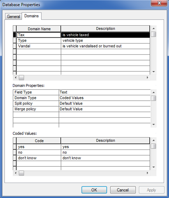
I started off by creating a new feature class for my abandoned vehicles in ArcMap. When adding fields, I made sure they matched the fields that I was using to capture details in the abandoned vehicle survey I had already set up in LVF. It’s definitely worth spending some time defining attribute domains for the fields.
As you can see below, I defined three domains in the geodatabase and specified that my fields in the abandoned vehicles feature class would adhere to them. Having a finite list of possible values for the vehicle type (car, 4×4 etc.) and yes/no/don’t know pick-lists for whether the vehicle is taxed or vandalised can make editing a lot simpler; particularly if this data is being used on a handheld device by a warden out around town in the wind and rain with thick gloves on! Using domains also removes the chance of typos or invalid values being entered.
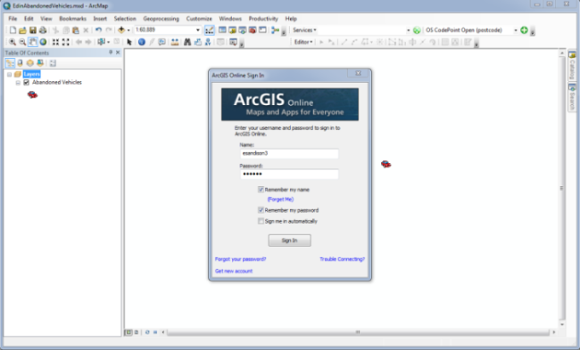
Next, I signed into my AGOL account from within ArcMap, as shown below, and published my map as a feature service. I enabled all the editing options so I’d have full access to the data.
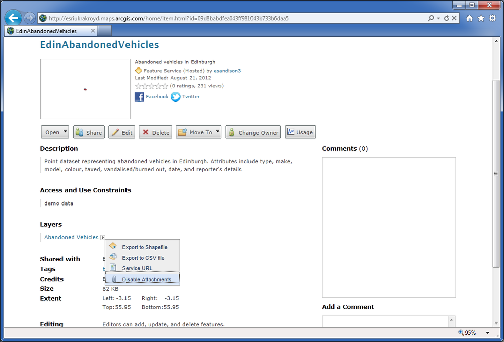
I then went to arcgis.com and signed into the same account. My new feature service is there and ready for use in a webmap or LVF application. All I did here was enable the ability to store attachments such as photos – you just click enable attachments, which I’d already done when I took this screenshot.
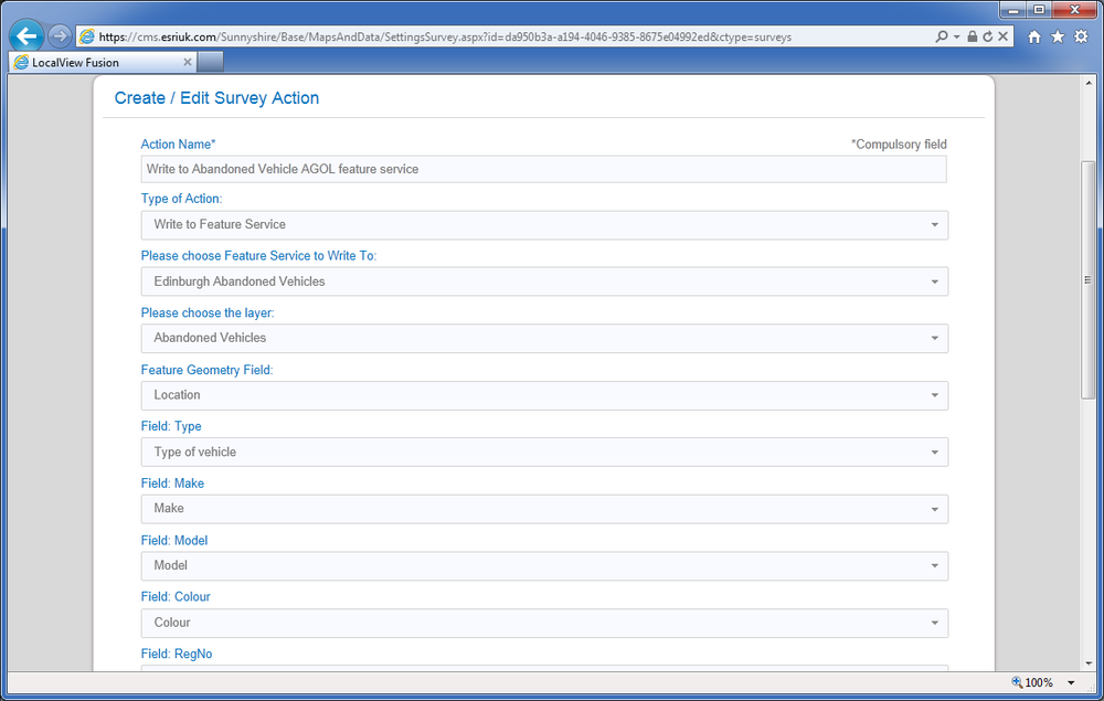
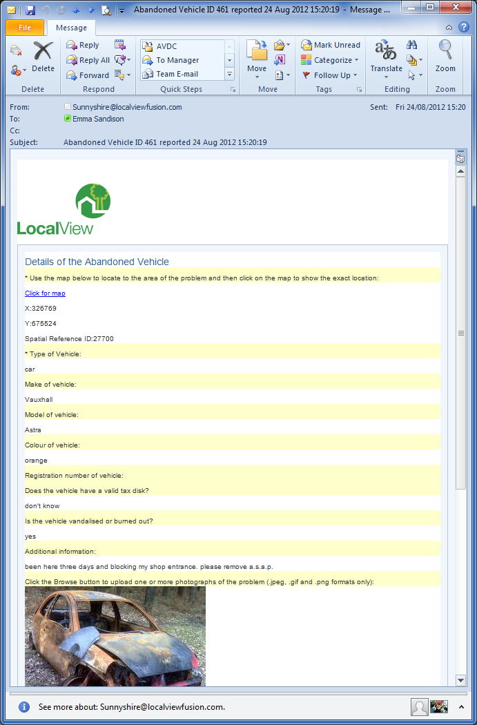
Conveniently, I already had a Report an Abandoned Vehicle survey set up in LVF. When someone reports a problem vehicle and submits their survey, they and the council receive an email with all the details reported along with a unique ID (there’s also the option to run a geoprocessing task to automate integration with CRMs etc. but I’m not using that here).
With the new integration between AGOL and LVF, I added another Survey Action to write the details collected in the survey directly into my AGOL abandoned vehicle feature service. I just needed to map the correct survey answers to the feature service fields as you can see in the screenshot below, and tick the box to also include any uploaded photos as attachments.
So with this set up, a member of the public can report an abandoned vehicle and get immediate feedback via an email, like the one you see here.
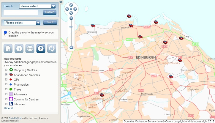
They can also view the location of it on either an AGOL web map or an LVF application as shown here.
This new integration functionality has several advantages. The likelihood of duplicate reporting is reduced since other people can immediately see the council has already been informed. Also, an abandoned vehicles officer or clean up team out in the field can easily view new problems assigned to them using the ArcGIS App for Smartphones and Tablets and can update the status of the vehicle once it has been dealt with.
I think this workflow is relevant for all sorts of reporting operations where you want to keep residents better informed whilst encouraging greater public participation in dealing with local problems. I hope my simple example has given you some ideas that you can try within your own organisation and that I’ve shown it’s quite straightforward to set up!