Earlier this month it was announced that there had been some updates to ArcGIS Online. I wanted to highlight one of these enhancements in particular which I believe will be of interest to UK based users.
It is now possible to localise ArcGIS Online for the UK. Defining your region sets the featured maps on the home page, content in the gallery, and the default extent of new maps in the ArcGIS.com map viewer to UK specific content.
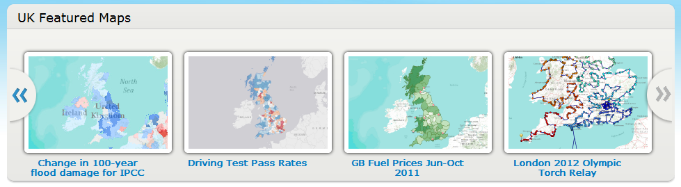
The carousel on the ArcGIS.com home page will be populated with UK specific content as shown in the image below. Also, if you navigate to the Gallery then you’ll see that this also now contains UK Maps, Web and Mobile Apps.
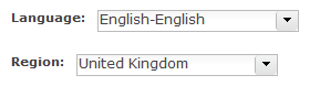
Before seeing these changes you will need to modify your region in your ArcGIS.com profile. To do this follow these steps
- Ensure that you’re logged into ArcGIS.com
- Click on your name in the top banner to access your profile
- In the Region options select “United Kingdom” (see below)
- Click the Save button
Whilst you’re on your profile page, why not ensure that you’ve included some information about yourself and perhaps upload a photo of yourself?
The other major benefit to setting your region is that all new webmaps that you create with the ArcGIS.com map viewer or ArcGIS Explorer Online will initialise with the extent of the UK. This means that you wont have to zoom and pan to the region before starting to create your map.
The maps and other content that appear in the UK Featured Maps and the Gallery will continue to be refreshed so keep an eye out for new content. Also, if you’ve created a map that you wish to be included in these sections then please let us know.