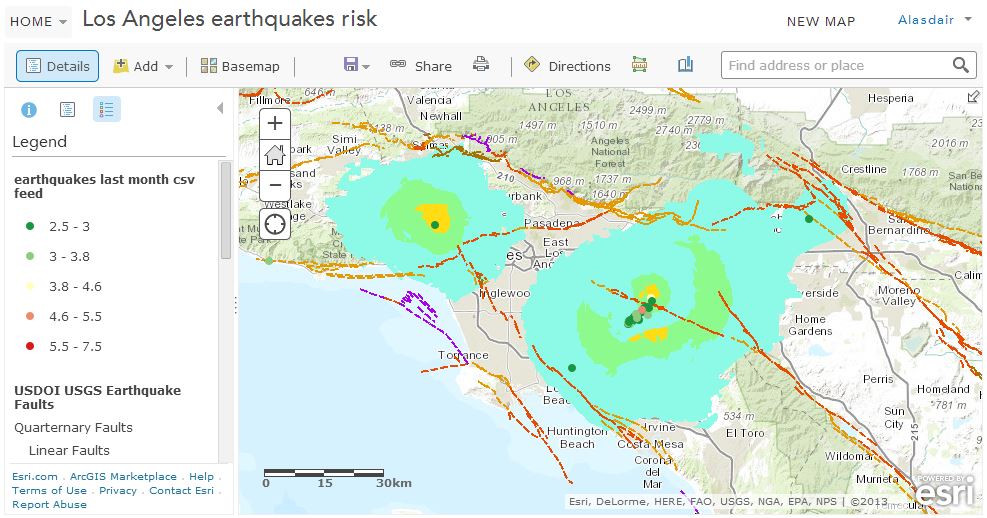
Every week new schools sign up to the Esri UK ArcGIS for Schools Programme and we are starting to see some great results. The immediacy that ArcGIS Online affords along with its simplicity has allowed some of our schools to produce maps in minutes as a response to recent world events. If you follow me on twitter (@GIS4Schools) you would have seen a steady stream of maps covering the recent earthquakes in Los Angeles and Chile plus maps on the recent UK air pollution event. The school in the spotlight at the moment is the Royal High School in Bath (RHSB), which has been particularly prodigious. As soon as we have some geography in the news the RHSB geography department, led by Raphael Heath, are publishing great maps from their ArcGIS Online schools subscription. They were first out of the blocks with the LA quake map:
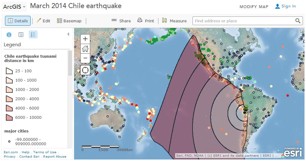
And then the Chile quake:
 http://www.arcgis.com/home/webmap/viewer.html?webmap=4dfdfec34c0c4f6bbb9ca0569ae786ea
Both of these maps were picked up and retweeted by Prof. Iain Stewart of BBC TV fame, which only adds to their credibility.
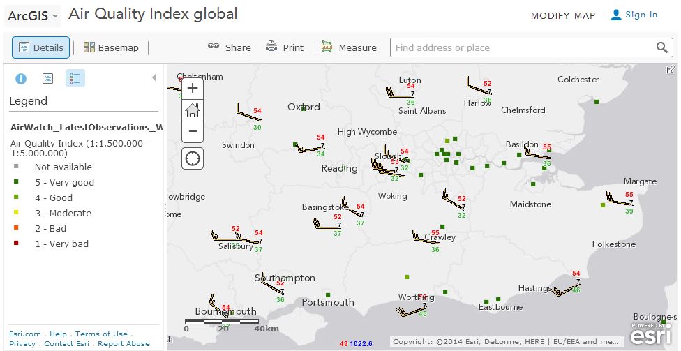
These were closely followed by their air pollution map:
 http://www.arcgis.com/home/webmap/viewer.html?webmap=c49907649c254714915f4c95b07ab7a5
The geography department at RHSB have developed some great GIS skills and the education team at Esri UK want to help every school in the country reach this same high standard. You can read more on our schools blog. If you have a school that you are associated with and you would like to help develop their GIS skills please get in touch.