After the recent enhancement to the Collector App to support offline data editing, a new app was released this week.
Explorer for ArcGIS compliments the existing apps by focusing on using maps as a communication tool. The initial release is for iOS, but the Android and Mac version are in development.
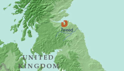
The interface makes finding and viewing your webmaps easy and there is a sketch tool to add your own highlights. Your annotated map can then be shared via a link or as a snapshot image. I used the demo map of world precipitation to show why I like working in the east of Scotland.
The communication theme will be taken further with the ability to create and access slide presentations within a webmap. The easiest way to understand how this will work is to download the app and access the hosted demo map about Alaskan glaciers. The demos are opened via the Try Explorer link at the bottom of the title page or there is a walkthrough in the documentation: http://doc.arcgis.com/en/explorer.
There is a bit more about the background to Explorer on the Esri blog here but the documentation is very approachable and covers the functionality in detail.
Being able to access some good hosted demos makes playing with the app the easiest why to understand what workflows it might help with. So I’m off to look at some views from the ISS…
Presentations are now live in ArcGIS Online.
You can create presentations to go with your web maps and then access these in the Explorer App. This is a great way to provide a sequence of map views to your audience, with contextual information in the slide titles. Being able to set an item’s pop-up to be shown when the slide opens is another way to guide a user to key information. Adding a presentation to a web map is really easy, just follow these steps.