The recent versions of ArcGIS for Desktop (version 10.1/10.2) integrate directly with ArcGIS Online. Desktop is a great tool for preparing content for ArcGIS Online but as a Desktop user what can ArcGIS Online bring to my party?
Collaboration
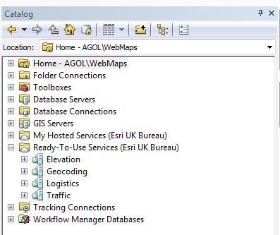
The most obvious thing is being able to collaborate dynamically with a wider audience. As well as sharing your desktop output you can also use the ArcGIS Online services for bringing information back in for analysis. Imagine the Tour De France* is coming through your area and you are part of the council team planning the parking restrictions. You can use desktop to identify roads that need closures and key features. Publishing the information to ArcGIS Online will let others access the dynamic map via simple web applications. Perhaps someone needs to take a copy of that data off-line to go and inspect the road crossings. Using Collector they gather information using a smartphone and synchronise it back to the ArcGIS Online service. It is now directly available to you within your Desktop environment for further analysis. The Add Data dialogue lets you find and add data from ArcGIS Online, including public layers that you want to make use of. If you have published hosted services they can be accessed directly from the Catalog window (My Hosted Services) and added by drag and drop.
Hosted Services
Since it was launched the analytical tools in ArcGIS Online have been steadily expanding. Several of these capabilities rely on an underlying set of hosted data and/or services. These can be used within ArcGIS for Desktop if you are signed in to an organisation account, primarily via the Ready-To-Use-Services section in the Catalog window:
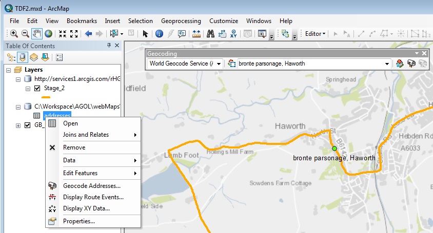
World Geocoder
You can search for individual locations (e.g. the Bronte Parsonage) or take a set of records with only address information and turn it into a feature class. The latter involves just a few steps; import as a table, then follow this workflow (you can also right click on the table and launch the geocoding workflow directly):
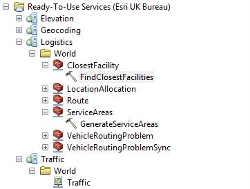
Routing network
The routing capabilities in ArcGIS Online can be used with local data in the Find Route tool. Being Signed-In also gives you access to a set of hosted geo-processing tools and the live traffic service:
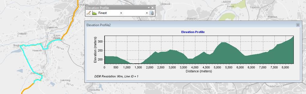
Elevation
Again, there are a set of hosted geo-processing tasks that can be used with your local data. They run against the hosted world DTM (Digital Terrain Model), which is part of the elevation services. The tools include the ability to create profiles and viewshed polygons. The Hydrology toolbox is a beta version and uses another hosted dataset of river networks to generate catchment areas against the DTM. To complement the hosted tools, a free-to-download Add-In has been released for creating profiles using the hosted DTM:
The thing I like about all this is that the hosted datasets and services make these workflows accessible and affordable to a wider community of users. If you are already following any of these workflows in ArcGIS for Desktop you may well have access to more detailed or specific datasets, but for ad-hoc use it makes it really easy. Complex data services and analysis can now be accessed in Desktop by signing in to your ArcGIS Online account.
*my idea for the scenario came from a post on our Maps Make Sense page.