Survey123 for ArcGIS got its formal release this summer. It provides a mechanism to configure form based surveys (that include location) using a spreadsheet. Survey123 supports the XLSForm specification. I had my first go at creating a survey last week and decided to include a cascading question – where the options available for the second question depend on the answer to the first. For my project, I was also interested in Survey123’s potential for mobile data collection.
Cascading Questions
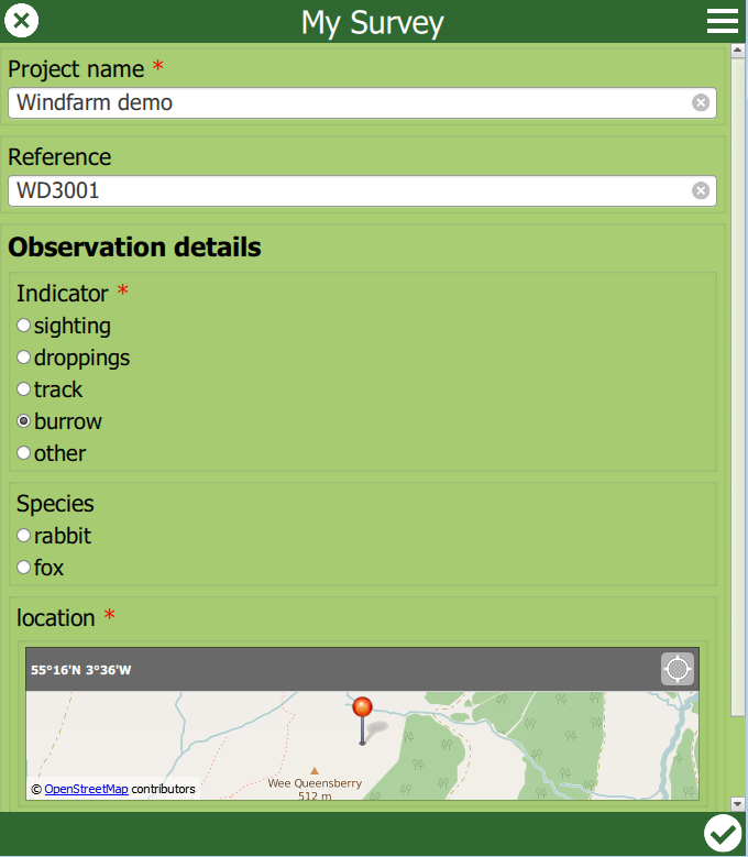
My survey was for recording animal sightings in a field survey. As well as including some text and date fields I set two of the fields to be pick-list choices and with a dependency on each other:
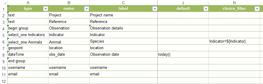
I wanted to use the indicator – sighting, track, burrow etc – as the first question. The animal species list would then reflect the indicator, e.g if you pick burrow then rabbit is an option but not hare. After a bit of puzzling I realised that the way to do this was to specify each valid combination:

It’s a little long winded (see below) but the result works well:
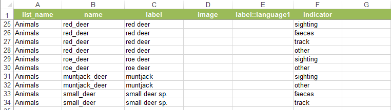
It also means you can include refinements: if, for example, you know that it isn’t easy to distinguish between Muntjack and Roe deer tracks you can make the option for a track something more generic:
Working offline
A key requirement for mobile GIS is being able to work offline – my animal sighting survey wouldn’t be much use on remote site without this. The ability to use a tile package (tpk file) as the basemap for recording location has been added to Survey123 (currently limited to Web Mercator maps). The help page does warn that it is a manual process at the moment but with a reassuring note that the aim is to improve the workflow.
The notes provided most of the information I needed to set this up on an iPad. Because iTunes doesn’t let you browse into the subfolders for an app you need to copy the folder structure onto your PC, add the tpk, make the config changes and then load the whole folder (ArcGIS) back on via iTunes. The one thing I struggled with was that final step – the version of iTunes I used only let you add individual files. The secret was to drag the folder onto the app’s file space in iTunes directly from windows Explorer.
Survey123 is quite a different approach to using an app like Collector, to create points and definitely has its place. I think cascading questions are a great way avoid long picklists – by asking for a group first – as well as avoiding invalid attribute combinations.