Ways of engaging with your wider community keep evolving. I have been looking at the different ways you can do this with ArcGIS technology, so I thought I’d share some apps I have found useful. I will be talking about GeoForm, QuestionWhere, and our Crowdsourcing apps.
When would you use these?
If you are interested in crowdsourcing information, then these apps are for you. They allow the public to engage with your ideas or surveys whilst allowing you to store data and manage the apps centrally in ArcGIS Online.
Which to choose?
If, like me, you have particular requirements for your crowdsourcing app, such as conditional questions, you will need to consider the capabilities of each app. Each app has a different design focus which might determine what app you choose. Hopefully this blog will give you a better understanding of the ArcGIS apps out there and which one would suit you best.
GeoForm
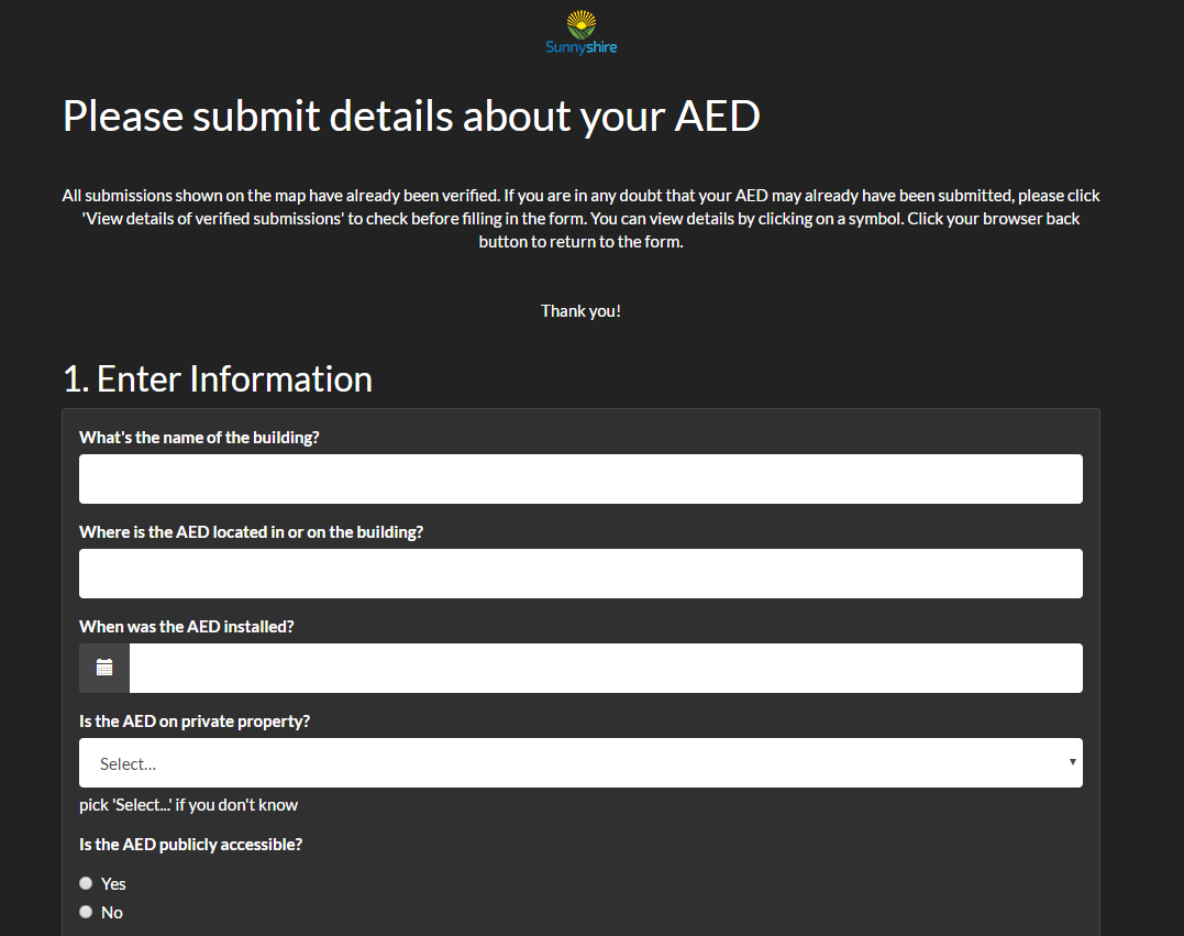
GeoForm is an out-of-the-box configurable app template that creates a simple one-page form that can be embedded in your website. GeoForm is useful for collecting new point data from a large audience of non-technical members of the community. As a form is an intuitive format for many users, GeoForm can be a good choice when engaging with citizens.
To get a feel of what GeoForm looks like, an example of an AED Reporter is here:
Now let’s take a look at GeoForm capabilities:
- GeoForm is available within ArcGIS Online and Portal for ArcGIS through your ArcGIS Online named user.
- Web browser-based application that supports use on smartphones, tablets and desktop.
- Allows for anonymous access via a guest login and social media sharing (Facebook, Twitter, and Google+).
- Can be used offline.
- Allows you to search for an address.
- Can create mandatory questions, picklists, multiple choice questions and add attachments.
- Very customisable: option to change the title, logo, layout theme (over 15 to choose from), images, and decide what attribute fields appear in the form e.g. order picklists appear in and add hint text.
- Configure the default map extent, where to locate on loading, and a basemap toggle button.
- Configure the locate methods to be available in the form: current location through GPS, manual search, and latitude and longitude.
If you want advanced functionality like:
- Configuring advanced workflows such as creating automatic processes, geoprocessing tasks and conditional questions.
- Capturing more than new data.
- Capturing lines and polygons (GeoForm is limited to points).
…then QuestionWhere would be more suitable.
QuestionWhere
QuestionWhere is an Esri UK Application, available through the ArcGIS Marketplace. It is a web-browser app that allows you to create multiple page questionnaires and to use the results to both update a feature service and kick off other processes (e.g. run a geoprocessing task or send an email).

GeoForm and QuestionWhere are similar, but there are differences that could determine which one you use. QuestionWhere holds all of the capabilities that GeoForm offers apart from social media login (only anonymous login). They both support many browsers: Windows: IE (8,9,10 & 11), Google Chrome and Firefox. iOS: Safari. Android: (4.0+, Google Chrome and default browser).
Now let’s take a look at QuestionWhere’s additional capabilities that sets it apart from GeoForm:
- Allows for advanced workflows like automatic tasks (‘actions’) to support existing business processes.
- Create multiple page questionnaires and conditional questions.
- Capture of points, lines and polygons.
- Configure a splash screen or a welcome page for citizens.
- Results are written directly to your ArcGIS Online content and kept private.
You can read about putting together a QuestionWhere survey here.
QuestionWhere gets frequent updates, and new features for this year (2017) are:
- Spam filter.
- Specify the number of results which come back from an organisation locator.
- .docx upload support.
Crowdsourcing apps
If GeoForm and QuestionWhere aren’t what you are after, then there are a range of Crowdsourcing apps that may be of interest. If you have an ArcGIS Online subscription, you already have access to these apps.
Crowdsource Reporter
Crowdsource Reporter is a configurable app template that allows users to report problems or submit feedback. It also lets them comment and vote on reports submitted by other users.

Reasons why you may choose Crowdsource Reporter:
- Anonymous access via guest login, social media login (Facebook, and Twitter), and ArcGIS Online account login.
- Captures points, lines and polygons.
- Allows the configuration of app theme, colours and logos.
Additionally, Crowdsource Reporter can be configured to work with the Crowdsource Manager app. This is a complimentary dashboard for internal staff to view and manage the reports coming in.
Also on our ArcGIS Solutions page, there are ready made maps specifically designed for Crowdsource Reporter. These can be quickly added into your organisation with the ArcGIS Deployment tool. Just some of them are:
- Citizen Science Reporter – allows citizens to report sightings of wild plants and animals.
- Citizen Problem Reporter – allows citizens to submit non-emergency problems e.g. graffiti, potholes and flooding.
- Capital Project Tracking – is designed to be used for local government staff to track project performance with key stakeholders and the public.
You may choose GeoForm, QuestionWhere or other Crowdsource apps instead if you want a form experience rather than a map, and if you want to create conditional or mandatory questions.
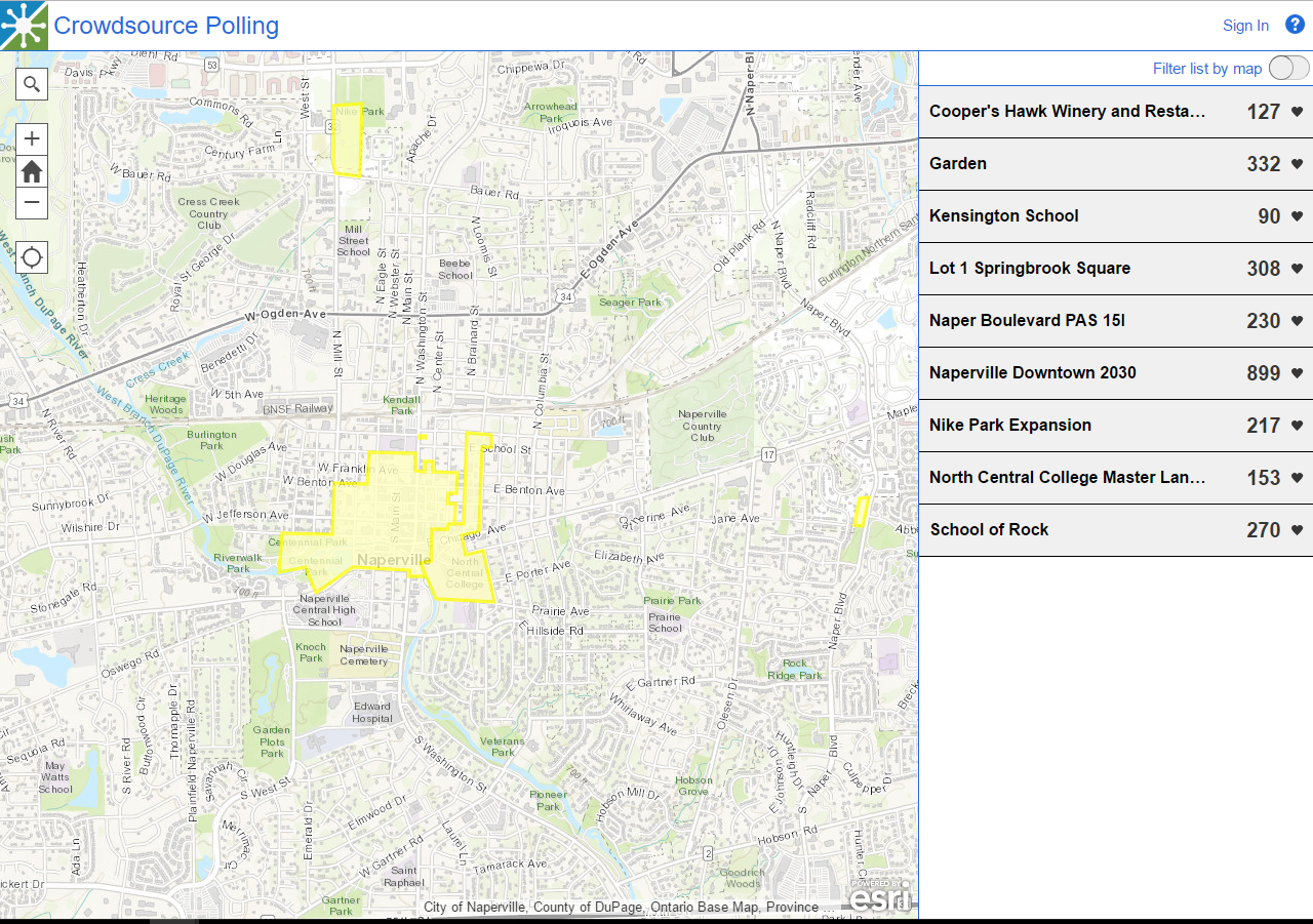
Crowdsource Polling
Crowdsource Polling is a configurable web app template that allows users to submit votes, and leave comments or feedback on existing plans and proposals. This app has been designed to be used on tablets and desktop. The public can use social media login (Facebook, Twitter and Google+) or anonymously submit new comments and/or vote.
You may choose GeoForm, QuestionWhere or other Crowdsource apps instead if you want to crowdsource information through a form experience rather than a map.
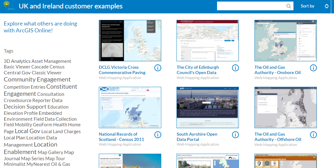
If you are after more examples of crowdsourced apps, take a look at our UK and Ireland customer example website here.
Story Map Crowdsource
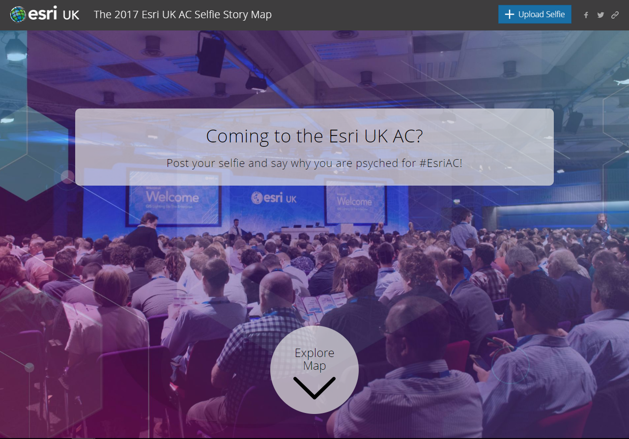
Lastly, the Story Map Crowdsource allows you to build a Story Map where anyone can contribute photos with captions (currently in Beta). You can use it to engage a specific or general audience on the subject of your choice.
The public can interact with the story map through anonymous access via guest login. They can also share the map on Facebook and Twitter. A vetting function lets you review and approve contributions.
Take a look at an example we created for our Esri UK Annual Conference (2017) here.
![]()