World Imagery Service
In the next few months the Imagery and Imagery with Labels basemaps may look a little different in your area. This is because we are updating the larger scales with imagery from DigitalGlobe. For some areas this will be with +Metro (0.3-0.5m) and/or +Vivid (0.5m) sub-metre resolution (down to Level 19) imagery for a number of cities including Leeds, Birmingham and London to name a few.
The new update will also improve the currency throughout the UK.
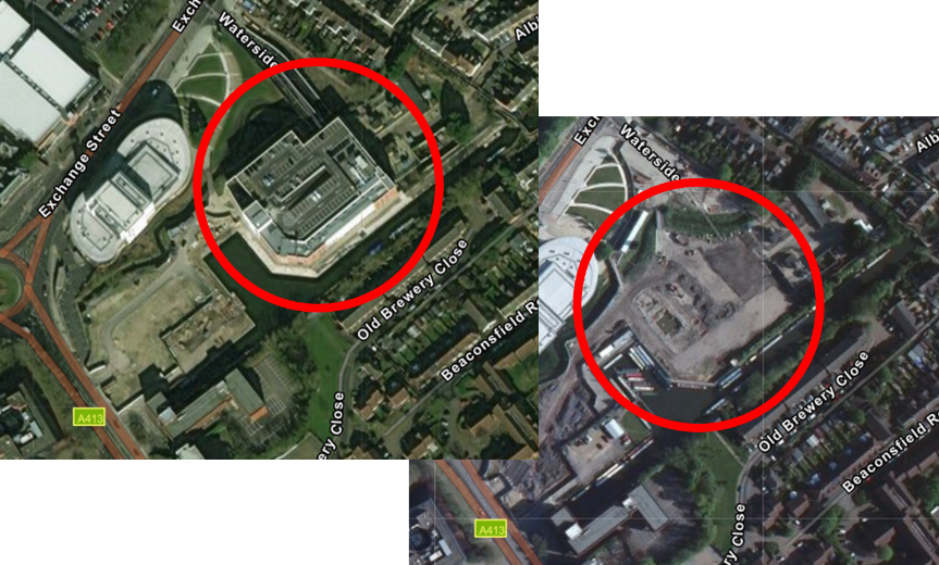 Front image is the new updated imagery showing a supermarket, the image behind is the previous imagery
Other improvements include image saturation at smaller scales.
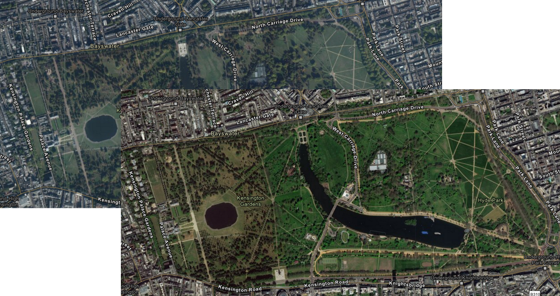 Front is image is showing the new colour saturation in the updated imagery, the image behind shows the previous aerial imagery
We have been able to provide this updated high resolution imagery through the Esri and DigitalGlobe partnership. The previous imagery was aerial imagery whereas the update is captured by satellite, which will allow us to update it more frequently. This means you may notice differences in resolution at the larger scale. If your workflows require the more detailed resolution of aerial imagery, or you are using the World Imagery service operationally and would like to continue to access the existing aerial imagery, there is now the World Imagery (Clarity) service.
World Imagery (Clarity) Service
There is a new Tiled Map service on the block. The World Imagery (Clarity) service (currently in beta), is an alternative view of the Living Atlas World Imagery service. This service focuses on image clarity or accuracy, rather than currency. It allows users to access imagery from the World Imagery archive that may not be available otherwise. For the UK this is going to contain the aforementioned aerial imagery.
We will be providing you with updates as to when the World Imagery service is refreshed and when the World Imagery (Clarity) service is released through our blog and social media channels. If you have imagery which you own and would like to have it considered to be part of the World Imagery or World Imagery Clarity service, please contact your Customer Success Manager or drop us an email at datacurator@esriuk.com.
![]()