This summer the next generation of Explorer for ArcGIS was released on iOS. The orginal app focused on providing a map viewing app for executives and decision makers, and was online only. With the new release, Esri has focused on field workers such as engineers, project managers and service technicians – making Explorer a great tool for mobile workers to work both online and offline. Interested but have an android? Don’t worry, Explorer is coming to android soon, or you can try the Beta version.
The current release of Explorer (version 17.1.2) allows you to do many new things. Let me tell you about a few of my favourites…
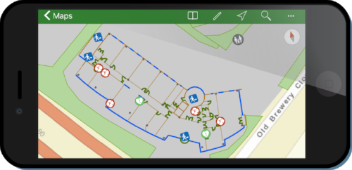
Exploring offline!
You can’t be connected everywhere you want to explore, so now you can download and use your maps offline. This means you can prepare your map in the office and put it on your iOS device for happy offline exploring. For information on how to take a map offline see Make an offline map.

Use the compass to find your assets
For harder to find assets, maybe a marker post in a field, there is a new compass tool that lets you walk straight to it. From a feature’s details, a search result, or pin – just select Compass. It then shows how far you are from the asset and which direction you need to go. For longer distances you can also get directions by launching Navigator for ArcGIS, Apple Maps or Google Maps, if you have them.
Improved markup and sharing
The markup tools have been improved to make it lots easier to capture sketches and notes on the map. You can add areas, lines or markers; then add notes and labels. There are extra options to straighten lines, make an area a circle or add arrows. You can view your sketches across your different maps and send screenshots from Explorer.
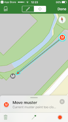
With the new version you can now share the markup back to your organisation via ArcGIS Online. Mobile workers in the field and ArcGIS Pro users in the office can see and act on what you’ve found.
Explore with related records
Another new feature is being able to work with related records in your map. To see the extra data, open the pop-up and look for the link button. You’ll then see the related records and their details in the pop-ups in Explorer. You might have read this post about using related records for repeat surveys of an asset. Now you could use Explorer for ArcGIS to give view only access to the surveys.

Other amazing updates:
- Labels are now supported and you can even use Arcade expressions to make the best labels for your maps.
- Explorer now honours the styling done through smart mapping. This means bringing the beautiful maps you are making in the Map Viewer right to your device.
- Support for vector tile basemaps brings crisp, responsive vector basemaps to your device. They give you a combination of tile access performance and high-resolution quality.
- Better UX customisation so that Explorer makes the best use of available screen space on your device. You can resize the side-panel to suit your viewing style – this could be collapsed, in a summary view or full-screen. On an iPad you can even use Explorer side-by-side with other apps, using the new split screen view.
Interested? Head over to the App Store today.
![]()