A new update has hit ArcGIS Online, bringing with it an evolution from User Levels to User Types and some related changes to permissions and accessible apps. In addition, there are interface updates - some to accommodate this change - and other enhancements.
I’ve been exploring these changes and what else is now available to guide you through the update.
Introducing User Types
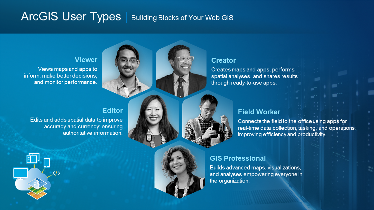
Prior to the update, ArcGIS Online had two User Levels, which should be familiar to you. There were Level 1 and Level 2 users, allowing users to either view ArcGIS Online content or have access to most capabilities (respectively). To provide more flexibility for managing users, ArcGIS Online has evolved User Levels into User Types - which combine permissions and access to apps, as bundles. There are now five User Types, each offering different capabilities and apps that align with typical GIS users.
The new Viewer and Creator User Types are equivalent to Level 1 and Level 2 user levels. There are then three new User Types: Editor, Mobile Worker and GIS Professional:

The change to User Types means organisations can tailor ArcGIS Online use to the requirements of different members. The change to User Types for most members won’t be noticeable, as functionality will stay the same between User Levels 1 and 2, and Viewers and Creators. Administrators will notice the updated terminology when they log in after the update.

App Bundles
App bundles group apps that are often used together, which can be assigned as a bundle through the new User Types. The bundles should help new users understand how different apps work together – particularly for people unfamiliar with the range of apps in ArcGIS.
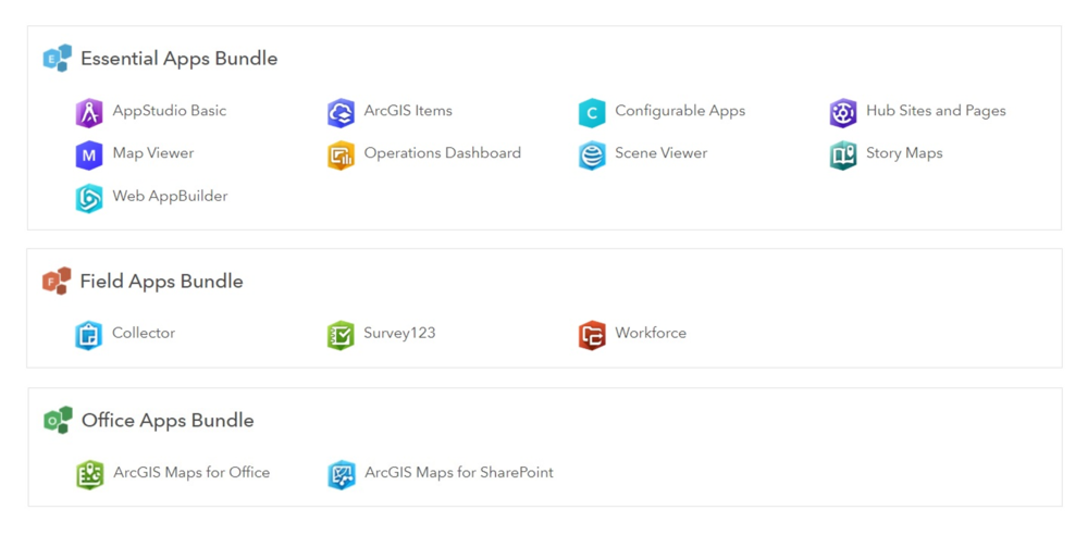
There will be 3 bundles available with the update: the essential apps bundle, field apps bundle and office apps bundle:
User Types come with app bundles assigned already (as licenses), these are included apps. I found that these are the apps a User Type are most likely to be using on a day to day basis.
Additionally, there are compatible add-on apps which allow members to access apps that aren’t included in the app bundles, if the organisation has the relevant licenses. For example, an organisation with Insights for ArcGIS licenses can assign them to members with compatible User Types. Add-on apps can also be re-assigned to other members.
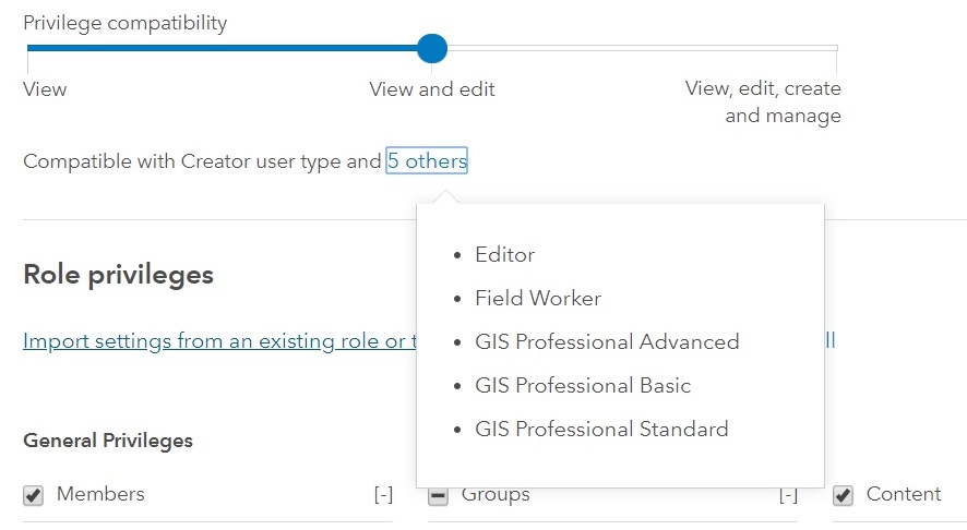
An example of add-on apps for the Creator user type are shown below. If you’re ever in doubt you can view compatible add-ons in your profile, as can administrators when changing member’s user types.
Follow this link for a more detailed outline of User Types outlining the capabilities and app bundles for each.
Roles
User Types define what capabilities a member can potentially access but, as before, administrators can assign custom roles. Roles are linked to a member’s User Type through the three options in privilege compatibility (shown on the right).

Updated look and navigation
ArcGIS Online has undergone a variety of interface improvements in the update, but don’t worry all the functionality you currently use is still available. The interface updates improve four key areas (shown for the Content tab below):
Navigation through pages has been improved - with repositioning of tabs, and restructuring of the header and sub-page navigation. Selected pages are clearly highlighted making it easier to choose the correct page or sub-page.
Contrast improvements have been made across ArcGIS Online which makes the active content on the page pop out, through improved foreground contrast.
The layout responsiveness of ArcGIS Online has been updated to dynamically resize for viewing maps on smaller browsers and devices.
Finally, the notifications system, used to highlight important changes within organisations, now allows all notifications to be cleared at once.
Other enhancements
There have been a selection of mapping and analysis enhancements: with refresh intervals added to tables and the ability to reference other layers in Arcade expressions for pop ups and field calculations. The routing tools have also been improved, with the ability to add point, line and area barriers.
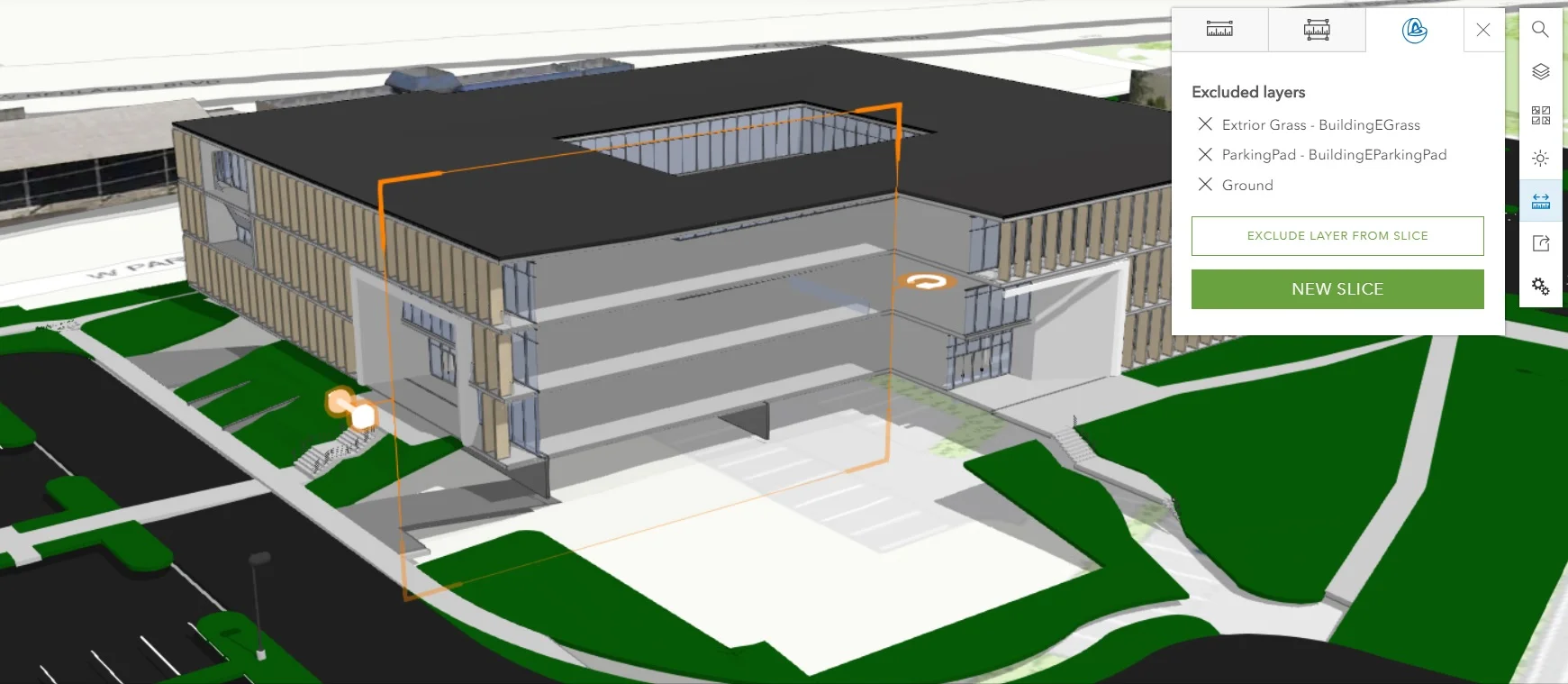
3D capabilities are developing through performance enhancements to large dataset visualisation in Scene Viewer. The UI for Add Layers has improved and is now similar to the maps one. Scene layers can be filtered by attributes and you can now slice content with a new interactive tool - enabling users to dynamically interact with data.

If you’re an Administrator, you’ll really appreciate the changes to inviting new members. This process has been updated to make sure members accounts are ready to go before they log in. This blog gives a quick overview.
The What’s New help page has a full list of the changes.
For a brief recap on User Types you can watch a video detailing this update here. For the full details for managing User Types and Roles please see the help page.


