Designed to help you work more efficiently and faster, ArcGIS Pro is aiming to modernise your user experience. Have you thought about moving on from ArcMap? Wondering what you can do better in ArcGIS Pro? I asked the team for their suggestions and here are our top ten things that you can do as well, if not better, in ArcGIS Pro.
10) Projects
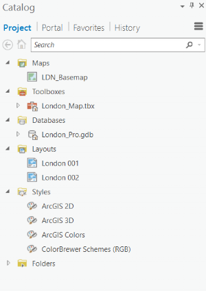
ArcGIS Pro allows you to organise the resources required to complete a project all in one place. This new structure contains maps, layouts, tasks, connections and tools; helping to organise and manage your work.
For me, having multiple maps and layouts in a single project is very helpful and you can copy and paste layers between your maps in a project. Project Templates make it easier to set up new projects by saving interface alterations, toolboxes, and connections.
Additionally, Catalog Favourites is a collection of frequently-used folders, databases, and connections which you can add to projects as needed.
9) Charting Capabilities
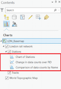
Charts are a supporting feature available within ArcMap, however, they exhibit a lot more power in Pro. Enhanced capabilities include multi-series support, filtering by map extent and selection, as well as Range Sliders.
Also in ArcGIS Pro, you have the option to create various kinds of charts to insert in your layouts. These charts remain live and update as you alter your data!
8) New Geoprocessing Tools
Almost all the geoprocessing tools that are available in ArcMap are also available in ArcGIS Pro. There are also some new tools in Pro such as:
- Tools to create a Network Dataset from a template and vice versa.
- Enrich Layer, for performing geo-enrichment.
- Tools to classify and calculate LAS dataset points by their height from the ground.
- Imagery Segmentation and Classification tools.
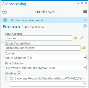
Enrich Layer
7) Visualising Data
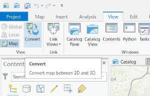
Remember when you had to open up ArcScene or ArcGlobe to look at 3D data? You can now Convert between 2D and 3D views with a single click of a button.
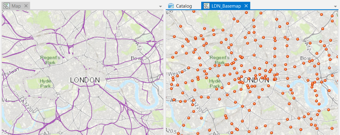
ArcGIS Pro allows you to visualise your 2D and 3D data alongside each other – with the option to link the views. Multiple maps, scenes, or a mix of visualisations give different perspectives on the same data. The example below shows two different 2D views of ‘London Rail Network’ data (from the Living Atlas of the World) alongside each other:
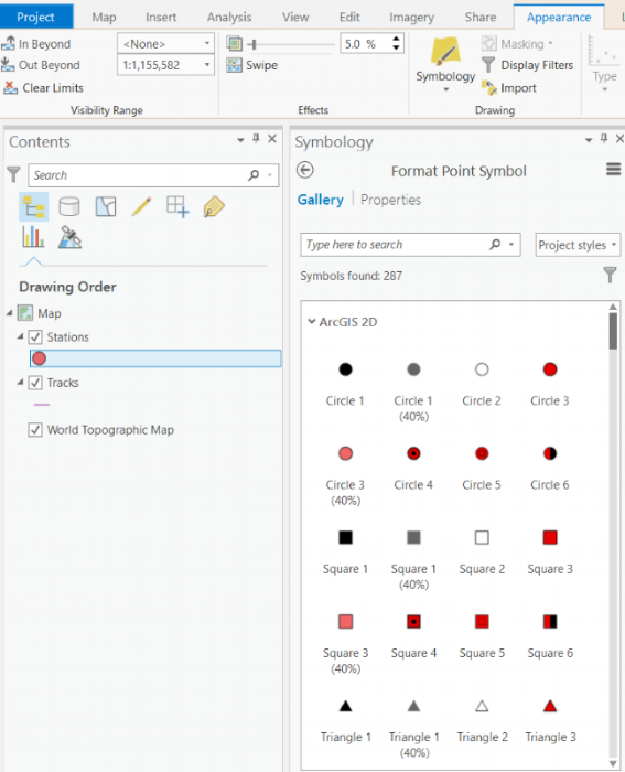
ArcGIS Pro has a new user interface for configuring Symbology, as well as more symbology types and richer options.
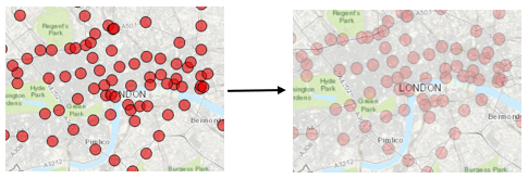
In Pro, you also have the option to apply Transparency to a layer. In fact, any colour in Pro can be transparent and you can use this to make text transparent too!
6) Fields view and Domains
In ArcGIS Pro, you can view and manage fields for a layer in the fields view. This allows you to model the attributes that are shared by features or objects in a table. With the fields view open, you can edit the fields and their properties, delete fields and create new ones.
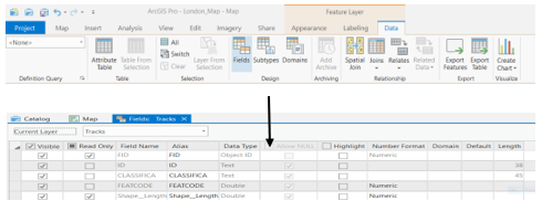
You can create domains from within the fields view too, as well as modify or delete a domain that has been set up. Applying a Domain to a field is done simply by clicking the drop-down menu in the Domain column for the field.
5) Transparencies in PDF exports
The Export to PDF function in ArcMap struggles with layer transparencies and can cause maps to become rasterised when exported – all layers below the data layer containing transparency are converted to a flat raster image in the export or print file.
ArcGIS Pro now supports transparencies with Export to PDF, without rasterisation occurring. Print to PDF also allows users to print a map or layout with transparencies to share with your organisation.
4) Smart Mapping – Heat Maps
One ArcGIS Pro feature that you can’t do at all in ArcMap is using heat map symbology. This draws point features as a representative surface of relative density, easily distinguishing points that are close together. Heat maps can also be displayed in 3D too!
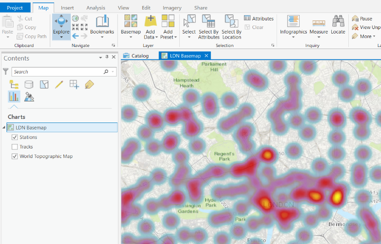
2D heat map of stations in London
3) Browsing for data from the Living Atlas
The Living Atlas of the World is the foremost collection of global geographic information. In ArcGIS Pro, browse the collection and different categories from either the Project pane, Project view or the Add Data dialog box. You can easily drag and drop the map image layers into your map too!
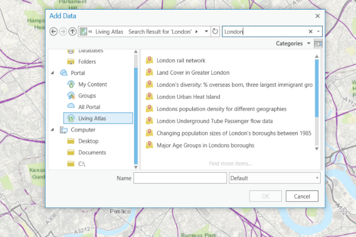
Browsing data in the Living Atlas via Add Data
2) Smart Ribbon Interface
We understand that your favourite tools may have moved around, but the contextual tab interface in ArcGIS Pro does recognise the tools you might need next as you work.

As part of the redesign, many of these workflows have been made more direct. You can also customise the ribbon interface too: create new tabs, add groups to these tabs and choose which buttons appear. If it’s the new layout putting you off Pro, you can customise the ribbon to provide a more familiar layout!
1) Integration with Portal
Overall, I believe the top reason to migrate from ArcMap to ArcGIS Pro is the tight integration with your Portal. For ArcGIS Online and Portal for ArcGIS users, the integration with ArcGIS Pro provides the ability to view and edit, both web maps and hosted data. You can also publish and share your content to Portal with the Web Map or Web layer tool – creating an item summary, adding tags and choosing who to share the content with:
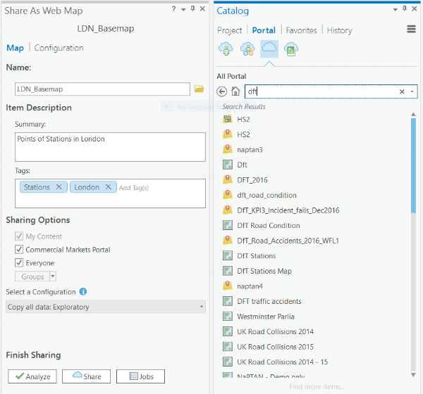
Share Web Maps straight from ArcGIS Pro and access web content directly
Also, web feature services can be used as layers in ArcGIS Pro for displaying, querying, and editing. You can add the entire layer to your map, or browse into the sublayers and add individual sublayers on their own.
Feel inspired?
ArcGIS Pro has a lot to offer and this blog is just a snapshot of the new functions. Have a look at the New Features blog post to see a wider range of tasks that you can carry out with the recent update. I would highly recommend having a think about switching from ArcMap, as these functions are only going to improve in the future.
![]()