The ArcGIS Online update has now arrived, and it brings many new features and updates that you should get excited about. I have been exploring what is now available and will take you through my selection of the top capabilities and functions.
Updated Organisation Page
Esri have been working hard to improve the user experience in ArcGIS Online and, as a result, there is a new look for the Organisation page. This re-design features a tabbed interface, and the new tabs include:
- Overview: showcases key information such as system health and licences used.
- Members: provides filterable, searchable member lists.
- Licences: place to manage licences.
- Settings: where administrators view and edit organisation settings.
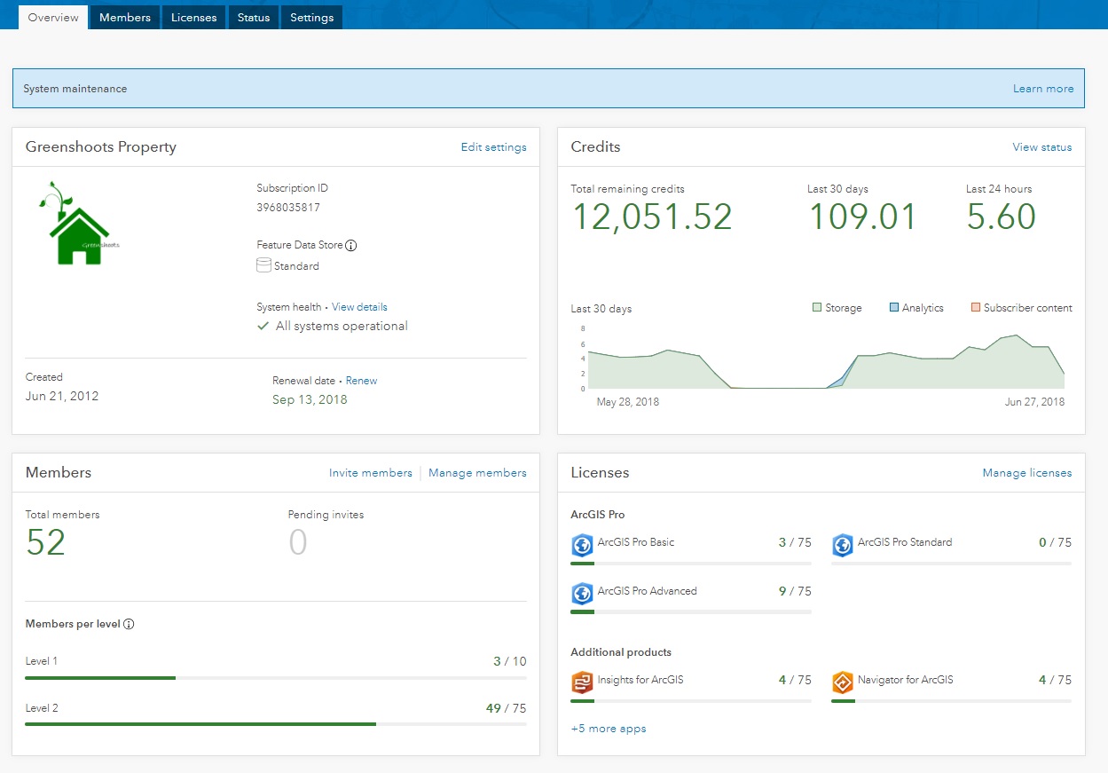
You can now filter organisation members by role and level, and disable or enable memberships for multiple members at once. This redesign is the result of feedback and recommendations from our customers, and therefore I am confident that the new design will be a preferred experience to the previous interface. This is the new Status view:
New ArcGIS Companion App
Along with the redesign of your Organisation page, there’s a new way to access your ArcGIS Organisation. Esri has just launched a new mobile application called ArcGIS Companion, that has been designed to complement and be used alongside your ArcGIS organisation.
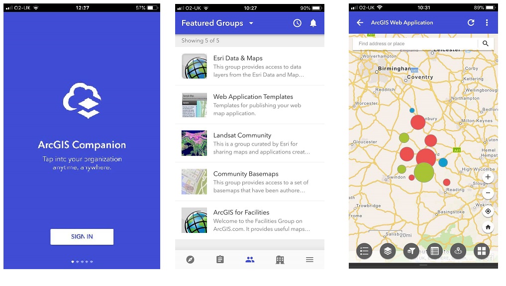 left to right: ArcGIS Companion sign in page, featured items list and map viewer
The new app, for iOS and Android, will allow you to access your organisation anytime and anywhere. You can explore content, view groups, edit your profile and much more. With a similar tabbed interface, users can also access key administrative features to help manage your members on the go. Find out more here.
Offline Map Areas
Map authors supporting offline field work now have the ability to create map areas from web maps. Using map areas makes it easier and quicker to take pre-planned maps offline for field use.
Mapping and Visualisation
A new smart mapping style – Relationship – is now available, allowing you to visualise relationships between numerical attributes in your data. As an example; explore where obesity and diabetes rates are both very high and whether levels of physical inactivity are consistent with the pattern. Combining two different sets of graphic colours or symbols displays a variation of the choropleth map, portraying two separate phenomena simultaneously and accurately. Read more about it here.
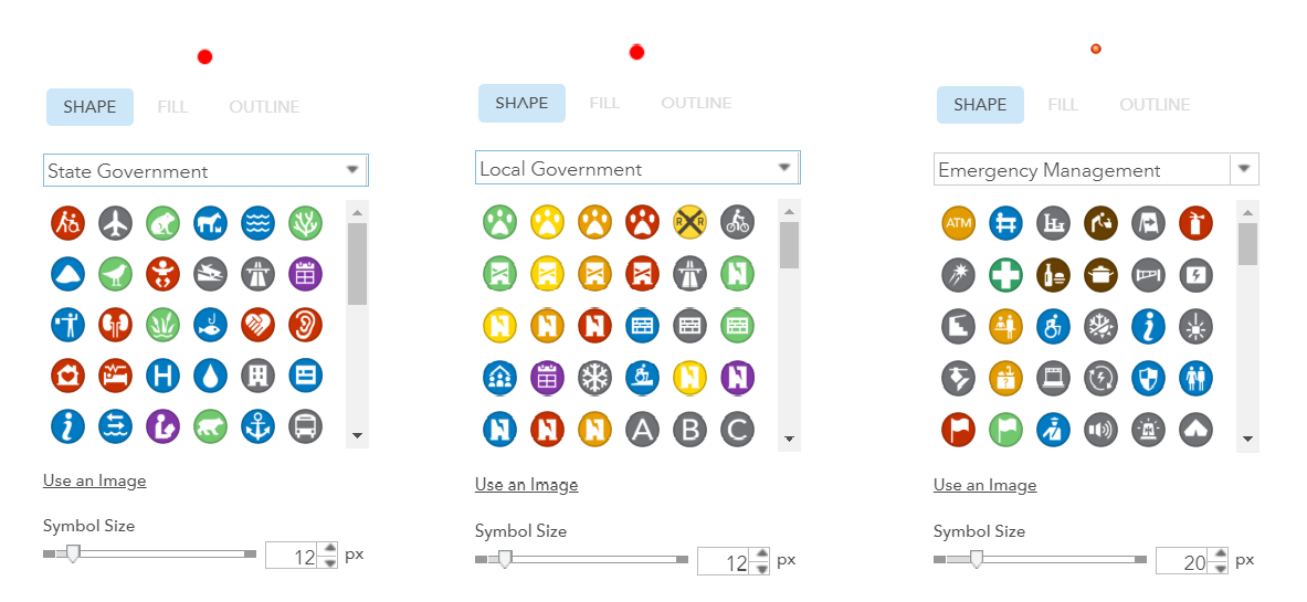
The Emergency Management, Local Government, and State Government symbol sets in Map Viewer have also been updated:
Analysis and Data Management
When using the Join Features analysis tool for one-to-one attribute joins, you are now able to store results as hosted feature layer views.
To complement the spatial analytics update, the number of features supported in the input layers for the Find Nearest tool has increased from 1,000 to 5,000!
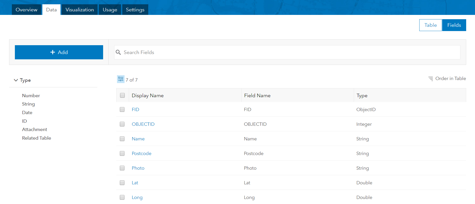
To help feature layer owners view and manage fields in the layer’s attribute table, a new Fields view is available on the details page. You can; filter fields by data type, sort the fields list, change the list order and explore extra information for specific fields. Layer owners and organisation administrators can also add or delete fields from hosted feature layers when viewing them from this page.
Defined data ranges (a.k.a domains) are a key way to manage the capture of data in an accurate way. Users can now define these values directly in ArcGIS Online! Fields can be edited in a hosted feature layer to include a defined list of possible values to choose from, helping editors to avoid typos or incorrect values. For numeric fields, you can also define a valid range of values. If an editor enters a value outside the range, ArcGIS Online will notify the user that the value is outside the supported range.
Want to be a Verified Organisation?
Organisations already have the ability to mark content as authoritative within their organisation after the April 2018 release. In the new version, organisations can request to have an authorised identity verified by Esri. Once organisations are verified, they can mark their publicly shared items authoritative.
An authoritative badge will appear within the organisation and in public searches to help searchers identify and filter recommended content, and the name of the organisation will be displayed as the item owner.
Living Atlas Content
Updates to content in the Living Atlas include a new vector version of OpenStreet basemap and the release of World Imagery (Firefly), which uses muted colours at small scales:

And Lots, Lots More…
This blog is just a snapshot of some of the exciting updates that are now available. New functionalities have also been added to 3D GIS, spatial analytics and apps. See the full list on the What’s New page of the new look Help.
I hope you enjoy using the new features within ArcGIS Online.
![]()