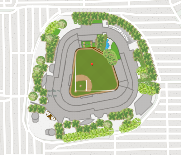
Angel Stadium- Los Angeles Angels.
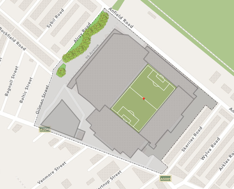
Anfield- Liverpool FC.
What happens when you contribute data?
For a little bit of background, I thought it would be good to explain what’s going on behind the scenes. Once you’ve submitted your edits, it will first be reviewed by Esri staff for quality assurance. After this weekly QA, the edits are made available to you as open data through a feature service. Then, every 3 weeks you can see the updates in the Esri basemaps.
How can you get started?
To use the Community Maps Editor app, you will need to have an ArcGIS Online subscription and join the Community Maps Editor group.
Once you join this group you will gain access to the app, along with information on map challenges and useful how-to guides. I would recommend watching the two videos introducing the Community Maps Editor to get you started. There is also a ‘sandbox’ version of the editor app which allows you to learn how to use the the app without saving the edits beyond your session.
Map Challenge – Cricket World Cup
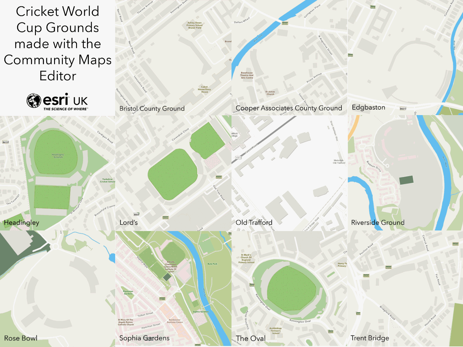
Want to get involved with our Map Challenge? The 2019 Cricket World Cup is due to begin late May in England and Wales and we wanted to make sure our mapped cricket grounds are a big hit.
The challenge is to pick a cricket ground that needs some work and enhance it by adding more detail to the pitch, stands and surrounding area. For more information, you can visit the Map Challenge page to join in! The map challenge is a great way to improve the basemaps while learning some skills that you could apply to your own community.
Whilst some of the biggest grounds being used at the World Cup have already been started (some Esri UK Staff got a bit carried away!), there are still plenty of grounds you could choose from. You could take your local ground, choose from the list below or, if you are feeling adventurous, go global.
Some suggestions of grounds that still need improvements:
-
-
- Northampton - County Ground
- Swansea - St Helen's
- Scarborough - North Marine Road
- Worcester - New Road
- Leicester - Grace Road
- Derby - County Ground
- Tunbridge Wells - Nevill Ground
- Chelmsford - County Ground
- Hove - County Ground
- Canterbury - St Lawrence Ground
-
A few tips and tricks
From spending some time on the Community Maps Editor over the last few weeks, I’ve put together a couple of my top tips that I wish I had known at the start.
- If you have features that have a mixture of straight and curved lines, use the ‘m’ key to flip between the two drawing types.
- Turn snapping on to snap to other vertices you’ve drawn or use the trace drawing type to quickly snap to complex edges.
- Make sure you flick between Editing View and Editing View (Clarity). Editing View includes newer satellite imagery but may be more oblique. The clarity view uses aerial imagery which may be clearer but not taken as recently. Therefore, switch between the two to get the best idea of the features you are creating.
- If you click and hold whilst creating a point, a little magnifying glass appears to help you place the point in the right location.
- Be prepared to use the undo button in the top right! If you are half way through creating a feature and go wrong, press the undo button to remove the last point. It will not delete the whole feature.
- Use the Help and Feedback section within the app for more tips and tricks, it’s really useful!
Whether you are a cricket fan or not, the Community Maps Editor is a fantastic tool for enhancing your local area and I would encourage you all to get involved where you can. It’s a great opportunity to contribute to basemaps that are viewed by thousands of ArcGIS users everyday and they could soon be viewing your edits!