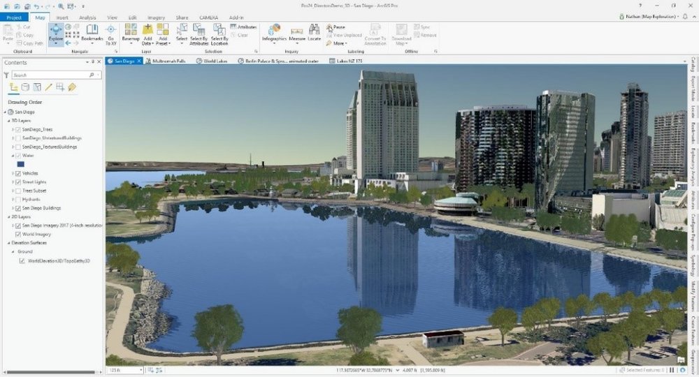
Realistic water rendering.
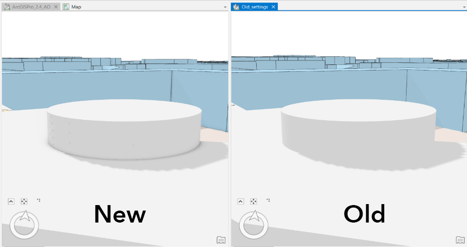
Realistic shading.
Exciting new 3D tools have been introduced at this release. You can now see a different dimension of your 3D data with new Profile Views - which presents your 3D data as a vertical stack. You can interact with it by using the select and measure tools as well as using pop-ups.
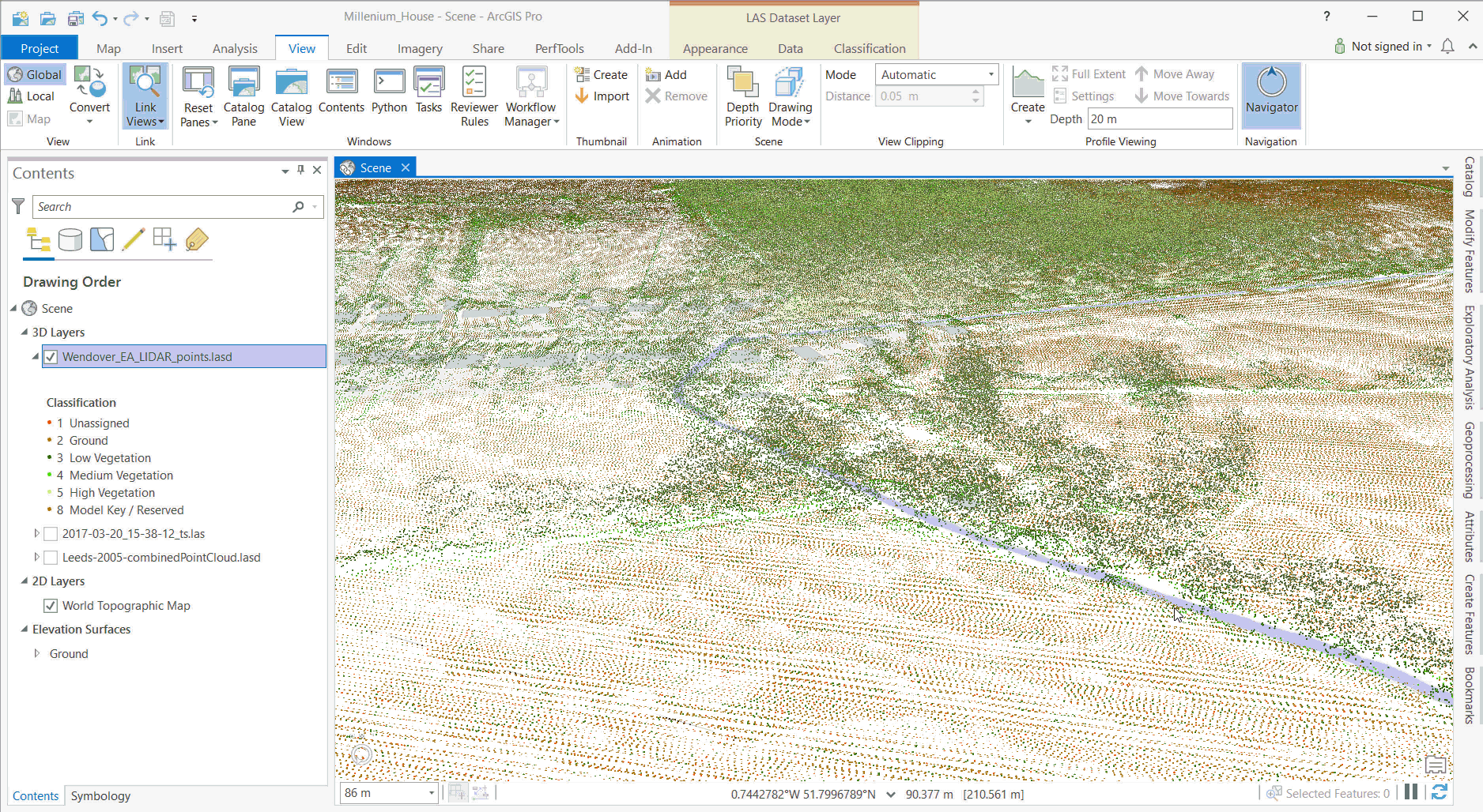
Profile View helps to understand 3D data sets - like this LiDAR scan of a group of trees.
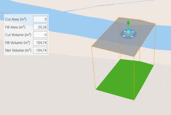
Determine amount of volume required to fill a hole.
There are also three new Multipatch Editing tools to help model 3D features more accurately:
- Slice Multipatch splits a Multipatch feature at a specified location using a horizontal or vertical cutting plane.
- Explode separates a Multipatch feature into its individual 3D faces.
- Merge combines individual Multipatch features or faces residing on the same later into a single Multipatch feature.
Dynamic Feature Binning
You can now dynamically aggregate point data into polygon bins to observe patterns at the micro and macro scale in your data using the Enable Feature Binning tool. It is worth noting that this tool only works with a relational database.
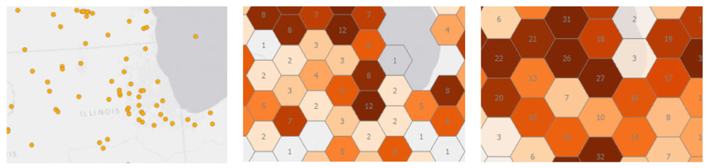
Dynamically aggregate data to micro and macro scales.
Pixel Editor
Have you ever needed to change an individual pixel or groups of pixels in raster or imagery data? Welcome to the Pixel Editor, found in the ArcGIS Image Analyst extension. Using this suite of new tools, your organisation can correct anomalies in DEMs, for example, or use pixelation to deliver public reports whilst withholding confidential information.
Use pixelation or correct anomalies in your raster data.
New and updated analysis tools
A few new geoprocessing tools have been added to enhance sales territory analysis and statistical analysis:
-
You can now generate sales territories or ‘zones’ with the new Build Balanced Zones tool, added to the Mapping Clusters tool set. This tool allows you to choose your zone criteria, for example, you could divide zones by equal size.
-
You can also restrict the growth of sales territories using a polygon or line feature with the Add Territory Barriers tool, in the Territory Design toolbox.
-
Find statistically significant relationships between two variables in a map with the new Local Bivariate Relationships tool, added to the Modelling Spatial Relationships tool set. With this tool, you can visualise areas where the variables are related and explore how their relationship changes across your study area,
Among the enhancements to existing tools, elevation surfaces now can be selected as an input to geoprocessing tools. If you want to use public transport in your network analysis, you can! You can include public transit stops, lines, and schedules into your analysis (access to GTFS public transit dataset is required).
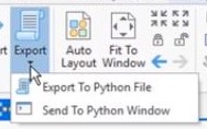
Export models to python.
Additionally, you can now drag and drop multiple tools from the Geoprocessing history into a model.
New Business Analyst tools
The Huff Model is a new tool to analyse market potential of a new facility while assessing the impact of sales, competitors, and attractiveness value, or in other words a gravity model.
Generate Drive Time Trade Areas using your local or online data to feed into reports and infographics. You can configure advanced options, such as time of day and travel direction.
Chart updates
Visualising patterns in temporal data can be tricky, which is why Esri have introduced a new chart type: Calendar Heat Chart. This can show patterns by day of the week and hour of the day, giving you an extra insight to patterns in car accidents, for example:
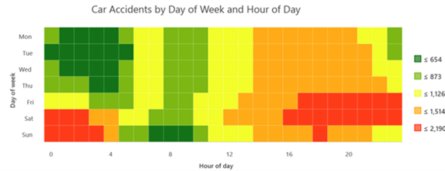
Visualise patterns differently with the new calendar heat chart.