ArcGIS Online summer update

Product News
1st July 2020

The events of the last few months put ArcGIS Online in the spotlight - not just as the basis for the Esri COVID-19 response package but also as a resilient system for delivering business as usual GIS during lockdown. In our Box Set interview with Jack Dangermond he talks about the work ArcGIS Online is supporting, but also goes on to share his vision for making it a platform that can deliver all GIS capabilities. The quarterly updates are the steps on that journey.

This update sees another step towards Jack’s vision with the release of ArcGIS Notebooks in Online. There are also changes to the home page editing and app creation workflows, as well as enhancements to geocoding and the Join function in Map Viewer.

Home page editor

Your home page is the gateway to your organisation’s GIS content, but until now the options for customising it have been fairly limited. ArcGIS Online now has a home page editor that lets you create a more engaging and effective home page - aligned with your organisation brand. The component based editor gives your more flexibility for showcasing key maps and apps, as well as providing important supporting information about your site.

As well setting up a title section you can add multiple text blocks and galleries. You can also add your own contact email address in the footer. It’s a fairly intuitive process - I did miss the click back to Content step after I’d done my Header but it was pre-coffee.

For a more in-depth guide try this blog.

You don’t have to change straight away, though we have seen issues where html and css was added to a home page, but the old home pages will be phased out in the future. Time for a 20 minute homepage revamp?

ArcGIS Notebooks

Jupyter Notebooks for Python were added to ArcGIS Online in the last update as a beta and are now released. Notebooks make it easy to create, run and share Python scripts within Online. This opens up new ways to run analysis, automate administrative tasks and changes the options for processing data within ArcGIS Online. Using notebooks for Python also makes it easy to document your script for others - or just to remind you what it does when you haven’t looked at it for a couple of months.

As with the anlaysis tools, Notebooks may consume credits but with a Notebook the charge is per minute of usage. To help manage credit usage there are three different levels available and the credit rate for Standard Notebooks is zero - I wasn’t expecting that either. It’s only the higher levels that will consume credits and even for Advanced it’s very modest:

Standard: includes ArcGIS API for Python and open-source Python libraries - ideal for admin tasks, data processing and simple analysis.

Advanced: includes ArcPy and everything in Standard - ideal for large scale data processing, advanced analysis and machine learning workflows. Credit use is 0.05 credits/minute, so an hours usage will only take 3 credits.

Advanced with GPU: includes GPU resources and everything in Advanced - the additional memory and computing power is ideal for intensive workflows such as big data analytics and model training. Credit use is higher with this, due to the additional resources required, at 0.5 credits/minute.

If you used the beta version, be sure to check this blog post.

Express app publishing

Some of the Configurable App Templates now take you through an express publishing workflow to help you quickly create the app you want. The express setup is currently available for Nearby, Minimalist, Zone Lookup, and Attachment Viewer.

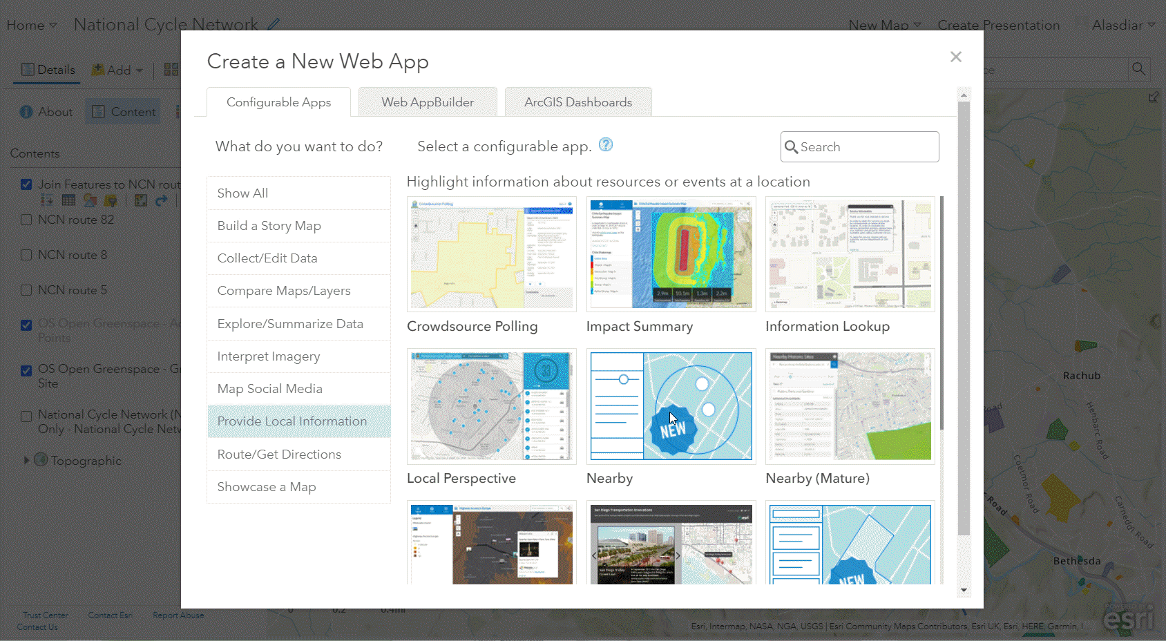
EXPRESS CONFIGURATION FOR THE NEARBY APP TEMPLATE.

They still have the full setup option if you want to access all the configuration options.

Geocoding

If you use the World Geocoding service in ArcGIS Online there are a couple of changes to be aware of. Firstly, the location has changed and the service now uses the Address Location (rooftop/parcel), where previously it used the Routing Location (side of street).

The other change is a new option when you upload and geocode data from a CSV file. You can now choose to include the geocoding information - with different levels of detail. What’s that then? The geocoder outputs a whole set of values about what address it has matched to and how ‘close’ the match is. By including this output, as well as the coordinates, you can now check how well your addresses were matched (the Score is good for this):

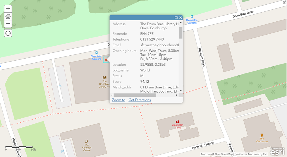
THIS ADDRESS WAS GEOCODED FROM A CSV WITH THE GEOCODER OUTPUT - NOTICE THAT THE WORLD GEOCODER NOW USES A LOCATION WITHIN THE BUILDING

Some handy bits and bobs

The Map Viewer has two new renderers for dynamically displaying imagery: Shaded Relief and Colormap.

You can now define the processing extent for analysis using a pair of coordinates - look out for the cog on the analysis panel to access the options. Join Features now has the option to keep all features. This makes the tool much more flexible for combining data from two different layers - for example identifying how many OS Greenspaces are within 50m of a section of cycle path:

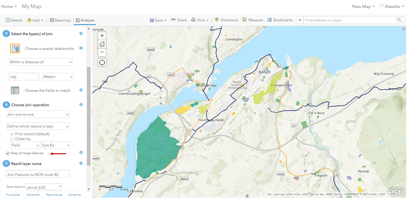
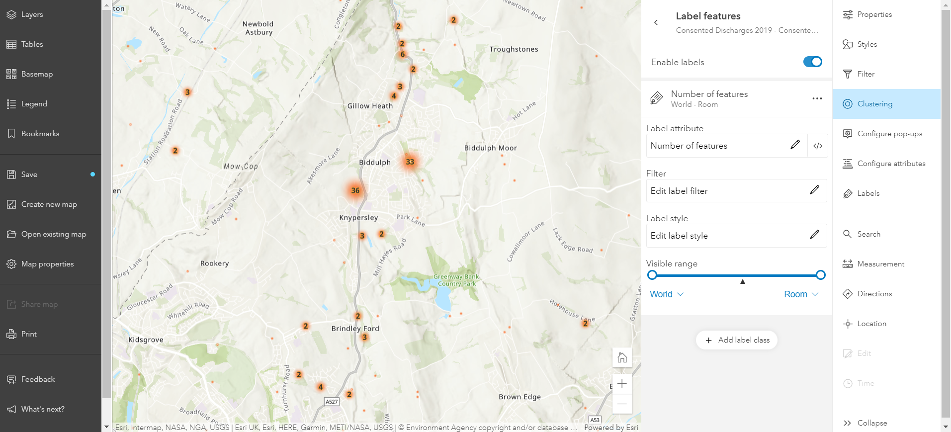
KEEP ALL TARGET FEATURES IN A JOIN

If you have hosted feature layers that have multiple layers, new options give you much greater control over user interactions with them. You can control what types of updates editors can make to the geometry and/or attributes of the features on a layer by layer basis. You can also create hosted feature layer views and publish other layers from individual layers (with the right permissions).

The new admin functions include detailed reports of the ArcGIS Online organisation’s members and items. There is also a bulk transfer option to re-assign a member’s items to another person - for example when a member of staff changes role or leaves. Did you know that you can directly download ArcGIS Pro from ArcGIS Online? I didn’t, until one of our Box Set presenters gave it as a little known fact. If you don’t want people to do this you can deactivate it.

If you use Integrated mesh scene layers, you’ll be interested to know that modifications, such as flatten or mask, published from ArcGIS Pro or ArcGIS Maps SDK for JavaScript can now be incorporated in your web scenes.

Map Viewer Beta

The latest set of additions to the Map Viewer Beta are just around the corner. It’s been a long time coming but we get the ability to group layers in a web map for the first time - for now just in the Beta viewer. We still suggest limiting the number of layers in a web map, but if you do need to include lots of layers you’ll be able to group them to make it easier to switch them on and off.

Among symbology enhancements is the ability to add cluster labels and choose the value shown - the number of features in the cluster being the obvious choice:

The release of ArcGIS Notebooks and the new home page editor are the big new features in this release but, as always, there are lots of smaller changes and enhancements that will make ArcGIS Online more effective and more fun to use. See the full of list of changes in the What’s New help page. Finally, if you prefer a video tour of new features - and you don’t mind some cheesiness - there’s a video guide to the update.

Product News