There are a wealth of datasets within the UK in the Living Atlas, prime for use by the GIS community. However, always filtering by the UK we may miss out on curated global datasets. Familiar global datasets include things like the World Imagery Basemap or the World Traffic Service. This blog will delve into some of the lesser known global datasets with UK coverage.
Weather and Climate
The UK’s weather is always a topic of discussion. Taking advantage of globally available weather datasets allows us to understand the unique position of the UK, adjacent to the Atlantic Ocean and with the jet stream blowing across from west to east.
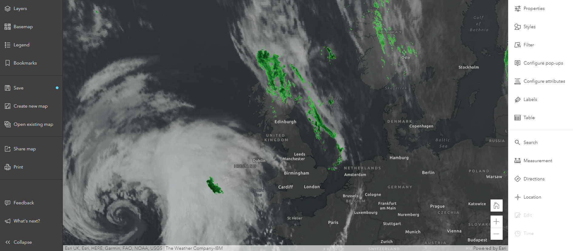
The Living Atlas includes this great Web Map showing daily radar coverage, this can be used to see the intensity of rainfall in near real time. A user can add their own data on top of this layer and save this as a new map. As a UK example, I’ve chosen to visualise the location of RNLI lifeboat stations adjacent to the North Sea in Scotland.
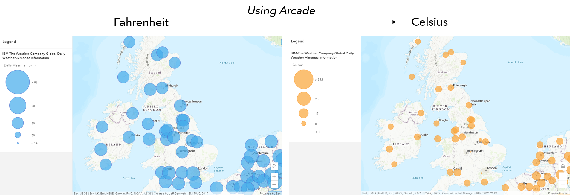
Alternatively, it may be that instead of an overview map, a user wants to know precise point based weather data. Taking the Daily Mean Temperature from the Global Weather Almanac layer we can use Arcade to convert this into Celsius for ease of use for users in the UK:
var Celsius = ($feature.Daily_Mean_Temp – 32) * (5/9)
There is also a Current Weather and Wind Station layer for different meteorological metrics.
Ecosystems at any scale
We are fortunate to have a wealth of relevant environmental datasets in the UK to use in visualisation and analysis. From a global perspective, we can use a set of World Soil layers in the Living Atlas to build up more of an understanding.
When creating a map of Great Britain which will also show the island of Ireland we would want to choose a global dataset that includes data for this landmass as well. This will provide additional context to some of the patterns we are highlighting these may have been missed if we were to choose a dataset solely within Great Britain.
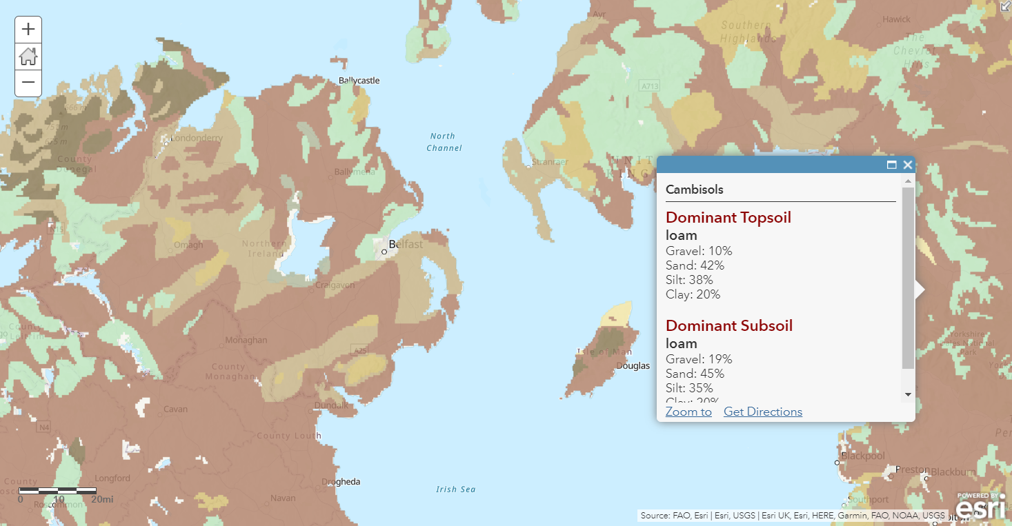
A user can choose to configure popups to remove additional metadata details we do not need to present in the final map.
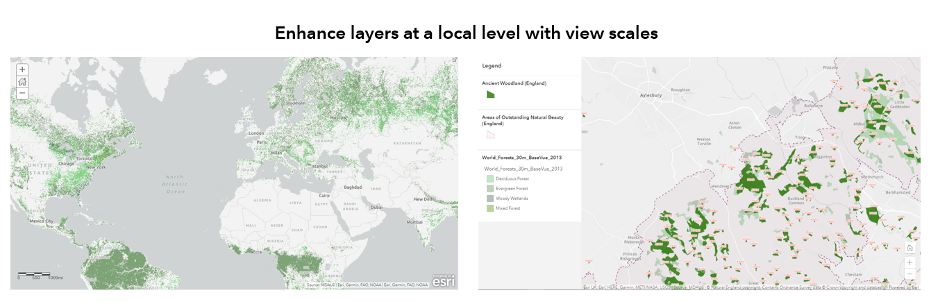
The perception may be that global datasets lack local level detail. I want to introduce you to the which has an incredible level of detail when panning and zooming into areas of the UK. Of course, we can combine this environmental layer with UK datasets to better inform users. One use of the World Forest Database may be to show forested areas at a national scale and as a user zooms into a regional or local level more layers are revealed. In the example below I use Ancient Woodland and Areas of Outstanding Natural Beauty from Natural England.
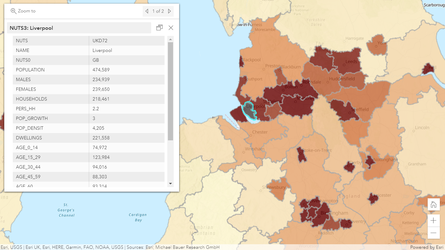
Demographics and people
Similar to environmental layers, we can compare demographic data at different scales. It is worth bringing to your attention the European NUTs boundaries which include demographic data relating to population, gender, age and employment characteristics.
Underneath the ocean
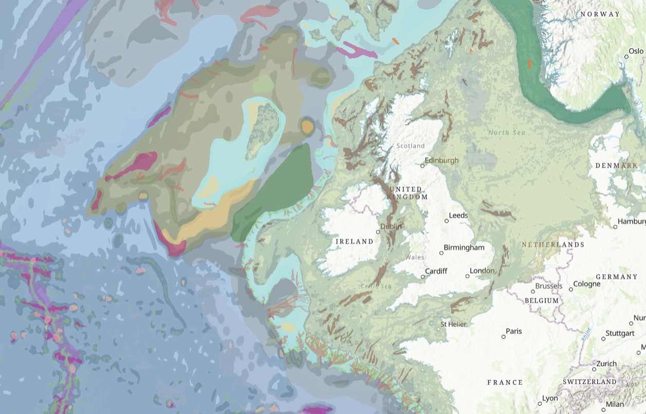
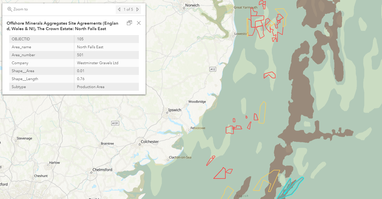
Basemaps can depict the seafloor quite uniformly unless choosing an Ocean specific style with bathymetry included. We can use a global dataset, World Seafloor Geomorphology to paint a detailed picture of the landscapes that appear outside of view below the water.
By viewing this layer alongside a UK nominated layer, in this case Offshore Mineral Aggregate Sites from the Crown Estate, we can gain insight that we wouldn’t have been able to with one of the default basemaps.
Takeaways
The Living Atlas really is a global collection of datasets and I thoroughly recommend taking the time to explore those which are available to you. Remember it is available to all ArcGIS users, you just need to log in as a Named User.
If you are interested in nominating a dataset for use by the GIS community you can do so from within the Living Atlas website. This nomination will then be reviewed by a member of Esri UK Staff.
I look forward to seeing the maps created with some of the datasets mentioned here.