At last year’s Esri User Conference Peabody Municipal Light Plant showcased the innovative processes that they had been able to achieve through implementing and using the capabilities of ArcGIS Utility Network, to manage their 25 square miles approx. of territory. This year they are back and discussing how they have used ArcGIS Utility Network and UNE for ArcGIS to enhance their quality control workflows.
Aim of the application
Peabody Municipal Light Plant’s workflow enables their team, typically non-GIS personnel, to capture missing assets or update the information they have from annotated paper maps directly to their Utility Network through an easy-to-use application.
To be able to achieve this, the application needed to; use branch versioning, allow users to edit specific features whilst recording who edited what, and provide users who aren’t from a GIS background with the ability to highlight any missing assets.
Making the app for their users
It’s important for Peabody Municipal Light Plant to have apps that are designed with their users in mind. As users typically aren’t from a GIS background, a lot of thought was put into how the app should behave to make the getting started experience as seamless as possible.
Simple to use
UNE for ArcGIS has an intuitive interface by design. This means tools are only shown to users as and when they need them. This reduces the learning curve and is ideal for the user group Peabody Municipal Light Plant are giving this app to, as they don’t have formal GIS training.
Top menu for UNE for ArcGIS
Peabody Municipal Light Plant are using the default UNE for ArcGIS application with additional capabilities that we’ll be diving into a little later in this blog. However, organisations can tailor UNE for ArcGIS applications further. For example, for some tools it’s possible to define the positioning or how they should work. When tools aren’t needed, they can be removed altogether.
Symbology and labelling
One of the benefits of the Utility Network is that it is one service that can be consumed in apps across the ArcGIS System. This means through a web map the look and feel of the service can be configured to match the users interacting with the data. In this case Peabody Municipal Light Plant were able to simplify the symbology and add labels so that map matched what the user would expect from CAD or paper-based maps.
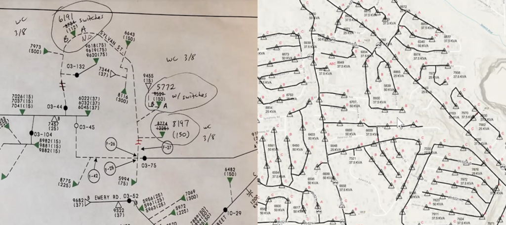
Left side paper maps and right side map in UNE for ArcGIS
Making the workflow
Branch versioning
UNE for ArcGIS has been designed to work natively with Utility Networks that have branch versioning enabled. There are several ways users of the app can interact with branch versioning, all of which can be configured in the builder.
Peabody Municipal Light Plant’s workflow allows users to navigate to an existing version or create a new version, using the versioning panel.
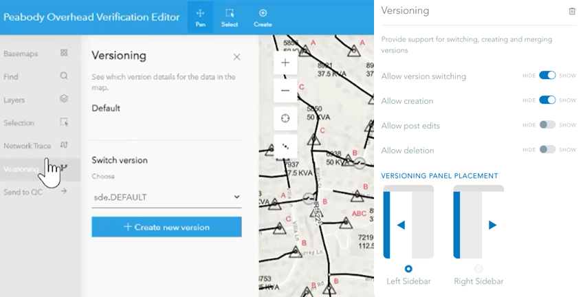
Versioning panel and configuration
Within the UNE for ArcGIS Builder, the ability to switch, create and delete versions can be enabled or disabled for users in the app. It is also possible to enable users to post edits. If this option is enabled there are options to say how merges should be handled:
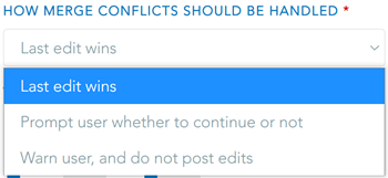
Conflict strategy in UNE for ArcGIS
As mentioned above there is the possibility to modify the look and feel of some of the capabilities of UNE for ArcGIS. This is true of versioning, where the placement of the capabilities can either be on the left-hand panel (above) or found in the settings of the app on the right-hand side of the app, depending how much prevalence the capability wants to be given.
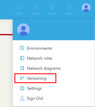
Versioning configured in the right hand panel
Red Line
Peabody Municipal Light Plant want this user group to focus on editing specific features. However, there may be an occasion where a user identifies other assets which are missing. Rather than populate the app with all the different types of features, Peabody Municipal Light Plant wanted users to be able to be mark-up these missing assets.
To achieve this workflow an additional layer was added to the web map and that allows users to capture information about what assets are missing.
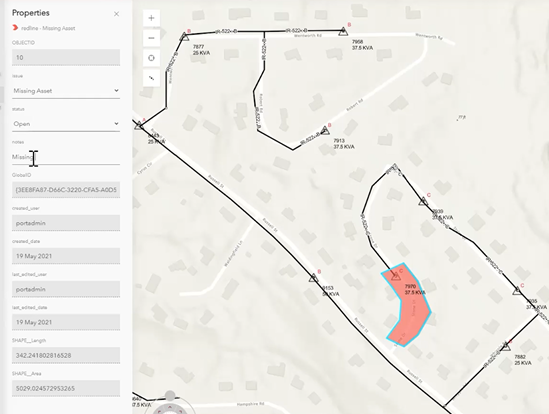
Highlighting areas missing assets
This information is then used by the QC workflow team to capture the asset directly into the Utility Network. Once this new asset is committed into the default version of their Utility Network, it is available in UNE for ArcGIS.
Sending emails
The final piece of the puzzle is making the QC team aware that edits have been made and are ready for review. This is a common workflow which could be achieved several ways using UNE for ArcGIS. For example, ArcGIS Dashboard could be used to show when new edits have been committed. Or integration with job management systems such as Workflow Manager could assign a job to this user group. Peabody Municipal Light Plant elected to use a custom command which checked in the changes, assigned the work to a QC user, and sent an email to this user to make them aware.
Commands are pre-defined tasks set up from the builder. These commands can then be performed by a user selecting them in the application. In this case the type of command used was Run Action, which can be used to pass instructions to the application and run logic. The command was configured via a simple Arcade script to pass details from the application, such as the active user and the name of the branched version they are reassigning, to an ArcGIS Geoprocessing Service that was set up to send notification emails.
We’re excited to see what Peabody Municipal Light Plant do next with UNE for ArcGIS. If you want to find out more about UNE for ArcGIS, check out esriuk.com/en-gb/arcgis/products/une-for-arcgis for resources, blogs, and videos.