Today we are excited to announce the Beta release of our new British National Grid Terrain 3D Elevation Layer. This opens a whole new world of 3D data and experiences in ArcGIS Online. Best of all, the layer is freely available through the ArcGIS Living Atlas of The World.
This service provides two significant improvements. Firstly it allows you for the first time to use Esri UK’s open basemaps within a 3D scene. Secondly it allows you to display 3D data with British National Grid coordinates without the need for reprojection, saving you time in your workflows. In this post we will explore how you can make use of the elevation layer, the benefits it will bring, where the underlying data comes from, and what’s next for 3D data in the Living Atlas.
How to use the British National Grid Terrain 3D Layer
Here’s our quick five step guide to getting started with the new elevation layer:
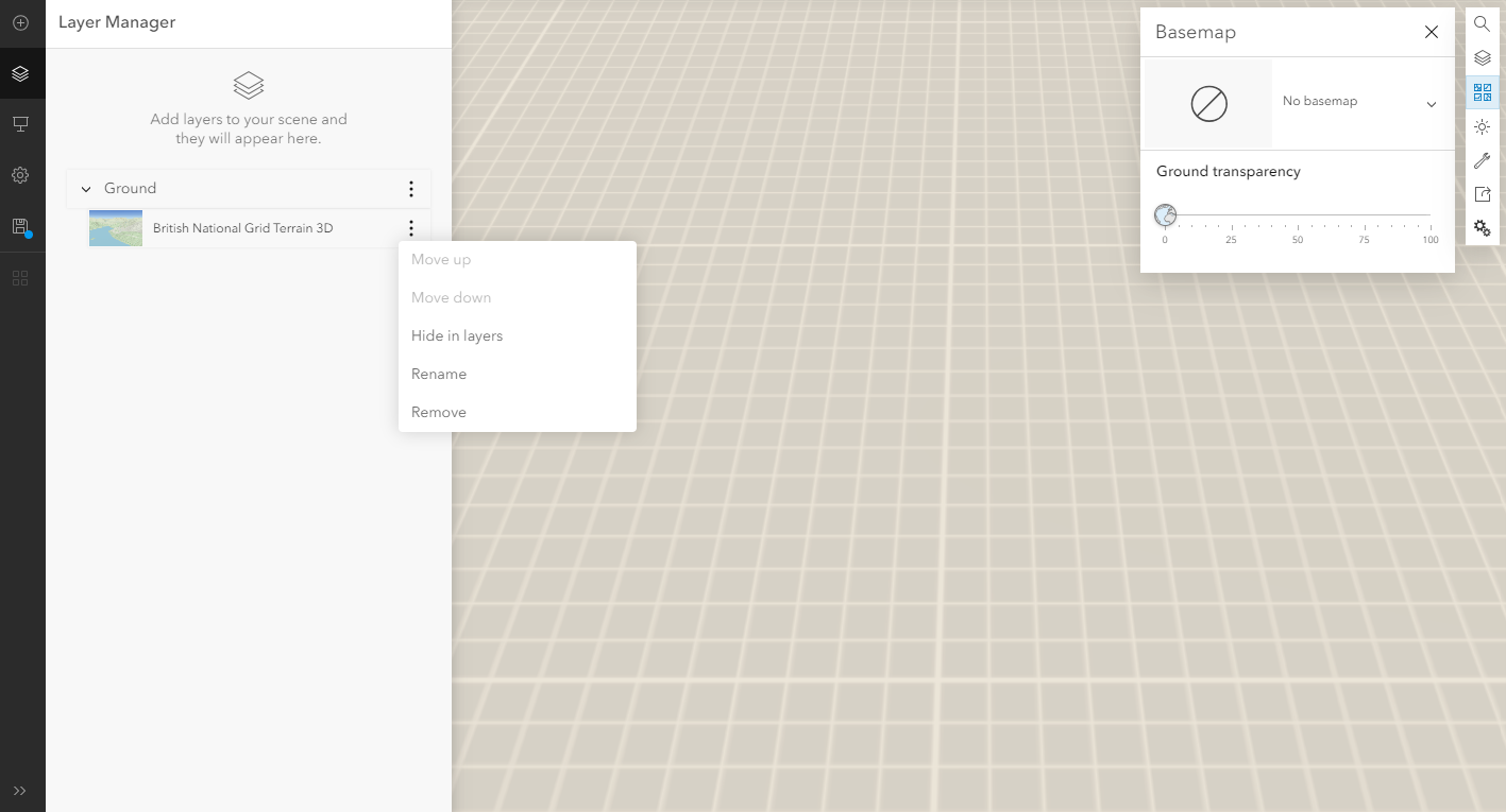
1. Start by creating or opening an existing local scene. If there is already a basemap in the scene remove it by clicking the basemap icon in the top right and selecting “no basemap”.
2. Under the layer manager, open the ground layer and remove the British National Grid Terrain3D layer.
3. From the menu on the left hand side, click the plus icon. Then browse layers and within the Living Atlas find the “British National Grid Terrain 3D Layer” and add it to your scene. It should automatically be added as a ground layer.
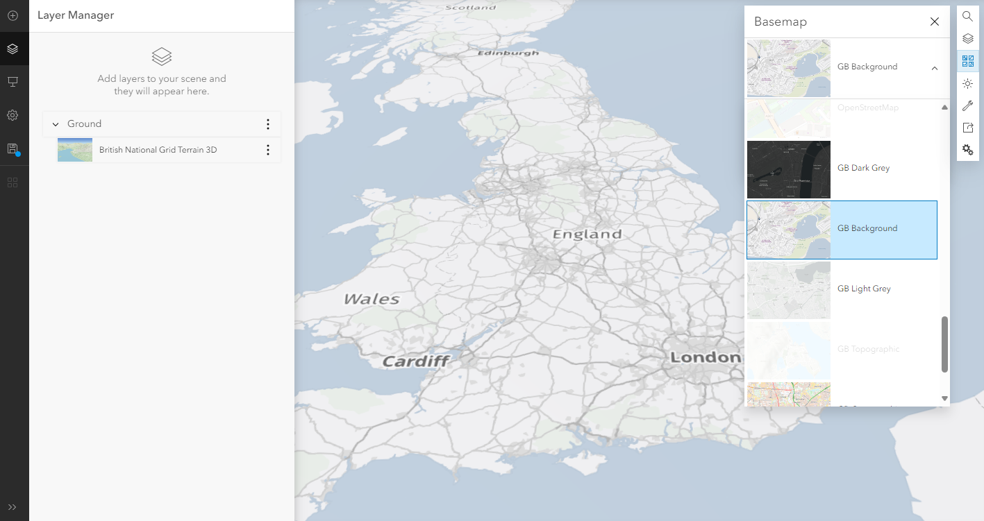
4. Next reopen the basemaps menu from the right hand side and select one of Esri UK’s open basemaps. You may need to scroll to the bottom, hey all have a GB prefix. If you are a Maps+ customer you can also add your Maps+ basemaps. You should now have a 3D basemap!
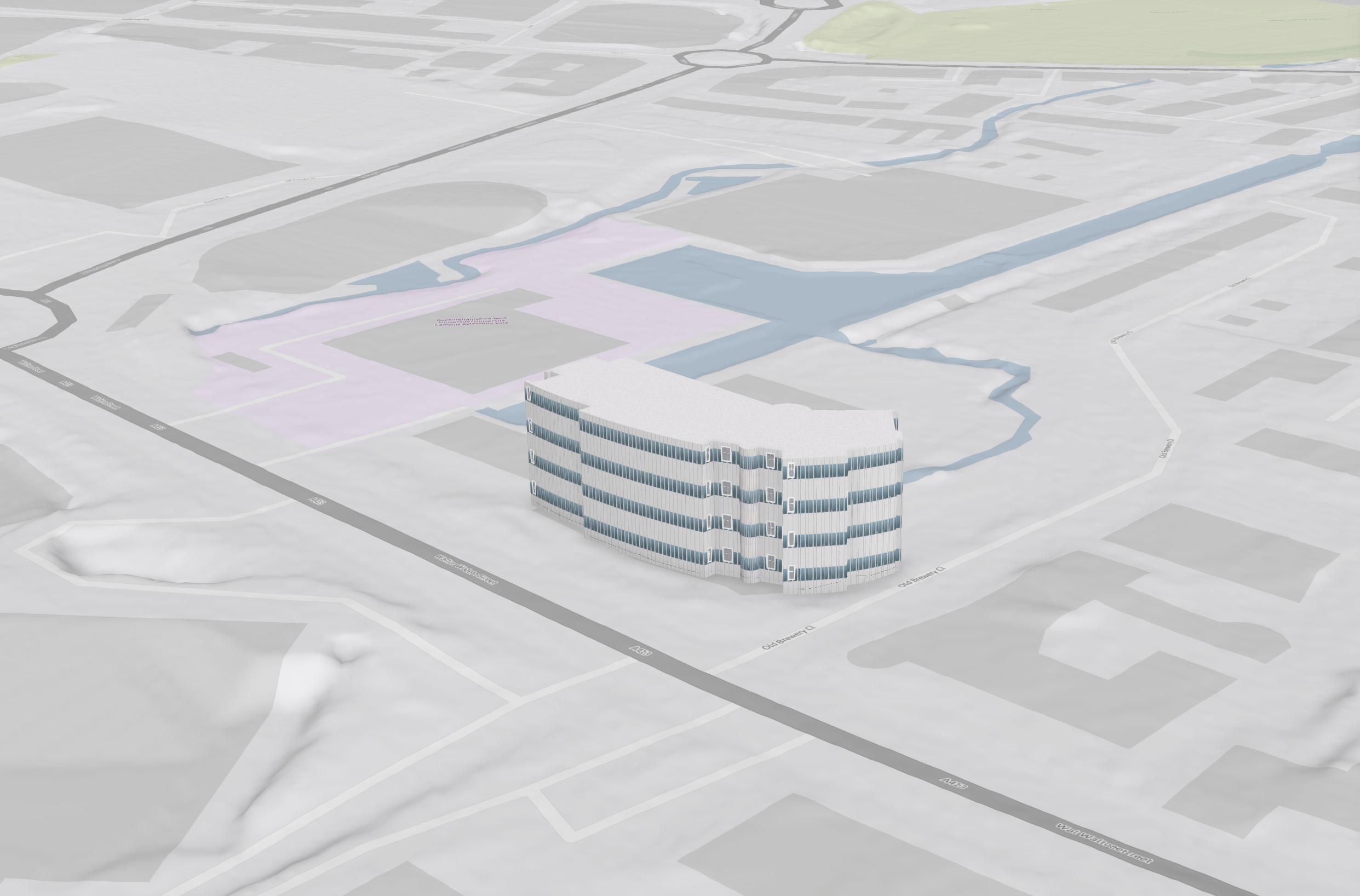
5 .Finally you can add a Scene Layer that is in British National Grid to show your data in 3D.
What Benefits Does This Offer?
The new elevation layer allows you to:
- Use OS Open Basemaps and Maps+ Basemaps with an elevation service in a scene.
- Add 3D models in British National Grid to a web scene saving you time re-projecting them and simplifying your workflow.
- Leverage the improved resolution (when compared to the existing world terrain service) to provide more detail to your web scenes.
Where does the data come from?
The majority of this dataset is created from the Environment Agency’s 1 Metre DTM Composite. The data was collected from surveys between 14th February 2003 and 5th May 2022. Surface objects were removed using the Environment Agency’s bespoke algorithms. There is a small area in North Yorkshire where there is incomplete coverage. In this instance the Ordnance Survey’s Terrain 50 dataset has been used to fill in the gap.
What’s Next?
At the moment, this dataset is in Beta and is only available for England. We plan to use the OS Terrain 50 to extend the coverage through Scotland and Wales. We will also work with other DTM providers to add improved resolutions in these areas with the aim of reaching the same coverage for Great Britain as the World Terrain 3D Layer.
This is just the start of a whole series of exciting datasets coming to the ArcGIS Living Atlas of The World. If you have ideas for datasets you want to see in the Living Atlas or feedback on the Beta service itself, please use this form to make a suggestion to the Living Atlas Team.