The days are getting longer, the sun is shining (here) and there’s a new version of ArcGIS Pro to explore – a happy Friday. Having looked through the full list of changes it’s time to choose some highlights to share.
ArcGIS Notebooks
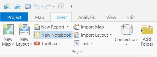
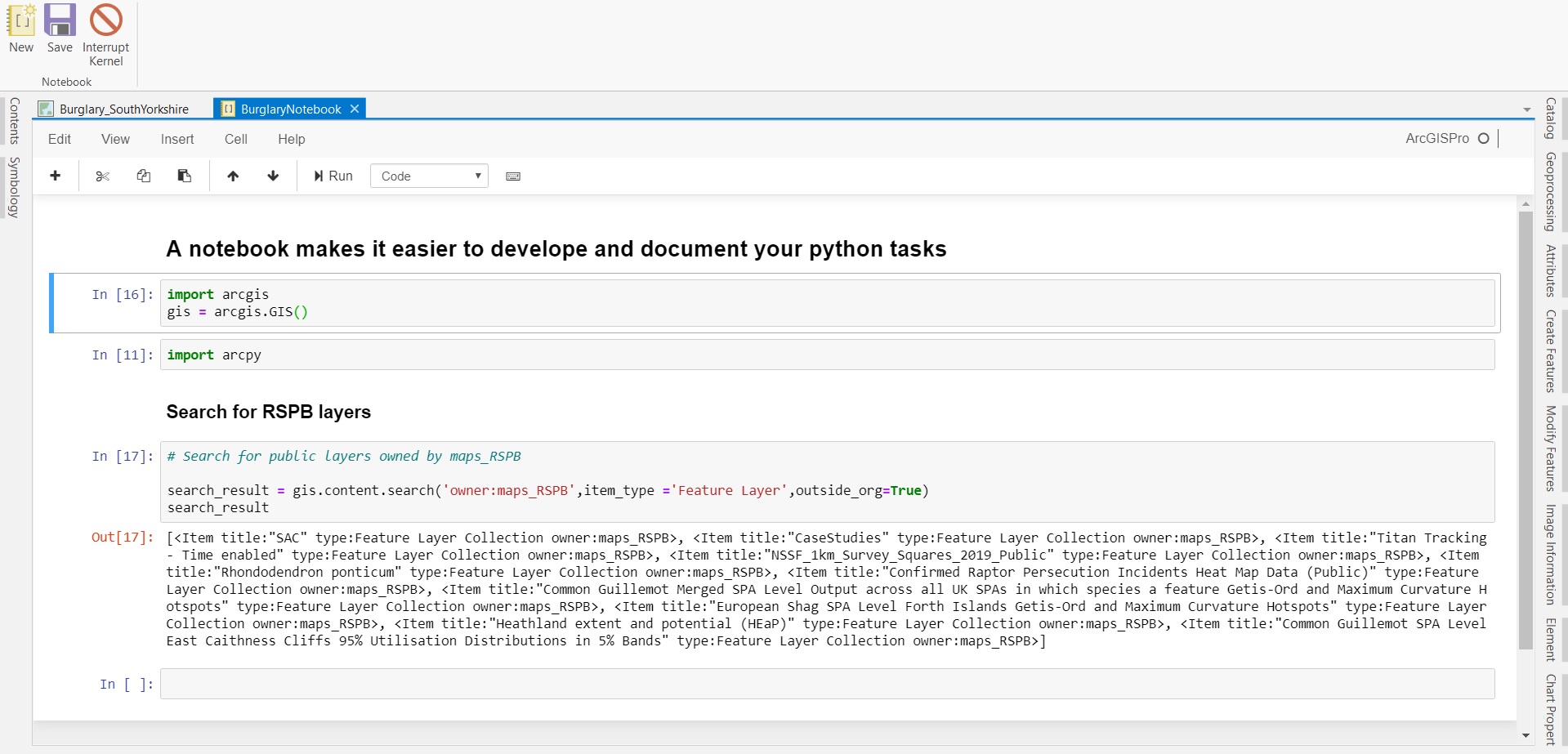
Having discovered the joys of Jupyter Notebooks, their inclusion in ArcGIS Pro gets my biggest cheer. I’m sure some of you are already working with Notebooks to create, document and run your python workflows. If not, now is a good time to try, as ArcGIS Notebooks are now integral to Pro and you can add new Notebooks to your project:

For someone that only uses python now and again, I find the cell structure a much easier way to develop a script and follow its structure. All of the Python libraries are available in the notebook, including ArcPy, ArcGIS API for Python, NumPy and pandas.

You can add other open-source libraries as well. Keep track of your configuration with the Python Package Manager.
In this release version of Python in Pro has also been updated to 3.6.9. There’s also a new Python Metadata module, arcpy.metadata, making it easier to automate some metadata management tasks.
Schedule Geoprocessing tasks
Having created your work workflow as a geoprocessing model or script you need to run it regularly. With Pro 2.5 you can now schedule gp tasks directly from the Geoprocessing pane.
Edit tools
There are lots of new editing tools in this release and enhancements to existing ones. Feature construction options now include Direction Direction, Line Intersection and a Spiral Curve tool. Multipatches get a look in too - with new Circle and Rectangle construction tools, and an Offset Face tool to create a jut or cavity.
Table data
Working with multi-field table data, you can now freeze and unfreeze fields to make comparing values across fields easier. Better still, they’ve added a Find and Replace function. It gives us a more interactive way to find records than Select by Attributes and the replace option makes it easy to alter those few fields values that need changing. For updating large numbers of features the Field Calculator is recommended.
Charts on maps
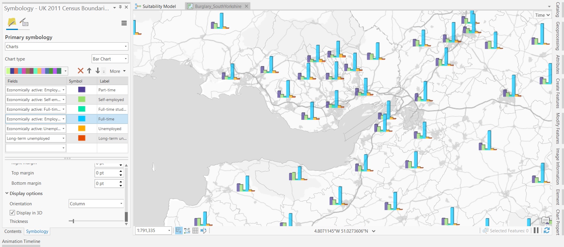
The chart tools in Pro are a great way to explore your data or enhance your output map in a layout. But sometimes the best way to show multiple attributes in a geographic context is to use chart symbols on the map. This option has now arrived in Pro and is really easy to use. I added some census layers from the Living Atlas and within a couple of minutes had bar plots for key attributes for Local Authorities showing in their location - all normalised by the total count. I usually switch off shadowing on charts, but on a map I think they work well:

You can choose between bar charts, pie charts or stacked charts.
The best of the rest
I’m nearly out of time but, as well as the ongoing performance improvements, I couldn’t finish without mentioning these…
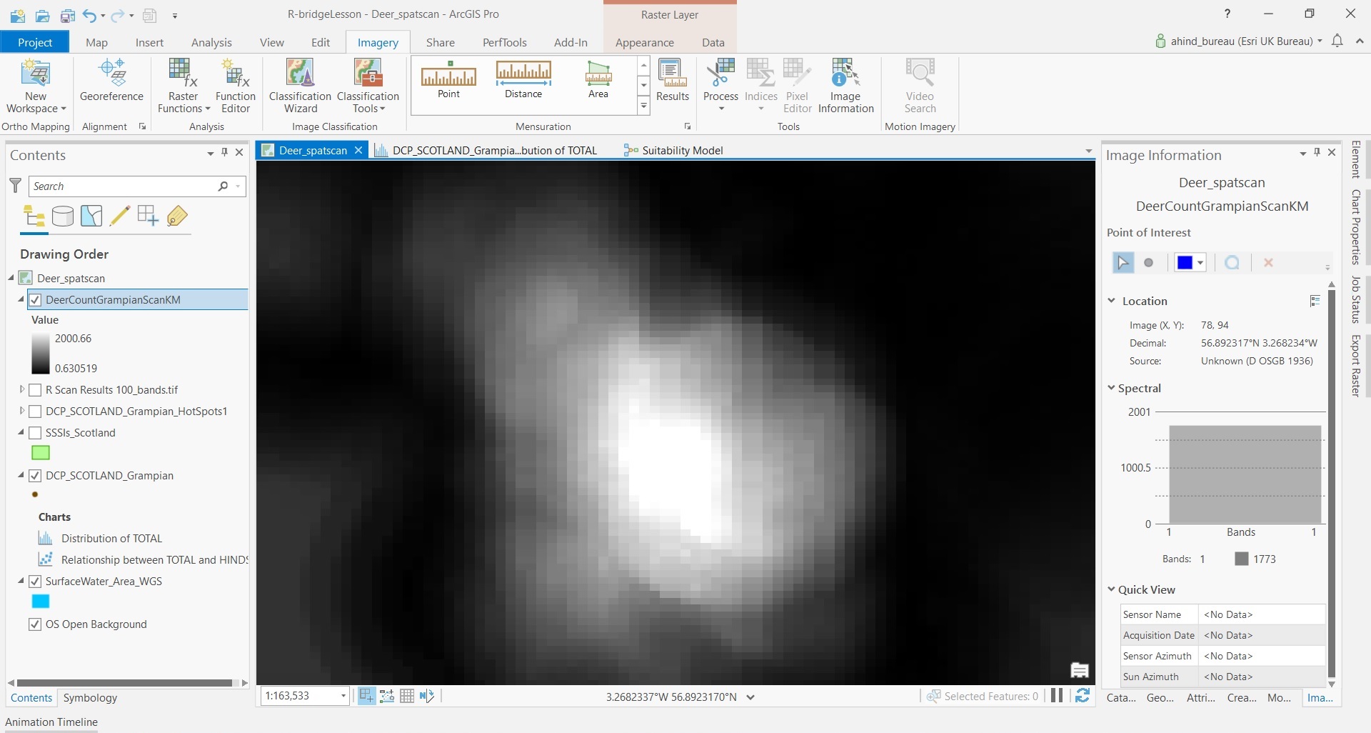
There has been lots of work on the spatial analysis tools, especially the raster tools. There’s an overview of the changes here. I’ll need to explore these properly another day, but I did try the interactive info panel, which makes it easy to explore the values across a raster or image:

The Network Analyst toolset has been available in Pro for a while but you can now create your network dataset as well. The Create Network Dataset tool creates a minimal network dataset. Once this is created, you can modify the properties by adding more attributes, historical traffic, and directions settings.
If you are working with replicated databases you’ll be interested to know that ArcGIS Pro now supports geodatabase replication workflows.
Finally, the map-geek in me is delighted that my professional work tool includes a homage to a cartographer - the inclusion of two Tobler projections honoring their creator Waldo Tobler. The other new projection is Adams Square II in case you want to explore them all.
There is so much in this release that it’s worth taking the time to read through the full list of What’s New. There’s also a video tour of the highlights.