I haven’t used Collector for a while, so I’ve been catching up with some of the new features and re-acquainting myself with the new(ish) Collector. This is currently only released for the iPad and iPhone, with a beta version for Android available.
Bar codes and QR codes
If your assets have bar codes or QR codes you can scan these with Collector and use the information to populate fields. All text and numeric fields show the option to scan a code.
![]()
Streaming Points
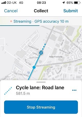
Previously I've collected either added points, or vertices, one click at a time, but I've been trying out the streaming option and really like some of the UI features.
I found that adding the first point to my line features by clicking and then activating streaming worked well – you do this through the options (three dots). I then switched back to add the last point manually. Once streaming is active the options button lets you set the streaming interval, either as a time interval or by distance.
The map shows the current shape of the line but also shows a breadcrumb trail extending from it so you can see where the next segment will go.
Accuracy of the fix is shown clearly - particularly useful when the moment of capture is automatic. don’t forget you can set an accuracy threshold in the options for Collector.
The other nice touch is the subtle progress bar (the blue line below the GPS accuracy) that shows when the next point capture will happen.
Arcade
Arcade allows you to manage things like symbology dynamically and replicate that across the ArcGIS Platform. This includes Collector. What kind of thing do I mean? One example I set up was to symbolise points that have four attributes for their status and I wanted the symbol to show the worst status level for any of the four attributes. An Arcade expression can be used to check across the attributes and return the worst value to the renderer – I used traffic light colours for the worst of the four status values. If you use Twitter, lookout out the Arcade tips from my colleagues #esriarcadetips
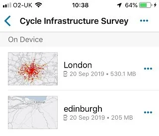
Offline Basemaps
Collector lends itself to having different maps for different data capture tasks, but for many field staff their working area would be the same. Taking a detailed basemap offline can have a big footprint – though using a vector tile basemap helps mitigate this. The most recent update allows you to setup your maps so they reference a shared offline basemap. This is prepared as a basemap package and, of course, can be side loaded onto the device. The side loading can now be done with either iTunes or the Files app.
I’ve been defining my own offline areas and found it clearer than I remember it in Classic Collector. With the switch to using vector tiles, I was impressed by how much bigger an area you can download and how quick it is.
Related features
Sometime spatial association isn’t a direct enough way of linking features and you may be using relationships to model this. Collector supports relationships. Click on a feature and it will show any related features - you can then jump to these. Collector also allows you to create related features and sync them back with your edits.
Don’t forget you can keep up to date with new features through the documentation pages and get a sneak peek at what’s coming.