Have you ever wanted to use weather forecast data to better understand how your assets might be impacted by rain, sleet and snow? This is now possible for all customers with the new Beta release of our UK Precipitation Forecast, available through the ArcGIS Living Atlas of the World.
What Weather Forecast Data is Available?
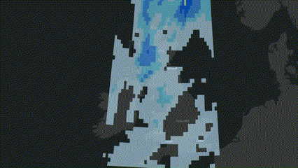
The UK Precipitation Forecast uses data derived from the NOAA 0.25 Degree Hourly GFS Forecast and is updated every 6 hours. It provides data for the next 72 hours and consists of both a cumulative forecast and an amount by time forecast. The latter allows animations such as the one above to be created using a time slider in an ArcGIS Online Web Map.
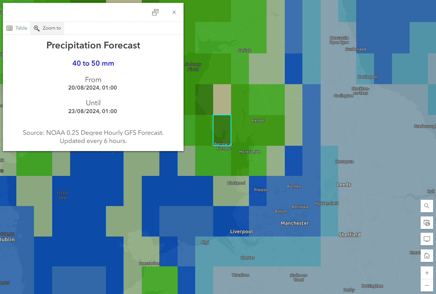
The new service can be combined with other location data to see how the forecast varies across different sites, points of interest, or regions. For instance, by overlaying the Cumulative Total Forecast onto major cities across the UK, you can quickly identify which cities are forecast to receive the most rain.
Dynamic Blending
If you’re only interested in a certain region of the UK, visually clipping the data is easy using Blend Modes in the ArcGIS Online Map Viewer. By placing the UK Weather Service layer into a group with a polygon of your area of interest, you can use the Compositing blend mode options to show the forecast only in the areas which intersect with your chosen region.
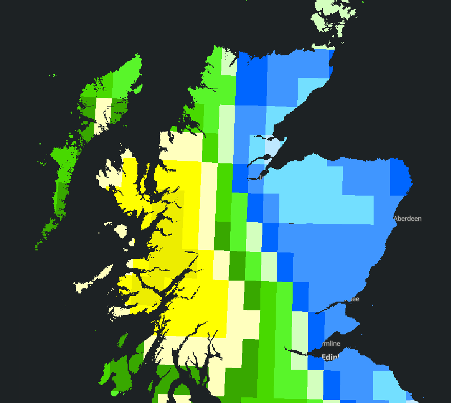
This is a great way to keep the data you are working with relevant to your area of interest, with the added bonus of making your maps more visually appealing. If your area of interest is a particular country, region, or LSOA, a polygon may already be available through the Boundary layers available in the Living Atlas.
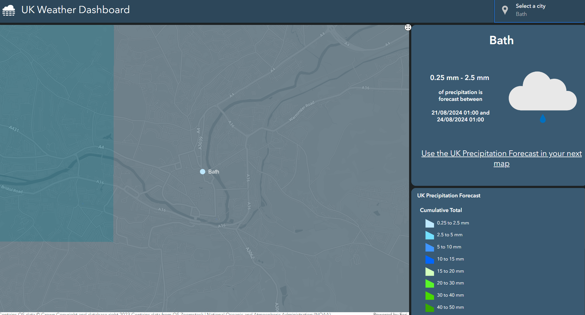
The UK Weather Dashboard
To take the UK Weather Service one step further, we decided to create a Dashboard which allows you to view the forecast for each city in the UK, with dynamic weather icons driven by Arcade expressions. The result is a clean and easy-to-use weather dashboard providing real-time information.
What’s next for the Living Atlas?
The UK Weather Service is one of a whole series of exciting datasets which are planned to join the ArcGIS Living Atlas of The World. If you have ideas for datasets you want to see in the Living Atlas or feedback on the Beta service itself, please use this form to make a suggestion to the Living Atlas Team.
Useful links