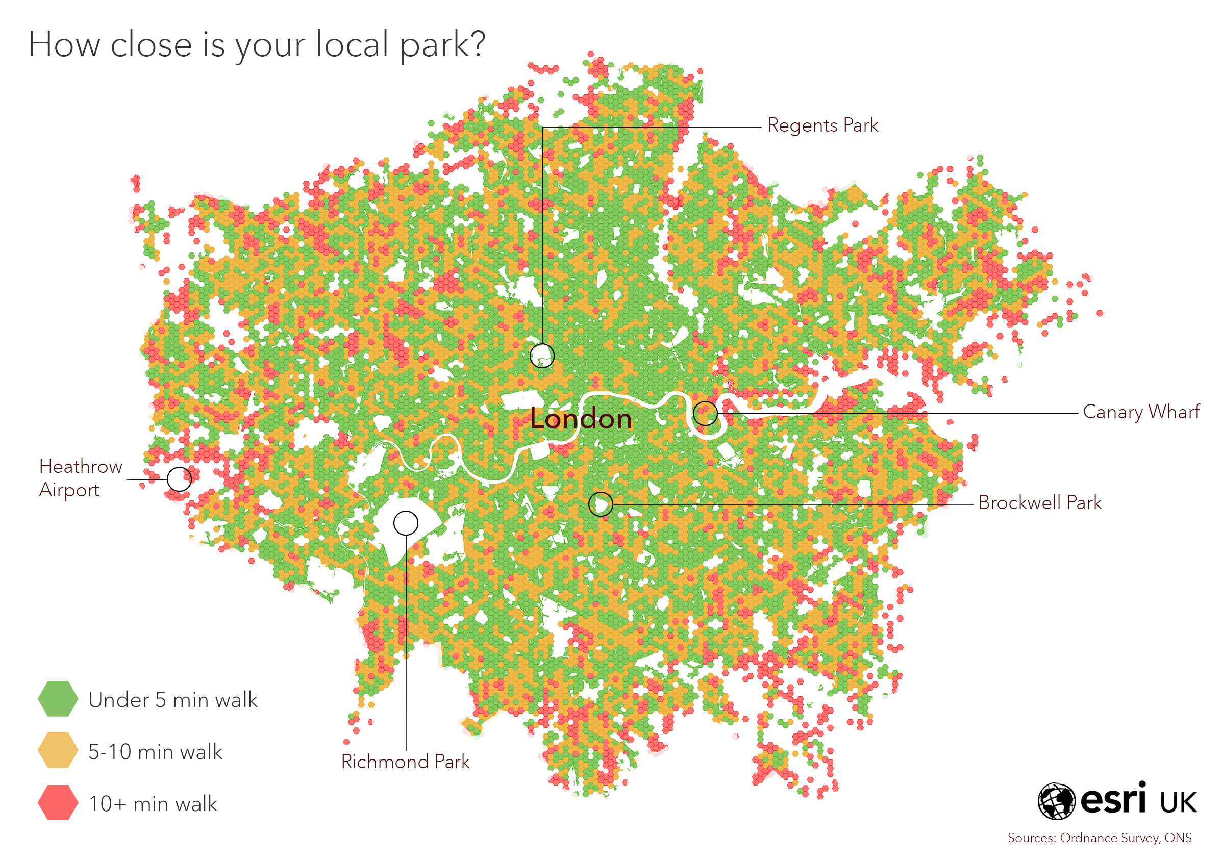
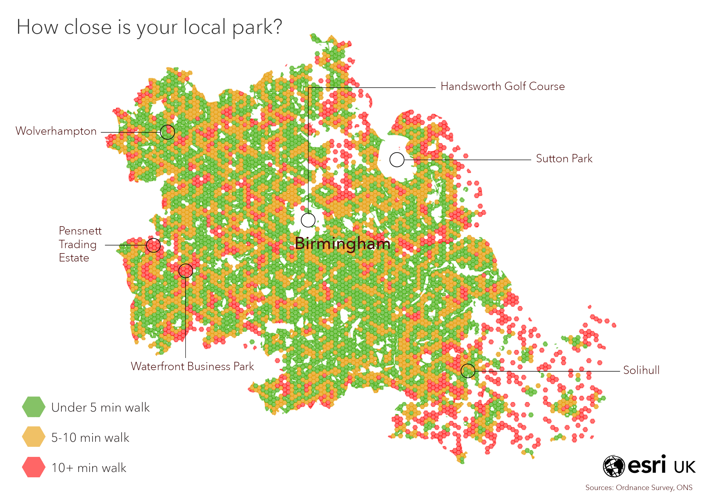
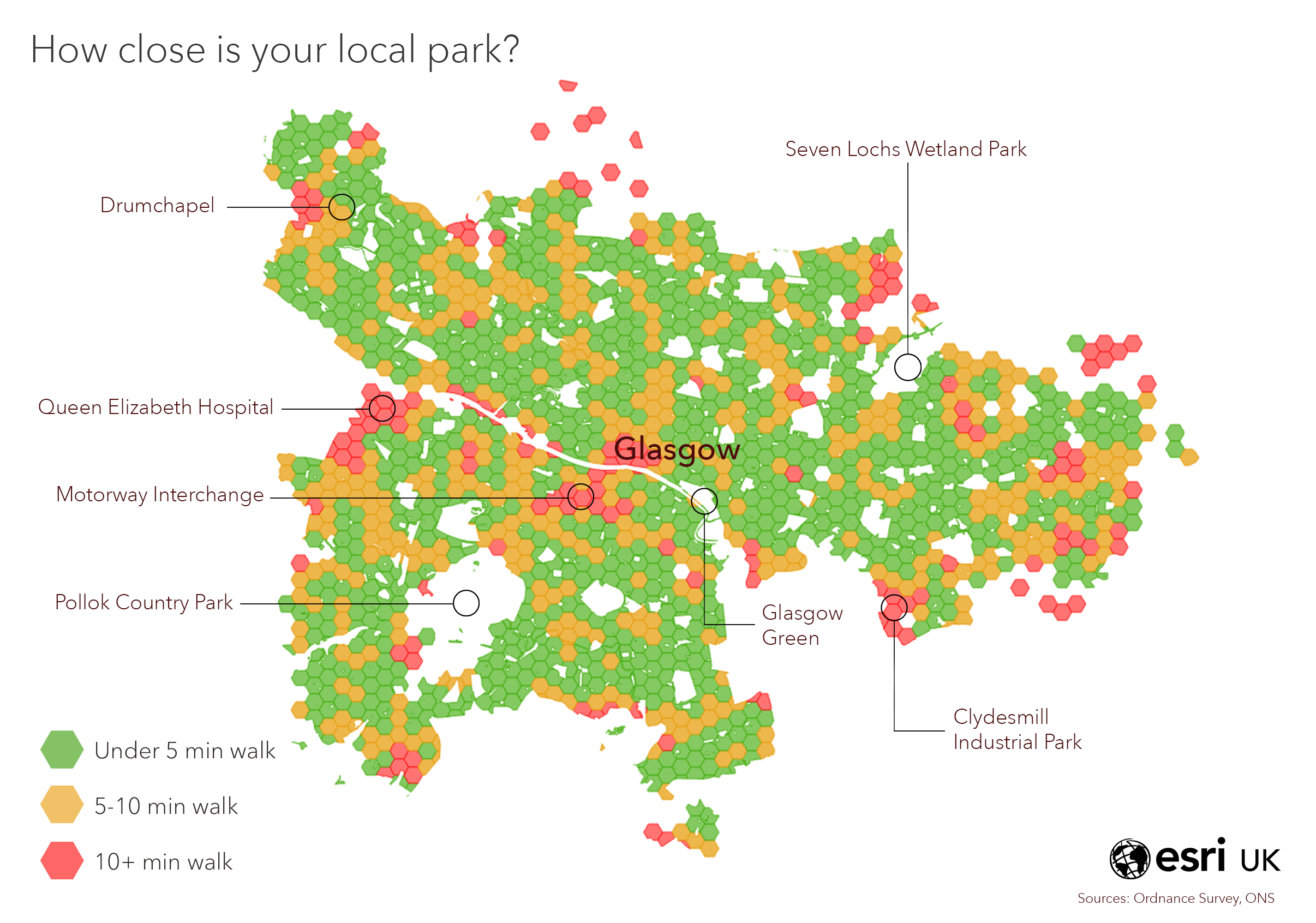
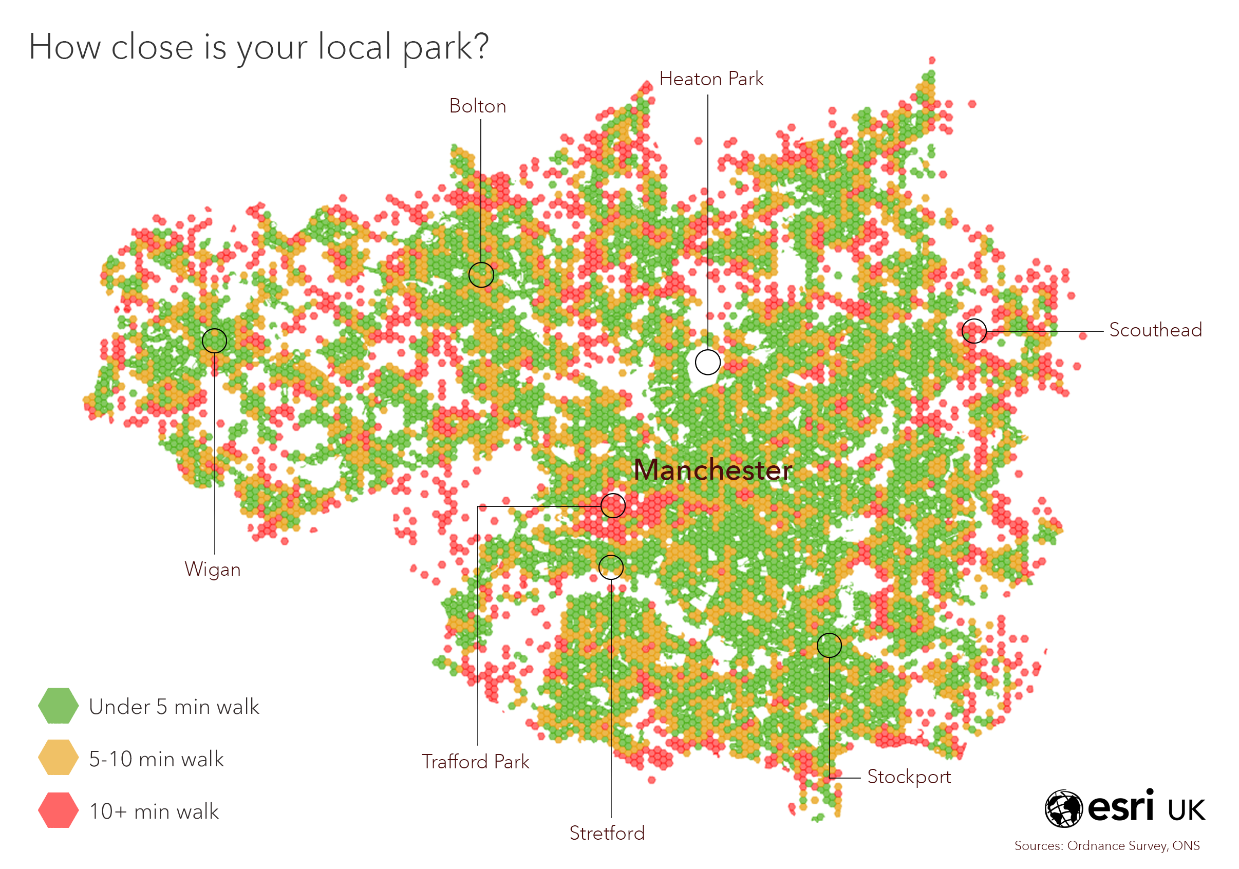
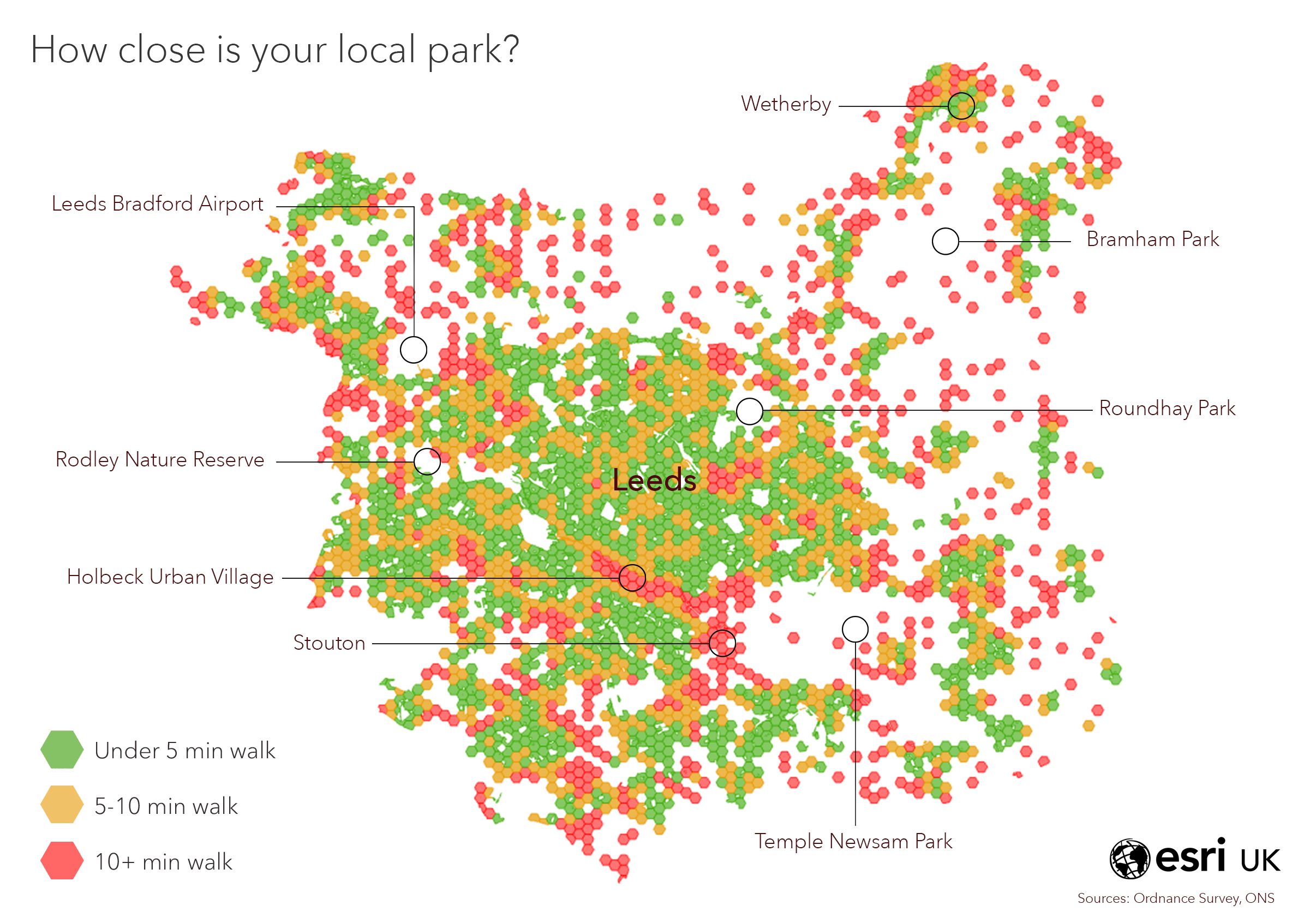
During the Great Lockdown of 2020, we’ve all had to re-familiarise ourselves with the local area surrounding our homes. Forcing us to explore the local parks and hidden bridleways you perhaps didn’t know existed before the pandemic. This sparked another map idea at Esri UK HQ. The overarching question we asked ourselves was “how far away is your local park?”.
We wanted to explore the average distance from people’s front door to their local park or green space, then identify areas of the UK that must travel further get some well-deserved fresh air (and suffer the effects of hay fever).
We realised that calculating the distance from every home in the UK would be a resource-taxing analysis, whilst also restricting us from sharing the output, as it would have required a premium dataset. So, we levelled up to postcodes. Taking the centre point of each postcode (which on average represents 15 properties), we created a network layer to draw a route from postcode to park, using the OS Greenspaces dataset (found here in the Living Atlas). This data also has access points to the green spaces, so we could accurately calculate the first point of contact with that overcrowded local park.
Once we had an average distance per postcode, we did some expert googling to find out what the internet considers ‘average pace’ and we stole TfL’s definition of 5-minute walk = 333 meters (thank you TfL).
We then made 3 categories; ‘under 5 minutes walk’, ‘5-10 mins’ and ‘10 mins +’.
Time to add a splash of cartography to jazz up the visuals - we opted for the trending style of hex bins. Methodology in 144 characters: we created a hex bin grid (Generate Tessellation) and then the Summarise Within tool to create an average walking time for each hex bin – viola! I make it sound like this took about 20 seconds, it didn’t.
Here are the outputs with a few labels added to pinpoint those high and low access areas. It was challenging to visualise the entire UK as one map, so we focused on 5 cities as we felt this conversation was more relevant to urban living… you lot in the countryside have plenty of green space so no complaints! Enjoy the final products…
