I know what you’re thinking….Machine Learning? Easy?… stay with me. Thanks to the Esri Analytics team, there are now pre-trained deep learning models available in the ArcGIS Living Atlas and the best part is, we can use these with no experience of machine learning! Let’s jump right in and see what’s available for us in the Living Atlas.
What’s Available?
The following is just a snapshot of the pre-trained models that are available to start using today: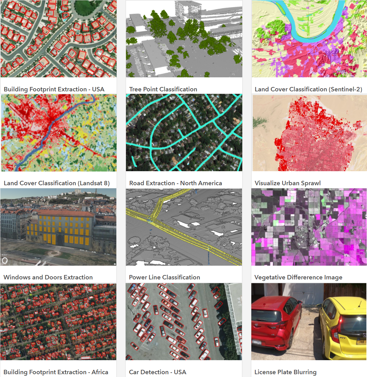
With the available pre-trained models, covering everything from building footprint extraction to licence plate blurring, it’s hard choosing just one to take a closer look at. Working in a city can have its limitations for open space so I’d like to determine the total percentage of land that is considered open space. With this information I’m interested in finding a new walk to enjoy at lunch within 10 minutes of the office. To achieve this, I’ve chosen the Land Cover Classification (Landsat 8) deep learning package which will allow me to determine the different land cover classifications.
I’ll be using ArcGIS Pro, but we can also use these pre-trained models in ArcGIS Enterprise with ArcGIS Image Server and on ArcGIS Online too, with the newly released ArcGIS Image for ArcGIS Online.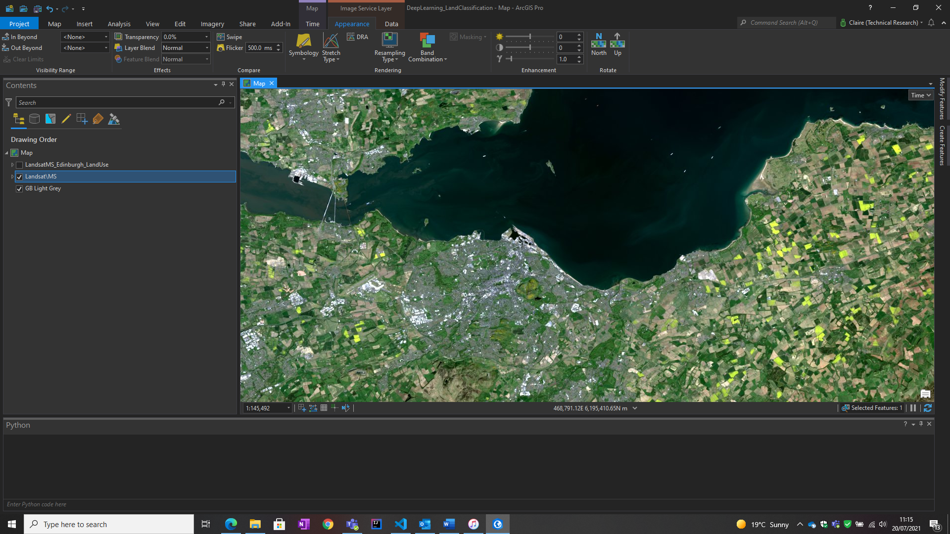
I’m going to need some Imagery..
I always like to check the documentation before getting started. I knew I was going to need imagery, but learnt that this model is optimized for Landsat 8. I acquired Landsat 8 imagery for the Edinburgh area through one of our partners – Planet.
Analysis
I’ve set out to achieve two things with my analysis:
- Determine what percentage of the area is ‘Developed – Open Space’
- Use the results of this analysis to determine which areas are within a 10 minute walk of my office – for a lunchtime walk with a coffee and occasionally a pastry!
Determining Open Space in Edinburgh
Let’s work on determining what percentage of Edinburgh is developed open space. Using the pre-trained deep learning model for land classification I need the Classify Pixels Using Deep Learning tool. With the available options I’m not entirely sure what parameters I need to change, if any, so I’ve turned to the documentation again to be sure I’m using the model correctly. I’ve used the recommended parameters given there, and run the model. I’m interested in how long it will take to process this area, since the pre-trained model has already saved me time in data gathering and training a model to achieve this result.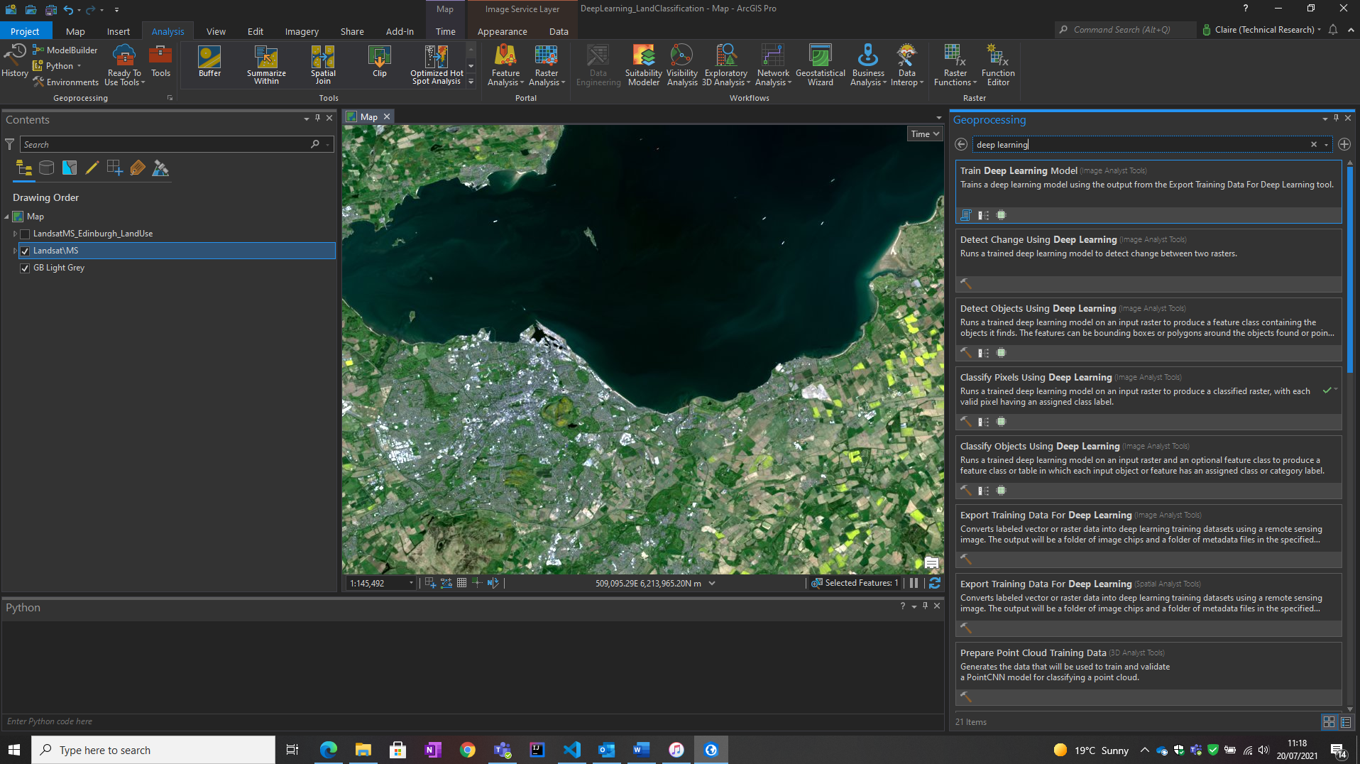
I won’t hold the suspense any longer, for the extent in the analysis below the processing time was … 1 minute 33 seconds. Quickly and effortlessly, a land classification for Edinburgh from imagery is ready to use – with no experience of deep learning!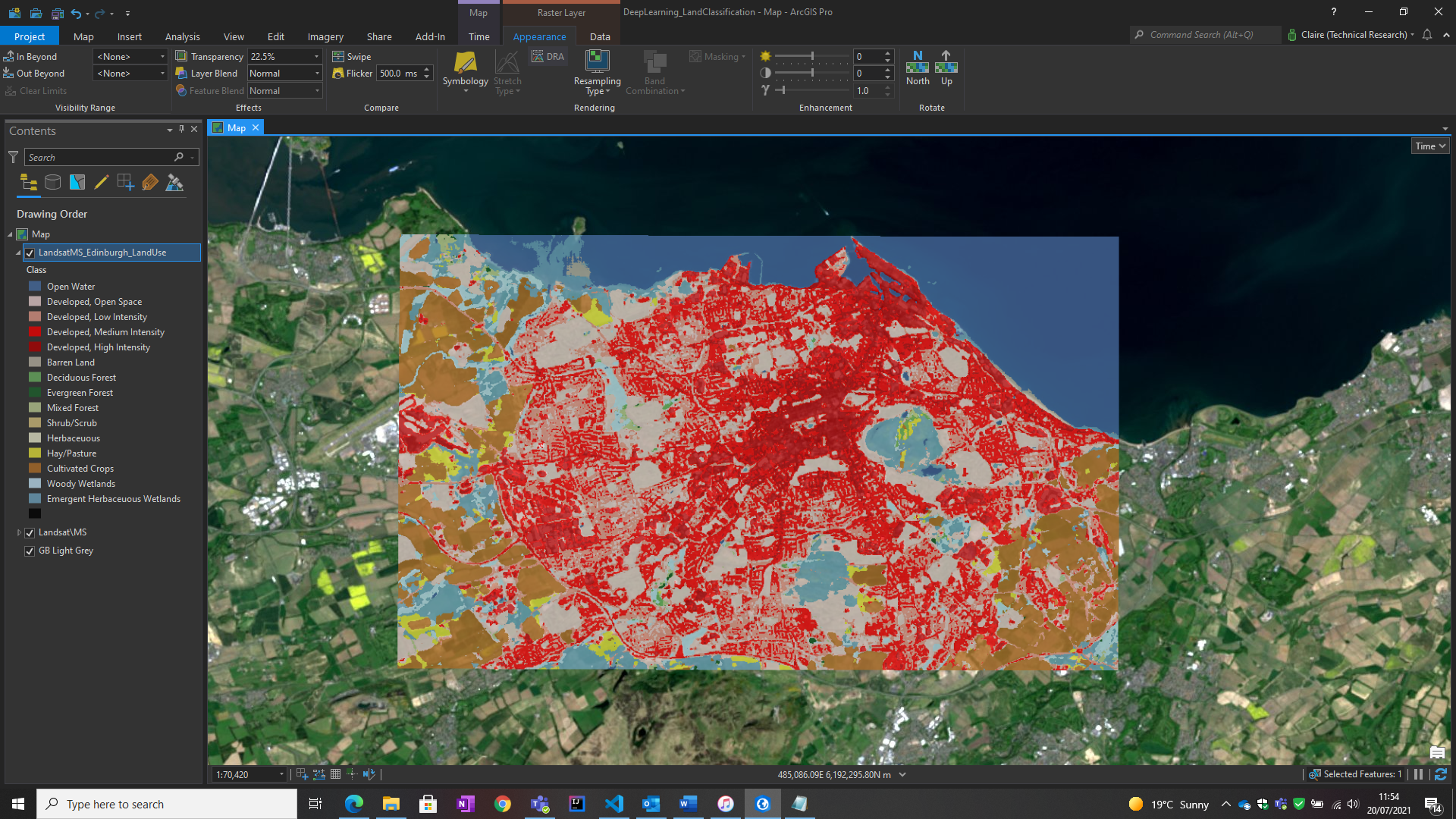
Visually there’s a lot of ‘Developed Medium’ (red) and ‘Developed Intense’ (darker red) areas, which is expected for a city of Edinburgh’s size. I’m interested in the ‘Developed Open Space’ areas (grey) and what percentage area they cover.
Converting the output raster to a vector, using Raster to Polygon, allowed me to Dissolve the result by land class, where the total area for each class is available in the attribute table. Using the statistics available from the attribute table and a quick percentage calculation, I can determine that the total area of Developed Open Space is 16.7%!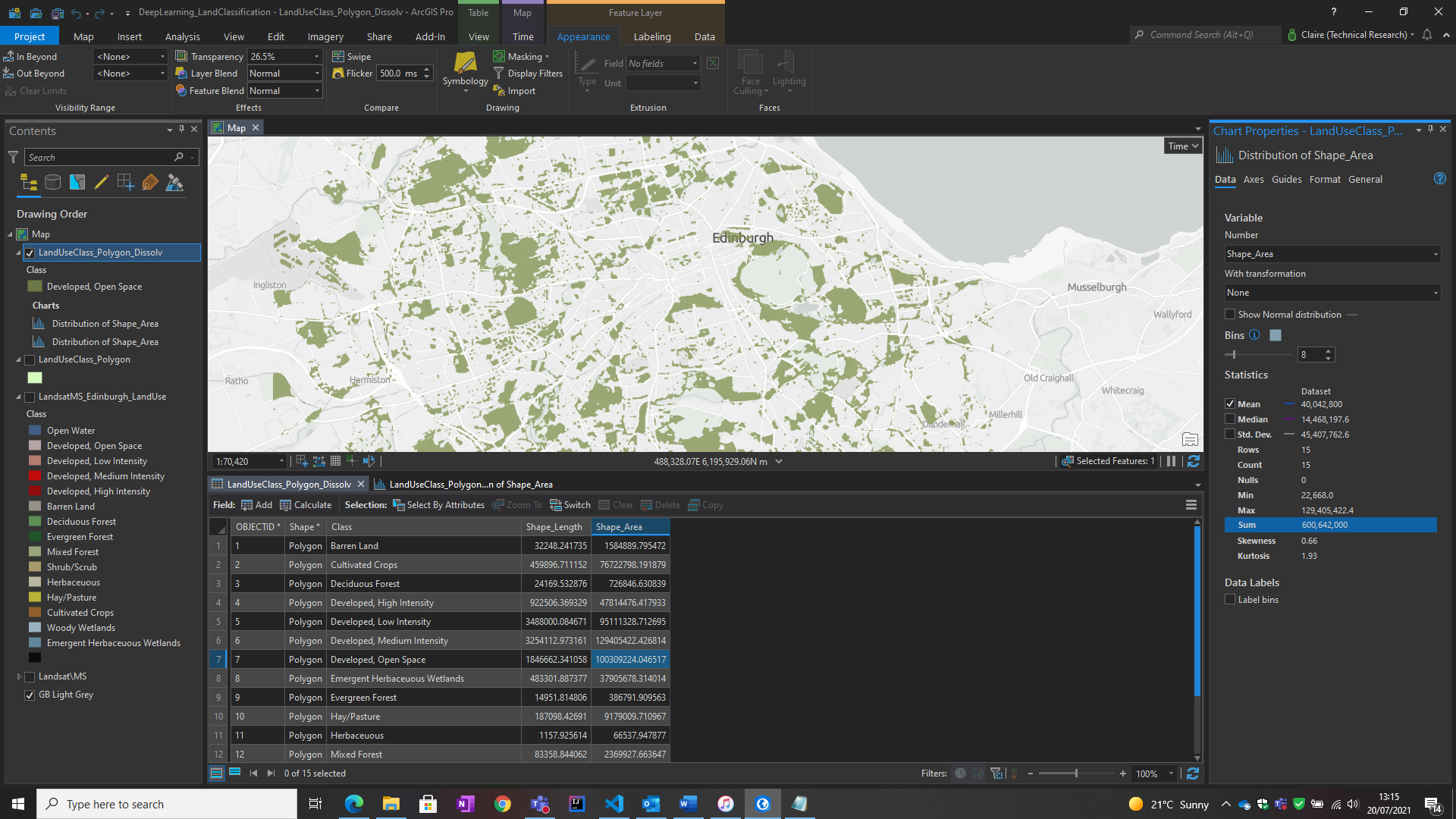
At this point in my analysis I’ve satisfied my first aim, to determine the percentage of developed open space. It’s scattered around the city, so most places are close to an area of open space, which is great! Ideally for my lunch hour, I want to be able to get there within 10 minutes on foot.
Finding Open Space within 10 Minutes’ Walk
This is really just an excuse to use one of my favourite tools – Summarize Nearby.
This tool lets us find target features that are within a specified distance of features in the input layer using a line distance or travel mode (walking, driving and more!), and provides us with statistics for the nearby features.
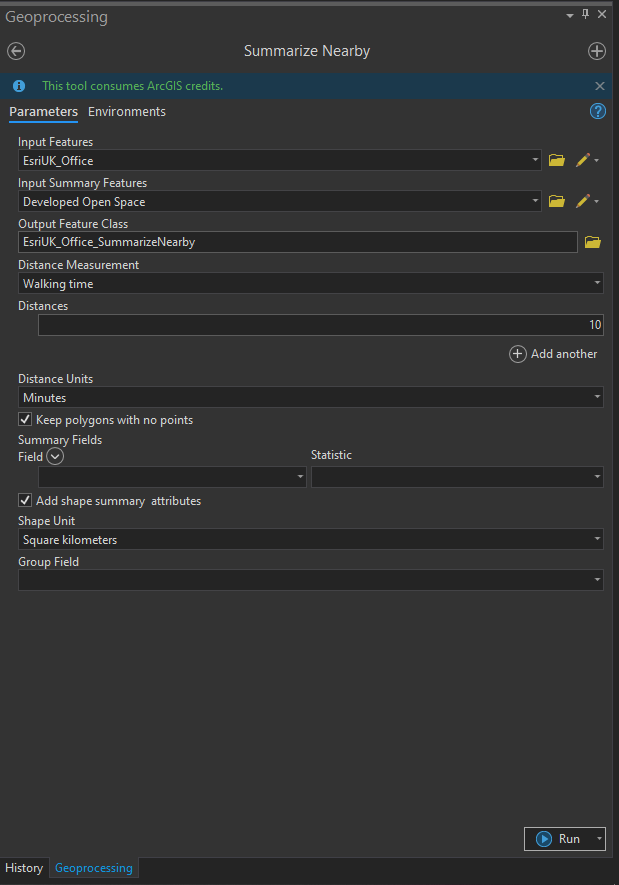
I’ve specified 10 minutes and given my input as the Office and summary features as the Open Space and now I have a better idea of where I can get to within 10 minutes, on foot.
With that I’ve achieved both objectives I set out, using Machine Learning to achieve them – without writing a single line of code.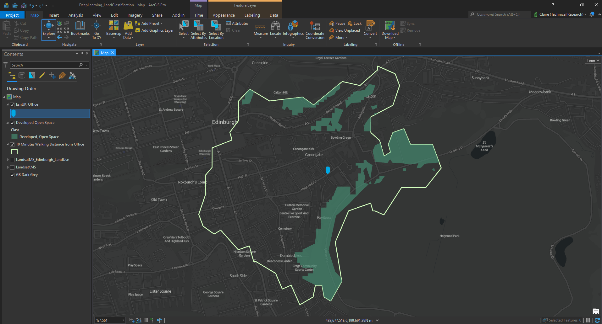
I now know that within my area of Edinburgh the Developed Open Space accounts for 16.7% of the total land cover. I’ve also determined what open space is within a 10 minute walk of my office so that I can enjoy those spaces on my lunchtime walks.
I hope this gives you a flavour of how we can use deep learning models with no previous experience and without having to write code! These are a great addition to the Living Atlas, enabling us to use Machine Learning in our projects, saving us time and providing us with additional insights to our data.
Getting Started
If you’d like to try these tools for yourself, a great place to get started with these tools is the Living Atlas, where you can find all the pre-trained models available together with tutorials and documentation. These models can be used in ArcGIS Pro like I did here and now even in ArcGIS Online via the ArcGIS Image for ArcGIS Online Extension, you can find out more about this here.
Easy peasy, right?