In Summer 2018, Esri released a number of vector basemaps using OpenStreetMap (OSM) data exclusively. With the benefit of regular updates and being free for all ArcGIS users and developers to use, these basemaps have proven very popular. This week, the OpenStreetMap basemaps switch to using OSM Daylight data.
What is Daylight?
Daylight is backed by Facebook and aims to provide a free, stable, and easy to use street-scale global map that is ‘scrubbed’ for consistency and quality. Using the combination of contributions from OSM editors around the world with quality and consistency checks from Daylight’s partners, they will release an updated map monthly. Esri has partnered with Daylight to provide this as a series of vector basemaps in eight different styles much like the current OSM vector basemaps.
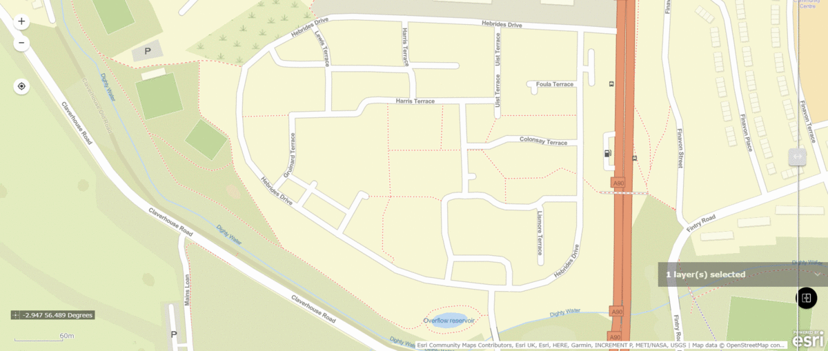
Comparison of Daylight map (swiping in) with the regular OSM vector basemap in Dundee © OpenStreetMap contributors
Another exciting element of the Daylight maps is the inclusion of the MS Building Footprint dataset from Microsoft®. These AI assisted building footprints are constructed using Bing imagery and are available in several countries such as the USA and Australia. On top of this, through Microsoft’s AI for Humanitarian Action Programme, there are also almost 18 million computer generated building footprints in Uganda and Tanzania. These additions to the map are perhaps the most noticeable difference to the current OSM basemaps and can really enhance the areas that have these footprints included.
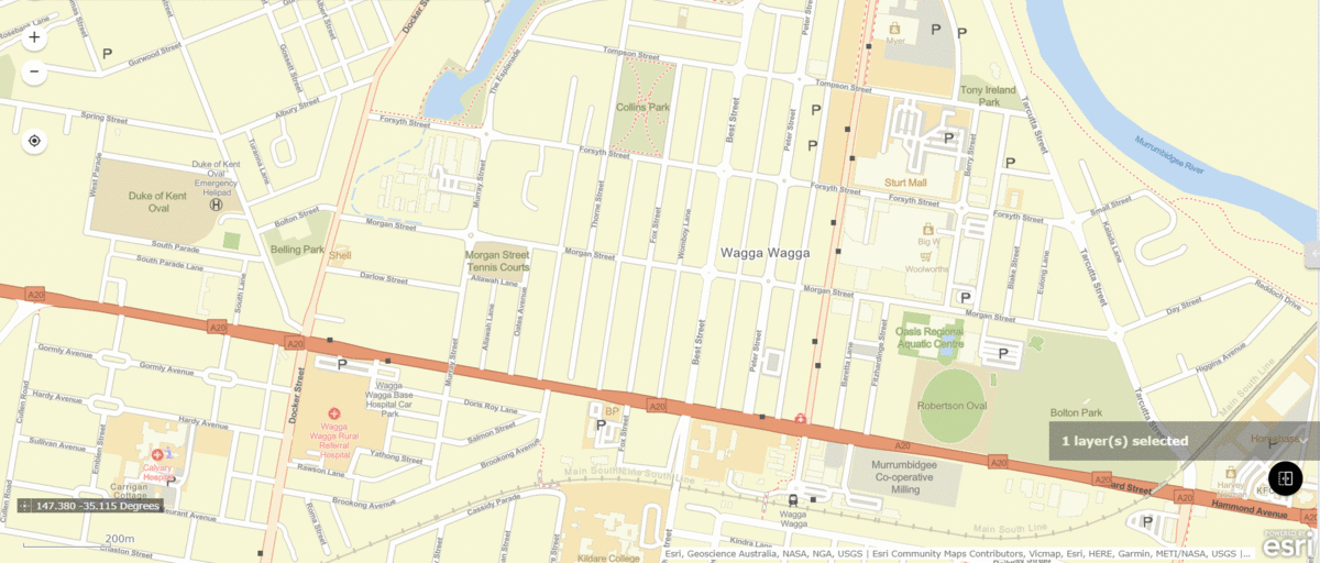
The Daylight Basemap (swiping in) contains much more detail here in Wagga Wagga, Australia © OpenStreetMap contributors
There have been many instances of OSM vandalism in recent years, which becomes problematic as more and more users see the data in everyday sites such as Snapchat, AllTrails and Strava. From renaming large cities to creating places which don’t exist, these issues can cause all sorts of problems for users – especially those who aren’t aware of the concept of OSM. Daylight recognises this and aims to create a dataset that removes these issues before they find their way into general use. This is great news for anyone who wishes to use OSM data for their maps as it gives extra value and confidence.
These changes are perhaps the most headline worthy. However, there are others which may not sound as exciting, yet are the backbone to the map. With each release, there are thousands of features fixed that had errors such as sharp angles and road name gaps. These may be small changes but they add up to creating an increasingly more accurate map. To find out what edits have been made each month, head to the Daylight website where you can see the latest release notes including a pdf of some highlights, as well as a hefty csv containing all the changes that have been made.
How can I get it?
If you’ve never used the OSM vector basemaps, you can find them in the Living Atlas. They come in a range of styles and are available in Web Mercator Auxiliary Sphere and GCS/WGS84 tiling schemes. Being freely available for any users to incorporate with their maps and web apps, they are a fantastic option for anyone looking for global basemaps that are regularly updated.
For those who already use the basemaps, the good news is that they will simply update on Wednesday night (16th June 2021) to incorporate the OSM Daylight distribution content. There is expected to be no impact to users who either use an OSM web map or OSM Vector Tile Layer. There are some scenarios where users will have to take action such as those who are using a copy of the OSM styles or those using Living Atlas for Enterprise. To find out more about this you can check out this blog post. Note, the beta OSM Daylight basemap will be retired.
So, there you have it, a great update for the OSM basemaps combining the benefits of free, open-sourced map data with additional quality checks for a much more reliable mapping experience.