OpenStreetMap (OSM) is widely regarded as the Wikipedia of maps, with an online community of volunteers building a map of the world from the ground up. The data is produced by these contributors using a combination of local knowledge, aerial imagery and GPS devices, and is being updated every day. What’s the best part of the OSM data? It’s free to use so long as users credit the data correctly.
Esri has had a relationship with OSM for years, with Esri providing a vector basemap with OSM data and OSM using Esri imagery within their map editing app. The latest product of this relationship is a set of feature layers that will be hosted in ArcGIS Online, produced using OSM data. Currently in beta, the new OpenStreetMap® Feature Layers create brand new opportunities for users to work with the latest OSM data. From footpaths to canals, places of interest to medical facilities, these layers pack a punch without a cost.
What are the layers?
So what layers are available from OpenStreetMap? Currently, this depends on the continent where your interest lies. Here in Europe, there are currently 11 available:
- Highways
- Tourist Attractions
- Buildings
- Amenities
- Shops
- Leisure Areas
- Medical Facilities
- Waterways
- Address Points
- POIs
- Medical Facilities
North America leads the way with 16 types with all of those in Europe plus the following:
- Land-use Areas
- Places of worship
- Educational Establishments (points & polygons)
- Address Polygons
Every continent is represented, with new layers to be added throughout the beta release. There’s even data from Antarctica for Natural Features and Natural Areas. Perhaps penguin leisure areas are yet to be mapped out?
The benefits of these feature layers
So, what is so special about these feature layers I hear you ask? Not only are they free but they are updated constantly, with layers being added in some cases, minutes after they are changed in OSM. To put this to the test, I spotted the most recent OpenStreetMap Ireland event, #MapPatrick21 was taking place over the days following St Patrick’s Day. The aim was to add building outlines to some towns in Ireland with significance to St Patrick himself. I added the Buildings for Europe layer to ArcGIS Online, then navigated to an area due to be mapped that had only a few building outlines. The result can be seen below:
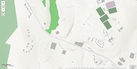
As you can see, the buildings appeared in the layer almost as soon as they’d been published in OSM. If you were using some OSM data and noticed something missing or incorrect, you could make the change in OSM and it would be almost instantly reflected in the layer. If that is of interest to you, join the OSM Community and add to the map which can benefit users around the world. With lockdowns still affecting many of us, what better way to spend your evenings?
How do I get them?
The layers are currently in beta release and not all features are available just yet. For example, the data can be used for visualisation and analysis in ArcGIS Online, but the ability to extract data hasn’t been enabled yet. Esri plans to roll out this functionality in due course.
All of the feature layers are currently available from the OpenStreetMap site in ArcGIS Online or from the OpenStreetMap Layers group. Alternatively, you can add the data to an existing map by: clicking the Add button in ArcGIS Online > selecting Search for layers > making sure ArcGIS Online is selected from the dropdown menu > search for a layer e.g. OpenStreetMap Highways for Europe > click the Add button on the bottom right of the layer to add it to your project.
As the data is a copy of OSM’s it is open for use under an Open Database License (ODbL) which means that you are free to use it in whatever way you like, so long as you credit OpenStreetMap.