QuickCapture – big button data collection

Mobile
15th August 2019

With ArcGIS QuickCapture, field data collection has never been easier. With the press of a button, it’s done. You may be familiar with Collector and Survey123, but QuickCapture takes ease of use and practicality to the next level - still collecting data quickly and accurately. The app is released on iOS, Android and Windows, so go and get capturing!

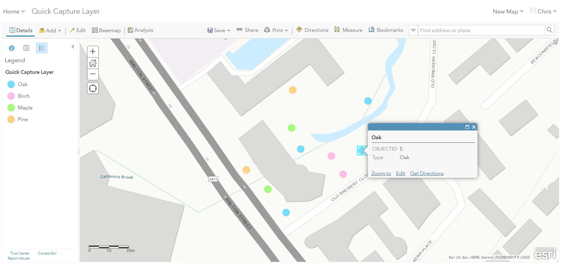
Here’s a project we created in just a couple of minutes!

This easily configured QuickCapture project can be used to instantly capture the location and type of tree whilst in the field, with the press of one button. This can then immediately be visualised and analysed on a map (below) or live dashboard online or back in the office.

The layout of your QuickCapture project is fully customizable, with the ability to change the size, shape, colour and labels on your buttons. This can be done through the intuitive designer interface:

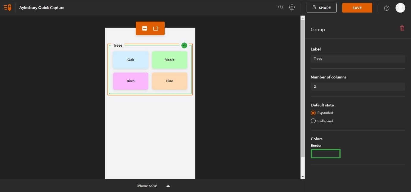
The QuickCapture designer is currently in beta, but is fully functional. The layout can also be customized by editing the project’s JSON for detailed changes.

How do I use it?

To take your QuickCapture project out into the field; download the application on your GPS enabled mobile device, login, download the form and start collecting! The app displays and records location accuracy information and you can link it to an external, high accuracy GPS.

What can I collect?

Answer – absolutely anything that is represented with a point or line. It’s especially useful for data collection on the move, whether it’s in a vehicle or on foot. QuickCapture allows you to record anything that has a location:

    • infrastructure
    • street furniture
    • vegetation
    • traffic
    • potholes
    • hazards/ disaster response
    • and the list goes on.....

What if it gets more complicated?

QuickCapture is about simple data collection. If your field data is more complex than a location and a type, then you could also use Collector and Survey123.

Want to know more?

You can find out more about QuickCapture for ArcGIS here. This includes step-by-step guides to creating and configuring projects.

Here is a great video showing the application in action.

Mobile