Many of us at Esri UK love to spend time in and around nature; however, it’s no secret that the biodiversity of the UK has had it rough for many years, facing an especially steep decline since the industrial revolution. Many tools have been included in legislation to combat these threats, including the comparatively new concept of Biodiversity Net Gain (BNG). This suggests that as part of the land development process, biodiversity should be enhanced and expanded beyond pre-disruption levels. We recently demonstrated how you can start mapping BNG at our 2023 Esri UK Annual Conference opening plenary; which you can watch on our website.
However, it’s not just an idea – legislation and frameworks such as the Environment Act 2021, and the National Planning Framework (Scotland) are highlighting BNG as a core principle to planning processes. Using maps and ArcGIS can help you meet this requirement and master BNG, bringing maximum benefit for both your construction and its associated nature.
Sweet for ArcGIS can be a powerful tool for planning Biodiversity Net Gain
Sweet for ArcGIS is a powerful editing tool. It’s the basis of the Phase 1 Survey app but many other different types of apps can be configured that serve a variety of different purposes, including Biodiversity Net Gain.
In the example app that I’ve created, we start with a map of the development site which we want to build a new hiking trail through. Using a configured template in Sweet, we can quickly draw a potential pathway; a buffer of 50m is automatically applied to this line and classified as ‘threatened land’, if it overlaps with an important habitat.
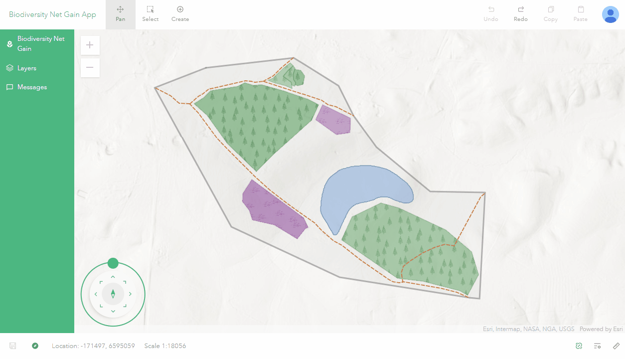
New paths can be planned out with just a few clicks.
Naturally, that impacted land will need to be mitigated with activities beneficial to biodiversity, such as the creation of new habitats – thankfully, this is also easy to plan in Sweet!
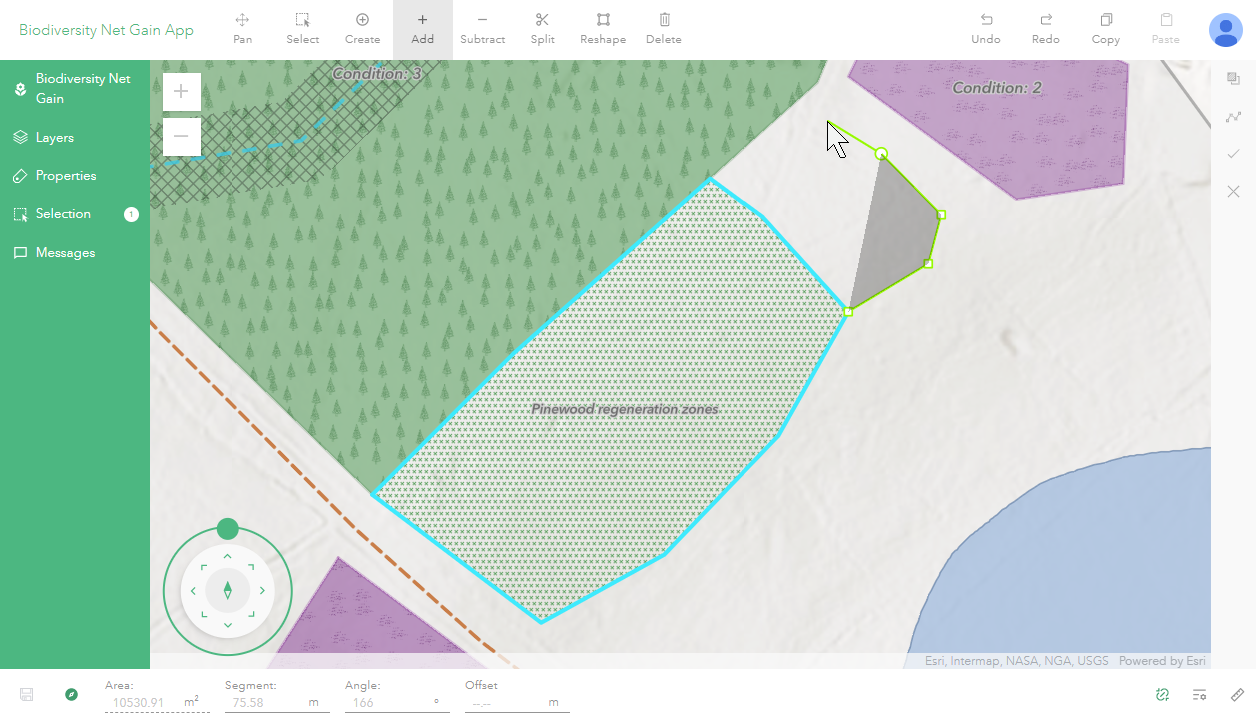
Polygons are drawn in the same easy way as lines.
Record only correct data with topological rules
But what if you’re worried about your editors making changes that don’t make logical sense? For example, multiple wildflower meadows can’t be placed on top of each other or planted in the middle of a lake. Topological rules can restrict how shapes within a layer are edited or control how different layers interact, preventing impossible edits.
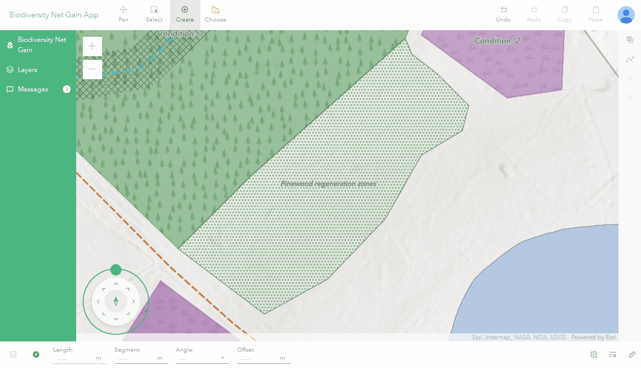
You can also restrict layers to only be drawn within other polygons.
These are powerful tools to make sure that your data is correct at the point of entry – no more cleaning up of erroneous datasets.
Include graphs that react to your different plans
Not only can Sweet be used for editing data, it can also make graphics to provide insights into your current edits. This live feedback may lead to you the BNG plan, such as adding more regeneration zones or improving different types of habitat.
These graphs can be added to custom panels alongside other elements which may improve the app. I’ve added three components to my BNG Sweet app to provide live feedback to the planner. The first is a warning message coded with HTML to let the user know when the total threatened area is larger than the replanting area – also compared by the bar graph.
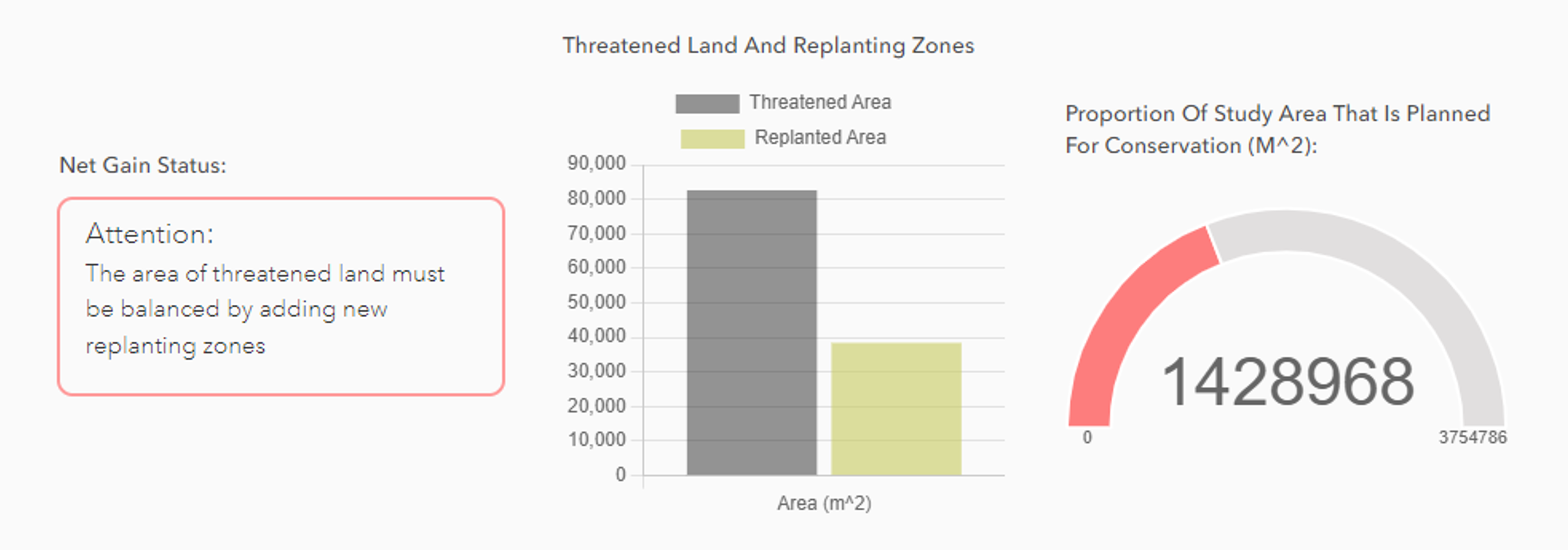
These graphs will update as you make edits to the data!
There’s much more you can do with Sweet
I’ve only scratched the surface within this article of what is possible with Sweet for ArcGIS. In terms of improving biodiversity, I’ve only talked about creating new areas to balance impacted areas. Other aspects of BNG could be incorporated into a Sweet app, such as the improvement of existing environmental features, the value of different types of habitat or the inclusion of hedgerows, important for habitat connectivity.
Sweet gives you the freedom to customise the Biodiversity Net Gain app however you like, so you can make it effective for your own sites and your specific workflows. With the power of GIS, we can make the lives of developers easier whilst also enhancing our incredible local biodiversity.
Don’t forget, you can see another example of this concept in action in the 2023 Esri UK Annual Conference opening plenary here.