This week we released the latest version of Sweet for ArcGIS which can be found on the ArcGIS Marketplace. If you’re interested have a read of what’s included in that release, read here.
“Sweet for ArcGIS can be configured to support your business logic.”
We say this a lot, and it’s not wrong, that’s why I’m starting a series ‘Sweet Treats’ to show you how Sweet supports your business logic. With the help of Sweet experts, we will show and tell our favourite features, tips and tricks.
To begin this series of blogs, I want to start with a feature that I personally love to use. They’re easy to set up, really powerful, and I use them in Sweet almost every day, no matter the app. I’m of course talking about the topology rules.
Topology rules ensure that the geometry of a feature is correct. For example, two land parcels are not allowed to overlap or a road segment must always touch another road segment. Sweet not only supports topology rules for each singular layer, but you can create topology rules that encompass multiple layers within your app.
Single layer
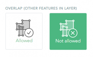
Let’s take a look at a recent example where I was using Sweet to create a digital copy of my house. I wanted to make sure the rooms in my house didn’t overlap, and I was able to do this by simply going into my topology rules and saying this layer’s features cannot overlap each other.

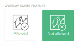
I also wanted to make sure the windows and doors didn’t overlap either, so I can go back into my topology rules, and select the option for configuring layer overlaps for this linear layer.

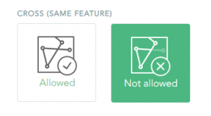
Thirdly, I needed to create a fence for my back garden, so I wanted to make sure my fence layer couldn’t cross itself. Again, this option was easy to configure within the topology rules.

Any user can find these topology rules by going to the Sweet Builder Wireframe, selecting Data Rules Editor, then selecting Topology. Choose a layer to see what topology rules you can configure. Configuring is as easy as selecting a button!
Multi-layer
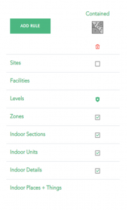
The topology rules I’ve described so far are what we call Single layer configuration, but we also have the ability to configure Multi-layer topology rules. This means multiple layers have a spatial relationship to one another, otherwise known as a topological relationship. In my application, I had a building footprint layer, this layer contains my walls, rooms, and fixtures layers. Once I set this rule trying to create any features outside of a building footprint would not be accepted by my Sweet app.

My application only used a small range of the topology rules accessible in Sweet. You could set up an app that ensures different underground pipelines don’t cross each other, or a housing development cannot exist in a an ecologically protected zone. You could also have a plot of land and create a rule that every plot of land must be covered by a building footprint. No matter the rule you set, Sweet will always run these rules and make sure your data follows them.
If you don’t use Sweet, but are interested to find out more, feel free to contact your CSM and take out a trial today.
Happy editing!