Esri’s ArcGIS Utility Network allows organisations to model their networks with high fidelity - so electric, water, gas assets can be represented as a connected digital twin. The Utility Network is a powerful tool for asset management, as well as supporting a real-time operational view of the network.
Making sure that it gets into the hands of those who need it, in a way they can use it operationally, is where the ArcGIS Platform apps come in. We’ve developed the new UNE for ArcGIS to give users the ability to view, edit and trace the network - in the office and out in the field, using the same lightweight web app. In this blog I’m going to share the Why behind developing it.
Lightweight and portable
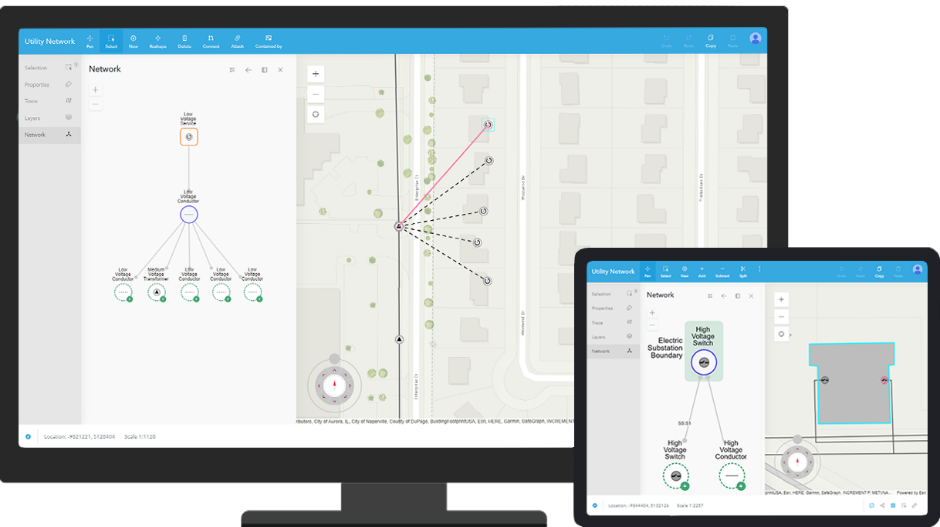
Firstly, we wanted to make sure that anyone with a utility network could access the application without having to have extensive and expensive hardware and deployment processes. As the app is web based it can be used on any device with a browser. Yes, even your iOS or Android phones, though you will have to use them in landscape mode!

Image of UNE for ArcGIS on multiple devices
The network is always ready for analysis and reporting
Whether it’s in a bureau, updating the network based on returns from the field, or engineers actually in the field making changes to the physical assets, editing the network needs to be fast - while protecting the integrity of the data. We wanted to make sure that any individual can make changes to the data and that it is ready for reporting and analysis within seconds, without lengthy cleansing and QA processes.
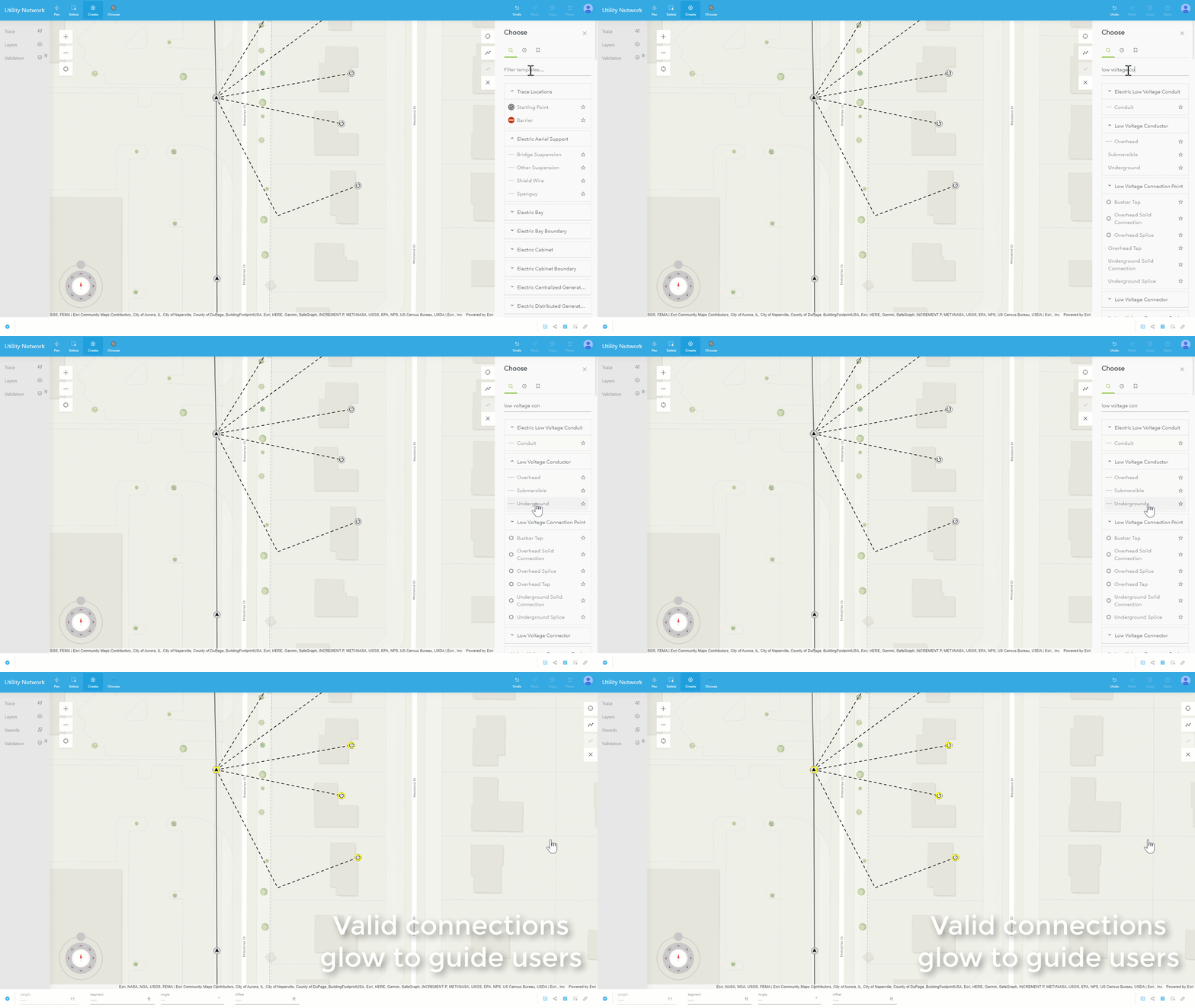
Users are guided to make changes that will keep the network valid and are given instant feedback on the decisions they have made.

Image of valid connections glowing in UNE for ArcGIS
UNE for ArcGIS understands the rules of your network and how assets are related to one another. It uses these rules to ensure that every edit is validated at the point of capture, so network connectivity is always valid.
The real-time application of rules combined with the instant feedback, ensures users can safely edit the network and that it is always ready to use as a single source of truth.
Easy to use for all staff
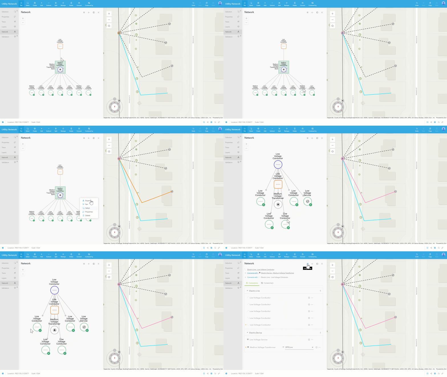
As more organisations go digital-first in their approach to asset maintenance, ground truthing and consuming data in the field, we wanted our application to be intuitive to everyone. We wanted to make sure that we were representing the complexity of the network, such as the connectivity of assets, in a way that wouldn’t require users to have a background in GIS. In this example we can see the geographical location of the assets in the map and the graphical representation in the Network Panel:

Image showing the connectivity of assets in a graphical view
We wanted users to be experts in their field without requiring them to become experts in ours.
Tools for Utility Professionals
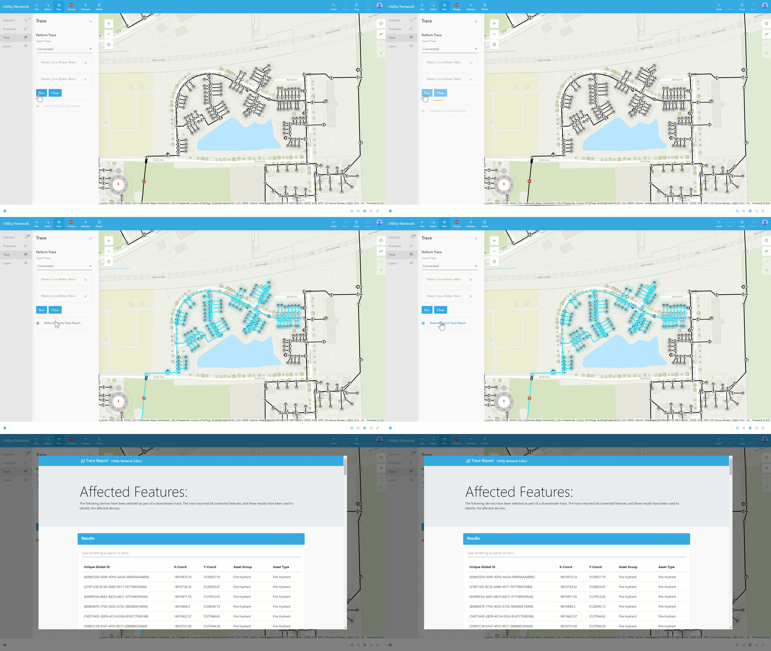
As part of the app we wanted to make sure the Utility professionals had the tools they need, whether in the office or the field. This includes the ability to trace the network for outages or leaks in the field, and immediately see the impact changes have on customers.

Image showing Trace and Trace Report in UNE for ArcGIS
Integrates with business systems
Finally, we wanted to make sure the app could be integrated with existing business systems. As the UNE for ArcGIS is built on the ArcGIS Platform it can be extended to integrate with 3rd party systems and partner solutions, ensuring the app works for the Utilities’ business.
I hope you’ve found this whirlwind introduction to the UNE for ArcGIS useful. To find out more or see the app in action check out our website, which contains all our videos, links to webinars and other resources.