The swallows are gone and the geese are migrating in for the winter, signaling time for the autumn update of ArcGIS Online. This update is an evolution of the capabilities rather than a revolution but there some are some great new features.
Vector Tile Layer management
You may be using, or thinking about using, your own custom vector tile layers alongside the collection of hosted vector tile layers. As the world changes you need to be able to keep your layers up to date. This Online update brings the ability to update layers in place, so you don’t have to update existing applications and styles that reference it. This is done by choosing the new Replace Layer option and specifying the layer that will be used to replace the entire tile cache for the target hosted layer.
Improved options in Proximity Analysis, aka drive-times
Having easy access to drive-time analysis is a popular feature of ArcGIS Online and there are some nice enhancements in this update. You can now choose whether to generate the current single polygon view (left hand image in the example below) or you can exclude unreachable areas from the result (middle image), this is only available for drive-times below 15 minutes. You also get the option to generate a second results layer with the reachable street network (right hand image).

Drive time analysis results generates with the default option (left), the new exclude unreachable areas option (middle and the include streets option (right).
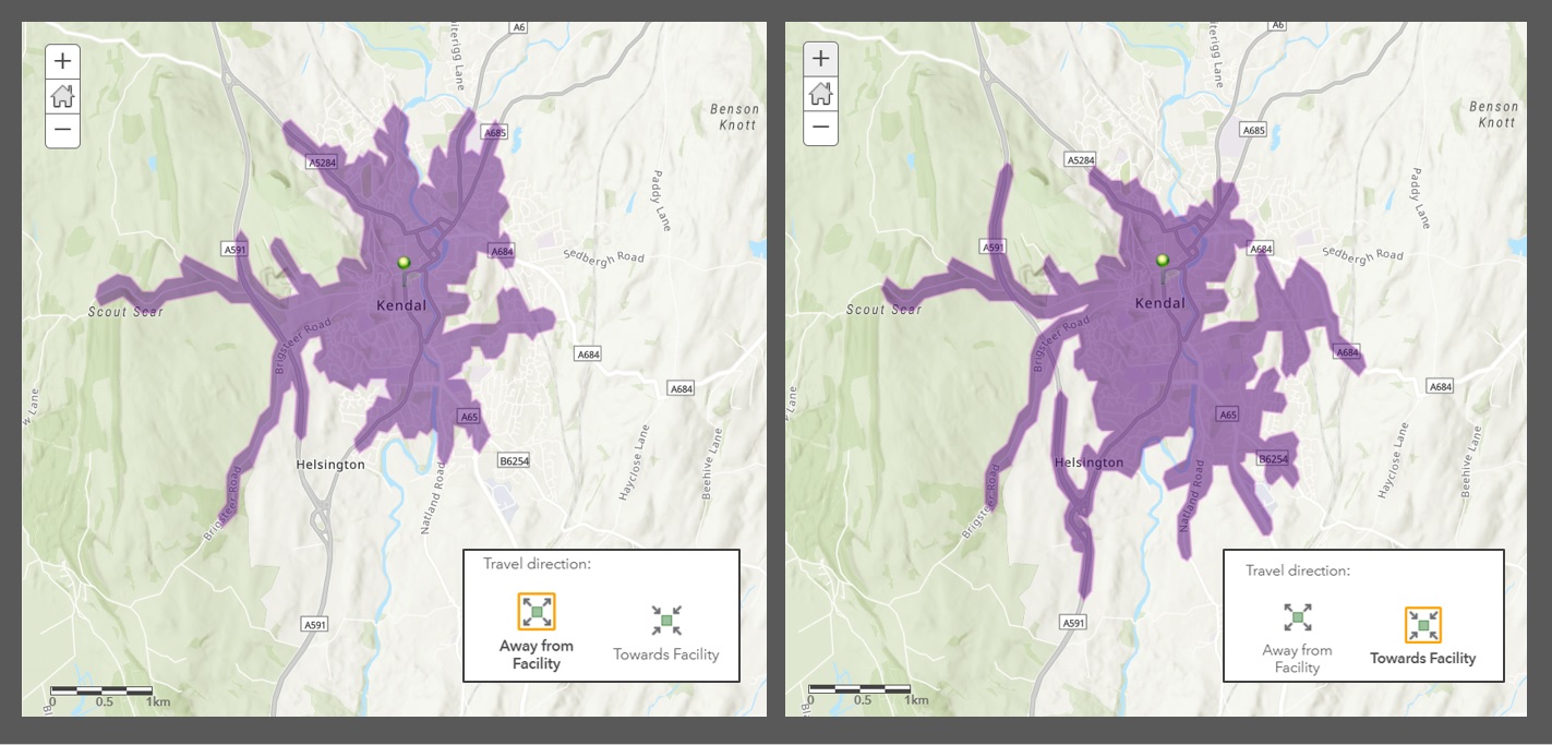
The other new option for drive-time analysis is the choice of whether to run the analysis for travelling from the location or towards it. Often the differences will be subtle at most, but for short drive-times that include a one-way system it can be significant. I’ve fallen victim of Kendal’s one way system a couple of time so I used it as a test - the most obvious differences are to the south and east:

Drive time analysis using the travel direction option. Both results used the same location and drive time but the start location is a one way system.
App updates
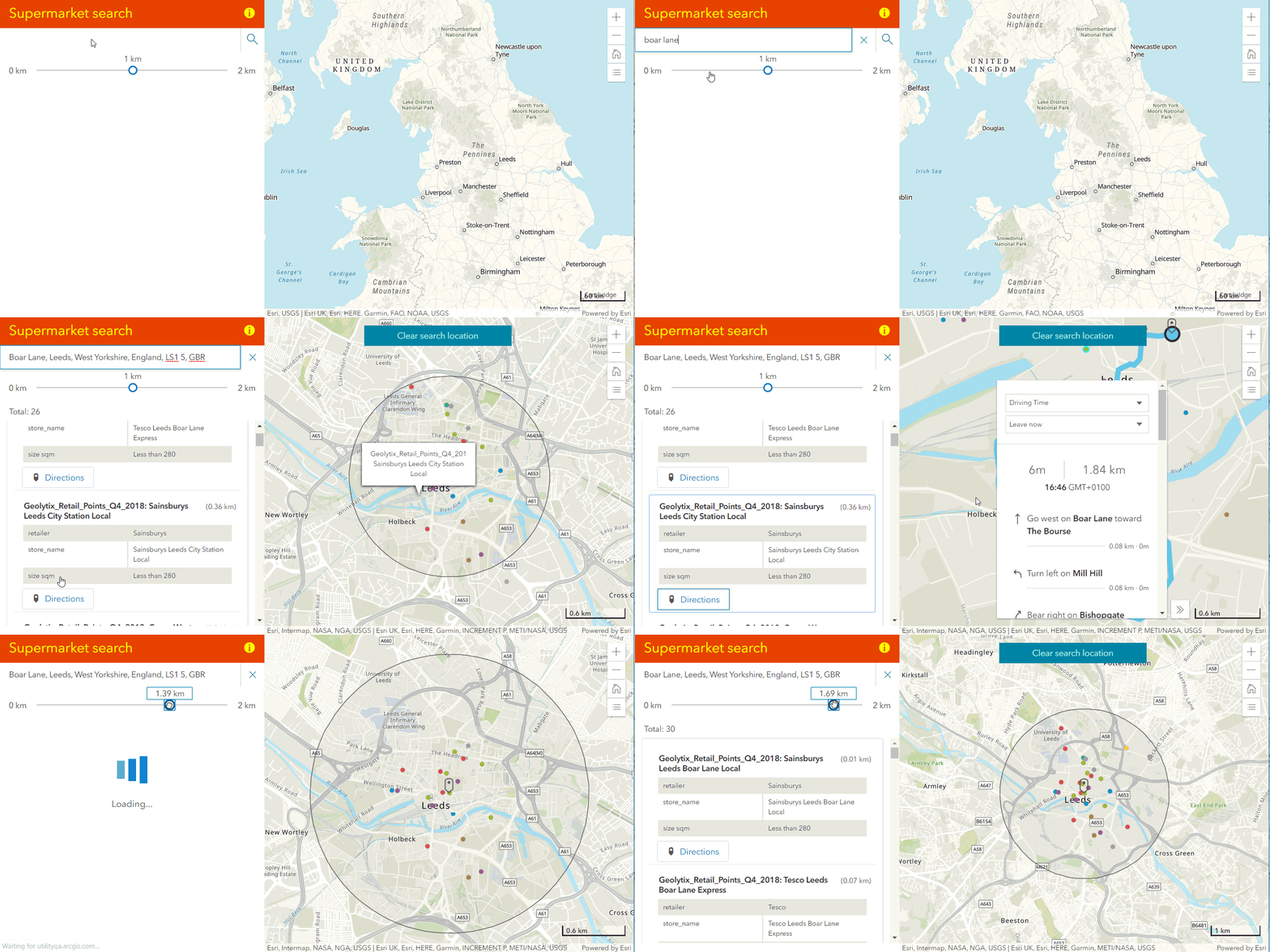
Nearby is a new configurable app for finding locations within a search radius of an address - or tapped location on the map. The locations found are listed, with the attributes that are included in the layer’s pop-up. The configuration options include grouping the results by type, whether the locations layer is visible before the search and whether to include a directions button.

Nearby app configured to find supermarkets within a kilometer of the search location, with the option to show directions.
Attachment Viewer gets a new, map-centric layout option to compliment the photo-centric layout. The new layout provides users with a gallery of attachments based on the features within their map extent. The attachment viewer also gets; the ability to display more than one layer, support PDFs as an attachment type and hide features that don’t have attachments.
Media Map has been enhanced with an interactive time slider. You can now showcase data that is time enabled by animating it over time.
The Category Gallery app has also been enhanced, as have several of the Web App builder widgets - including Smart Editor, Filter and Draw.
Arcade
This update brings four new functions into the library available in ArcGIS Online:
- FeatureSetByRelationship - access features from layers that have relationships.
- FeatureSetByPortalItem - get data from any layer without adding the layer to your map.
- GroupBy - group features within a feature set by a field and return statistics for each group.
- DistanceGeodetic - calculate the shortest distance between two points along a great circle.
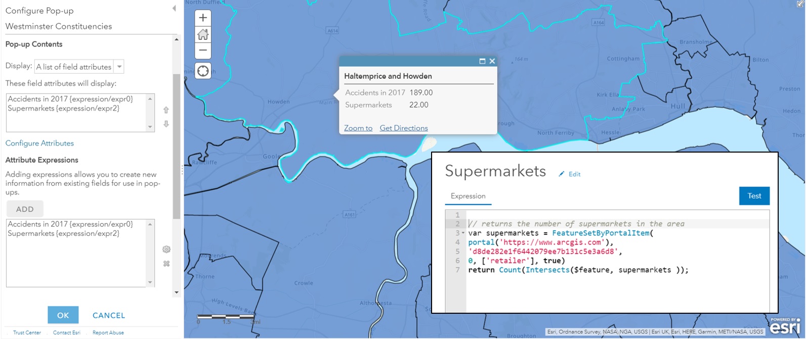
I’ve only had chance to have a quick try, but these open up some really interesting options for custom pop-ups. FeatureSetByPortalItem means you can have information in the pop-up that is coming from a layer that isn’t even included in the map. Here’s an example using a layer I own (accidents) and one from the Living Atlas:

Using one of the new arcade functions to show a count of point features from layers not in the map.
I found I had to include an additional argument to specify the portal (a known issue) - which was also key to using the Geolytix layer from the Living Atlas. I haven’t quite finished it but the next thing is to combine this with GroupBy to show the number of accidents listed out by type.
3D
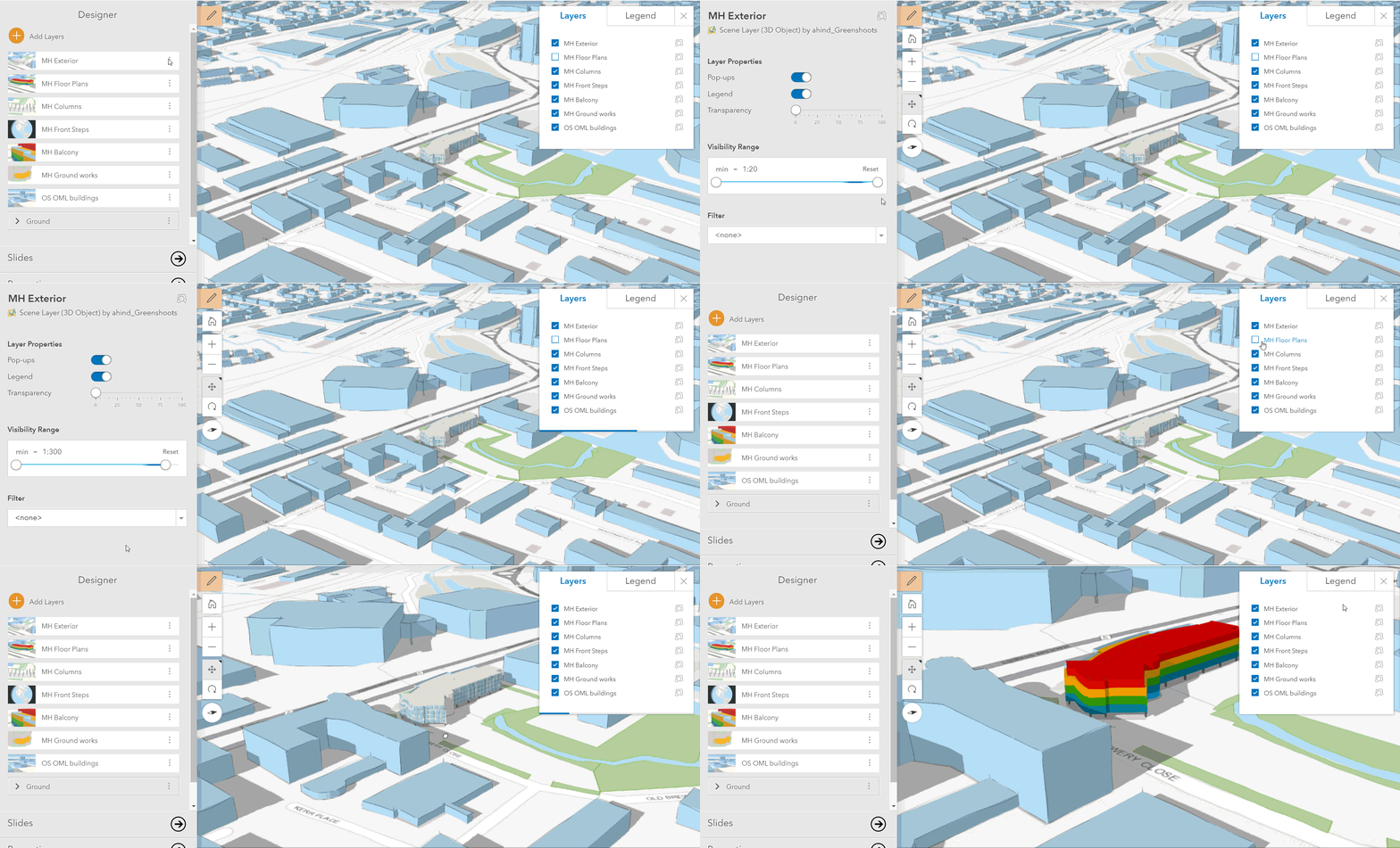
Among the changes are further performance improvements, the addition of pop-ups for point clouds and a visibility range option in the Scene Viewer. Some of the scenes I’ve built include switching between different levels of detail as the view changes. Previously I had to manage this using slides but I can now set the visibility range of the layers so they switch dynamically:

Visual enhancements for Scenes include improved transparency rendering for edges and adjacent extruded polygons and a new lighting and shading model. The latter adds contrast and more definition to your 3D content when you choose Quality in the Settings tool.
For more details and links to some of the functions check the What’s New page. Also keep an eye out for the Map Viewer beta - coming later in the year. This will be our chance to try the exciting new Map Viewer and provide feedback about the design and functionality. The plan is for the beta to be available to all ArcGIS Online users (with an admin option to limit access). Look out for it in the app launcher and as an option when opening items. Find out more here.