Ordnance Survey: © Crown copyright and database rights 2020 OS AC0000823798
The basemaps you use will define the projection to be used for all layers in your map and while ArcGIS Online can reproject your overlay layers for you, performance will be affected, so if possible make sure any data you add uses the same projection.
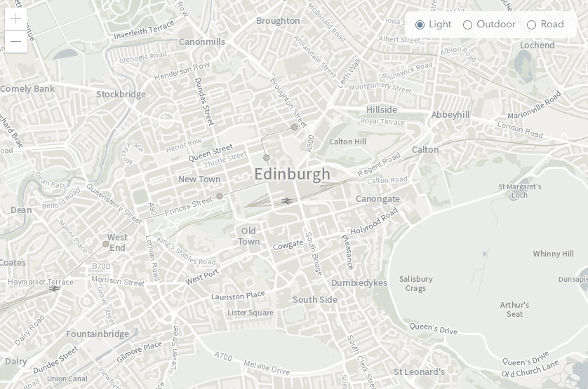
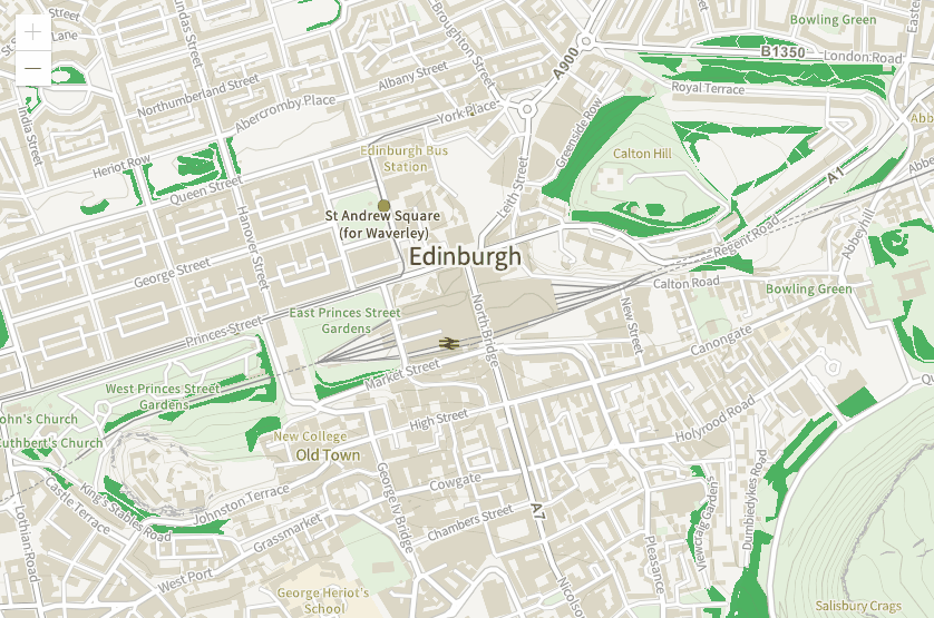
OS Vector Tile API
The Vector Tile service provides data as a customisable basemap. It is available in British National Grid and Web Mercator.
Vector tiles can be restyled for different uses, either by supplying a style file or using client-side code. They also adapt better to the resolution of the display device and have a small file size, so they load fast, especially on machines with newer hardware .
Using VectorTileLayer you can provide the URL of the service itself or, to apply your own styles, the URL of a separate style file. VectorTileLayer does not provide a way of specifying your API key, but you can use esriConfig to intercept and append the key to your URL request.
var serviceUrl = 'https://api.os.uk/maps/vector/v1/vts';
var apiKey = 'INSERT_API_KEY_HERE';
esriConfig.request.interceptors.push({
    urls: serviceUrl,
    before: function (params) {
        if (!params.requestOptions.query) params.requestOptions.query = {};
        params.requestOptions.query.key = apiKey;
    }
});
var map = new Map({
    basemap: new Basemap({
        baseLayers: [
            new VectorTileLayer(new VectorTileLayer({ url: serviceUrl }))
        ]
    })
});
Once your tiles are loaded you can use client-side code to make further style changes. In this map I used code to highlight woodland by changing the fill-color property.
Ordnance Survey: © Crown copyright and database rights 2020 OS AC0000823798
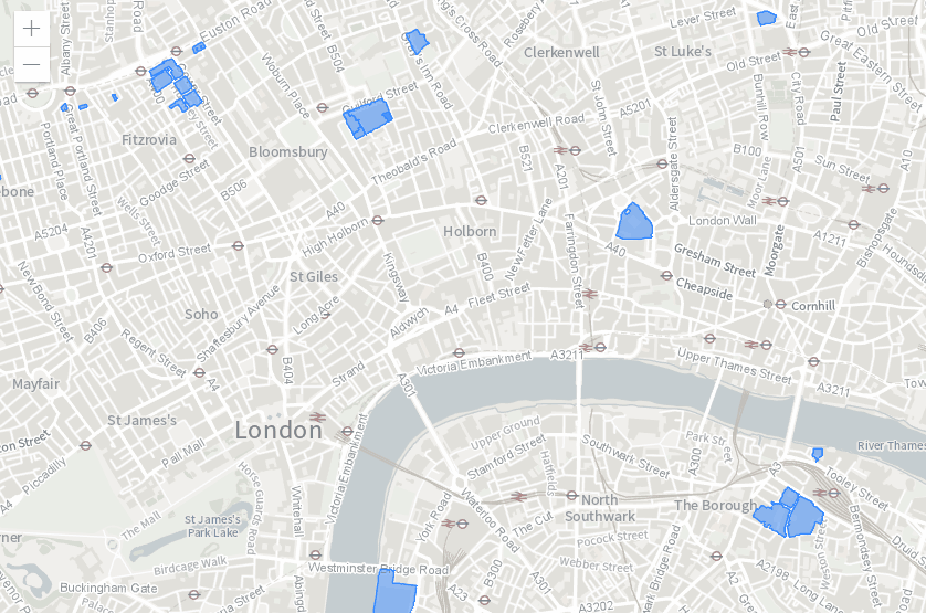
OS Features API
This is a Web Feature Service (WFS) that provides the ability to run spatial and attribute queries against features such as buildings, roads and greenspaces. All data supplied by the WFS will default to EPSG:27700 (British National Grid) unless otherwise specified.
The service has a limit of 100 features returned per request. You should also restrict the number of features yourself by including an additional filter such as a map extent, buffer or attribute value in your request. For this reason, the service isn't suitable for use as a basemap.
The JavaScript v4 API can support the Features API using a standard WFS GetFeature operation to retrieve the data I needed.
Adding a couple of features to a map can be done using the map views graphics layer. For greater control over the features, I found it was best to set the output format of my request to "GEOJSON" and load the resulting features into a GeoJSONLayer.
In the map below I’ve used a filter to display all Functional Sites within the current map extents where SiteFunction = 'Hospital'. The returned hospitals are rendered to the map views graphics layer.
Ordnance Survey: © Crown copyright and database rights 2020 OS AC0000823798
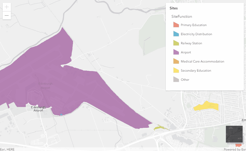
This map classifies sites based on their function. I applied a filter to display only sites within the current map extents. Pan the map to see the legend updating as new sites are added to the map. Toggle the basemap to see how smart mapping is used to adapt the legend colours to the selected basemap.
Ordnance Survey: © Crown copyright and database rights 2020 OS AC0000823798
What do you do if you expect more than 100 features to be returned as the result of a query? To make sure you retrieve all the features you can send multiple requests making use of the "count" and "startIndex" parameters to keep track of the number of features remaining. A good example of how to do this can be found at OS Data Hub Examples.
For developers the OS Datahub APIs provide a great way to add OS data into your ArcGIS custom apps, and combine them with the rich content and data available in the ArcGIS Living atlas or that you are hosting in your ArcGIS Online account.
All of the code for the examples above can be found in GitHub. Just add your own API key.