Blog Archives

What 2019’s Smartest Cities Have in Common
Go behind the names on the 2019 smartest cities list to see what makes these cities so advanced.
London and New York are the world’s smartest cities, according to the 2019 Cities in Motion Index (CIMI), issued by the IESE Business School. The index ranks 174 cities across nine dimensions: human capital, social cohesion, the economy, governance, the environment, mobility and transportation, urban planning, international outreach, and technology.
Many of the smartest cities on the list use location intelligence to help civic leaders and executives create data-driven performance, operational efficiency, and situational awareness and plan long-term improvements that benefit all residents.
Article Snapshot:
Location Intelligence: Building Smart
As IDC analyst Alison Brooks put it in a recent podcast, location is the grammar of smart cities. In the face of complex challenges such as homelessness, mobility, pollution, and aging populations, leaders of the world’s smartest, most sustainable cities are combining location-based technologies with human ingenuity to improve living and working conditions.
Six of the CIMI dimensions for measuring smart cities benefit from the introduction of location intelligence:
Environment—As they do in San Francisco (#21 on the CIMI), smart city planners can model potential buildings and predict short- and long-term impacts on the environment. Conservationists can choose where best to incorporate green spaces or plan conservation projects, as well as analyse air quality and spot its causes in different areas of the city.
Governance—City agencies often use location technology called a geographic information system (GIS) to share data across silos and operate more efficiently. Los Angeles (ranked #16 on the CIMI) created a dedicated information hub to centralize the city’s open data and communicate with citizens about smart city initiatives.
“When LA began to organize all of its open data with the [geo]spatial tag, it allowed great insight across the department,” said Harvard professor and former Indianapolis mayor Stephen Goldsmith in a recent podcast. “So now the departments can see each other’s data located in a sense of place.”
Industry-leading businesses have taken a similar approach to data, believing that information reaches its full potential when it is democratized.
Human Capital—Strategists and business leaders can analyse the demographics of a city’s population and use that insight to plan improvements that attract specific talent. Some cities that fly under the radar of global business schools like IESE have done pioneering work in this area, including Bentonville, Arkansas, home of Walmart’s global headquarters.
Mobility and Transportation—Forward-leaning officials can better manage transportation systems and plan repairs with the help of location intelligence. For example, Metropolitan Transit Authority executives in New York City (#2 on the CIMI) use GIS to manage $1 trillion in assets and plan long-term improvements for the country’s busiest subway. Meanwhile, Paris (#4) uses IoT-based applications to optimize the flow of traffic in the city, and Singapore’s autonomous taxis rely on virtual maps as a source of truth.
London (#1 on the CIMI) built autonomous vehicles to enhance mobility at busy Heathrow Airport and combined GIS with building information modelling (BIM) technology to undertake Crossrail, Europe’s largest construction project. Crossrail executives needed to know the precise locations of underground infrastructure to safely weave new tunnels through the built environment.
Urban Planning—City leaders; businesses; and architecture, engineering, and construction (AEC) firms can see how a structure will look before they decide to build it, measuring views from a virtual apartment window or the shadow of a skyscraper on a local park.
Cities such as Boston (#25 on the CIMI) are constructing 3D models of their physical infrastructure and using location data as a connective thread to experiment with virtual plans.
Technology—The CIMI calls out technology as its own dimension, but as the above examples show, technology is the backbone of many smart city initiatives. According to IESE, a smart city can be measured in part by the access its citizens have to critical communications technologies, including computers, mobile devices, and the Internet. One telecom company in Italy is working to make that access more equitable, while its peers in the US and elsewhere are using artificial intelligence to roll out the 5G networks that will power tomorrow’s smart cities.
The Inner Workings of Location Intelligence
Location data helps cities get smart and businesses make better decisions. See what that looks like in practice in this e-book on location intelligence.
The Business Value of Smart Cities
As cities work to become smarter and more sustainable, savvy business leaders are getting involved. Authors of the CIMI report note that the private sector is uniquely experienced and skilled in project management and technology applications and has much to contribute to smart initiatives.
Business executives can benefit from smart city projects by building better relationships with city leaders, understanding local markets more deeply, and profiting from the greater international visibility that attracts talent to their cities.
Conversely, there’s much at stake for business leaders if their host cities don’t get smarter and stay competitive. IDC’s Brooks warns of the knock-on effects to businesses in cities that aren’t improving:
The cities that don’t digitally transform to meet up with those citizen expectations and business expectations, they in fact lag in terms of economic viability across the board, so they don’t attract talent, they don’t attract businesses, and so then there’s this process of degradation and stagnation that occurs. We see the direct linkage between digitally transformed organizations, citizen satisfaction, and economic growth and viability, which altogether makes it a collective no-brainer.
Advancing Technology, Advancing Cities
Goldsmith’s perspective on smart cities is coloured by the drastic technology changes experienced in the past decade.
“In the last five years, the technology breakthroughs have been just breathtaking. And the problems that now can be solved with technology were unimaginable, I mean, 10 years ago, even 5 years ago.”
It’s a good reminder that becoming a smart city isn’t really about getting a top score in a report, but about solving urban problems and making life better for every citizen and business. As many civic leaders now realize, when location intelligence meets innovation, cities and citizens get smarter.
Find your city and compare it with others in this interactive map from IESE.
This article was originally published in the global edition of WhereNext.

Tech Giants Anticipate Augmented Reality Future
A recent Apple acquisition signals more business investment in augmented reality. Which businesses are already benefiting from AR?
Apple’s acquisition of Akonia Holographics, maker of lenses for augmented reality (AR) glasses, could signal the next wave in mobile computing for businesses and consumers—devices that are more wearable and less intrusive.
AR glasses superimpose location-specific information and graphics onto a user’s field of vision through transparent lenses. In 2012, Google launched the first notable iteration of AR glasses, then called Google Glass. In 2015, parent company, Alphabet ended production of Glass temporarily. Since then, makers of smartphones and mobile devices have been working to incorporate AR applications into their products.
Wearing the Future
Apple’s CEO Tim Cook has called augmented reality a “big and profound” technology development. Among tech giants, he’s not alone in this assessment. Microsoft’s HoloLens stands out as one of the more mature AR headset technologies. Other headset makers have focused on virtual reality goggles, which encapsulate the user in a digitally generated world.
While AR has been available on smartphones and handheld devices (think Pokémon Go) for some time, the growth of wearable devices may hold significant promise for businesses. Consider that Alphabet’s Glass headset, while a dud in the consumer world, showed strong enough adoption by business users that Alphabet relaunched the effort in 2017. Google Glass is now being used by employees at the edge of organizations—GE field workers and doctors at Dignity Health among them.
Doctors could be among those who benefit from Apple’s Akonia acquisition. Apple runs its own health division, which partners with software providers to deliver medical applications on iPads and related devices. Through the Akonia acquisition, that and other Apple divisions could add cutting-edge AR technology to their portfolios.
Locating the Field of Vision
For any company looking to incorporate augmented reality into employee workflows, experts see location as critically important. One Toms River, New Jersey, utility offers a case in point with its service-focused application of AR, which saves time and resources while increasing accuracy.
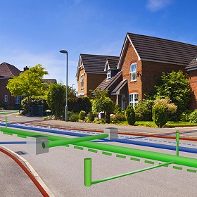
Field workers at Toms River Municipal Utilities Authority use augmented reality and HoloLens to see underground utility lines beneath their feet as AR-generated holograms projected at their exact locations. The system relies on a geographic information system (GIS) that tracks the location of every pipeline, valve, connection, and intersection, to an accuracy of just centimetres.
With the location intelligence powered by that data, work crews minimize the risk of digging through critical infrastructure, Len Bundra, the organization’s IT director, told WhereNext last year. “You want to make sure your GIS is in shape and accurate,” Bundra explained. “If your maps are inaccurate, don’t think the [AR] hologram is going to make them accurate.”

As innovative organizations know well, location is critical in AR apps. Placing digital objects in physical space requires a deep understanding of where assets are located.
AR in Practice across Industries
Many organizations, including the planning agency for the US capital, start forays into augmented reality by creating a 3D digital twin—a precise model of reality made with GIS. The digital twin includes detailed attributes about assets. This information makes it easier to create AR experiences that guide real-world interactions.
Examples of industries embracing 3D GIS with an eye toward AR:
- Architecture, engineering, and construction firms combine 3D GIS data with building information models to inform infrastructure design and construction.
- Urban planners use 3D GIS to convey zoning information and visualize plans in a real-world context.
- Utilities view and analyze more-accurate representations of real-world assets–for instance, revealing the location and details of underground infrastructure using AR without needing to dig.
- Defense and intelligence operators use 3D GIS to provide a common operating picture and enhanced context to aid rapid decision-making
With AR hardware manufacturers adding devices, companies such as Apple making acquisitions, and early adopters like the New Jersey utility realizing compelling returns, many industry observers expect augmented reality to become a valuable tool throughout the business world.
One market researcher pegs AR’s annual growth rate at nearly 74 percent through 2023. Meanwhile, leading companies are already demonstrating that a combination of location intelligence and digital guidance can deliver real-world productivity gains.
