Moving towards a more efficient tendering process
With responsibility for a £5 million survey budget, the Maritime and Coastguard Agency needed a way to validate bids from contractors to ensure that it was getting good value for money. It used Esri’s ArcGIS platform to help create accurate estimates for work and manage contracts more tightly.
The Customer
The Maritime and Coastguard Agency (MCA) has a remit to ensure ‘Safer Lives, Safer Ships, Cleaner Seas’ on and around 10,500 miles of UK coastline. Headquartered in Southampton the geographically dispersed, 1170 strong staff of the MCA is responsible for implementing the Government’s maritime safety policy.
ArcGIS analyses multiple datasets and parameters to generate an estimated cost of survey information, which can then be compared to contractor quotes
The Maritime and Coastguard Agency can now better manage contract variations and prevent contractors from over quoting
The organisation can gain quantifiable and repeatable results, in much less time, than its previous subjective methods of estimating
The Challenge
One of the key deliverables for the MCA is the provision of survey information to maintain nautical charts (marine maps for mariners) through the Civil Hydrography Programme (CHP). The aim of the CHP is to ensure that UK waters are adequately surveyed to ensure safe passage for shipping in and around the coastal waters of the UK.
The 2004 survey season saw the first use of multi-beam echo sounding technologies to gather bathymetric depth information for inclusion in nautical charts. Although this technology provides greater efficiencies, it has made it difficult for the MCA when responding to contractors tendering for work. With different models of multi-beam sensor, used on different ships, operating in different sea conditions quotes for work now vary dramatically from contractor to contractor.
The MCA needed a solution which would enable it to validate contractors’ bids in an informed, consistent and fair manner, to ensure that the £5 million survey budget is spent in the most efficient and effective way, as well as providing a method for agreeing payment for changes to the survey programme that occurred mid-contract.
The MCA are pleased with the flexibility and functionality of the Esri products it has used to develop the new costing tool
The Solution
The resulting survey costing tool, developed with Esri ArcGIS technology by Esri UK, allows a number of geospatial datasets and parameters to be analysed in order to generate an estimated cost of survey.
The ArcGIS spatial analysis utilises data including:
- The type of echo sounder proposed by the contractor. The survey tool can be configured to take into account proposals which use different survey tools in shallow and deep survey areas. The tool creates a grid of the survey area based on the swath width of the sensors.
- The user defined survey area polygon. This polygon is used to clip out the data required to perform the analysis. Clipping the data reduces the processing overheads. Data including a grid based on soundings is re-sampled to ensure that the pixel size matches that of the sensor swath width.
- Temporal information such as the maximum survey speed the ship may attain without degrading quality of survey data, downtime for crew rotation and ship turns.
- The maximum, mean and standard deviation of wave heights in the survey area. This information, provided by the Met Office, enables the calculation of the likely downtime a survey vessel may experience per calendar month.
All of the spatial grids are added up to allow a cost to be assigned to each pixel. This in turn allows the calculation of estimated survey cost. A map of the number of survey lines required to complete the survey along with statistics on how the estimate has been generated, is automatically populated within a Microsoft Excel spreadsheet. This spreadsheet forms the basis for contract negotiations between the MCA and survey contractors.

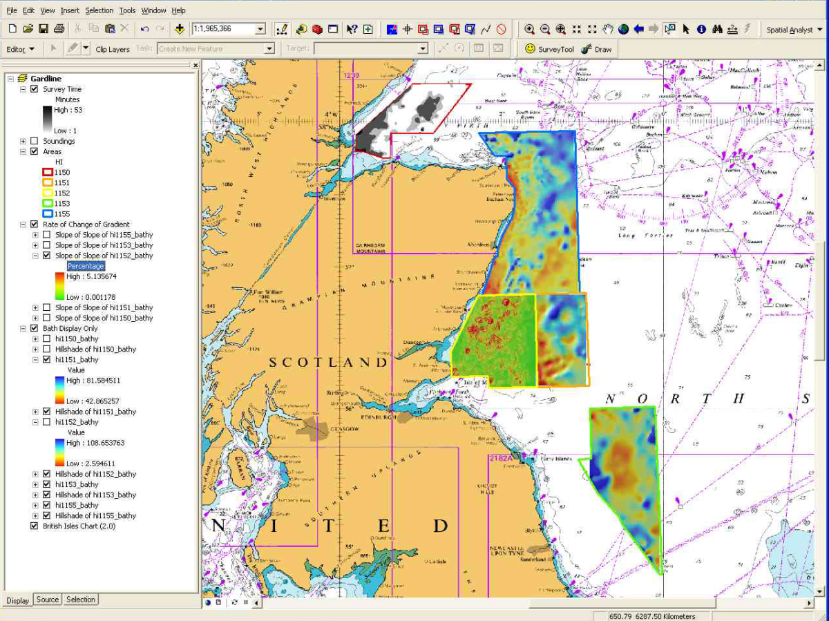
Example of the areas to be surveyed with user defined parameters
The Benefits
The use of the survey costing tool has enabled the MCA to analyse the datasets required to create accurate estimates for the commissioning of hydrographic surveys. The costing tool allows the MCA to:
- Manage contract variations with a pre-agreed costing methodology preventing contractors over-quoting for variations.
- Determine the cost of proposed survey areas quickly in advance, ensuring that the “cost” in the cost-benefit equation is known precisely when choosing areas to survey.
- Providing quantifiable and repeatable results in much less time, rather than the old subjective, manual method of determining costs for surveys.
- Supporting business cases that the MCA puts forward for additional funding for hydrography.

Output of results indicating total number of days required to complete the survey
The Future
The survey costing tool could be made available to sister organisations around the world. Due to the parameter driven nature of the application and its development in ArcObjects, the tool is easily customisable to allow for localised environmental factors. There are plans for the costing tool to be enhanced to be able to calculate risk to the mariner of not surveying a particular area. The tool could thus calculate risk and cost, and an algorithm could be written to determine where the MCA should survey in order to maximise the benefit from its budget.


