Blog Archives

City of London Police
With improved insight into where the majority of crimes occur and the locations of the most harmful crimes, City of London Police can optimise its allocation of resources and prevent more crimes.
At a time when police resources are stretched to the limit in the UK, City of London Police has used ArcGIS to implement a new, evidence-based approach to urban policing. The force is now operating more strategically, increasing its arrests and preventing harmful crimes at the heart of London’s financial centre.
ArcGIS Pro provides critical insight through identification and analysis of the most harmful crime locations
ArcGIS story maps put new intelligence about crime into the hands of officers on the beat, in an interactive format
Esri UK consultants helped the force to turn academic research into a highly effective, real-world policing tool
The Challenge
While the City of London covers little more than a square mile and has just 8,000 permanent residents, it is visited every day by over 500,000 workers, students and tourists. In addition, the area’s 715 streets are all highly urbanised and surrounded by historic buildings, high value business premises and soaring skyscrapers, making this financial district an incredibly challenging environment for policing. Following a gradual reduction in funding, City of London Police needed to find a smarter, more targeted approach to crime prevention that would optimise the use of its resources and improve its effectiveness.
“Arrests have increased dramatically since we started to focus our efforts on those priority crime areas identified by ArcGIS.”
Detective Inspector Lee Bowen, City of London Police
The Solution
For many years, City of London Police has used Esri’s ArcGIS platform to help it analyse patterns in crime and plan policing responses. Through a research programme at Cambridge University, the force identified an opportunity to leverage advanced functionality within the ArcGIS platform and develop a new smarter approach to crime prevention. It then worked with Esri UK to elevate the use of its existing ArcGIS solutions and transform the academic research into a real-world policing tool.
Under the leadership of Detective Inspector Lee Bowen, City of London Police first used algorithms in ArcGIS Pro to analyse a database of 21,000 crimes and identify where the most crime was taking place, in the fewest locations. While the force had used ArcGIS before to show crime hot spots, its new, more advanced spatial analysis enables police officers to pinpoint the fewest locations where the most crimes take place and therefore identify policing priorities with a previously-unattainable level of precision.
Next, City of London Police used ArcGIS Pro to analyse the relative harm caused by each individual crime, using the Cambridge Crime Harm Index as a way of measuring the severity of crimes. This spatial analysis revealed only a handful of 50m2 locations with a high proportion of serious crime and gave police officers unequivocal evidence of the areas where it should focus its activities, for the first time.
City of London Police then used ArcGIS to develop interactive story maps to make all of its new intelligence about priority policing areas and harmful crime accessible to police officers in a format that is easy for them to understand. Officers working on the beat now use these story maps on mobile devices to get instant access to information on specific crimes in their locations, right when they need it.
“Our use of spatial analysis helps to put the police ahead of the criminal.”
Jane Gyford, former Commander of Operations, City of London Police
Benefits
Optimal use of finite policing resources
Using the insight provided by ArcGIS, City of London Police can now deploy police officers and resources to exactly those locations where high volumes of crime and the most harmful crimes occur. The spatial analysis is used every day to inform the City of London Police Patrol Plan, allowing true evidence-based targeting of resources within the force for the first time. “Our use of ArcGIS enables us to put the right people in the right place, at the right time, to deliver the best possible public service with the resources we have available,” says Detective Inspector Bowen.
A significant increase in arrests
The adoption of advanced spatial analysis has undoubtedly improved the effectiveness of police activities in the City of London and contributed to large numbers of arrests in the area. “Arrests have increased dramatically since we started to focus our efforts on those priority crime areas identified by ArcGIS,” Bowen says. “We have also been able to prioritise the crimes communities are most concerned about, by focusing on areas with a large number of crimes with a high harm index.”
Effective crime prevention strategies
By allocating resources more strategically, based on better evidence about criminal activity, the City of London Police is improving its ability to prevent crime and therefore eliminate costs across the whole criminal justice process. Jane Gyford, former Commander of Operations, City of London Police, says: “In policing we talk about prevention all the time, but actually being truly strategically preventative is a key aim of City of London Police. Our use of spatial analysis helps to put the police ahead of the criminal.”
Better information for officers on the beat
Police officers within the force can now use story maps on the beat to find out detailed information about crimes, in the locations where they are working. The story maps give police officers autonomy, so when they are patrolling a high harm location, they have the information they need at their fingertips to make decisions about the best premises to visit and how to engage with the public to improve their effectiveness.
Improved collaboration in crime prevention initiatives
City of London Police is also sharing the insight it gains from its spatial analysis with external organisations and the Crime Prevention Association, as part of a range of target hardening initiatives that aim to make it harder for criminals to operate. For example, the force advises companies on ways to improve lighting and make private security professionals more effective as deterrents. “ArcGIS gives us evidence we can share with businesses in the City of London, so that they understand the risks in their location and can take measures to minimise their vulnerability to crime,” Bowen says.


HS2
We are making information about HS2 Phase 2b easier to find, explore and understand by publishing an online story map.
As part of preparations for Phase 2b of the High Speed Two railway, HS2 Ltd is using a story map to share information about the possible environmental impacts of the scheme. This digital method of communication is helping the organisation to make complex information more accessible and engage more effectively with stakeholders about the future of Britain’s railways.
Digital approach allows information from a 10,000+ page draft report to be made more accessible
Story map format is well received by general public, with 22,000 hits during consultation period
HS2 employees use story map in call centre to respond effectively to general enquiries
The Challenge
High Speed Two is joining up Britain to build a fairer, more balanced country. By creating much needed capacity and connectivity for the country’s rail network, it will be the catalyst for economic growth and regeneration, with local areas planning to create around half a million jobs from the arrival of high speed services. With enabling works underway along Phase One of the route between the West Midlands and London, and parliamentary approval expected for Phase 2a, extending the route north to Crewe, HS2 Ltd is currently undertaking planning and consultation for Phase 2b, completing the ‘Y-shaped’ network to Manchester and Leeds – and beyond.
HS2 Ltd has a statutory obligation to publish an Environmental Statement identifying any possible environmental consequences of building and running the Phase 2b railway and describing planned measures to reduce the impacts on local communities. The organisation wanted to engage with as many members of the public and other stakeholders as possible, during a period of consultation, to gain feedback on its draft Environmental Statement. However, it recognised that its working draft was both complex and long, comprising more than 10,000 pages, making it difficult for people to find and understand information pertinent to their local areas.
The Solution
To try to make its Environmental Statement more accessible to a wider number of people, HS2 Ltd set up a project group to explore the possibility of creating a digital tool to support the working draft that would provide a visual and interactive overview of the environment information detailed in the statement. This project team soon identified that it could create an online navigator for its working draft, quickly and inexpensively, by leveraging Esri technology already used within HS2 Ltd to create a story map.
The digital solution was developed using two interlinked ArcGIS StoryMap templates, which provided the framework for displaying the environmental information in a highly visual way. HS2 Ltd embedded existing high resolution, high impact project images and corporate videos into its online navigator to draw people into the story. Most importantly, the organisation incorporated a series of interactive, digital maps allowing people to explore their own community areas and see the precise locations of the HS2 Phase 2b route.
With links directly from the HS2 website, the online navigator allows users to zoom into the map to see new features, such as tunnels and cuttings, and click on hyperlinks to access more detailed information from the full suite of documents. By overlaying different maps on top of one another in the story map, HS2 Ltd was able to show people the existing situation and likely future scenarios in a very clear way and illustrate precisely how the HS2 Phase 2b route is likely to change the environment.
Benefits
Effective engagement with stakeholders
The development of the HS2 Phase 2b online navigator has enabled HS2 Ltd to engage more effectively with a wide range of stakeholders, online and at regional events, during and after the consultation. Over a period of six months, the Environmental Statement online navigator was viewed more than 22,000 times, which demonstrates just how successful it was in engaging the interest of the general public.
Clearer communication of relevant information
One significant benefit of the online navigator is its ability to make the working draft of the Environmental Statement more meaningful and relevant to everyone. Users can use the interactive tool to quickly find the information that matters to them and zoom in to see likely environmental changes in the communities where they live or work.
Faster responses to telephone enquiries
Unexpectedly, the online navigator is also helping HS2 Ltd to improve its customer service by helping it to respond to enquiries more quickly. Members of staff in the HS2 call centre routinely use the story map to find the locations that callers are concerned about and zoom in to find the information they need to answer specific questions about possible environmental impacts.
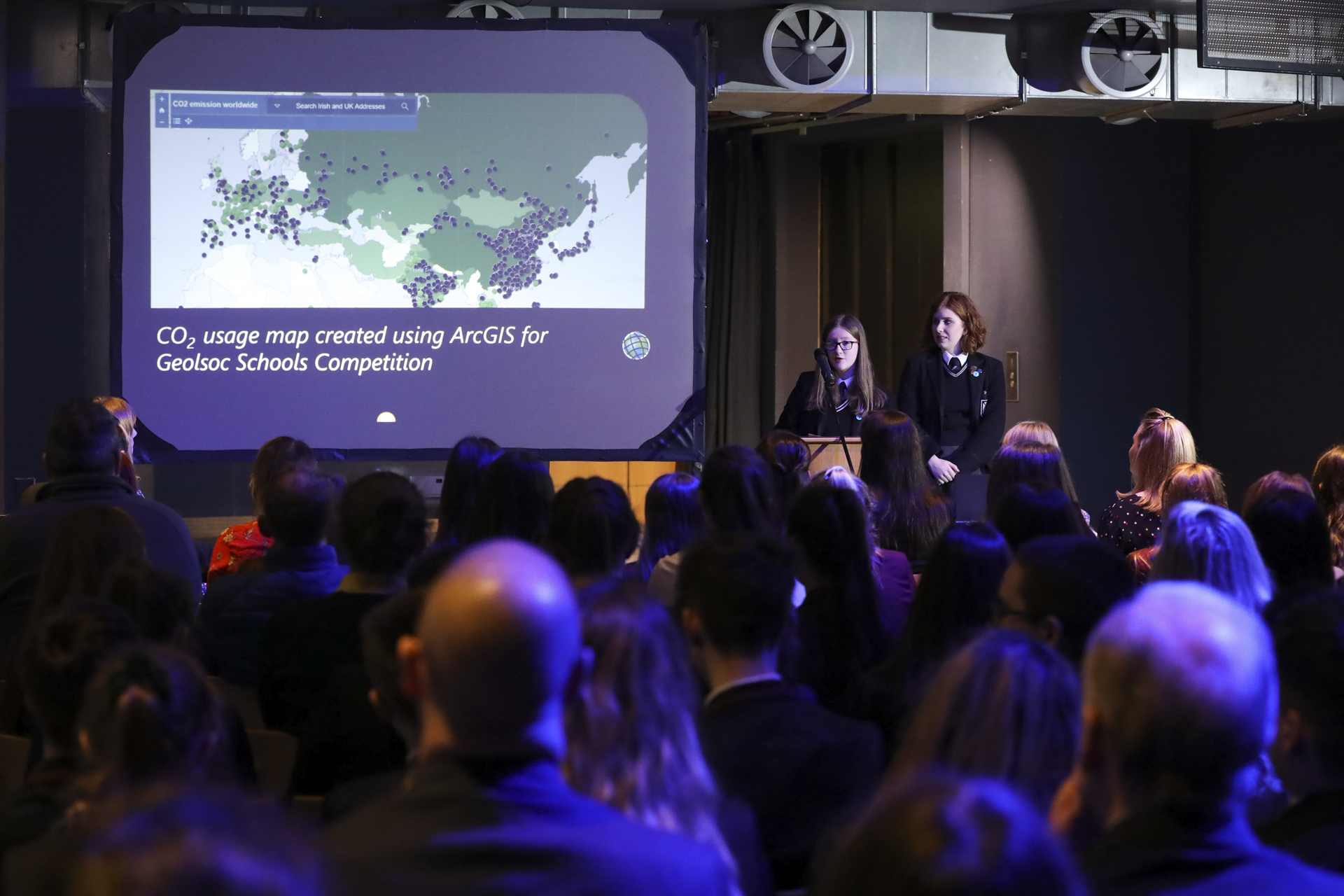
Methodist College Belfast
Students use ArcGIS to evaluate the environmental, economic and social impacts of renewable and non-renewable energy sources
Pupils at Methodist College Belfast have the opportunity to use ArcGIS in the classroom, in the field and in extra-curricular activities. In these ways, they are gaining the real-world GIS skills that will give them an advantage at university and in their future careers.
In the classroom, pupils engage more enthusiastically in their geology lessons using ArcGIS
During field trips, pupils can collect more accurate data using ArcGIS on smartphones
In extra-curricular activities, groups have achieved success using ArcGIS in competitions
Why GIS?
Affectionately known as Methody, Methodist College Belfast is one of Northern Ireland's leading grammar schools. Pupils here have the opportunity to study Geology and Geography courses at GCSE, AS and A Level, as well as participate in a wide variety of extra-curricular opportunities that strive to develop pupils’ interest in university courses and careers relating to Geology and Geography.
Geology teacher Karen Parks needed to integrate the use of geographic information system (GIS) technology into her teaching with A Level students, because the compulsory ‘Practical Endorsement’ part of the A Level states that students must be able ‘to compile and analyse geological data sets through to visualisation using GIS’. In addition, she wanted to integrate GIS into more of her lessons with pupils of all ages, to ignite their interest in GIS and give them real-world IT skills that they may need in their future studies and work. She therefore signed up to use Esri’s ArcGIS platform free of charge, through the ArcGIS for Schools programme.
“When my students go to university to study geology, geography or other related courses like civil engineering, they are not afraid to use GIS. They already have real-world GIS skills, which puts them a step ahead of other students.”
Karen Parks, Geology Teacher, Methodist College Belfast
Benefits for students
Parks now regularly uses ArcGIS solutions and interactive maps available in ArcGIS Online, along with teaching resources prepared by Esri Ireland, to make lessons fun and engaging for pupils. For example, she helps pupils understand the potential impact of volcanoes using the ArcGIS Online Volcano Top Trumps map, where volcanoes around the world are given scores for height, deadliness, unpredictability and destruction potential. “I find that the pupils who engage well with GIS tend to get a better understanding of global issues, as they can think about them spatially,” she says.
The Geography teachers at Methody will also be using the Esri’s Survey123 app to allow students to collect data on their smartphones while on field trips. Use of this mobile GIS solution enables pupils to record very accurate locations on maps, take their own pictures and make notes in any weather, without worrying about soggy paper. Pupils have enjoyed using the technology in the field, and Parks expects to use Survey123 during all geology field work at GCSE and A Level in the incoming academic year. She says: “Using GIS in the field gives pupils an insight into the working world. Professionals in a wide range of civil engineering and environmental careers need to be able to access and use maps in the field.”
Pupils have also had the opportunity to use GIS in extra-curricular activities and deepen their knowledge of GIS. For example, a group of students recently used ArcGIS as part of research to enter the National Schools Geology Challenge and also participated in the Association for Geographic Information (AGI) conference in Belfast. They used ArcGIS to explore the environmental, economic and social impacts of renewable and non-renewable energy sources and presented their ideas in a presentation and poster entitled ‘Fuel for Thought’.
“When my students go to university to study geology, geography or other related courses like civil engineering, they are not afraid to use GIS,” Parks says. “They already have real-world GIS skills, which puts them a step ahead of other students.”
“I find that the pupils who engage well with GIS tend to get a better understanding of global issues, as they can think about them spatially.”
Karen Parks, Geology Teacher, Methodist College Belfast
The teacher’s perspective
Before starting to teach ArcGIS in the classroom and on field trips, Parks attended an ArcGIS for Schools training course organised by Esri Ireland and a GeoMentor from Esri Ireland came to Methody to deliver training workshops for some Geography and Geology students. She then took advantage of some of the ready-made resources that have been prepared by Esri Ireland for teachers to use, adapting some of them and using others straight ‘out of the pack’, which saved her time.
Parks has had tremendous support from GeoMentors at Esri Ireland and Queens University, Belfast, who have encouraged her and given her practical help and tips along the way. She has also benefited from help from the wider GIS community, including the Geological Society Northern Ireland. “Lots of people have been very enthusiastic about ArcGIS and that has made all the difference,” she says.

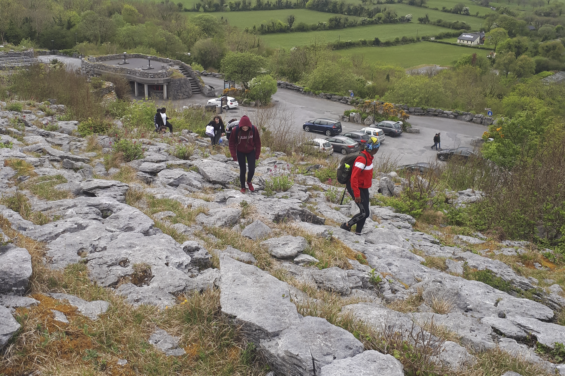
St Conleth’s Community College
Students of all abilities at Saint Conleth's Community College are developing important life skills through the use of ArcGIS.
Students of all abilities at Saint Conleth's Community College are developing important life skills through the use of ArcGIS. Whether they are undertaking field-work surveys in the Burren or analysing information in the classroom, they are engaging enthusiastically in their geography lessons and developing critical thinking abilities.
Students develop valuable life skills in areas such as critical thinking
Young people of all abilities can learn and succeed in geography lessons
ArcGIS supports independent and collaborative learning in classrooms and during field trips
Why GIS?
At Saint Conleth’s Community College in Newbridge, County Kildare, Ireland, teachers proactively seek out new ways to expand the learning opportunities for their students, recognising that practical skills are as valuable as academic skills.
Deirdre O’Crowley, a geography teacher at the school wanted to embed the use of geographic information system (GIS) technology into her lessons to help her broaden the learning experiences for students. “Geography is not just about theory,” she says. “There are lots of practical elements to the teaching of geography. I felt that GIS would complement and enhance the other skills that students develop throughout the Junior and Senior Cycles.”
As a result of O’Crowley’s enthusiasm for GIS, Saint Conleth’s Community College became one of the first schools in Ireland to participate in Esri Ireland’s ArcGIS for Schools Program. Through this scheme, the school now has free access to Esri’s digital mapping platform, ArcGIS Online, along with lesson plans, teaching resources and guidance from GIS professionals.
“ArcGIS enhances students’ engagement in learning about geography and helps them to become critical thinkers.”
Deirdre O’Crowley, Geography Teacher , Saint Conleth's Community College
Benefits for students
Having now used ArcGIS with students for a full academic year, O’Crowley is convinced that the technology delivers significant benefits for students. She says, “ArcGIS enhances students’ engagement in learning about geography and helps them to become critical thinkers. Using ArcGIS they can query multiple layers of data on interactive maps, explore environments and constantly ask questions to find answers.”
O’Crowley also recognises that ArcGIS enhances learning for students will all levels of ability. “ArcGIS promotes an inclusive learning environment,” she says. “Using ArcGIS in the classroom gives students of all abilities the opportunity to excel in geography. It helps them to work collaboratively and develops their vocabulary which benefits other subjects.”
O’Crowley has employed ArcGIS very effectively with a group of fifth year students as part of a field trip to the Burren, or ‘Rocky Place’ in Co. Clare. This limestone landscape features unusual stone patterns and is often visited by school groups as part of their geography studies. The students from Saint Conleth’s Community College used ArcGIS to plan their research and created a Story Map to plot their route to the research location. Once in the field, they used an ArcGIS mobile app, Survey123 for ArcGIS, to collect data on their mobile phones about underground features such as stalactites and surface features such as limestone pavements. Then, afterwards, the students used ArcGIS Online to visualise their survey results on a field study map layer, analyse their results and present their findings.
In addition, Saint Conleth’s Community College has used ArcGIS in the classroom to support teaching on topics as diverse as earthquakes and economic development. In one project, pupils were shown how to use ArcGIS to help them identify the best location to set up a multinational company, taking into account factors such as local employment, transport services, training providers and communications. “Students have been very creative and motivated in their use of ArcGIS,” says O’Crowley. “I have been able to give them a brief outline of the task to complete, which allows them to become independent learners.”
A number of students have used ArcGIS Online independently to create Story Maps combining pictures, videos, maps and data to help them revise for exams. “Students like the interactive and creative way of learning,” O’Crowley says.
“Using ArcGIS in the classroom gives students of all abilities the opportunity to excel in geography.”
Deirdre O’Crowley, Geography Teacher, Saint Conleth's Community College
The teacher’s perspective
To build up her own GIS skills, O’Crowley has attended free training sessions and workshops held by Esri Ireland. She has also taken advantage of Esri Ireland’s pre-prepared teaching materials to help her incorporate ArcGIS Online into her lesson plans.
Such is her continuing enthusiasm for the ArcGIS for Schools Program that O’Crowley is now actively promoting it to other teachers, both within her own school and at other schools. She hopes to encourage her teaching colleagues at Saint Conleth’s Community College to use ArcGIS with first year geography students for the first time and even embed ArcGIS into science lessons. “The more I use ArcGIS in teaching, the easier it gets,” she says. “I urge other teachers to give ArcGIS a go, make a plan and use it regularly.”

Sellafield
ArcGIS has become a pivotal strategic planning tool, helping us to work efficiently, reduce costs and respond rapidly to incidents.
Decommissioning and remediating the Sellafield nuclear facility is an incredibly complex and hazardous project that is expected to take 100 years to complete. Esri’s ArcGIS is being used to help plan hundreds of simultaneous and adjacent programmes of work, improve the efficiency and safety of employees and deliver millions of pounds in cost savings.
ArcGIS provides 11,000 employees with the information they need to work efficiently and safely
A control room app makes real-time data available in emergencies to enable rapid decision making
Esri UK consultants deliver ongoing consultancy to help Sellafield Ltd make optimum use of GIS
The Challenge
The scale of the challenge for Sellafield Ltd cannot be underestimated. The organisation has been tasked with decommissioning and remediating the Sellafield nuclear site, which currently comprises 1400 buildings, 250 nuclear facilities, over 330 km of utility pipes and drains, a 55 km road and rail network and 20 km of overhead cables. The target completion date for this mammoth undertaking is 2120, so the organisation needs to plan a schedule of highly complex and hazardous programmes of work, in close proximity to each other, over the next 100 years. In order to treat and safely store legacy nuclear inventory, Sellafield Ltd needs to construct at least 50 new buildings, decommission and demolish existing facilities and move hazardous materials safely around the site, while minimising costs.
In 2010, the nuclear accident at the Fukushima Daiichi nuclear plant in Japan, caused by an earthquake and subsequent tsunami, focused global attention on the need not only for exceptionally robust safety measures, but also for effective emergency response systems. Sellafield Ltd recognised that if it expanded its use of geographic information systems (GIS) for day-to-day operations, it could, in tandem, make better data and systems available to support rapid decision making in the event of an emergency.
“ArcGIS helps us to ensure we put specialist facilities in the right places, to reduce costs in the building phase and ensure they can be operated efficiently during their lifetime.”
Richard McGrath, Spatial Development Lead, Sellafield Ltd
The Solution
Through an Enterprise License Agreement with Esri UK, Sellafield Ltd used Esri’s ArcGIS to create a web mapping platform, called Sellafield Maps, that makes GIS capabilities and spatial data accessible to 11,000 employees and thousands of supply chain resources. Sellafield Maps comprises hundreds of data layers showing everything from the locations of 5,000 manholes and the routes of underground gas pipes to the nearest bus stops. The service typically receives 20,000 hits and handles 100,000 feature searches every month. “Sellafield Maps is now part of the daily toolkit that people use to do their jobs,” says Richard McGrath, Spatial Development Lead at Sellafield Ltd.
In addition, Sellafield Ltd has used ArcGIS Portal to develop more than fifty specialist GIS apps that deliver specific GIS functionality and data for certain groups. One such app has been developed to support emergency responses and is displayed on a large screen in the control room. The app mimics the company’s prior use of whiteboards, allowing employees to see the incident location, incorporate live weather reports and wind direction, to enable a plume to be automatically drawn once a radioactive release point has been identified. The app can also be accessed remotely by managers working off site, alongside government teams and emergency services if necessary.
Both Sellafield Maps and ArcGIS Portal use a ‘Data Wheel’, a centralised library with nine data categories for storing and accessing all data in a standard way, so that when departments are inevitably reorganised during the next 100 years, the way that data is stored can remain consistent. “We received support from consultants in Esri UK’s Professional Services group, who help us push the boundaries of Esri software,” says McGrath. “The consultants show us how to do things differently and build apps more efficiently to reduce server load and deliver additional services for users.”
“It is reassuring to have a proven ArcGIS emergency app in place that we know we could rely on if a serious incident were to occur.”
Richard McGrath, Spatial Development Lead, Sellafield Ltd
Benefits
Effective implementation of a century-long plan
The Sellafield site has a finite land resource and is heavily congested. ArcGIS plays a pivotal role in helping Sellafield Ltd to identify the optimum sites for new buildings, based on the locations of utilities and adjacent facilities, and subsurface ground conditions and visualise what the site will look like at different points in time, as old buildings are demolished and new structures take their place. “Over the next 20 years alone, Sellafield Ltd will be investing £13.5 billion in new facilities for the storage and treatment of nuclear waste,” McGrath says. “ArcGIS helps us to ensure we put specialist facilities in the right places, to reduce costs in the building phase and ensure they can be operated efficiently during their lifetime.”
£2.5 million in efficiency savings
The use of Sellafield Maps and ArcGIS Portal apps allows teams right across the business to work more efficiently. On average, Sellafield Ltd estimates that employees save fifteen minutes every time they consult an ArcGIS map or app. Even taking into account the ArcGIS licence, IT hardware and staff time, these time savings equate to an annual cost saving of £2.5 million pounds, year after year.
Readiness for any future emergency
Sellafield Ltd is confident that its extended use of ArcGIS puts it in a better position to respond quickly to future emergencies. Following a recent failure in part of the site steam system, the emergency control room used the ArcGIS app to quickly access relevant information, understand the implications of the incident, explore different scenarios and make rapid decisions. “It is reassuring to have a proven ArcGIS emergency app in place that we know we could rely on if a serious incident were to occur,” McGrath says.
Improved collaboration and safety on site
Several teams at Sellafield Ltd, including the utilities teams, make extensive use of ArcGIS Portal apps to share information with employees working in different zones across the 262-hectare site. “ArcGIS improves clarity for employees working at locations right across Sellafield,” McGrath says. “It supports collaboration between teams and improves safety, by ensuring everyone knows what is happening nearby, when new projects are being kicked off and where hazards are located.”

St Kevin’s College
Students use ArcGIS to analyse data and make informed decisions and deliver effective presentations using ArcGIS Story Maps
Transition Year students at St. Kevin’s College on the north side of Dublin have used ArcGIS in an incredibly diverse and creative range of projects, from searching for Hollywood film locations to exploring the viability of ‘no-fry’ zones. The students’ use of professional GIS technology has helped them develop the decision-making, team-working and presentation skills that will be invaluable in their future lives.
Students use ArcGIS to analyse data and make informed decisions
Groups deliver effective presentations using ArcGIS Story Maps
Teacher gains free training, a wide range of resources and ongoing support
Why GIS?
For geography teacher Andrew Horan, ArcGIS for Schools was the perfect solution to an unexpected challenge. He discovered, quite late in the summer, that he would be teaching Transition Year students from September and, as he had not taught Transition Year for four years, his previous teaching materials were outdated. With limited time available, he needed to come up with a new programme that he could put into place quickly and that would engage and inspire his students.
“A colleague mentioned the ArcGIS for Schools programme and it ticked all the right boxes,” Horan says. “I wanted to offer something new and exciting. Straight away, I could see that ArcGIS would encourage a more active learning approach, incorporate ICT into geography and allow students to explore local, national and international issues.”
“I can’t speak highly enough of the help I received from Esri Ireland, right from the start.”
Andrew Horan, Geography Teacher, St. Kevin’s College, Finglas
Benefits for students
During the course of the school year, over forty Transition Year students had the opportunity to use ArcGIS in a geography programme that was based around a series of creative projects. According to Horan, “ArcGIS helped the students develop critical project skills, from how to gather, analyse and reflect on data, to how to work as part of a team and present your results.”
One group considered if it would be possible to establish a new school anywhere in Dublin, without it being within a ten minute walk of a fast food takeaway, and discovered that it was impossible to find a ‘no-fry’ zone. Another group conducted a nationwide search for remote locations that could be used as Hollywood film sets and might prove as successful as the island of Skellig Michael, in Kerry, where filming took place for Star Wars, The Last Jedi. “I was quietly impressed by the range of project titles that students selected and the way that they went about exploring data with ArcGIS to support their ideas.”
ArcGIS was particularly effective in helping the students to develop skills in analysing information and finding evidence to support decision-making. In one block of lessons, the Transition Year students were asked to find the best site to locate a new business, in their choice of industry, in Dublin, in an empty building or on a parcel of land available for development. Using ArcGIS, the students were able to take into account a wide range of factors, including transport links, local skills, the locations of suppliers and the distance to Dublin airport, to inform their decisions about the best sites.
Students were also able to hone their presentation skills, by creating ArcGIS Story Maps to present their projects. One group created a Story Map to share its findings about accident black spots in the local area. “All the project skills our students developed during their Transition Year will be invaluable for them in their future careers, particularly if they go into engineering or town planning roles,” Horan says.
“ArcGIS helped the students develop critical project skills, from how to gather, analyse and reflect on data, to how to work as part of a team and present your results.”
Andrew Horan, Geography Teacher, St. Kevin’s College, Finglas
The teacher’s perspective
Through the ArcGIS for Schools programme, Horan was able to access free training, ready-made lesson plans and hand-outs which helped him prepare for his Transition Year class in a matter of weeks. “I can’t speak highly enough of the help I received from Esri Ireland, right from the start,” Horan says. “Any fears I had about not being prepared for teaching Transition Year were wiped away.”
During the course of the year, experts at Esri Ireland were always on hand if Horan or his students had any queries, and this was very reassuring and helpful. Now, Horan is looking ahead to another academic year and will be using ArcGIS with Transition Year students for the second year running. Esri Ireland has provided a GIS mentor to provide ongoing support to the staff at St. Kevin’s College and is helping Horan to fine tune a 10-week Transition Year programme. Without hesitation, Horan reports, “The ongoing support has been amazing”.

Presentation College Headford
Using ArcGIS and creating Story Maps helps our students to develop research skills and gives them experience of using different types of maps at different scales. It also encourages them to think about how information is communicated and improve their presentation skills.
At Presentation College Headford in County Galway, Transition Year students have been learning how to create Esri Story Maps that give insight into local and international destinations in an attractive, interactive format. Their accomplishments have won them recognition in a major national award scheme, as well as praise from local councils.
School expands opportunities for students and engages their interest in geography with GIS
Students use ArcGIS Online to help them achieve success in Ireland’s Young Environmentalist of the Year Award
Students create high quality, attractive Story Maps, suitable for publication on council websites in Ireland
Why GIS?
“Just looking at maps in books and on whiteboards can be a bit tedious for students,” says Colette Flanagan, a geography teacher with 28 years of experience in the classroom. When the opportunity arose for her to embed geographic information system (GIS) technology into her lessons at Presentation College Headford, she immediately recognised that this was a technology that could really inspire students.
“Young people nowadays are so technology focussed that using computers and digital maps is second nature to them,” she says. “ICT is already a huge part of their learning in so many areas, that it makes sense to use technology to get them more engaged in geography lessons and help them learn important new life skills.”
Presentation College Headford is a secondary school in County Galway in the Republic of Ireland and it became one of the first schools to sign up to Esri Ireland’s ArcGIS for Schools Program. Through this scheme, all Irish schools can gain free access to Esri’s digital mapping platform, ArcGIS Online, along with lesson plans, teaching resources and expert support.
“Using ArcGIS and creating Story Maps helps our students to develop research skills and gives them experience of using different types of maps at different scales. It also encourages them to think about how information is communicated and improve their presentation skills.”
Colette Flanagan, Programmes Coordinator, Presentation College Headford
Benefits for students
Presentation College Headford started by making ArcGIS Online available to Transition Year students and showing them how to use ArcGIS to create engaging Story Maps. One group produced tourism Story Maps, combining historical, cultural, environmental and commercial information in one place in an appealing format. Some of these Story Maps presented information about international cities including Rome and Hamburg, while others focused on local towns and villages including Headford in County Galway and Shrule in County Mayo. “These Story Maps are so good that some of our local councils want to publish them on their own websites,” Flanagan says.
Other Transition Year students used ArcGIS to create a Story Map to support their entry for the Young Environmentalist of the Year Award. The Story Map provided the group of young people with the ideal way to present a vast amount of data about an area of woodland, including archaeological sites, public amenities, survey results and trails. The team was successful in winning the regional round of the competition, and Flanagan believes that the students’ use of Story Maps made them stand out from other groups, contributing to their success. “ArcGIS enabled the students to share information in a much more effective and attractive way than simply using a PowerPoint presentation,” she says.
All of the students at Presentation College Headford who have had the opportunity to use ArcGIS Online have responded very positively and learned valuable new skills. “Our students really enjoy working with GIS,” Flanagan says. “Using ArcGIS and creating Story Maps helps our students to develop research skills and gives them experience of using different types of maps at different scales. It also encourages them to think about how information is communicated and improve their presentation skills.”
“Our Transition Year students have gained a lot from using Esri’s technology and Story Maps, and I want to make this opportunity available to as many of our students as possible.”
Colette Flanagan, Programmes Coordinator, Presentation College Headford
The teacher’s perspective
Flanagan found it relatively easy to learn how to use ArcGIS for teaching, despite the fact that GIS was entirely new to her. She attended a workshop run by Esri Ireland to gain an initial overview of the capabilities of the ArcGIS platform and saw demonstrations of how it can be embedded into lessons and projects. She then subsequently gained inspiration by reviewing Esri Ireland’s online resources, including pre-prepared teaching materials. “Using the information online, I could pretty much teach myself,” she says.
Following the success of using Esri’s Story Maps with Transition Year students at Presentation College Headford, Flanagan now plans to use ArcGIS in the Junior Cycle for classroom-based assessments and in the Senior Cycle for geographical investigations that are part of the leaving certificates for senior students. She also plans to start using Survey123, an Esri field collection app included as part of the schools program, with Transition Year students. This enables them to use mobile devices to collect information during field-work exercises and embed their own GIS data into their Story Maps.
Recognising that she cannot achieve all of this at once, Flanagan plans to extend the use of GIS at Presentation College Headford one step at a time, calling on support from her designated GeoMentor, a GIS professional assigned by Esri Ireland to provide the college with free ongoing support and encouragement. “Every year, I want to build on what we have done with ArcGIS and continue to incorporate new uses of GIS into our teaching,” she says. “Our Transition Year students have gained a lot from using Esri’s technology and Story Maps, and I want to make this opportunity available to as many of our students as possible.”

Crowther Lab
Interactive maps enable us to communicate the Lab’s findings with a broad community, so they can learn something new and make the right decisions.
The Crowther Lab is a network of leading global climate scientists, specialising in ecology, whose aim is to help identify nature-based climate change solutions. The Lab enhances climate predictions by pairing top-down satellite data with the world’s largest set of ground-sourced data and uses ArcGIS, amongst other tools, to visualise the results and communicate ground-breaking climate change solutions.
Greater public awareness of global climate change solutions
Complex data visualised in eloquent, powerful maps
More efficient decision-making guiding restoration
The Challenge
The threat that climate change poses to mankind and the planet is a huge and complex topic. However, it is widely accepted that ecosystems act as the Earth’s regulatory system and biodiversity has an intrinsic role in mitigating the impact of climate change. Crowther Lab has generated quantitative models of the Earth’s ecology and revealed that it is possible to offset climate change by restoring plants and soils across the globe. It has identified that restoration of the Earth’s forests is one of the most effective solutions to climate change available today and the location of where global tree restoration should be implemented without affecting existing cities or agriculture is fundamental to its work.
In arriving at its conclusions, the Lab has unrivalled access to spatial data sets and ground-sourced data from researchers, ecology bodies and labs across the globe. Ensuring that data is clean, consistent and accurate is vital to continuing interpretation and analysis and keeping on top of these data sets and making the best use of Big Data is one of its primary operational challenges.
The ability to successfully communicate its findings that global tree restoration is a tangible climate change solution is a further challenge. The Lab shares its findings with multiple audiences, from individuals to global scientific bodies, aiming to convey that there is a viable solution to help mitigate climate change without compromising cities or agriculture.
“When you start viewing the world using interactive maps you can immediately see where the priority areas for restoration are.”
Devin Routh, Geospatial Ecosystem Ecologist, The Crowther Lab
The Solution
The scientists at Crowther Lab conduct Global Ecological Monitoring (GEM), classifying global ecological systems by pairing top-down satellite imagery with its ground-sourced data sets of forest tree and soil diversity – the largest in the world. GIS acts as a foundation for the Lab’s data strategy, pulling the data together with geoprocessing tools filtering and converting data into layers of information, generating a richer understanding of the world’s forests.
By using geoprocessing tools, the team can perform spatial analysis, manage GIS data and build custom tools to automate complex tasks and solve problems. ArcGIS and other tools are then used to create interactive maps to communicate the Lab’s findings, including the essential identification of sustainable land where forests could be restored without affecting existing cities or agriculture. This information sharing is vital to the success of Crowther Lab’s work to communicate a quantitative understanding of what’s possible; different options for where and which ecosystems should be restored, thereby improving the efficiency of restoration projects.
These interactive maps are vital communication tools enabling users, from scientists to anyone interested in climate change, to interrogate the Lab’s findings, learn something new about ecosystems and take decisions and act on quantitative information, beautifully presented.
Access to the Lab’s maps and data visualisations has further been extended by their availability on the ArcGIS Living Atlas of the World, an evolving collection of authoritative, ready-to-use global geographic information. Content includes imagery, basemaps, demographics and lifestyle, landscape, boundaries and places, transportation, earth observations, urban systems, ocean and historical maps that can be combined with data to create new maps, scenes and apps and perform analysis.
“Interactive maps enable us to communicate the Lab’s findings with a broad community, so they can learn something new and make the right decisions.”
Tom Crowther, Founder, The Crowther Lab
Benefits
User-friendly tools
Both experienced and non-GIS specialists with no coding knowledge work with ArcGIS’s intuitive, user-friendly interface to rapidly bring together data from multiple sources to create powerful visualisations.
Impactful data visualisation
Complex data is presented in eloquent, stunningly-designed maps, enabling users to more easily grasp how global tree restoration presents a powerful and viable solution to mitigate climate change.
Insightful Communications Tools
Crowther Lab’s interactive maps are powerful communications tools enabling viewers from any background, from students to scientists, governments or commercial organisations, to query the data presented and help find the answers to questions they may have.
More efficient decision-making
The articulate presentation of quantitative data in map form makes it possible for decision-makers to develop more insightful strategies into restoration management. By identifying specific locations to restore trees, plants and soils the efficiency of restoration efforts can be improved.

Flagship Group
When tenants, members of the public or employees report issues with trees on our land, we can respond quickly and effectively to ensure public safety.
Flagship Group owns and manages thousands of trees and can receive up to eighty requests for tree work every single month, in addition to scheduled tree maintenance. It can now plan these tasks more efficiently using Esri’s Workforce for ArcGIS and respond faster to any issues that might pose a risk to the public.
Time required to log requests and schedule tasks has reduced from 1 day to 2 hours
Urgent tree maintenance tasks can be sent to arborists in the field within 10 minutes
Data collected in the field improves customer service and cost management
The Challenge
In a typical month, Flagship Group receives between fifty and eighty reports of issues relating to trees on its land – and this number can increase significantly following large storms. The housing association provides 28,000 homes for affordable and market rent and is responsible for thousands of individual and groups of trees, covering an area from North Essex to North Norfolk.
Previously, when tenants reported damaged trees in their gardens or employees noticed tree issues on land owned by Flagship Group, information was simply emailed to the organisation’s in-house arborists. The team manager then had to rely on his local knowledge to plan work schedules for the arborists, and he allocated tasks by email. In the field, the arborists used pen and paper to gather data about trees and typed up information into spreadsheets when they got back into the office. Consequently, three arborists typically spent a whole week doing administration in the course of every month, which limited their ability to manage trees efficiently and effectively.
“Within ten minutes of an urgent tree incident being reported, all the relevant information can be in the hands of the right person, in the best location, and the potential hazard can be dealt with quickly.”
Andy Blackman, GIS Developer, Flagship Group
The Solution
Flagship Group had previously used Esri’s ArcGIS platform to successfully improve the efficiency of its grounds maintenance workforce. The organisation therefore decided to adopt a similar approach and developed an integrated solution for tree works using Esri’s Workforce for ArcGIS and Collector for ArcGIS, integrated with Microsoft PowerApps (part of Office 365).
Once responsibility for the tree is established using ArcGIS Enterprise mapping, information from an employee, tenant or member of the public is recorded via a PowerApp form. The relevant details are exported using Microsoft Flow and programmatically uploaded to Esri’s Workforce for ArcGIS solution, where an assignment is automatically generated. The lead of the tree works team then uses Workforce for ArcGIS to view the locations of jobs and operatives on an interactive map, allocate the task to an arborist and schedule tasks according to priority. Workforce for ArcGIS includes real-time functionality, allowing the arborists to receive notification of urgent jobs near their current location, as they are assigned.
In the field, arborists use Workforce for ArcGIS on iPads to see their job list. When undertaking tree work, they can capture before and after pictures using Workforce for ArcGIS, and the solution automatically records useful data, such as the start time, pause time and completion time of each job. The arborists also use Collector for ArcGIS on their iPads to view tree data, confirm trees are the organisation’s responsibility, amend asset information and collect new data to update Flagship Group’s central database.
“Esri’s Workforce gives us really valuable information, so we can continually improve the efficiency of our tree works and deliver better services for our customers.”
Victoria Green, Business Intelligence Developer, Flagship Group
Benefits
An efficient tree works management process
The ArcGIS-based solution has freed up weeks of employee time per year, improving the efficiency of the entire end-to-end tree works process. In the office, the lead arborist no longer has to log individual requests for services and manually plan work schedules. Equally, arborists have access to better information in the field and no longer have to type up notes back in the office. “One team member commented that it took him just two hours to complete a task that previously would have taken a day,” says Andy Blackman, GIS Developer at Flagship Group.
Rapid response to public safety issues
Using Workforce for ArcGIS, Flagship Group can respond far more quickly to any public safety issues that might arise from damaged trees. Blackman explains: “When a request is logged, it becomes visible to the team manager on Workforce for ArcGIS almost immediately, and he can dynamically assign the job to the arborist who is nearest to that location. Within ten minutes of an urgent tree incident being reported, all the relevant information can be in the hands of the right person, in the best location, and the potential hazard can be dealt with quickly.”
Effective management of costs
The data collected by Workforce for ArcGIS helps Flagship Group to make better-informed decisions leading to cost efficiencies. For instance, the organisation can ensure tree jobs are priced correctly, based on actual time taken, and billed to the relevant internal departments or the customer. The organisation can also analyse historic data on tree falls and undertake pre-emptive pruning to reduce costly emergency jobs. “Esri’s Workforce gives us really valuable information, so we can continually improve the efficiency of our tree works and deliver better services for our customers,” says Victoria Green, Business Intelligence Developer at Flagship Group.
Improved customer service
Flagship Group can now deliver an improved service for its customers, because its central geospatial database of trees is improving in quality all the time. “When customers call the contact centre to discuss a particular tree, our staff can be confident that the data they are viewing shows accurate information,” says Blackman. “Because Collector for ArcGIS is so simple to use, it just takes a couple of minutes for field workers to amend our tree records and keep our asset data up-to-date.”
AOC Archaeology Group
We are bringing history to life for our clients and the wider public, by using ArcGIS to collect, analyse and share archaeological information.
While AOC Archaeology is concerned with revealing and recording archaeology about people who lived thousands of years ago, its use of technology is right up-to-date. The company is using solutions from Esri’s ArcGIS platform in the field, on desktops and online to deliver efficient, cost-effective and professional services for clients.
Archaeologists save time using ArcGIS mobile apps to collect data about ancient artefacts and heritage while in the field
Consultants have faster access to accurate data, enabling them to provide well-informed recommendations
Clients and members of the public can view and interact with archaeological data online, improving their understanding
The Challenge
Demand for commercial archaeology services is rising sharply. Communities are successfully raising funds to explore their local heritage, while developers are increasingly required to provide archaeology reports as a precursor to gaining planning permissions. In addition, there are over forty large, multi-million pound infrastructure projects planned in the UK over the next five years, almost all of which will need to take archaeology into account.
To meet the increasing demand for its services, AOC Archaeology recognised that it needed to update its traditional methods of surveying sites, collecting and analysing data and sharing information. In particular, the company needed to transform its field-based processes, so that archaeologists would no longer have to take physical maps to sites, in all weather conditions and difficult terrains, and then type up their notes manually when they got back to the office. “Using paper-based systems alone is not viable anymore,” says Laura O’Connor, Geomatics and GIS Manager for AOC Archaeology. “We needed better systems to help us respond to the growth in demand for commercial archaeology services, by delivering highly professional services for clients more quickly and cost effectively.”
“By improving efficiency, ArcGIS is helping AOC Archaeology to achieve cost savings of around 25% - and on big projects this can be many thousands of pounds.”
Laura O’Connor, Geomatics and GIS Manager, AOC Archaeology
The Solution
To thoroughly modernise its processes and eliminate the need to use paper in the field, AOC Archaeology deployed a suite of solutions from Esri’s ArcGIS platform.
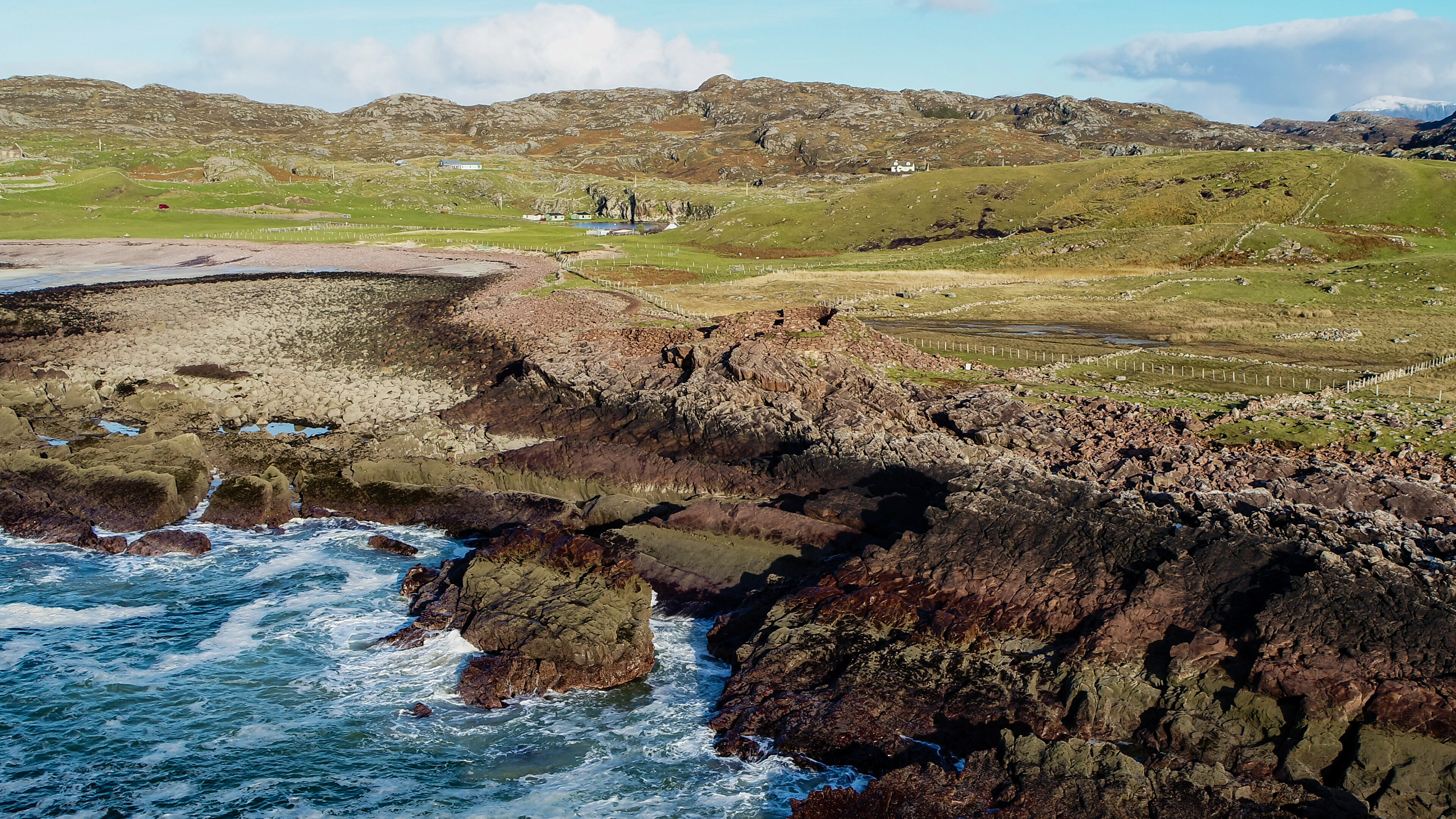
Now, AOC Archaeology’s consultants use Esri’s Collector App for ArcGIS to record information about their site observations and archaeological finds, on mobile devices, during pre-development site walkovers. In tandem, the company’s geophysical survey team uses Survey123 for ArcGIS to collect and share information about land access permissions, vegetation, crop growth and other issues that might impact archaeology projects. Both apps work effectively online and offline, allowing them to be used in remote locations including the Scottish Orkney islands.
All the data collected in the field using the ArcGIS mobile apps is uploaded automatically to Esri’s cloud solution, ArcGIS Online, where it is instantly visible to team members in AOC Archaeology’s four national offices. ArcGIS Online also provides a flexible platform for sharing information about heritage sites, in an interactive format, with AOC Archaeology’s clients, local interest groups and the general public.
In addition, AOC Archaeology’s consultants and geophysical survey team members use either ArcMap or ArcGIS Pro on desktops to combine the data collected in the field with historical mapping, third party environmental data, local authority records and high quality LIDAR imagery. Both teams perform sophisticated geospatial analyses to help them build up a more detailed understanding of sites. They can then provide well-informed recommendations to clients and share their analysis with clients using ArcGIS Online.
“Just because we study the past, doesn’t mean to say we live in the past when it comes to recording the nation’s heritage. Our use of state-of-the-art GIS technology is enhancing people’s understanding of Scotland’s history.”
Laura O’Connor, Geomatics and GIS Manager, AOC Archaeology
Benefits
25% cost savings from improved efficiency
The use of ArcGIS mobile apps has generated significant cost savings for AOC Archaeology, by improving the efficiency of its data capture processes. Archaeologists spend less time at sites, don’t need to type up notes when they get back into the office and have easy access to all the information they need to produce reports more quickly. “By improving efficiency, ArcGIS is helping AOC Archaeology to achieve cost savings of around 25% - and on big projects this can be many thousands of pounds,” O’Connor says.
Deeper understanding of the past
AOC Archaeology has begun to use ArcGIS to perform more location-based analysis and derive greater insight from its data. For example, at Clachtoll Broch, an Iron Age structure in Scotland, the company has captured the exact locations of over 500 archaeological finds and is analysing this data with ArcGIS Pro. By evaluating where different types of artefacts were located, in different areas of the Iron Age dwelling, it has gained a deeper understanding of how people lived. “Just because we study the past, doesn’t mean to say we are live in the past when it comes to recording the nation’s heritage,” O’Connor says. “Our use of state-of-the-art GIS technology is enhancing people’s understanding of Scotland’s history.”
Highly professional commercial services
The extended use of ArcGIS has put better data into the hands of consultants, enabling them to produce detailed pre-planning reports incorporating map images and make well-informed recommendations about how best to consider archaeology in new developments. AOC Archaeology also uses ArcGIS Online to share information directly with clients as part of its professional services. For example, the company used ArcGIS Online to improve collaboration with an international engineering firm as part of a pre-development project relating to a major rail infrastructure project.
Greater public interest in local heritage
In response to growing public interest in local history, AOC Archaeology is using ArcGIS Online in initiatives to help people to connect and engage with their heritage. In Scotland, the company has recently published an interactive web app for the Inverness Townscape Heritage Project that displays information and historic photographs about the history and development of a key street in the town. The web app includes a time slider tool, comparing historic maps and modern satellite imagery, which really captures the extent of the townscape’s development in recent times, thereby enhancing people’s knowledge of the area.