Blog Archives

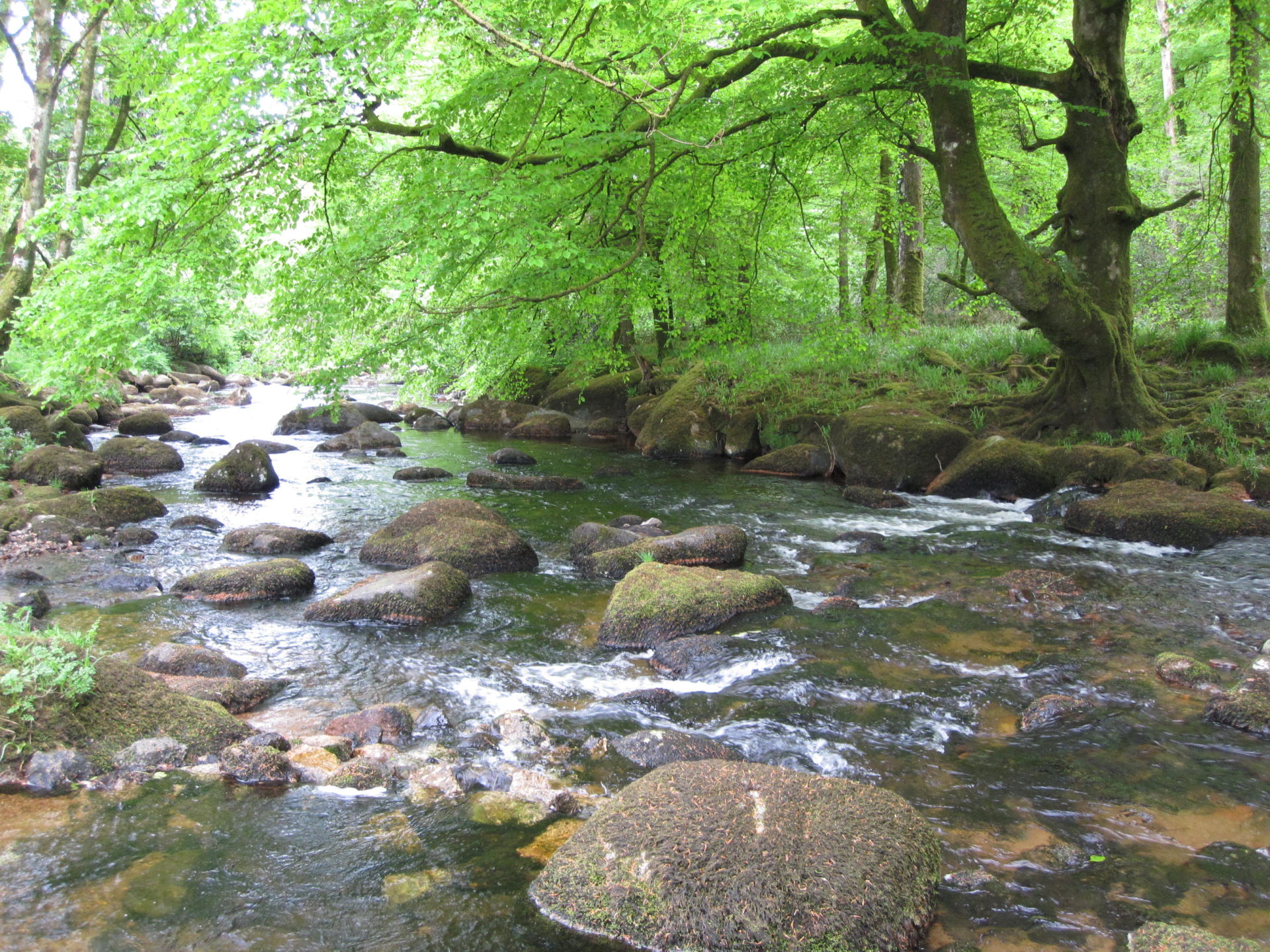
Environment Agency
Using ArcGIS, the Environment Agency can now pinpoint high risk locations more quickly, collect evidence via smartphones and operate more efficiently to help improve river water quality.
Tasked with reducing river pollution, the Environment Agency needs to identify the individual fields that are responsible for dispelling soil, fertiliser and nutrients into rivers, within catchment areas covering hundreds of square kilometres. Using ArcGIS, it can now pinpoint high risk locations more quickly, collect evidence via smartphones and operate more efficiently to help improve river water quality.
Search area for potential soil run-off reduced by 96% from 140 km2 to 5.6 km2
Number of inspections possible per day, per officer, increased from one or two to as many as ten
Faster interventions and projects with farmers, improving river quality
The Challenge
Rivers are the healthiest they have been for over 20 years, but there is still more to do. That includes tackling river pollution, which is a key factor when it comes to improving water quality for the Environment Agency. One of the most commonly occurring causes of river pollution is the run-off of soil, fertilisers and nutrients from agricultural land. Indeed, in Herefordshire where soils are generally light in composition, 48% of rivers that fail to achieve ‘good’ ecological status under the EU’s Water Framework Directive are contaminated by soil and soil-based nutrients.
The Environment Agency has the resources to work with farmers to help them understand and address the problem, as well as the authority to penalise farmers who continue to cause pollution to nearby rivers. The challenge is identifying precisely which fields the soil and nutrients come from, in a potential catchment area of hundreds of square kilometres. Previously, environment officers only had past intelligence to help them identify places across Herefordshire that might pose water quality concerns. During heavy rainfall they would visit these areas for signs of soil run-off, at the same time looking out for visible signs which could indicate new areas of concern, but the fields that cause soil pollution are rarely accessible by vehicle and, depending on land gradients, may be some distance away from the rivers they contaminate.
Rather than having to hunt for potential sources of pollutants across the entire trial area of 140 km2, we could see that just 4% of the catchment posed a possible threat
David Throup – Area Environment Manager for Herefordshire and Worcestershire, the Environment Agency
The Solution
In what has proven to be a highly successful trial in Herefordshire, the Environment Agency is now using Esri’s ArcGIS platform to analyse river catchment areas and identify agricultural fields that are likely to pose a high risk to water quality. It combines Sentinel satellite data and vegetation data to identify ‘brown’ ploughed fields that are more susceptible to soil loss, then adds LIDAR data, showing land gradients of 6% and above, to hone in precisely on those cultivated fields that are steeply sloped towards the river.
This analysis, performed in Esri’s ArcGIS Desktop solution, is uploaded to Esri’s cloud-based ArcGIS Online, where it is visible to all Environment Agency employees. Specialist environment officers then use Esri’s Collector App for ArcGIS on smart phones and tablets to find and survey the ‘high risk’ locations during heavy rainfall, which allows them to collect evidence in the field and upload it directly to the cloud in real-time.
We will be able to see how changes in land use have a changing impact on river pollution, year after year, and use this insight to plan future river conservation programmes
James Barnes – GIS Manager, the Environment Agency
Benefits
Rapid identification of potential risks
Using ArcGIS, the Environment Agency can now identify potential river pollution risks with far greater precision. “Rather than having to hunt for potential sources of pollutants across the entire trial area of 140 km2, we could see that just 4% of the catchment posed a possible threat,” says David Throup, Area Environment Manager for Herefordshire and Worcestershire. “In this case, 4% corresponded to just 50 fields, so we could focus our attention on inspecting these specific locations.”
Improved efficiency in the field
Environment officers are now not only more targeted in their approach, but are also able to work far more efficiently due to the use of Collector App. “Previously, environment officers would probably have gone out on a rainy day, looked at one or two locations, that may or may not have been causing a problem, and then come back to the office to write up their report,” explains Throup. “Now, they might inspect around 10 locations and upload all the data while in the field. It’s quicker and more relevant.”
Real-time resource allocation
When environment officers are dispatched to conduct inspections during heavy rainfall, employees back at the office can use ArcGIS to track their progress and review the data collected as soon as it is uploaded. Managers can then make instant decisions to direct the officers to different fields, based on the evidence that they or their colleagues are gathering. As Throup explains, this use of mobile and cloud-based GIS allows the Environment Agency to “make the most of heavy rainfall events to gather the most evidence with a small team.”
More effective river conservation
Now, the Environment Agency is able to find problems quickly, engage in more conversations with farmers about river pollution and enforce regulatory controls where necessary. “Over time, I am sure that our use of ArcGIS will result in less soil going into Herefordshire’s rivers,” Throup says. “Since the trial began, there have been a number of successful interventions that have resulted in farmers changing their farming practices to reduce soil run-off.”
Better long-term conservation planning
Over time, the Environment Agency expects to be able to gain more and more insight by collecting and analysing information in ArcGIS to build up a picture of high risk locations and high risk activities. GIS Manager James Barnes, who helped develop the solution says, “We will be able to see how changes in land use have a changing impact on river pollution, year after year, and use this insight to plan future river conservation programmes.”


Westcountry Rivers Trust
Working with large groups of diverse stakeholders, we can be more effective in introducing river conservation schemes
The Westcountry Rivers Trust is safeguarding fragile river environments in the South West of England, by helping large groups of stakeholders to reach consensus about river usage and conservation. It uses Esri’s ArcGIS Online and data from the national umbrella body, The Rivers Trust, to clarify the ecological impacts of human activity on rivers and prioritise schemes to improve water quality and biodiversity.
Improved understanding of environmental challenges among diverse groups
More effective and collaborative decision making about conservation priorities
Targeted conservation projects that address urgent environmental issues
The Challenge
Rivers in the South West of England flow hundreds of miles, crossing county borders and traversing land owned or managed by as many as 2,000 stakeholders, ranging from local authorities and utilities, to water sports operators and farmers. These organisations, groups and individuals have a shared responsibility to work together to protect their nearby river environments for wildlife and future generations, but can often have widely differing points of view.
Like other rivers trusts throughout the UK, the not-for-profit organisation Westcountry Rivers Trust works with large groups of such stakeholders as part of a catchment-based approach to managing river courses in its region. It aims to facilitate open communication and gain agreement from all groups involved to pave the way for river conservation schemes. “Everyone has their own language for talking about rivers,” observes Sarah Wigley, Data and Evidence Officer for Westcountry Rivers Trust. “Commercial organisations, government bodies and community groups all use different terminology and have very different priorities for river use. Our challenge is to find a way to help everyone understand each other’s needs and to see the bigger picture.”
Interactive, digital maps give people from varied backgrounds a common language for collaboration and communication
Sarah Wigley – Data and Evidence Officer, Westcountry Rivers Trust
The Solution
In 2013, the national, umbrella organisation, The Rivers Trust, was assigned by Defra the role of supporting river catchment partnerships across the country (as part of the Catchment-Based Approach initiative). Part of this role was to encourage the use of data and evidence in river catchment management. Since then, The Rivers Trust has gathered and published a wide range of datasets using Esri’s cloud-based ArcGIS Online platform, including information on river flooding, commercial activity, biodiversity, water quality, land character and soil typology. All this data is attributed with river catchment boundary information, so it is easy for catchment partnerships nationwide to use. This online data portal is a valuable resource and has already promoted the use of ArcGIS Online amongst many local partnerships.
The Westcountry Rivers Trust uses Esri’s ArcGIS Online and the data from The Rivers Trust to analyse issues of particular environmental concern, comprehend river ecosystems and present the information clearly to river catchment partners. It uses interactive, digital maps during workshops and meetings, and produces high quality maps for reports to help multiple stakeholders, from any background, better understand and appreciate key issues. The trust is also beginning to use ArcGIS Online to create persuasive Story Maps that help to highlight issues and explain conservation projects in a highly visual and engaging format.
Over time, ArcGIS Online will play a key role in helping river catchment partnerships to improve river quality and biodiversity
Sarah Wigley – Data and Evidence Officer, Westcountry Rivers Trust
Benefits
Clearer communication of environmental issues
The Westcountry Rivers Trust has been able to significantly improve the effectiveness of catchment-based partnerships in the South West by using ArcGIS Online to present complex information, exceptionally clearly, on maps. Groups and individuals, who may not previously have realised that their commercial, agricultural or leisure activities were having an impact on water quality or biodiversity, can now better understand the environmental consequences. As Wigley says, “ArcGIS can open peoples’ eyes to the broader issues.”
More collaborative, multi-party decision making
Critically, the use of ArcGIS Online helps all of the diverse organisations and individuals involved in catchment-based partnerships to reach collective agreement. “Interactive, digital maps give people from varied backgrounds a common language for collaboration and communication,” Wigley says. “It’s an effective way to bring people together, at the same level, to understand different points of view and work together to make decisions.”
Implement more targeted conservation projects
By using ArcGIS to analyse data on river catchment areas more systematically, the Westcountry Rivers Trust is now able to easily identify issues of concern and can better prioritise conservation projects. In Cornwall, for example, the Westcountry Rivers Trust was able to use ArcGIS to identify declining fish populations and instigate a project to remove barriers at strategic sites along two key rivers to improve access to up-stream breeding areas. “Over time, ArcGIS Online will play a key role in helping river catchment partnerships to improve river quality and biodiversity,” Wigley says.
Raised awareness of the need for river conservation
Finally, by creating Story Maps, the Westcountry Rivers Trust now has a new means of raising public awareness of river conservation issues and the impact of poor land practices alongside rivers. “Story Maps are a good way of presenting scientific data to members of the public in a way that they can easily understand,” Wigley says. “We plan to use Story Maps increasingly in the future to engage the wider community in river conservation programmes.”

Land Use Consultants
We use ModelBuilder to automatically analyse parcels of land against hundreds of datasets to help local authorities find suitable land for future housing development.
LUC, a multi-disciplinary consultancy, is using Esri’s ArcGIS to help local authorities respond more effectively to the critical shortage of housing in the UK. The consultancy’s use of advanced geospatial analysis enables councils to identify suitable development land for new houses far more quickly and meet Government targets for new homes.
LUC’s GIS team reduces site assessment from 7 days to 2-3 hours, using automation
Robust and consistent evidence generated from the analysis of 150+ datasets
Better decisions about sustainable future development based on in-depth criteria assessment
The Challenge
In the UK, there is currently a significant shortage of homes, contributing to rising house prices, high rental costs and even, in rare cases, homelessness. In response, the Government has committed to a range of reforms to increase the supply of new housing. As it points out in its February 2017 white paper ‘Fixing our broken housing market’, there is an urgent need to plan for “the right homes, in the right places” and, critically, “build homes faster.”
Local planning authorities have a pivotal role to play in driving the success of this Government policy. They are required to produce a Local Plan that sets a vision and framework for the future development of the area, including identifying areas suitable for housing developments and making sufficient land available to meet ambitious targets for new homes. In what is a highly complex process, they have to evaluate thousands of parcels of land throughout their administrative areas, taking into account dozens of factors ranging from flood risk and agricultural value to environmental protection and local services such as schools and transport. They also need to consider data from neighbouring local authorities and partners, as part of a fully auditable process that can produce consistent evidence for decision making.
A considerable percentage of local planning authorities find it hard to undertake a detailed study of their potential development land, primarily because of the enormous spatial complexity of the task. Our standardised, ArcGIS-driven approach now makes it both fast and easy for councils to make consistent well-informed decisions about the best locations for new housing
Edith Lendak – Principal GIS Consultant, LUC
The Solution
LUC recognised that it could help local authorities to identify and assess potential development land more effectively, by creating a new automated tool to analyse housing growth options. The company has been using Geographic Information System (GIS) solutions from Esri’s ArcGIS for 20 years, so instinctively turned to ArcGIS to design, build and deliver a brand new service for its local government customers.
Using Esri’s ModelBuilder, LUC created an advanced geospatial analysis system that can systematically and automatically analyse parcels of land against hundreds of data sets and categorise them according to their relative levels of suitability for new housing. The solution automatically assesses factors such as flood risk, proximity to historic monuments and existing local services, drawing on data from local authorities and government advisory bodies, such as the Environment Agency and Natural England.
A key advantage of the approach is that analyses can be repeated easily, on demand, allowing LUC to test different weightings for certain planning constraints and explore a number of different options, without having to start again from scratch. Free from human error, the analysis results will always be consistent, so if LUC undertakes projects for neighbouring councils, the outputs will be directly comparable.
ArcGIS generates a robust evidence base which underpins Growth Options Assessments and enables decisions to be made with greater confidence
Edith Lendak – Principal GIS Consultant, LUC
Benefits
LUC used its geospatial analysis system to help Central Bedfordshire Council identify and assess realistic options for the development of up to 20,000 new homes and related infrastructure by 2035. The benefits that the ArcGIS-based solution delivered include:
Substantial time savings
LUC’s approach, using ArcGIS to analyse the council’s area against three assessment strands (primary constraints, secondary constraints and access to services), using more than 150 datasets, ensured tight project deadlines were met. This complex evaluation process would have taken around 35 working days of manual GIS work for five iterations, whereas it took just two days for five iterations using the prepared automated models.
Repeatable, modular and flexible processes
As LUC’s geospatial analysis process is both fast and repeatable, specialist planners at LUC and Central Bedfordshire Council were able to explore different options for site assessment. They could easily make changes to their land selection criteria, change the weighting of constraint factors and re-run the analysis to model different scenarios in just a few hours. This enabled the planners to evaluate issues more thoroughly and find the right balance between meeting the needs of a growing population and protecting the environment.
Robust and defendable evidence base
The integrity and accuracy of the new GIS-based approach created an auditable process that enabled Central Bedfordshire Council to justify the selected land parcels in preparation of its Spatial Strategy, which will form part of its emerging Local Development Plan. As Lendak says, “ArcGIS generates a robust evidence base which underpins Growth Options Assessments and enables decisions to be made with greater confidence.” Rather than having multiple reports and data sources to study, planners could see at a glance, on colour-coded maps, which parcels of land may be most appropriate for sustainable development and drill down to understand why.
LUC’s GIS team is currently extending the capabilities of the Growth Options Tool, to provide even greater flexibility and speed when testing different scenarios for housing site selection. The solution forms part of a suite of tools aimed at identifying sustainable development opportunities for renewable energy and housing and will be used on projects for councils across the UK.

The Mighty Creatives
We gained skills to visualise our data and create digital story maps within hours of working with an Esri Consultant and can now produce interactive content to promote our charity
Having decided to use ArcGIS Online to build a mapping tool to promote and deliver its services, The Mighty Creatives utilised Esri UK’s ArcGIS Online Launchkit to get up and running quickly. This gave the charity the skills and confidence to make digital mapping a central element of its service offering.
Provided staff with the skills needed to create their own maps without external advice or expertise
Gave the team the confidence to exploit digital mapping as a tool to promote the charity’s services
Visualisation of its own data gave the charity new insight into operational information and processes
The Challenge
The charity, The Mighty Creatives, believe that creativity is vital to every child’s development and that, unfortunately, there are too many limited opportunities for children and young people to be creative and to play. Their mission is to change this and to achieve their goal they bring together schools, arts organisation, communities and businesses forging partnerships and enabling collaboration.
To support this creative drive, The Mighty Creatives needed a visual, easy to use, way of enabling organisations to easily discover other organisations working across the East Midlands.
The Mighty Creatives identified that ArcGIS Online from Esri UK could be used to create the solution they needed, but were unsure how to get started. The team had limited experience in geography or digital mapping and without any technical skills they lacked the confidence to move forward.
Furthermore, there were many important questions:
- What data should we use?
- How should that data be formatted, imported and managed?
- How should we present the data in an interesting form?
- How can we make the system easy to access?
- How will the new tool work with our existing CRM system?
Within the first half an hour, the Esri Consultant swept away our confusion, so we could clearly see what we could do with ArcGIS online and where to start
Laurie Parsons – Development Coordinator (Arts Alliances) – The Mighty Creatives
The Solution
The Mighty Creatives found the answers in the form of an ArcGIS Online Launchkit from Esri UK. An Esri UK Consultant carried out the two-day program at The Mighty Creatives’ office, helping to get the new tool live in the shortest possible time. The Launchkit included support with the installation and configuration of the ArcGIS platform, demonstration of the capabilities of ArcGIS online, and advice and training on how to implement the new tool.
The Consultant put an additional focus on several key areas that were important to The Mighty Creatives:
- Understanding how to present geographic information so that the visualisation accurately represents the underlying data, without distortion
- The capabilities of different packages, such as ArcGIS Pro and ArcGIS online, and which tools to use in different situations
- How to use StoryMaps to create engaging online content and get across the story they wanted to tell
After the Launchkit was completed, The Mighty Creatives quickly built its first online mapping tool. Since then a further five searchable maps have been developed and the team have now started building tStoryMaps. Future plans are increasingly challenging and sophisticated, including for example, demographic analysis to identify geographic distributions of demand and match these with local supply.
Working closely with our Esri consultant through the Launchkit instilled confidence in our abilities to create digital maps and use them to promote our service
Laura Bates – Development Manager (Arts Alliances) – The Mighty Creatives
Benefits
Self sufficiency
The Esri UK Launchkit rapidly provided The Mighty Creatives with the skills needed to create their own maps without the need to call in external advice or expertise. This also gives them the foundations to take on future challenges.
Confidence
An organisation largely composed of artistic, creative and educational professionals with a lack of confidence in their knowledge of technology have now developed the confidence necessary to use and exploit digital mapping as a tool.
Insight
Through its own maps, The Mighty Creatives could see it its own information in a new light, prompting the team to question current processes, reflect on them and see new ways to operate.
Teamwork
Building the mapping tool was a shared learning experience, requiring input from across the team. This promoted buy-in from all parts of the organisation and made a positive contribution to the working environment.
Like many charities The Mighty Creatives needs to carefully manage its expenditure, so it can optimise its reach and impact; the investment in and ArcGIS Online Launchkit was therefore a relatively significant outlay. However, the charity believes that the experience has been exceptionally valuable and is helping the organisation forge new partnerships and drive collaboration.

Greater London Authority
ArcGIS is helping us to address the education needs of London’s rapidly growing school-age population
In a ground-breaking project initiated by the London Mayor’s Office, the Greater London Authority has launched an online atlas of London schools, across its 33 London boroughs. The unprecedented clarity of information in the atlas will help the capital meet rising demand for school places, as well as allow families to make better-informed decisions when selecting schools.
London boroughs can understand the cross-boundary flow of pupils to better anticipate demand for school places
Education providers have evidence to justify their funding applications for new schools and expansion projects
Families can see consistent information about all schools and make the right choices for their children
The Challenge
In just eight years’ time, by 2025, London is predicted to need as many as 160,000 additional school places. This phenomenal growth is significantly faster than any other area of the UK and presents a significant challenge for the 33 London borough councils, which are responsible for providing school places in the capital. The complex relationship between population growth and demand for places varies hugely by location and over time, as ‘bubbles’ of growth can work their way through the school system. Understanding the picture spatially is vital because as many as 20% of young people cross borough boundaries to go to school each day.
The picture is similarly complex for parents in the capital who have to decide which schools to apply for or which new area to move into. Although some local authorities publish guidelines or catchment maps, their approach varies, making it difficult for parents to compare the likelihood of getting into different schools and the onward flow from primary schools to secondary schools.
ArcGIS gave us the robust platform we needed to openly share the findings from the Mayor’s Educational Inquiry recommendations
Paul Hodgson – GIS and Infrastructure Manager, Greater London Authority
The Solution
Recognising these challenges, The Mayor of London launched an Educational Inquiry and recommended the pan-London collection and analysis of data about school places. The Greater London Authority (GLA) used Esri’s ArcGIS Desktop solution in combination with other products to analyse anonymised data from the National Pupil Database, which comprises information on 8 million pupils, gathered over a five year period. “There aren’t that many systems which can handle the breadth and complexity of pupil and location data that we wanted to analyse and visualise,” says Paul Hodgson, GIS and Infrastructure Manager at the GLA. “ArcGIS gave us the robust platform we needed to openly share the findings from the Mayor’s Educational Inquiry recommendations.”
The organisation then used ArcGIS Server and JavaScript to create a customised, highly intuitive and interactive online map to display its data. This map, named the London Schools Atlas, shows for the first time the areas where pupils from particular schools live, historic catchment areas and feeder schools. Parents can click on their address and select a nearby school to see not only what percentage of children from their area attend this school, but also view the exam results and Ofsted inspection grades for this school and even calculate the journey time by foot or public transport.
The GLA supplemented the London Schools Atlas with data on birth rates, moves in and out of the capital, building developments and other factors that will have an impact on the net growth in pupil numbers in the period 2015-2025 to create graded maps that clearly highlight those areas of London where additional school places will be required in the future, to support critical education planning.
One of the GLA’s core missions is to provide strategic coordination across London. This project is a good example of how the GLA is fulfilling that role and adding value for Londoners
Paul Hodgson – GIS and Infrastructure Manager, Greater London Authority
The Benefits
Clear information for parents and carers
Following the launch of the London Schools Atlas, parents and guardians have a single point of reference for consistent, accurate information about all primary, secondary and specialist schools in London. They can access the interactive map from any desktop, tablet or mobile device and easily find the information they need to ascertain the probability of getting places at different schools. “There’s often a lot of anecdotal information at the school gate about how close you have to be to schools to get a place and which secondary schools primary pupils generally feed into,” Hodgson says. “The London Schools Atlas enables parents to make informed decisions when making and ranking their six school choices as part of the school application process.”
Accurate evidence to support future planning
Critically, The London Schools Atlas gives London’s 33 borough councils the evidence they need to approach the Department of Education for central government funding for new schools and school expansion projects to meet the population growth. Likewise, free school groups and academies can use the data presented in the London Schools Atlas to make sure that their proposals for new schools are in the right locations to fulfil projected demand. “It has been estimated that 4,000 new classrooms of 30 children will be needed in London over the next ten years, but not all in the same place at the same time,” Hodgson remarks. “The London Schools Atlas helps all education providers to understand at a local level, where and when places are required.”
Added insight coupled with reduced administration
Education managers working within borough councils now have added insight into demand for school places in their boroughs, because, for the first time, they can clearly see the cross-border flow of pupils. The project also saves time in education departments in boroughs right across the capital, because, as Hodgson says, “instead of publishing schools information 33 times in 33 different formats, it is just done once.” Indeed, individual boroughs will now be able to spend less time looking for and analysing information and can focus instead on meeting pupil needs and raising education standards.
Exemplary public sector coordination
In many ways, the London Schools Atlas is a beacon of best practice for London, as it demonstrates how the London Mayor’s Office and the GLA can provide leadership to improve efficiency and optimise public services in the capital. Hodgson says: “One of the GLA’s core missions is to provide strategic coordination across London. This project is a good example of how the GLA can fulfil that role and add value for Londoners.”

Norfolk County Council
Improving the commissioning of school transport for vulnerable children Norfolk County Council is using Esri’s ArcGIS platform to help it arrange the most suitable school transportation for pupils with...
Norfolk County Council is using Esri’s ArcGIS platform to help it arrange the most suitable school transportation for pupils with special educational needs. This insightful application of GIS is improving services and safety for children, while also helping the local authority to achieve its cost savings target.
With greater understanding of pupils’ travel needs, employees can commission safe, appropriate journeys
The council can easily see opportunities for pupils to share journeys or make shorter journeys to reduce travel costs
Efficiency savings from the use of this app will contribute to the SEN team’s £500,000 cost reduction target
The Challenge
Every year, Norfolk County Council is required to arrange travel to and from school, by minibus, car or taxi, for over 2,000 pupils with special educational needs (SEN). The county is predominantly rural and covers a large area of 2,074 square miles, so the annual budget for SEN transportation in Norfolk exceeds £10 million. In common with all departments within the council, the SEN transportation team was under pressure to reduce its operating costs and downscale this budget, but its priority none-the-less remained the same: to provide safe and secure journeys for vulnerable young people.
At the time, the SEN transportation team made decisions about journeys based on manual reports and commonly referred to a map pinned to the wall to help them understand distances between pupil addresses and schools. It was a lengthy, manual process, which relied largely on people’s experience and knowledge of the county, and this was neither efficient nor sustainable.
Our new ArcGIS app allows us to provide a high quality transportation service for children with special educational needs, while operating cost efficiently.
Tracy Jessop – Assistant Director of Highways and Transport, Norfolk County Council
The Solution
Norfolk County Council has been licensing geographic information system (GIS) solutions from Esri UK and gradually introducing new solutions for the council based on the Esri ArcGIS platform for over six years. So, when it came to creating a solution for the SEN school transportation team, the organisation already had both the technology and skills it needed in-house. “We married ArcGIS with our new data warehouse to create the solution,” explains Tony Collins, Senior Analyst Programmer, GIS and Data Warehousing, at Norfolk County Council. “From the original concept, it took us just two months of development.”
The solution, known internally as the SEN Travel Viewer app, allows the SEN transportation team to view a map of Norfolk and see at a glance, where pupils live, which schools they attend, what kind of vehicle they travel in, if they travel alone and how far they travel. The team can now easily see and investigate anomalies, such as two pupils in adjacent villages having separate transportation to the same school. They can also use the app to plan and commission the most appropriate journeys for pupils who are new to the area, reaching school age or changing schools, taking into account existing transportation arrangements for other pupils nearby.
The app speeds up the whole SEN transportation process, from beginning to end.
Tim Hudson – Information Exploitation Team Manager, Norfolk County Council.
The Benefits
Reduced costs in the provision of school transport
As Norfolk County Council can now more easily identify opportunities for pupils to share journeys or make shorter journeys, it can reduce its expenditure on transportation, while continuing to meet pupils’ needs. In its first year of use, the council expects the SEN Travel Viewer app to make a significant contribution to the SEN department’s savings target of £500,000. “Our new ArcGIS app allows us to provide a high quality transportation service for children with special educational needs, while operating cost efficiently,” says Tracy Jessop, Assistant Director of Highways and Transport, Norfolk County Council.
Fine-tuned services that meet the needs of vulnerable pupils
Using ArcGIS, members of staff now have better access to information, which enables them to ensure that travel arrangements are the most appropriate for pupils’ needs and security. “ArcGIS enables the council to take an evidence-based approach to commissioning school transport and justify the need for explicit transportation services for specific pupils, based on a better understanding of the journeys they need to make,” says Tim Hudson, Information Exploitation Team Manager at Norfolk County Council.
Improved staff productivity and faster decision making
The app has been well received by members of staff, who can now work more productively. The rapid visualisation of schools and pupil locations enables the SEN transportation team to make quicker decisions about the most suitable transportation routes and methods. Consequently, the team can process applications in less time and advise families about travel arrangements more promptly. As Mr Hudson says, “The app speeds up the whole SEN transportation process, from beginning to end.”
Better information to support future planning
In the future, the SEN Travel Viewer app will also be used to help pinpoint the most advantageous locations for new SEN schools and facilities, based on the proximity of the young people who require access to these services. The council will be able to identify central locations and plan strategically to reduce journey times and improve convenience for pupils and their families. In this way, ArcGIS will continue to play a key role in helping the council to improve both the quality and cost efficiency of SEN provision throughout the county in the years ahead.

Transport Infrastructure Ireland
We can complete our annual skid resistance road inspections more quickly, and collect better quality data, with fewer staff
Transport Infrastructure Ireland (TII) has deployed a mobile ArcGIS solution to help it automate, standardise and accelerate its annual survey to assess the skid resistance of national roads throughout Ireland. It can now plan and undertake road surface inspections with 20% fewer people, while collecting better data to inform highway improvement programmes.
Mobile inspectors find inspection sites more quickly and collect data more efficiently in the field
Office-based teams don’t waste time printing maps, creating forms, uploading data and filing information
Senior managers monitor and manage progress with real-time insight into the status of surveys
The Challenge
The national road network in Ireland is around 5,300 km long, incorporating multilane motorways and rural single carriageways. Every year, Transport Infrastructure Ireland (TII) is required to undertake detailed inspections of around 1,000 locations nationwide that have been identified as potentially posing an increased risk of skidding in the future. While none of the inspection sites present an immediate threat to safety for the general public, TII has to complete its survey within four months, so that recommendations can be acted upon as part of proactive road maintenance activities.
Known as the HD28 survey, the skidding risk assessment used to be a very manual process, demanding a large amount of staff time. Inspectors would be given print-outs showing maps of the locations of inspection sites and would collect road observations and data on paper forms. Typically, they had a bundle of around 40-50 sheets of paper for a week’s work and wasted lots of time in the field trying to find inspection sites, as well as grappling with paper in wet and windy weather. Many days of effort were also required in the office to plan inspections, print maps, report on the survey’s progress, enter the collected data into central systems and file away the paper forms.
The mobile survey app and reporting dashboard were created and deployed in just one day by the TII in-house team, with no need for consultancy support
Brendan Kennedy – GIS Manager, Transport Infrastructure Ireland
The Solution
TII completely transformed its paper-driven HD28 survey process using solutions from Esri’s ArcGIS platform. Using Collector for ArcGIS, the organisation created a mobile app enabling inspectors to see the precise locations of inspection sites on digital maps, collect data in the field using drop-down boxes and upload it directly to Esri’s ArcGIS Online. Critically, the solution works in online and offline modes, so it can be used in rural areas where there is no mobile coverage. TII also used Esri’s Operations Dashboard for ArcGIS to create a live reporting interface for management at TII to monitor the progress of surveys.
Remarkably, TII was able to create this entire solution incredibly quickly, due to the “ease-of-use and flexibility of ArcGIS,” according to Brendan Kennedy, GIS Manager at TII. “The mobile survey app and reporting dashboard were created and deployed in just one day by the TII in-house team, with no need for consultancy support,” he says.
A key advantage of the ArcGIS-based solution is that the app can be used by employees on their own devices, including mobile phones not owned by TII. Users simply download the app and log in with a secure user name and password. “We didn’t have to purchase and deploy tablets or make any other hardware investments, which kept the cost down,” says Kennedy. “We can also flexibly introduce more people to the survey team from our regional offices, when necessary, to help us meet targets.”
Due to staff changes, we have around 20% fewer personnel and yet can still complete the HD28 survey programme within the required timeframe
Tom Casey – Head of Pavements, Construction Materials & Innovation, Transport Infrastructure Ireland
The Benefits
Efficiencies improved by 20%
As employees no longer have to manually plan their surveys and transfer their survey findings from paper to electronic systems, individual efficiencies have increased by around 10-20%. Indeed, TII estimates that six employees each save one month per year as they do not have to print, file, upload and manage hard copy forms and maps. “Due to staff changes, we have around 20% fewer personnel and yet can still complete the HD28 survey programme within the required timeframe,” says Tom Casey, Head of Pavements, Construction Materials & Innovation at TII.
Greater speed and flexibility in the field
Using the ArcGIS mobile app, inspectors waste less time trying to find sites and can complete nearly twice as many inspections in a typical day. “When the process was paper based, I would get through around 7 to 8 inspections per day; with the app I usually do around 15 inspections per day,” estimates Stephen Smyth, Senior Manager for the Pavement Asset Programme. As all the data inspectors need is always with them, on their phones, they can carry out surveys on a more flexible, impromptu basis, at short notice, when they are already in the area, without having to return to the office to collect the necessary paperwork, which significantly improves their efficiency.
Real-time oversight of survey programme
Previously, TII employees had to develop weekly reports on the status of the survey for senior managers. Now, however, real-time information is available on demand, online, allowing managers to monitor and manage the survey process more effectively. “We can identify regions where perhaps an additional inspector is needed to complete a job list and better allocate resources around the country to ensure that the survey is completed as quickly as possible,” Kennedy explains.
Better decisions about road maintenance
The GIS-driven process improves the accuracy and consistency of the survey data collected, which in turn helps TII to make better informed decisions about interventions and restorative roadworks. The organisation can incorporate skid resistance improvement works into other planned road improvement programmes in the same area, reducing the cost of interventions, minimising disruption for road users and maintaining the safety of roads for years to come.

Aylesbury Vale District Council
An Esri UK Embedded Product Specialist has helped us to transform citizen engagement through ArcGIS Online.
After reviewing its current reporting system, used by residents to report issues and concerns, Aylesbury Vale District Council utilised Esri UK’s professional services expertise to create a new and improved online reporting model. Not only delivering a better service to its citizens but also making vital resource and cost savings.
More efficient reporting of problems – fewer queries, errors and wasted trips
Improved service to residents – easier online reporting and faster resolution of problems
Reduced contact volumes – by avoiding duplicate reporting and minimising clarifications
The Challenge
Engagement with residents to maintain and improve their quality of life is a critical aspect of Aylesbury Vale District Council (AVDC)’s work. ReportIT is a mechanism by which issues or problems can be reported by residents, for action by the council. The system covers a broad range of concerns, from abandoned vehicles and antisocial behaviour to fly tipping and the safety of young people.
This important activity was found to be labour-intensive and potentially error-prone. The review of ReportIT identified several factors contributing to inefficiencies:
• Reported problems often lie outside the council’s jurisdiction. Residents can be unaware of council structures and responsibilities, so would raise concerns to AVDC that were actually the responsibility of a different council.
• Problems were being reported multiple times. Residents had no indication whether a problem has already been reported, so it would be reported again, causing duplication of effort.
• Contractors resolving problems often attended the wrong location or needed to visit the site repeatedly, leading to wasted time and cost. This was because the reporting form did not capture all the information, including precise location, needed for first time resolution.
• Residents like to be kept informed, but provision of regular updates was time consuming.
As part of its transformation journey, AVDC is adopting a ‘New Business Model’ which will remove such inefficiencies. The council identified that by shifting the primary contact channel to a new online reporting system it could:
1. Reduce the number of inbound contacts.
2. Reduce the cost of processing each report.
3. Improve feedback to residents.
AVDC had a suitable technology platform – ArcGIS Online from Esri, but cuts had meant that it did not have the resources to create the new solution. Furthermore, cost savings were needed quickly, so time was of the essence.
The new ReportIT solution has significantly improved the quality of information we are able to obtain on the initial contact enabling us to make improvements in our handling time for each individual report
Debbie White – Interim Customer Relationship Team Manager, Aylesbury Vale District Council
The Solution
The council contracted an Embedded Product Specialist (EPS) from Esri UK, chosen for their deep knowledge of the capabilities of ArcGIS Online. The EPS used standard templates to quickly create two vital applications:
1. Reporting tool. Esri UK’s QuestionWhere Builder enables a questionnaire or survey to be built around location-based questions. The EPS used QuestionWhere Builder to create a suite of forms, one for each type of problem being reported. A built-in map ensures that the location of the problem is correctly identified and that the problem falls within the regional boundaries of AVDC. Each report includes all the information a contractor needs to resolve the problem.
2. Analysis dashboard. AVDC’s communities and customer services teams needed a simple, visual way to monitor activity and identify any problems needing action. The EPS created a map-based visualisation that enabled the teams to query by boundary area, class of report and thus identify patterns and resolve issues.
Rather than write an exhaustive specification, the EPS used rapid prototyping techniques to create demonstration versions that gave AVDC a quick view of what was possible. The council provided immediate feedback to the EPS who, based in the council’s offices, implemented any changes there and then. This iterative approach kept the project on track and shortened development timescales.
The EPS also trained key IT staff from AVDC to use the tools, create new reports, edit existing reports, and maintain and develop the solution going forward. The whole project was completed in just five days.
Having the Esri UK EPS on site meant that we could try out different approaches and rapidly iterate the solution. The new ReportIT tool is already having an impact on our operations and thanks to the training from the EPS, we now have the capability to adapt our solution as needs change in the future
Debbie White – Interim Customer Relationship Team Manager, Aylesbury Vale District Council
The Benefits
Speed
The EPS helped AVDC rapidly assimilate the latest technology. Reporting and resolution processes are now smoother and faster as there are fewer queries, errors and wasted trips.
Flexibility
The council’s requirements are sure to evolve over time and it is well equipped to change the functionality of the solution as needed in the future. Yet AVDC is not dependent on permanent IT resources for ongoing development and support.
Improved service to residents
Residents can now report problems and track progress at a time of their own choosing. Their concerns and problems are now resolved by AVDC more quickly and with minimum need for discussion.
Reduction in contact volumes
The map-based tool helps residents report correctly – so that AVDC does not have to process reports that are outside its jurisdiction. Costly duplicate reporting is avoided and further questions and clarifications are minimised.
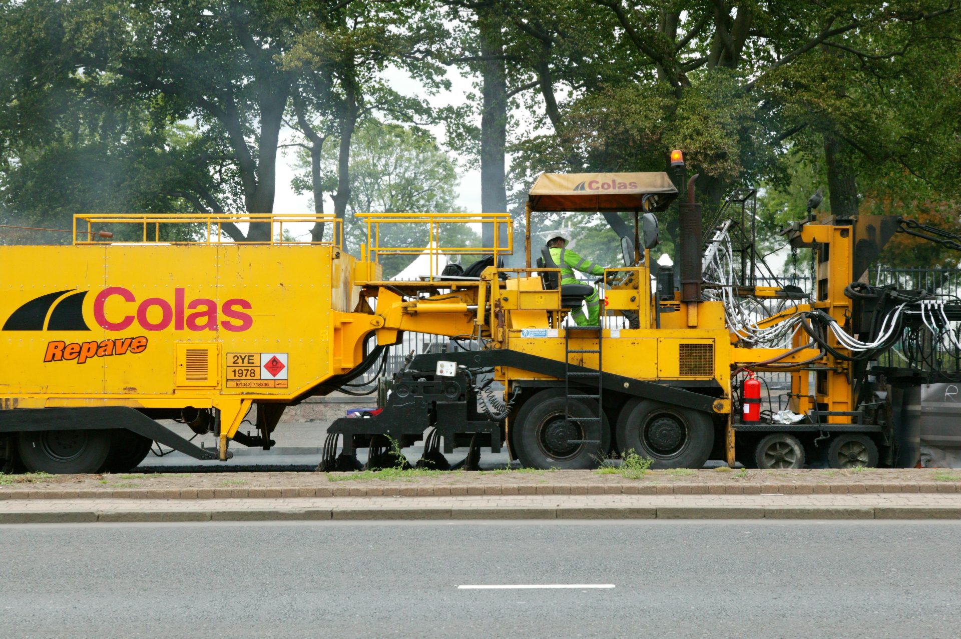
Colas Ltd
We undertake pre-emptive maintenance on thousands of assets over a 480km network of roads and this approach helps the company reduce costs and deliver a high quality of service
The civil engineering business Colas uses solutions from Esri’s ArcGIS to help it undertake pre-emptive maintenance of thousands of assets over a 480km network of roads in Portsmouth. This proactive and strategic approach to asset management helps the company to reduce costs, improve public safety and deliver a high quality of service for Portsmouth City Council.
Colas can collect and share accurate, detailed information about ageing and deteriorating assets
Maintenance tasks can be scheduled more intelligently, to improve long term efficiency
Public safety is ensured as potential faults can be proactively repaired, before they cause incidents
The Challenge
Colas is responsible for the management and maintenance of Portsmouth’s highway infrastructure through a Private Finance Initiative (PFI) with Portsmouth City Council. Under the terms of this contract the company has to uphold the quality of more than 480km of roads, 16,000 street lights and 84 structures, and carry out extensive roadworks, ranging from the resurfacing of major junctions to the clearing of drains, until 2029.
Committed to sustaining a high quality road infrastructure for people living, working and travelling in Portsmouth, Colas wanted to be able to focus on more than just implementing reactive repairs. It aimed to build an optimised and efficient process that would allow it to identify and implement asset repairs on a more proactive basis. The company had previously invested in Esri’s ArcGIS to help it manage and visualise assets, not only for the Portsmouth PFI contract, but across all its projects and joint ventures in the UK and Ireland. So, pushing ahead from this solid foundation, it elected to make ArcGIS a key element of its proactive asset management solution.
We can make better informed decisions about which assets to maintain and when, on a proactive basis, which ultimately helps us to be more efficient
Dan Winslow – ICT Product Development Manager, Colas
The Solution
Every year, Colas carries out a comprehensive survey of the highways assets in Portsmouth, in which the asset condition is graded from good to unsatisfactory. In the proactive asset maintenance process, this information is now loaded into Esri’s Collector App for ArcGIS, to enable Colas’ own team of specialist highways inspectors to visit and check all those assets graded poor or unsatisfactory. Using the Collector App, the inspectors can take accurate location references, upload pictures, verify the condition of assets and add supplementary information, all while in the field.
There is no need for inspectors to take notes on paper and, consequently, no need for them to waste time typing up survey reports back in the office. All the Service Inspection information collected is automatically transferred from the Collector App to ArcGIS Server in the company’s head office and visualised on interactive maps. Office-based employees can then perform analysis, improve their understanding of maintenance requirements across an area of more than 40km2 and use this insight to prioritise and plan proactive maintenance activities.
Colas makes its Service Inspection data available to over 120 employees using Esri’s ArcGIS Online web portal, so that everyone working on the Portsmouth PFI has access to the latest and most accurate asset information.
Finally, Colas also provides a login to ArcGIS Online for Portsmouth City Council, which helps the two organisations to maintain a co-operative working relationship.
By using ArcGIS to collect data and inform our maintenance scheduling process, we can get to and repair assets before they become a safety issue
Dan Winslow – ICT Product Development Manager, Colas
The Benefits
By using ArcGIS for its proactive maintenance process – to collect, visualise, analyse and share data – Colas has gained a number of operational advantages including:
A shared understanding of asset quality
Colas now has far more accurate and extensive data available about the condition of old and deteriorating assets within the highways network in Portsmouth. Each asset graded poor or unsatisfactory can be quickly and efficiently surveyed in the field, and up-to-the-minute information about more than 70 different categories of assets can be made instantly available to employees, contractors and the council online. “The use of ArcGIS for our Service Inspections has helped us to become an asset driven business,” says Dan Winslow, ICT Product Development Manager at Colas. “We can also share our asset knowledge with Portsmouth City Council, which helps us deliver a transparent and high quality of service.”
More efficient business operations
Only repairing assets when they cause problems on the network can be very ineffective, as faults may occur anywhere in the city, at any time of the day or night – and often need rapid attention. By using ArcGIS Server to visualise and analyse its Survey Inspection data, Colas can now plan maintenance activities more strategically, by location. “Our proactive repairs process allows us to work in a smarter, more agile way than we did before,” Winslow says. “We can make better informed decisions about which assets to maintain and when, on a proactive basis, which ultimately helps us to improve services for citizens.”
The ability to ensure public safety
Significantly, Colas’ proactive asset maintenance process plays a key role in helping the organisation to maintain public safety in Portsmouth. “The process enables us to address issues that may not currently be causing issues to traffic or pedestrians, but that due to their evolving condition, could become safety concerns in the future,” Winslow explains. “By using ArcGIS to collect data and inform our maintenance scheduling process, we can get to and repair assets before they become a safety issue.”

Fera Science
We can deliver cutting edge services to our clients by enabling them to analyse drone imagery in a new web app that helps them to make decisions about agricultural yield and land management.
The agri-food research company Fera Science has developed a GIS-based web app to share high resolution imagery from an Unmanned Aerial System with a range of government and commercial clients. The solution gives decision makers a deeper understanding of complex environmental and agricultural challenges, so they can plan more effectively to protect our natural resources and food security.
A root vegetable grower can identify inconsistencies in crop sowing to increase future food production
A government agency can survey and protect endangered trees more cost effectively
A large landowner can plan a more sustainable business expansion, while improving safety
The Challenge
In a world challenged by population growth, pollution and climate change, Fera Science provides accurate, scientific evidence to support critical decisions in the agriculture and environment industries. It delivers research data and advice for 7,500 government and commercial organisations, helping them to increase food production, ensure water quality, maintain food nutrition and sustain our natural resources.
Every year Fera undertakes over 600 research assignments and, in the Land Use and Sustainability Team specifically, nearly half of all projects involve the collection and analysis of remotely sensed imagery. To supplement the use of imagery from satellites and manned aircraft, Fera acquired an Unmanned Aerial System (UAS), capable of taking higher resolution spatial images at a significantly lower cost than a piloted aircraft. However, to optimise the value of its new UAS services, Fera needed a way to make the high quality imagery and analysis available to clients, in a format that they could interrogate, interpret and ultimately use to make better-informed decisions.
Esri’s Web AppBuilder enables us to produce web apps easily in-house, without the need for support and bespoke code from specialist app developers
Lee Butler – GIS Specialist, Land Use and Sustainability Team, Fera
The Solution
Fera has been using solutions from Esri’s ArcGIS platform for many years and has an Enterprise Licence Agreement with Esri UK that gives it unlimited access to Esri’s full software portfolio. Taking advantage of Esri’s ArcGIS Web AppBuilder, the company designed a web app that allows clients to view data from the UAS, zoom in to the full resolution of the imagery, turn on map layers and view attributes specifically relating to their projects. A typical 25-minute UAS flight generates over 6GB of data, comprising up to 3,000 individual photographs that are mosaicked together to create a single, seamless image.
The simplicity of ArcGIS Web AppBuilder means that Fera can quickly build a bespoke web app for each client to include ‘widgets’ that allow decision makers to perform analysis tasks, such as counting trees or crops in a custom-defined area. “Esri’s Web AppBuilder enables us to produce web apps easily in-house, without the need for support and bespoke code from specialist app developers,” says Lee Butler, a GIS Specialist within Fera’s Land Use and Sustainability Team.
The ArcGIS web apps allow our clients to interact with, interrogate and analyse the imagery collected by the drone, which they couldn’t do previously
Lee Butler – GIS Specialist, Land Use and Sustainability Team, Fera
The Benefits
An efficient and high quality service for clients
The use of ArcGIS web apps enables Fera to deliver a UAS imaging service for its clients that is as cutting-edge and professional as its scientific research methods. Furthermore, as Fera no longer has to manually produce paper and pdf maps, it saves up to 10 hours every month and can deliver its UAS imagery to clients more promptly. “The ArcGIS web apps allow our clients to interact with, interrogate and analyse the imagery collected by the UAS, which they couldn’t do previously,” Butler says. “It allows them to acquire a far deeper understanding from the aerial imagery and gain added value from our services.”
Increased agricultural crop yields
One of the first companies to benefit from Fera’s web app is an agricultural company that grows potatoes and root vegetables. After the UAS flew over two large potato crop fields, the client used the web app to assess planting efficiency and automatically count plants, so that it could estimate yield more accurately and provide better forecasts to its customers. Using the ArcGIS web app, the client identified unexpected gaps in fields, where the planting machinery had not planted in a uniform manner throughout the crop and at the start of planting rows. Enlightened, it is now using this new information to review its planting techniques to increase crop yields for next year.
More cost efficient environmental surveys
Another of Fera’s clients, a government agency, is using the web app to help it monitor the outbreak of pests and disease in trees more cost efficiently and protect British woodlands. The UAS flies over areas where there are confirmed or suspected incidents of tree disease. The imagery is then processed and classified to tree species using imagery classification techniques. Tree inspectors can then view the imagery using the ArcGIS web app to identify the precise locations of tree species that are susceptible to that particular disease. Using this newly-gained insight, inspectors can plan their surveys more effectively to save time and money. They can even access the web app in the field using web-connected tablets, to help them find potentially infected trees more quickly.
Safe and sustainable land use
The ArcGIS web app can in fact be invaluable in supporting the use of UAS imagery in all kinds of land use projects. For instance, it is currently being used by a quarrying company in County Durham, where the UAS captured images over a 174 hectare site. Senior executives at the quarry use the ArcGIS web app to better interpret imagery in 2D and 3D and make decisions relating to the ongoing, sustainable use and future expansion of the site. They also use the app to brief visitors and members of staff about the locations of potential hazards, which helps to improve health and safety.