From extensive national parks to local nature reserves, areas of protected land are close to many of our hearts. In my own hometown of Whitley Bay is a beautiful but tiny nature reserve called Holywell Dene. A dene, if you’re a Geordie, is a small, usually wooded valley with a stream running through. Despite its small size, Holywell Dene is one of the few areas of ancient woodland left in the North East, and is home to an abundance of trees, wildflowers, and wildlife. The Dene has been a recreational area of nature since the Victorian Era and was formally designated as protected land in 2003. It will now be protected for generations to enjoy.

A Victorian postcard of Holywell Dene.
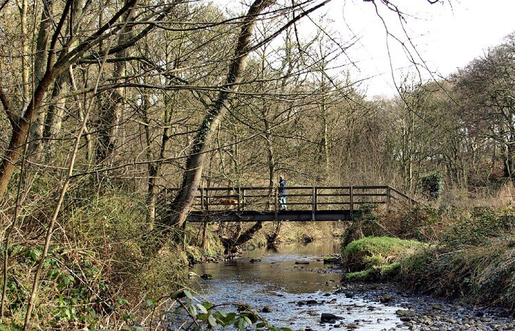
Holywell Dene today.
Our planet needs protected areas like Holywell Dene. Thankfully, recent trends suggest we’re starting to recognize this. Almost 15% of the Earth’s land surface and 7% of our oceans are covered by protected areas, according to the latest Protected Planet Live report .
Knowing the location of these protected areas is crucial. Scientists, businesses, governments, as well as other decision-makers and stakeholders, need access to this information for development, planning and policy decisions. With this in mind, the UN Environment Programme World Conservation Monitoring Centre (UNEP-WCMC) has recently made the World Database of Protected Areas (WDPA) available in ArcGIS Living Atlas of the World. All ArcGIS users will now have access to this dataset in a GIS-ready format, which updates every month using our Live Feeds methodology.
WDPA in the Living Atlas.
Explore your local protected areas
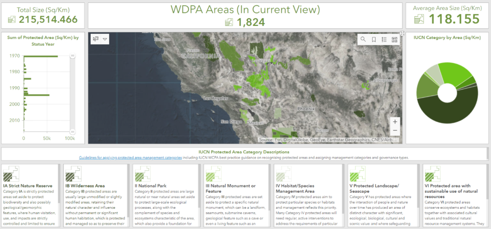
We used Operations Dashboard to create an application that allows you to search and view the protected sites in your local area. Type your town into the search bar or pan around the map and browse the protected areas nearby. See what year they were given protected status, their size and what ICUN protected category they are. Like me, you might bring back some great memories of time spent in our planet’s protected areas.
Do you have a favourite Earth place? Share it with us here.