David Attenborough is new on Instagram. In his first 5 hours Sir David passed 1 million followers – a new record. His reason to debut?
He explained in his first post:
“I'm making this move, and exploring this way of communication to me, because the world is in trouble. Continents are on fire. Glaciers are melting. Coral reefs are dying. Fish are disappearing from our oceans. The list goes on and on.”
Sir David is spending his tenth decade campaigning for us all to take action. The question for companies is how to respond to his challenge.
You can’t respond to his challenge unless you understand the world around you, and your impact upon it. And to do that, you need a Geographic Information System (GIS).
We asked Chris Jackson, head of commercial markets and sustainability at Esri UK, for his insights into the ways GIS can improve sustainability and contribute to regeneration. Chris is more than an expert on spatial analytics. He's a passionate – okay, obsessive – environmentalist with decades of work in the field. He's always learning. This year alone he completed an advanced course at Cambridge University on promoting sustainability in business.
He says the first step is to map out your goals.
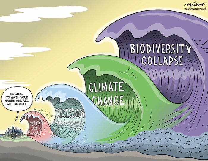
“Business leaders have to urgently rewire their mindsets,” he says. “The scale of the crisis we now face is unprecedented. 2020 has been a tragic year for human health and the economy, but it’s nothing compared to the potential catastrophic impact of human activity to the planet (and thereby humankind) over the next 20 years. Global population is predicted to rise to over nine billion at current rates, whilst most scientists are predicting that the planet will only be capable of supporting between one to three billion if we carry on the way we are.
“Embracing business sustainability in this context can be summarised as looking after the three Ps, which are People, Planet, and Profit - meaning a balanced business approach of social wellbeing and equity, environmental stewardship and economic prosperity.” He adds, with a nod to John Elkington’s original thesis on Triple-Bottom Line accounting and the emerging BCorps movement.
"If you continue to only focus on the bottom line you'll eventually lose customers and staff as they seek alternative companies that demonstrate care for all three. You’re also not making any contribution to Sir David’s cause.”
The belief that there's a trade-off – profits versus the environment - is nonsense, he stresses. Societe Generale, the investment bank, for example, will only invest in sustainable businesses, as these deliver higher absolute returns. Larry Fink, CEO of Blackrock, put sustainability at the heart of Blackrock’s investment approach – with the conviction that sustainability and climate-integrated portfolios will provide better risk-adjusted returns to investors. Going green really will keep you in the black.
Start with a map
So how can GIS deliver results?
It starts with visualisation. “Most businesses run on people, places, and interconnected networks. It follows that most businesses can be described as being ‘geographic’ in one way or another, but many leaders don’t think that way,” says Chris. “You can start by plotting your operations on a map in 2D, 3D or 4D. I've had clients in the past who, when we showed them a map of their sites, suppliers and competition, said it's the first time they've ever seen it.”
This is at the heart of the opportunity. Say the word Geographic to most people and they immediately think back to school of wet school trips and igneous rocks. “We’re trying to adapt that muscle memory and raise awareness of this amazing technology,” says Chris. “It has lots of different names – location intelligence, geospatial analysis – but it’s actually really simple. Just take a step back and look at your business in a local, regional and global context. Everything is connected to everything else. That’s how the world works – and we’re constantly delighted by how powerful this business approach is proving for our customers.”.
Jack Dangermond, Esri Founder and CEO, puts it this way “Understanding where things are, and why, is essential for rational decision-making.”
For Example, mapping out your operations can help reduce your carbon footprint. Routes can be better calculated. Logistics improved. “Spatial analytics can really help,” says Chris. “If you’re only interested in profit, you might think it’s OK to send goods from the Port of London up to the Midlands, where storage is cheaper, and then back down to the South East to be distributed to retail outlets. But what of People and Planet? Finding a location that is closer would definitely reduce carbon emissions and road congestion, as well as potentially reduce stress on drivers. The reduced travel costs, faster service, and potentially increased productivity could thereby lead to more contracts and trigger faster business growth – all of which arguably could outweigh the previous cheaper storage cost. I would much rather invest in a company taking that kind of holistic approach than just looking after the bottom line. Many consumers are voting with their feet for similar reasons.”
Add layers. Then more layers
The beauty of GIS is the way models can be enhanced with more layers. Just add data and keep adding to your model. The results can be stunning.
For example, where should a new store be located? Esri offers the opportunity to weave dozens of variables into a single integrated model.
Chris says: “Imagine you are a retailer opening a new outlet. You need to choose where to put it. Available land, competition, customer profiles, spending habits, transport access, footfall data – the possibilities are limited only by the imagination of the retailer. You can add transport routes for workers based on bus routes, train stations, roads, cycle paths, even distances to employees' homes. The data is rich, for example taking into account average travel speeds and road closures. Then you could filter sites by factoring in the carbon footprint of workers. It's straightforward work for an analyst trained in GIS. So you end up with a location that's easy for staff and customers to access. You'll retain staff and customers over the long term as you've considered their journey. In this way GIS can optimise your environmental impact and contribute to health and wellbeing, as well as improve financial performance.”
This modelling can also be expanded to the entire supply chain.
Chris continues, “Esri offers insights on a global level. You can hold suppliers to account and check they are living up to their commitments.”
Ikea, for example, checks to see if suppliers are harvesting wood from sustainable forests. Any supplier infringing on a protected site is quickly exposed.
Advances in satellite data capture now mean the information available via Esri is near real-time.
“There are thousands of satellites every day capturing images,” says Chris. “Our customers are able to map wildfires, floods, the recovery after floods and the damage caused.”
Maps can be augmented with sensor data to enhance the picture. For example, the GSMA, a world body for mobile networks, is mapping air quality with sensors. It's perfect data for incorporating into a rich map for real time air quality tracking. A company might, for example, want to guarantee workers are not exposed to excessive PM2.5 and PM10 particulates. Sound can also be measured. Even decibels from a facility can be monitored to ensure local wildlife is not disturbed.
Maps can be enriched by a wide variety of additional data. For example, soil composition and geological information improves the risk model for insurers. It's even better in 3D.
Chris says, “Network Rail, for example, has detailed 3D models of the UK rail network, which helps to identify locations at risk of subsidence and flooding. When you make the move to 3D it's just an incredible eye opener. In fact, pretty soon we’ll wonder why we ever did this sort of modelling in 2D. We’re well on our way to delivering the digital twin of planet earth.”
Build operational strength
Modelling the Planet in this way is beginning to improve the way companies treat the other two Ps: People and Profit.
People can be served better when GIS is part of the strategy. For example, the proposed Access to Cash legislation announced in the 2020 Budget calls for equal and fair access to cash machines. This is an inherently geographic, and sensitive issue. “Our library offers a wealth of demographic data,” says Chris. “A bank can factor in age, spending habits and mobility of different neighbourhoods to reveal where ATMs and branches are best located. This could avoid zones of unacceptably low service.”
Profit can be improved too. New products and policies can be built on the back of GIS. For example, insurers increasingly harness GIS to create bespoke offers for households and businesses. Chris explains, “Not that long ago, insurers quoted premiums based purely on postcodes. But postcodes in rural areas can cover many square miles. It’s possible that two houses with the same postcode - one at the top of a hill and one at the bottom in a flood plain would attract the same premium. Likewise with claims fraud – rapid geographic insight means potentially lower pay outs. Satellite imagery is now routinely used to assess storm damage to rooftops. Using accurate location data means fairer premiums, fairer pay outs, a more customer-focussed service, higher customer satisfaction and ultimately higher profitability.”
“In this way, the 3Ps, People, Profit, and Planet are deeply interconnected,” says Chris. “And if you embed them all into your strategy, the long-term sustainability of the entire business can be improved. For example, when companies literally map out their supply routes, they can identify potential issues. If you ship goods through the Gulf of Aden there are multiple risks. Piracy. Political issues. Weather events. Spatial analysis allows you to systematically analyse threats to the supply chain and build contingency scenarios. Maybe plot a secondary route to avoid flashpoints. It's an illustration of how understanding your business geographically can improve long-term performance.”
Reimagine your business and make Sir David proud
Sir David's plea is for all of us to change our thinking. He put it thus: “People are always asking what they can do to turn this situation around. The truth is there isn't one single answer, though we can make a big difference by putting nature at the heart of our decisions.”
GIS is the best way to do that. When companies think of their operations as part of the natural world everything changes.
It's a mission that should unite us all.
“If we don't get this right there won't be a world fit for us to live in,” says Chris. “The stakes are that high.”

Chris Jackson - Esri UK
Chris is a geographer who is passionate about the environment and creating sustainable businesses & communities. Chris has spent over 25 years in high-tech software industry working with mapping and geospatial technology for government and private sector organisations as a technician, consultant and manager. He joined Esri UK in 2001 and holds a Senior General Management position covering a diverse group of industries, delivering solutions to enable Digital Transformation & Sustainability.