Advances in access and functionality are changing the way students use geographic information system (GIS) technology to learn at the University of Exeter in the United Kingdom.
Dr. Damien Mansell, senior lecturer of physical geography at the University of Exeter, has helped lead the evolution by establishing the Geography with Applied GIS program.
The centrepiece of this effort is the university's GIS mapping and analytics platform, which is available to all students on campus through the university's new single sign-on (SSO) integration. SSO enables users to quickly and securely authenticate their permissions and instantly gain unfettered access to the university's ArcGIS without having to create and manage additional logins.
Mansell's advocacy for geospatial learning and the advantage of SSO have resulted in over 1,360 students, academics, and researchers using ArcGIS. Beyond the application for the geography field, they are using GIS for their work in diverse areas of study such as archaeology, engineering, biosciences, renewable energy, and geology and mining.
A New, Applied Approach to Learning
In 2014, Mansell redesigned a spatial skills course that he was to begin teaching, transforming it into an applied GIS and remote sensing course. It was the first course on campus to provide an introduction to GIS as a discipline, wherein students could learn the geospatial skills necessary to apply to geographic research.
After attending the 2014 Esri User Conference, he returned to campus with a deeper understanding of what ArcGIS Online could provide his program's students. They were introduced to a new spatial analysis workflow, discovering how they could capture primary data with the ArcGIS Collector mobile app in the field, upload and analyse that data in ArcGIS Online, and showcase it with ArcGIS StoryMaps. Previously, students were presenting their data in reports, using static map figures and writing figure captions, similar to a scientific paper. Now, with the evolution of interactive maps in their toolkit, students can build a powerful narrative by visualizing their compelling story.
Teaching GIS within the Context of Physical Geography
Mansell's Geography with Applied GIS program at the University of Exeter is the first of its kind in the United Kingdom. The new, applied approach to GIS being taught in Mansell's classroom is making an impact on students, with a hands-on learning model.
"Rather than saying this is a GIS module today, we're going to learn about polygons or geocoding or whatever it might be, we're actually studying it all in context of a research problem or question," said Mansell.
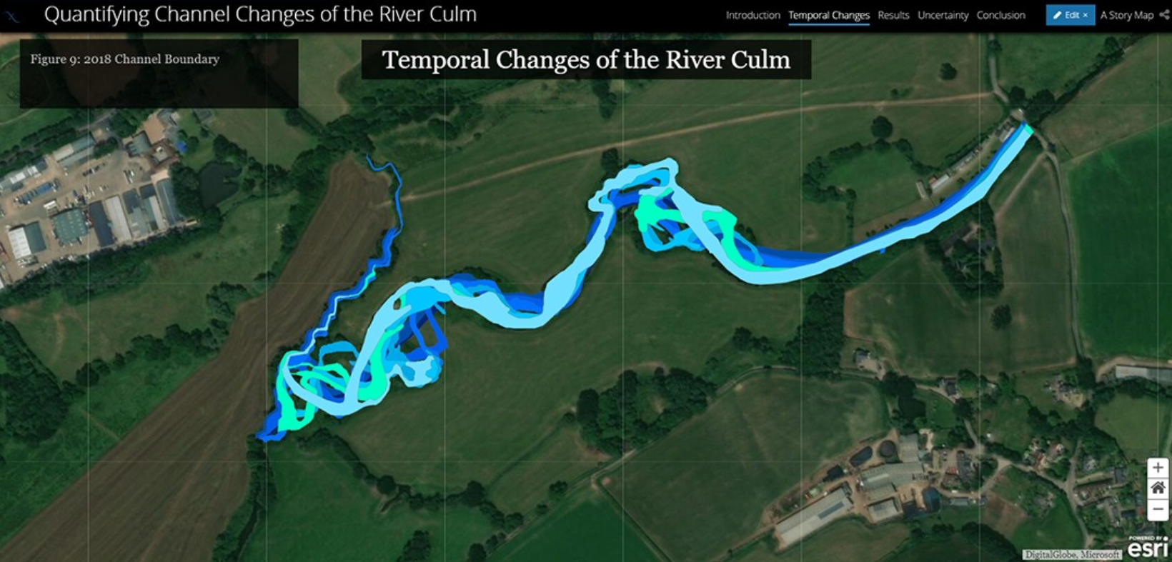
One such example involved his students examining local fluvial geomorphology, interactions between the physical shapes of rivers, their water and sediment transport processes, and the landforms they create.
"And so everything was focused on the inquiry . . . how they can build that understanding of something—fluvial geomorphology—something they've learned at school, but obviously to research it, measure and understand it using spatial analysis. So they're learning GIS through answering a research question," said Mansell.
Mansell is interested in using the geospatial approach for non-traditional GIS courses at the university—showing students how to utilize GIS to answer questions beyond geography.
"So the current situation we have is that students come to us, enroll in geography. They start learning geography through exploring it in GIS. They get hooked on the tools, and then half of the physical geography students are transferring into Geography with Applied GIS and graduating as GIS students," said Mansell.
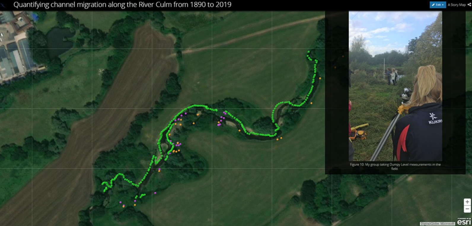
GPS points updating the current channel position are shown in green, sites or transects and other points of observation are in purple and yellow respectively. Field photos are presented as interactive pop-ups, geotagged to the GPS point using Esri’s collector app. In this photo pop up students are measuring transects or relic fluvial channels using a surveyor’s level.
Streamlining Access to GIS across Campus
One of the major developments widening the adoption of GIS at the University of Exeter was the integration of SSO functionality, which linked ArcGIS with the university's information technology (IT) system.
The ease of use SSO provides has made GIS accessible from anywhere on campus, to serve any student, professor, or researcher, regardless of discipline or subject area. Prior to implementation, the university was using a manual process that required the review and approval of each individual's request for access to ArcGIS.
The new login system has significantly reduced the administrative workload required to manage users across multiple ArcGIS organisational accounts, allowing IT staff to focus more of their time on tackling important issues that are of higher priority.
Applied GIS Learning Gains Wide Interest
While the implementation of SSO has directly contributed to the increase in adoption of GIS by students outside geography, it is Mansell's efforts to promote the technology's wide-ranging capabilities that have made a lasting impact.
More and more students not enrolled in core geography courses are asking to use the GIS tools that the program has made available. They are interested in using ArcGIS StoryMaps to present their findings in a visually appealing way.
As a result, ArcGIS StoryMaps is being offered as an assessment support tool in courses that do not include GIS training. Students outside GIS modules are leveraging their new geospatial skills to demonstrate their learning of subject-based knowledge in the discipline.
The popularity of the program has surpassed all expectations, as more and more students are discovering GIS, developing interest, and transferring into it. The new approach to learning spatial analysis, established by Mansell, is making it relevant to their coursework, both inside and outside the program.
"The feedback I was getting from graduates who went into GIS careers was that they were coming out of the program with skills which surpassed most of their fellow geography graduates from other universities," said Mansell.
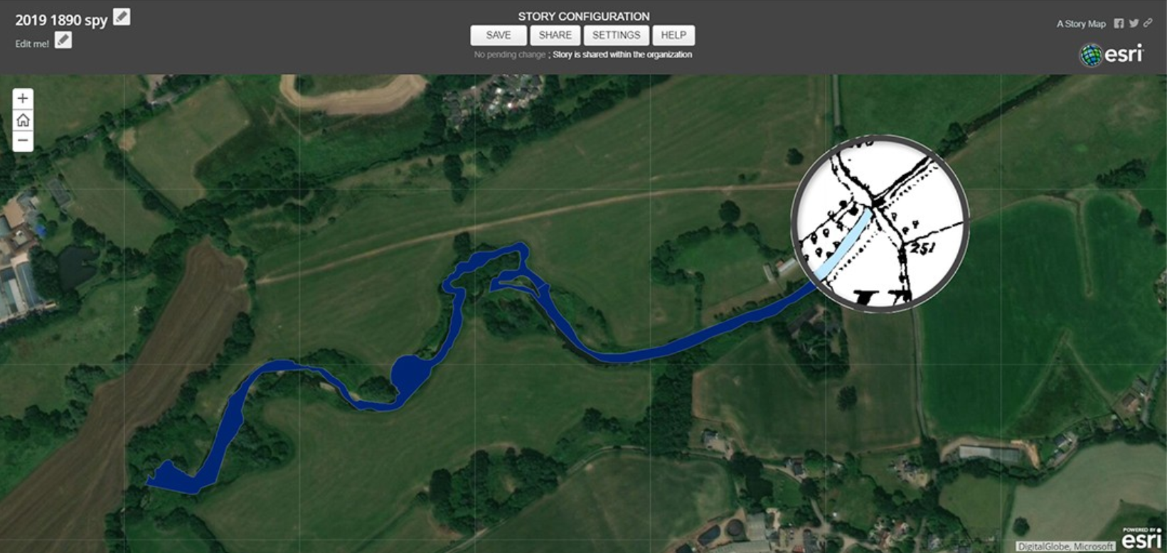
Spyglass feature tool allowing the user to interactively visualise the changes from Esri’s imagery basemap and a georectified historic map from 1890. In this screenshot of student work the spyglass highlights an area of channel stability. Here the river has maintained its course, flowing under a bridge so is due to anthropogenic influence on the flood plain
Studying in the University of Exeter's new Geography with Applied GIS program has been an invaluable experience for transitioning into a GIS-based career. Learning how to utilize GIS in various landscape management applications taught by expert lecturers in the field has provided me with not only the sought-after technical skills to analyse geospatial data but also a great passion for remote sensing and the environment.
_________
Rebecca Marsden
Graduate of the Geography with Applied GIS program, University of Exeter
Addy Pope – Esri UK
Addy is the Higher Education Customer Success Manager for Esri UK. In this role, he helps universities across the UK and Ireland to use ArcGIS to enhance teaching & learning and to enable research. Addy has over 20 years’ experience in the GIS sector working in research and consulting roles before moving into education service provision with Edina at the University of Edinburgh prior to joining Esri.


