An awful lot has happened in the year since we last wrote a blog on the capabilities of ArcGIS Survey123 and there have been a lot of exciting updates. With that said, let’s take a look at five of my favourites. If you’re not familiar with Survey123 take a look at our 1-2-3 guide to Survey123. Put simply, it is an easy to use tool to make the creation of surveys and the ability to share and analyse them an straightforward and manageable process.
1) New question type – Ranking
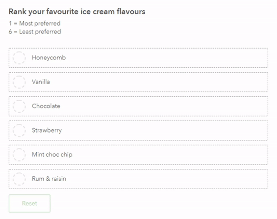
This new question type allows your users to rank a series of answers for a question from highest to lowest. This is really useful if you’re trying to understand what the preferred choice of your participants are!
Top tip – To get the most effective and insightful data, try and limit your ranking questions to 5 to 10 options. Users often find that more than this can be overwhelming. Also, if there are a lot of options the middle rankings may not be very reliable as there isn’t much difference between a rank 5 or 6 out of 10 options.
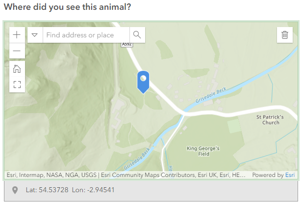
2) New question type – Map
The GeoPoint question has now been superseded by the new and improved Map question (GeoPoint is still available in the XLSForm). This allows you to ask the user to choose a specific point on a map, draw a line or even create a polygon.
3) Multiple file submissions now possible
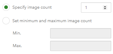
Collecting data for your survey questions is now easier than ever with multiple file submissions for image and file questions. You can now set how many images or files can be uploaded, as well as a minimum and maximum amount.
4) Barcode functionality
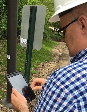
You can now add barcode questions via the Survey123 Connect app. This allows users to respond to certain questions by opening their camera and scanning a barcode, including QR codes. You may want to use this in a survey if your users are repeatedly going to set locations and gathering data on certain assets. For example, a user who carries out sign inspections can scan the barcode on a sign to quickly gather its ID number and add information about the asset.
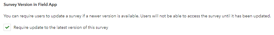
5) Keep your survey up to date
As a survey author, maintaining an up to date survey is very important and ensures the data you collect is up to date with any amendments that you have recently made to your survey. This is now possible with the new option that requires users to update to the latest version of your survey before they are able to submit a new response. This setting can be found in the settings tab under the subheading Version.
If you would like a more in depth look at some other capabilities and features within Survey123 for ArcGIS take a look here.