Over the course of 2022, we have accepted 255 new datasets to the UK Living Atlas and welcomed 8 data contributors to the platform!
I’d just like to say thank you to those who have shared their data to help the wider GIS community, and for our users- thank you for continuing to use Living Atlas as an authoritative source of content for your maps and projects. For a more in-depth summary of our 2022 performance, check out this Living Atlas Rewind!
Recap the best bits from 2022 with Living Atlas Rewind.
For this winter wrap-up, we’ll be exploring the new and noteworthy datasets that have been added over Q4, so grab your hot chocolate and read on for your Living Atlas winter wrap-up. Highlights include: 67 new datasets including data from National Trust and Natural England.
Environment
Explore coastal land use change with Neptune Coastline from the National Trust
National Trust have shared two datasets from their Neptune Coastline Campaign. This project aims to map coastal land use and was carried out in 1965 and 2014, mapping a total of 775 miles of the English coastline.
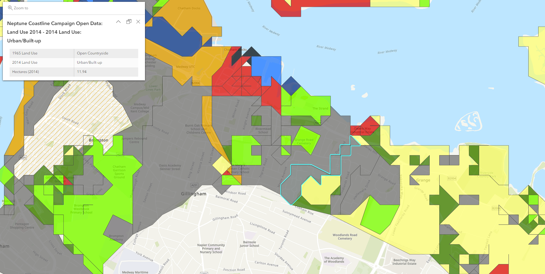
National Trust’s Neptune Coastline data showing coastal land use change between 1965 and 2014.
The project was initially started to help raise money to protect the most pristine stretches of coastlines and identify those at risk from development. The timeseries element of this dataset means you can also use this to find out how coastal land use has changed over time.
Learn about England’s habitats from Natural England
Natural England shared a national habitat layer from their Living England project. The habitat probability map displays 17 broad habitat classifications including: Arable and Horticultural, coniferous woodland, coastal saltmarsh and more.
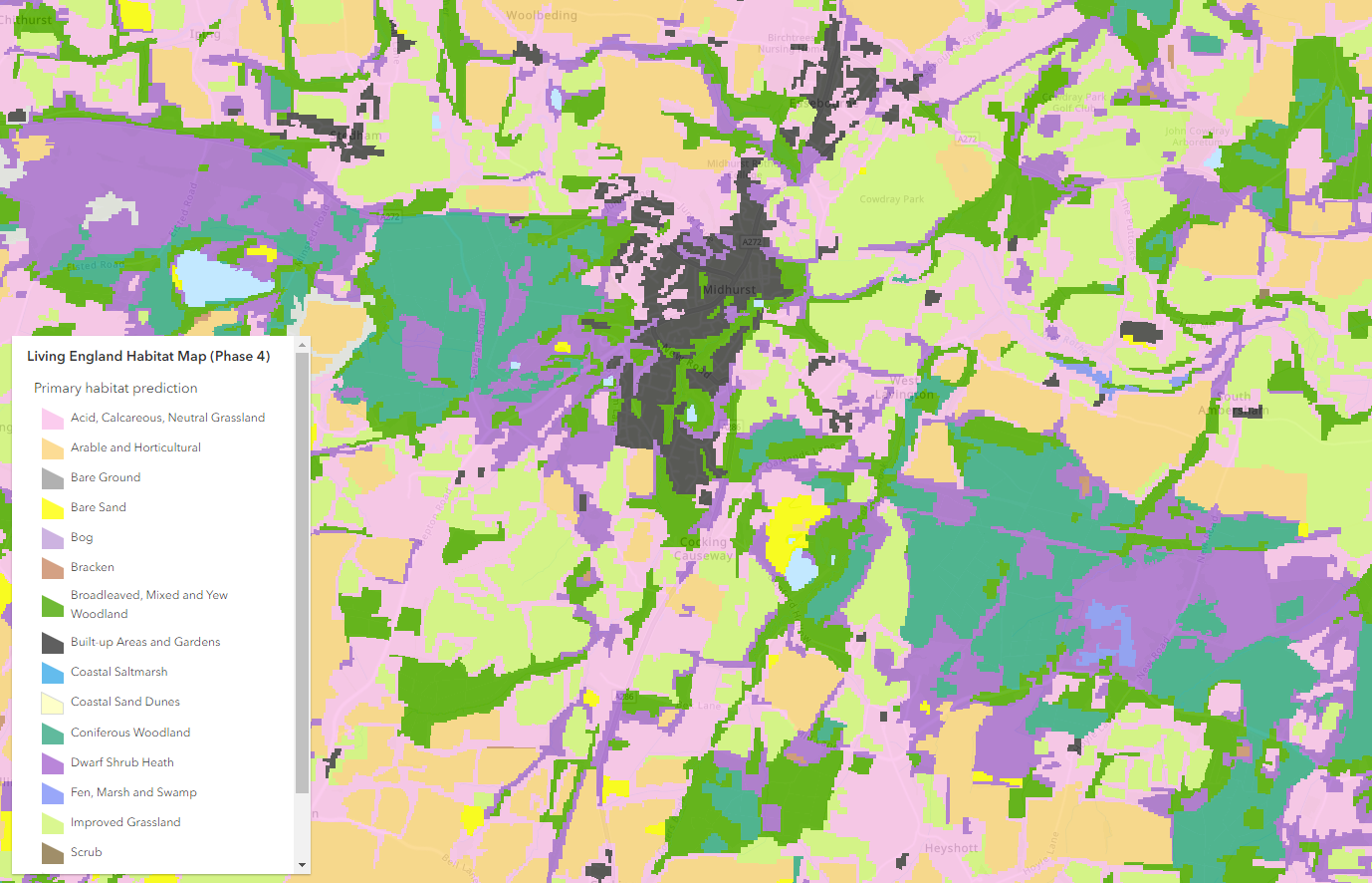
Natural England’s habitat probability map.
The Living England project aims to deliver a habitat probability map for the whole of England using satellite imagery, field surveys and other records geospatial data in a machine learning framework. As it is a probability map, extrapolations are made to areas where there is no available data. This will help support decision making, evaluation and policy development especially in areas where data is limited.
Learn about the most threatened habitats with Natural England’s Priority Habitats Inventory
Natural England’s Priority Habitats’ Inventory is a spatial dataset that describes the geographic location and extent of 25 priority habitats in England. It maps most of the terrestrial semi-natural habitat types that were identified as being the most threatened and requiring conservation action under the UK Biodiversity Action Plan. These habitats are considered of principal importance for the conservation of biodiversity.
Check out the user guide and metadata information in a zip file in the description to find out more about this dataset.
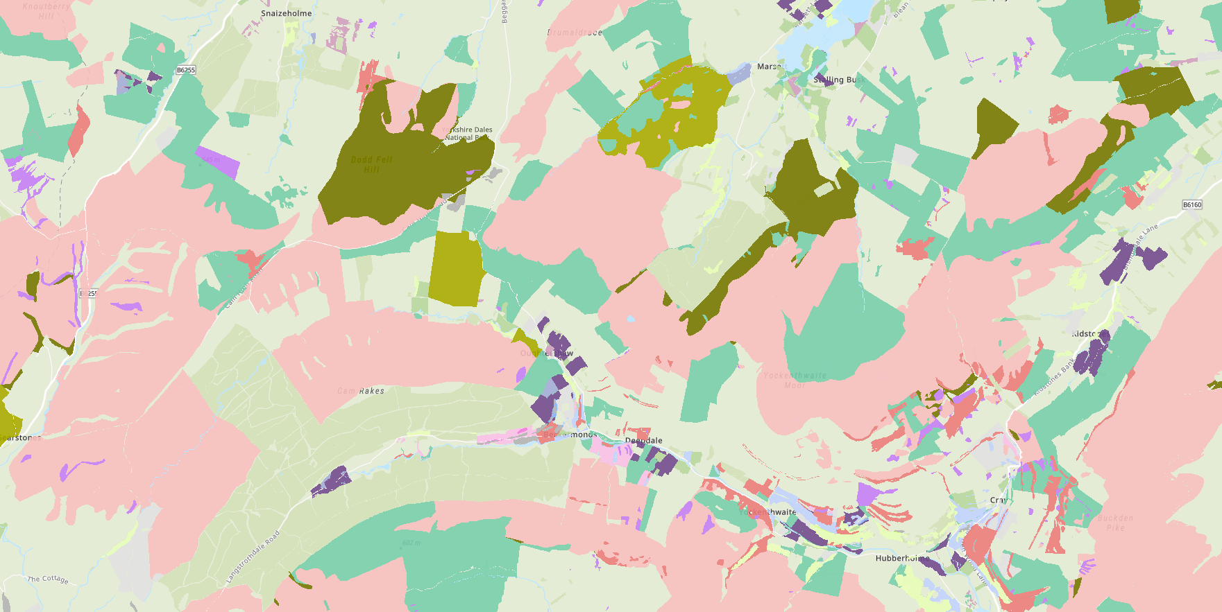
Natural England’s priority habitat inventory.
Updated Antarctic coastline datasets from the British Antarctic Survey
British Antarctic Survey recently updated their Coastlines Data to reflect November changes. This includes grounding lines and ice shelf fronts, at varying resolutions to help you gain a better understanding of the topography of Antarctica.
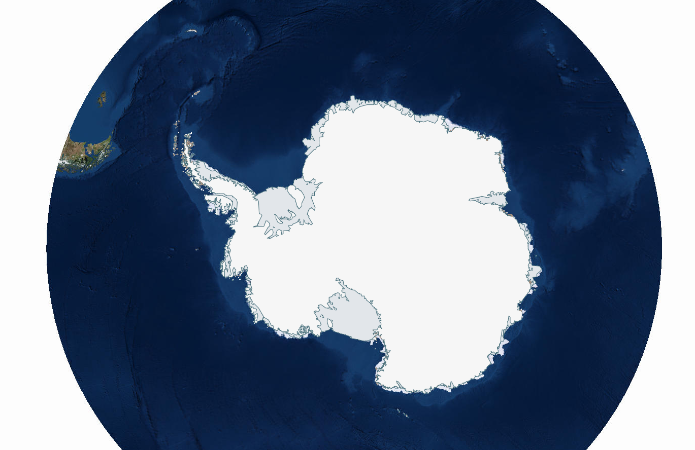
Antarctic coastlines dataset from the British Antarctic Survey.
Infrastructure
Find out which heritage sites are at risk in 2022 with Historic England
Historic England have published their Heritage at Risk Register for 2022 which looks at the overall state of England’s heritage sites in 2022 and highlights assets most in need of safeguarding. Use this to find heritage sites near you and find out if they are at risk.
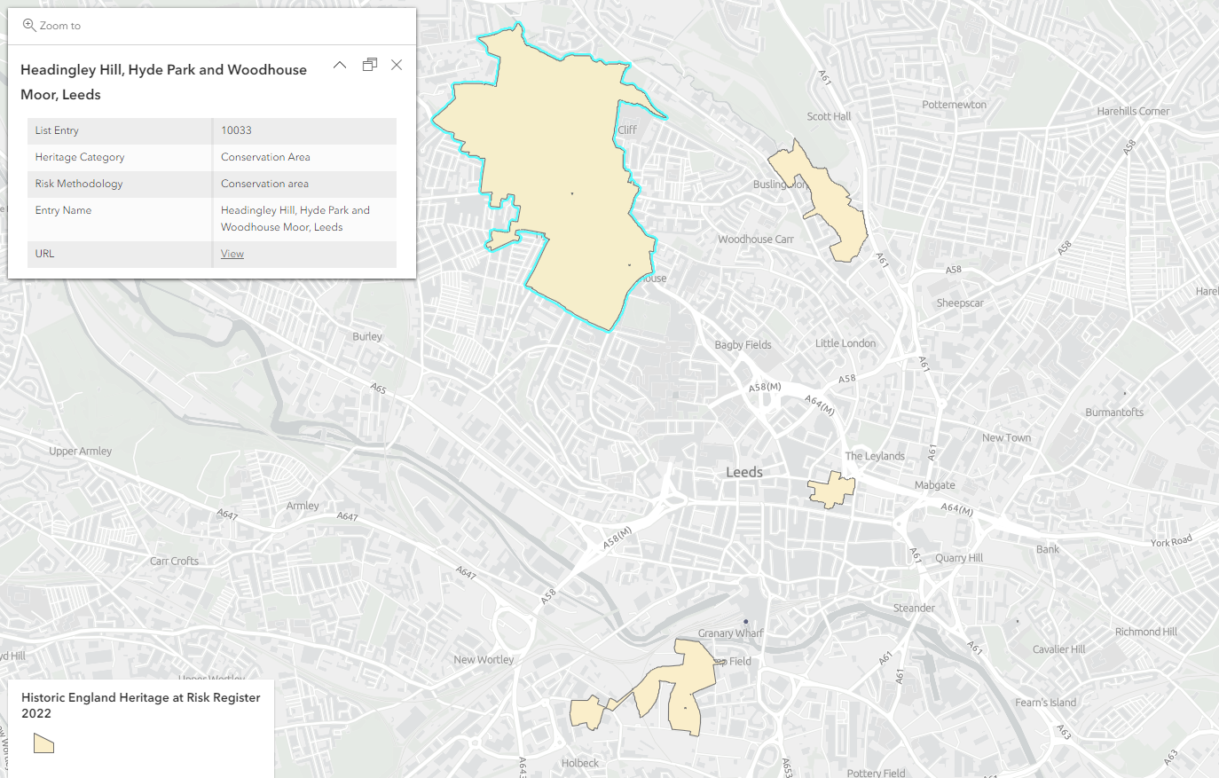
Heritage sites at risk in Leeds using Historic England’s Heritage at Risk Register 2022.
Updated Retail Points from Geolytix for Q4
Geolytix have updated their Retail Points dataset to reflect changes for Q4. This is a comprehensive map of all UK supermarkets and has been rooftop allocated and attributed with store name, address, open date and size band of store.
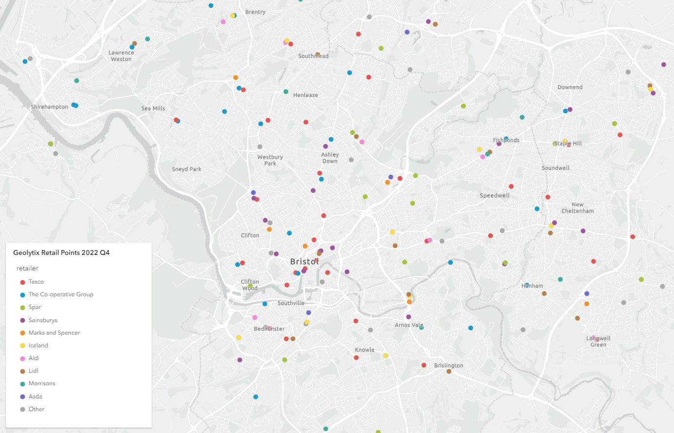
Retail Points in Bristol using Geolytix 2022 Q4.
Boundaries
Office for National Statistics (ONS) boundaries to give your maps a foundation
Following their migration, the ONS have re-nominated 61 of their boundary datasets to Living Atlas. These boundaries include: Counties, Local Authority Districts, Wards and more.
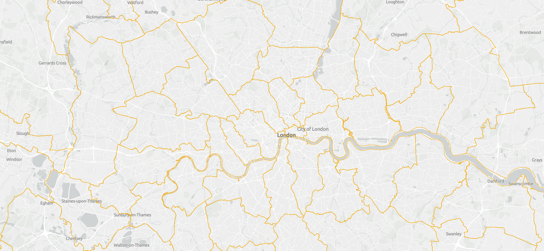
Office for National Statistics boundary datasets in Living Atlas.
If you want to find out more about their migration and how it might affect you, read this blog.
Living Atlas Resources
Here are some Living Atlas resources that are worth checking out:
- Back to Basics with Imagery is a StoryMap which looks at what imagery services are available throughout the ArcGIS system and how they can be used in wider applications.
- Climate and Climate Change data StoryMap collection highlights what climate and climate change data is available on the Living Atlas.
- There is also a blog detailing the Census data available in Living Atlas, what information you can get from it and what’s to come.
To make it easier to access Living Atlas resources, I have created this ArcGIS Online group.
General News
All GB Basemaps and OS Open Data under ‘EsriUKContent’ have now been updated. The currency of the data is the latest version, and the next planned updates will be in spring/summer.
Now you’re up to date…
Why not visit ArcGIS Living Atlas of the World to explore the thousands of authoritative content at your fingertips? Find out what’s in the UK Living Atlas with this Dashboard.
To keep up to date with other ArcGIS Living Atlas news, check out Esri’s blog and follow our dedicated Twitter account. Join Esri Community to connect with other ArcGIS Living Atlas users and share ideas, solutions and collaborate to solve problems with GIS.