The days are brighter, daffodils are blooming which only means one thing – spring has finally sprung! Like the daffodils, ArcGIS Living Atlas of the World is growing. Since our last winter update, there are 28 new UK datasets and we have also welcomed a new contributor – Sustrans! Here are some of the top Living Atlas highlights from Q1…
Environment
A series of new flood data from the Environment Agency
Earlier this year Esri UK added seven new Environment Agency flooding datasets in Living Atlas. This includes Flood Warning Areas, Flood Alert Areas and the Flood Map for Planning data series. These services get updated on a regular basis and help users better understand, plan and mitigate against the impacts of flooding. Check them out here.
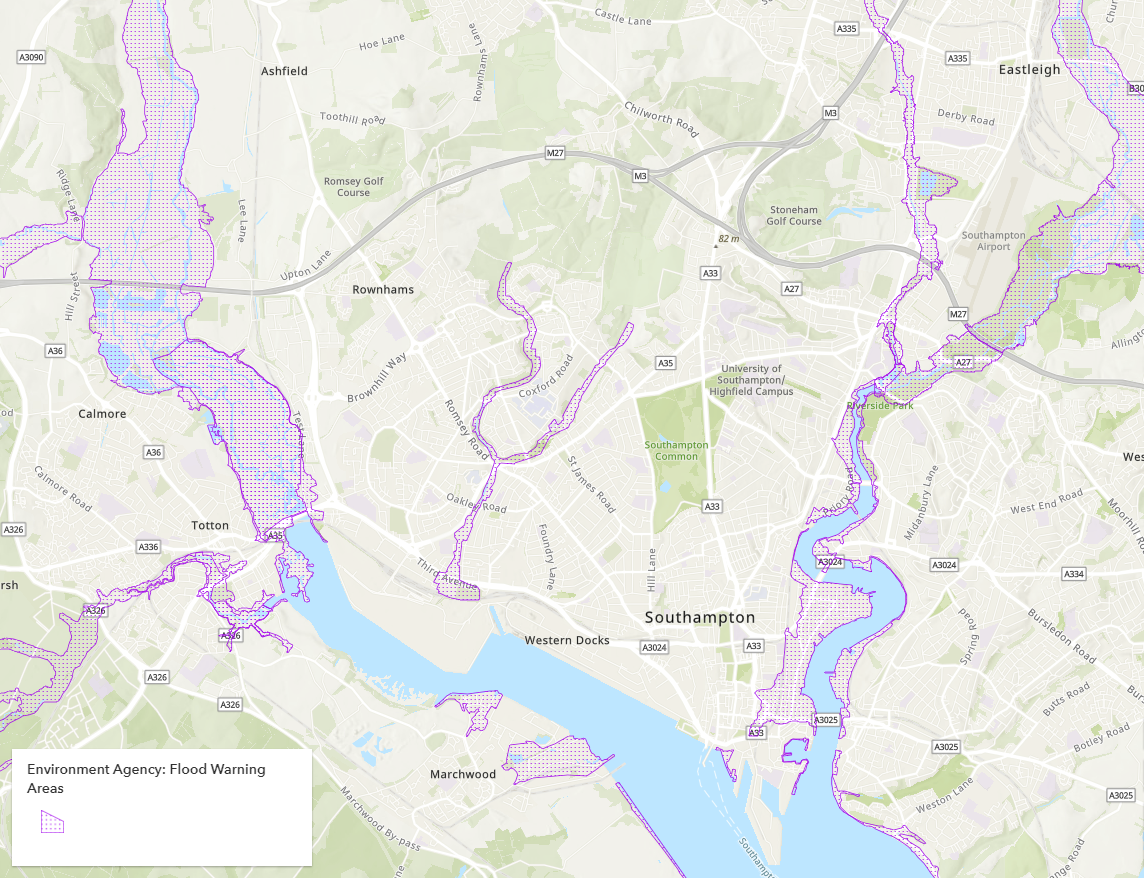
Looking at flood warning areas in Southampton using data from the Environment Agency.
To highlight the flooding services available in ArcGIS, Esri UK have also created this StoryMap. This introduces the range of available datasets – from Environment Agency data in Living Atlas to our premium content offerings from partners such as JBA, Ambiental and more. Learn the differences and their use cases with this resource.
New 10-metre resolution global land cover datasets
Last year we saw the release of Esri’s 2020 Global Land Cover map, which you can read more about in this blog. Please note this item is now in Mature Support and will be retired in December 2024.
To replace this, Esri have added two new global land use/land cover (LU/LC) datasets to help look at current conditions and changes in our landscape. The first is the 10-metre resolution LU/LC imagery from Sentinel-2, with data spanning from 2017 to 2021. The second is the 10-metre resolution WorldCover from the European Space Agency for 2020.
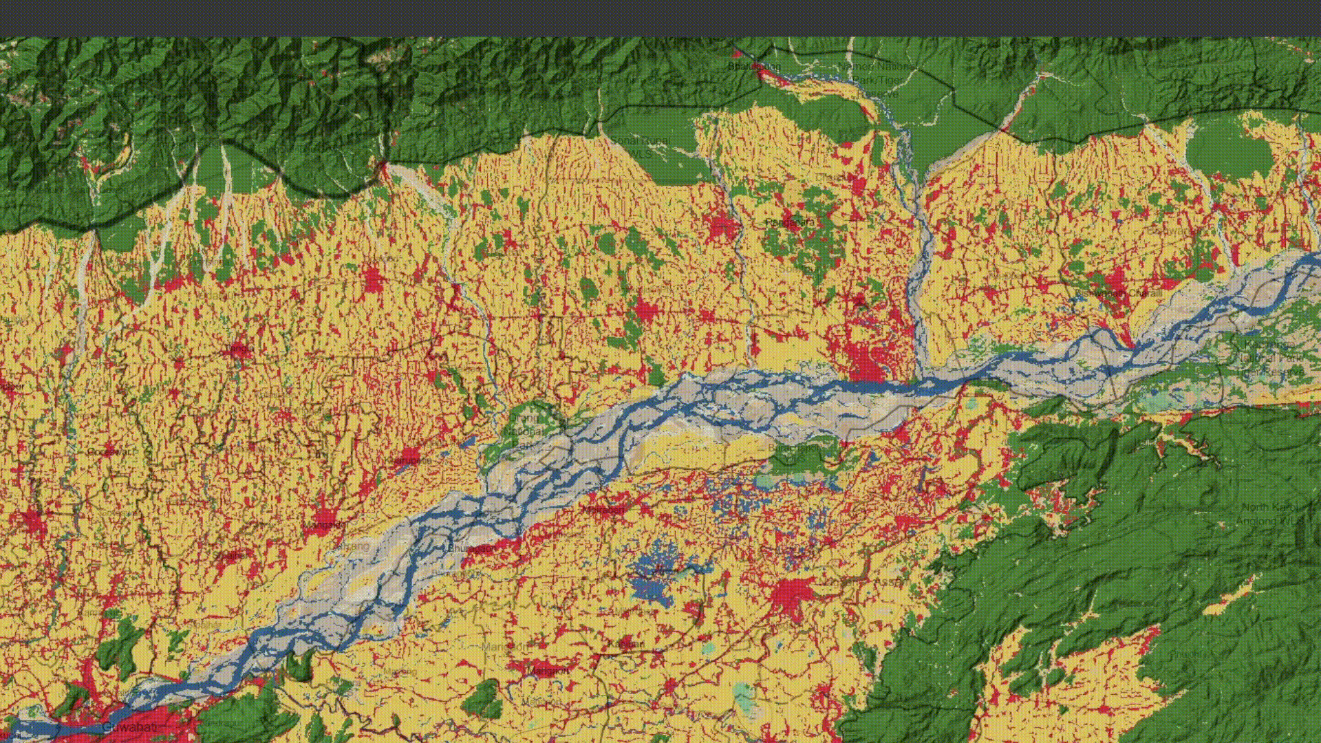
Using the new Sentinel-2 10-metre resolution land cover maps to look at stream braiding in the Brahmaputra River.
Both services present unique capabilities for the visualisation of our changing planet. The time-series element helps animate the natural and anthropogenic processes that continue to transform our world. Read this blog to see how the datasets are used to analyse changes in urbanisation and tree cover, and this StoryMap to learn how the Sentinel-2 data can be used to explore LU/LC change over time.
Explore global monthly evapotranspiration with ESRI’S new live feed imagery layer
Evapotranspiration (ET) is a key component of the water cycle and is useful for many analysis and mapping applications. A new time-enabled imagery layer with monthly ET measurements is now available in Living Atlas. This data has been derived from the Operational Simplified Surface Energy Balance (SSEBop), a remote sensing based model that provides actual evapotranspiration estimates, and is updated monthly. Use this to help with the conservation of ecosystems, monitoring of protected areas and assessment of water consumption. Learn more about these use cases in Esri’s blog.
Monthly evapotranspiration in North America for 2021.
More environmental data from Natural England
Natural England are a key contributor of environmental data for England, and they have recently nominated three new datasets to Living Atlas.
The first is Peaty Soils Location (England) which identifies the extent of 3 classes of peaty soils (deep peaty soils, shallow peaty soils or soils with peaty pockets). This dataset was produced for the ‘Partnership Project to Protect and Enhance Peat Soils’, which hopes to improve the understanding, management, and restoration of peat soils in England.
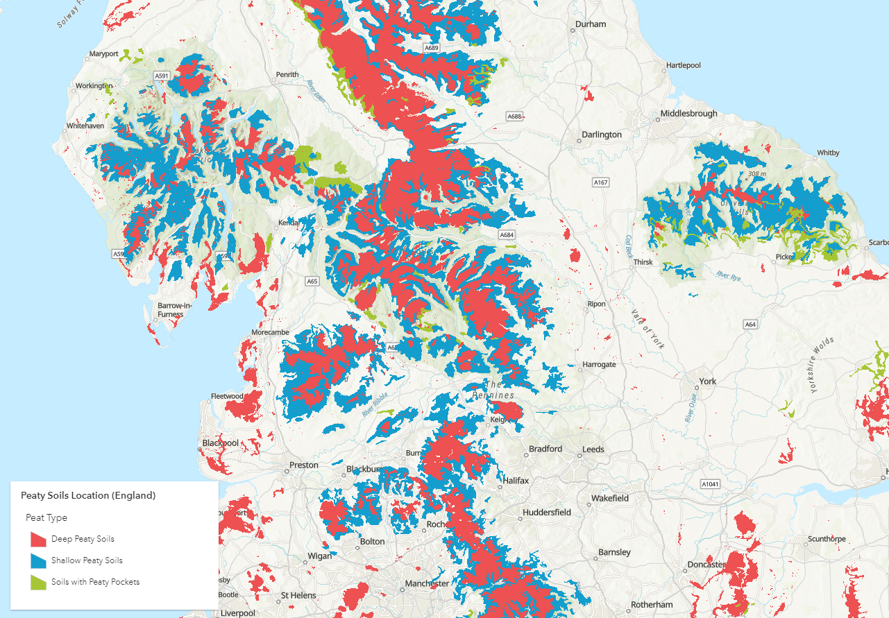
Classifying different types of peat in Northern England using Natural England’s Peaty Soils Location dataset.
The second, Biogeographic Zones Living England (2021), is a spatial dataset defining regions for the Living England Phase IV habitat classification. These 14 regions were created in England to balance resource requirements and scalability.
Lastly we have the Gamebird General License 500 m Buffer Zones (England). From 31st May 2021, the release of common pheasants or red-legged partridges into the wild is not allowed on European sites or within 500 m of their buffer zone, except under a licence. This dataset highlights the location of these European sites and their 500 m buffer zones.
Infrastructure
Enhance your retail analysis with this Retail Points dataset from Geolytix
Geolytix are location planning experts who have published their ‘Retail Points’ dataset for 2022 Q1. Retail Points is a comprehensive map of all UK supermarkets and has been rooftop allocated and attributed with store name, address, open data and size band of store. Integrate this in your workflows to optimise location planning, competitor analysis or when reviewing your network strategy.
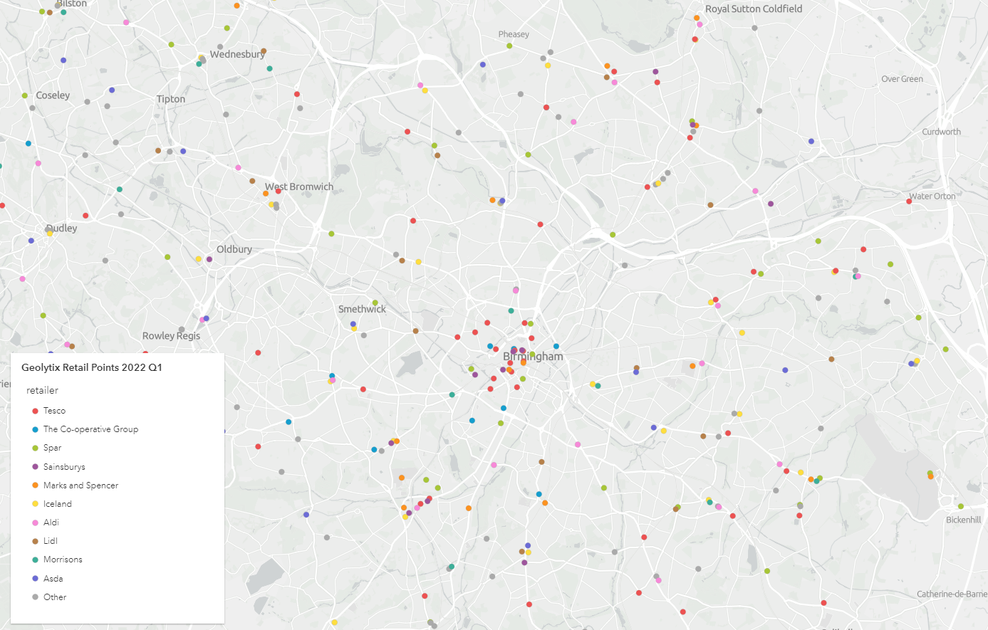
Discovering retail points in Birmingham using Geolytix data.
Explore Sustrans’ National Cycle Network
We are pleased to welcome Sustrans to our growing family of Living Atlas contributors. Sustrans are a charity dedicated to making it easier for people to walk and cycle. To help with this, they have shared their flagship project the ‘National Cycle Network’ to Living Atlas. This dataset depicts more than 12,000 miles of paths and routes for walking, cycling and wheeling. It contains information of route type, quality of the route, lighting and more, with data updated every Sunday. It’s the perfect dataset to assess things like accessibility and to discover routes you can take to explore the outdoors in the UK.
Sustrans National Cycle Network near Cardiff, Wales.
Boundaries
Identify site agreements in the UK with data from The Crown Estate
The Crown Estate have contributed 11 datasets relating to different types of site agreements in the UK. From wind farm sites, wave sites, pipelines to marine aggregates and more, these boundaries are a true reflection of what has been signed in the Agreements for Lease and Lease documents. Use this data to identify the location of UK’s important national assets, including our offshore wind sector.
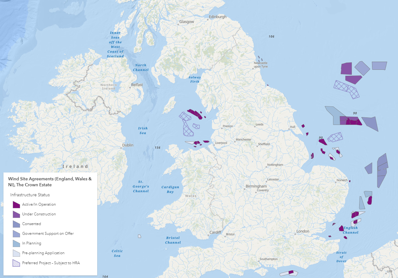
The Crown Estate’s data which shows all current offshore wind farm agreements in English, Welsh and Northern Irish waters.
Basemaps
Localise your work with these Local Names vector basemaps
Accessibility is a key focus at Esri UK. Last year we released web map versions of the GB Local Names basemaps (read more here), and now we have made the vector tile services of these styles available in Living Atlas.
You can find these basemaps in popular styles such as GB Light Grey, Topographic, Cartographic and more. Vector basemap tiles adapt to any resolution of the display giving better overall performance, and you can even customise the map using our vector tile style editor. The Local Names element means that labels are provided in local language (Welsh, Scottish Gaelic, local English) where available, helping you enhance the localisation of your GIS work. More info on customising vector basemaps can be found in this blog.
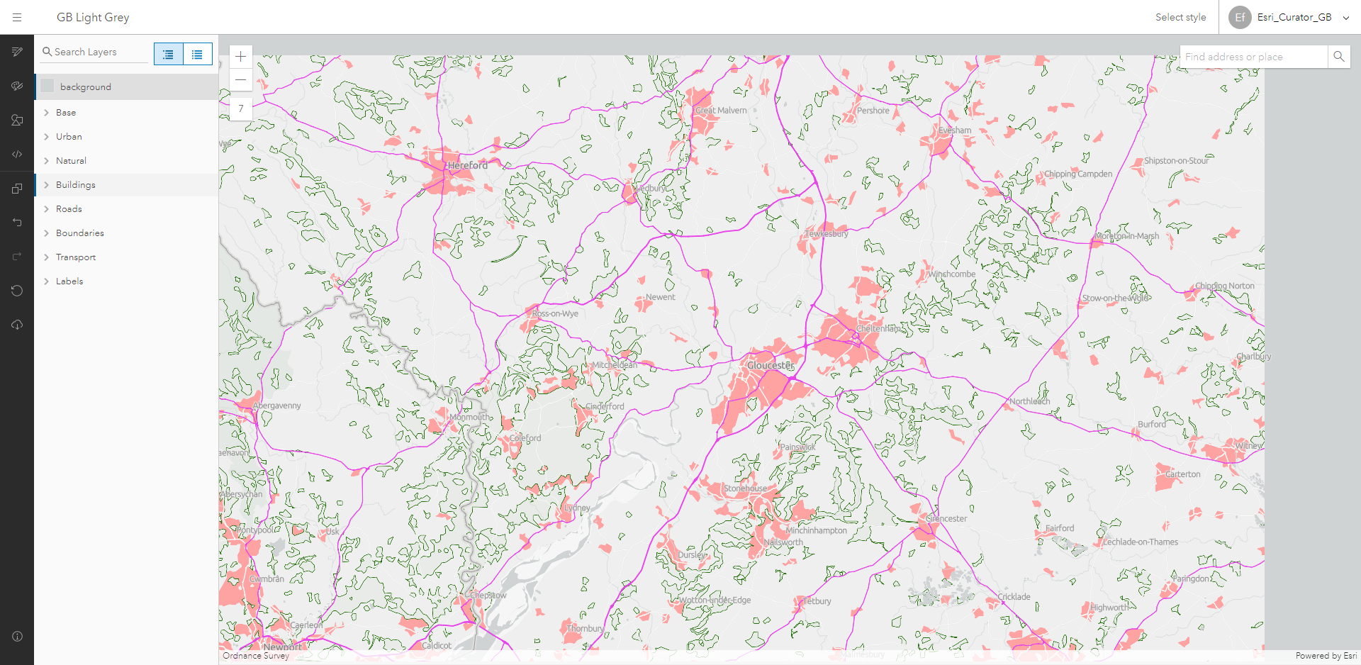
Editing the GB Light Grey basemap using the vector tile style editor. Here, the colours of the roads, urban and woodland areas around Gloucester have been changed.
Living Atlas Datasets in Action
As Data Curator, not only do I want to raise awareness of new Living Atlas content but also help users understand the wider applications of the data. So, I created this ‘Living Atlas in Action’ StoryMap collection to do just that.
This resource showcases datasets available in Living Atlas and gives examples of their use cases. The information has been sourced from blogs, learning pathways, conferences, webinars and more and is updated on a regular basis.
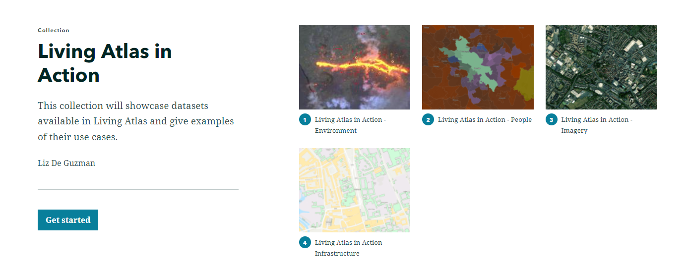
Living Atlas In Action is a StoryMap collection which showcases data available in Living Atlas and their use cases.
Contribute to Living Atlas
See what our Living Atlas contributors have to say about sharing their data to Living Atlas…
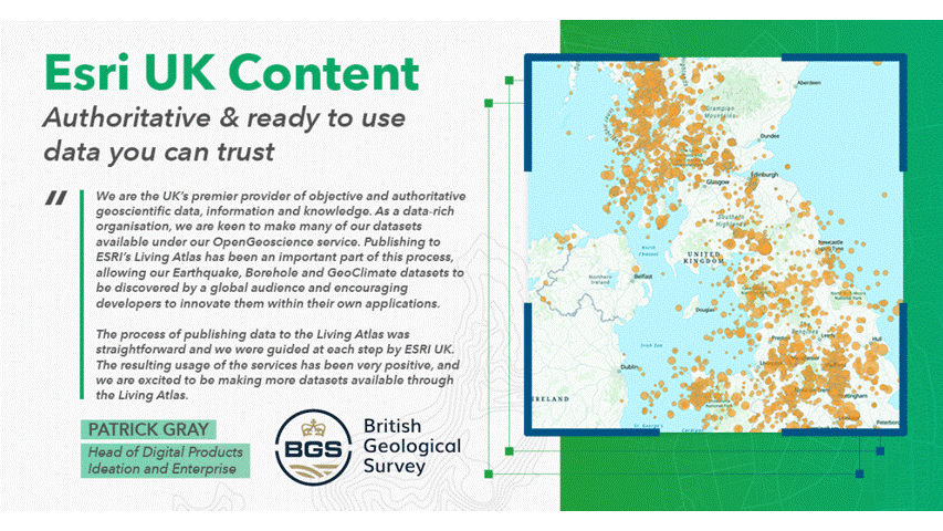
Statements from the British Geological Survey and Geolytix about their experience of contributing data to Living Atlas. Please note this is a timed gif and the statements change every 20 seconds.
If your organisation has authoritative datasets that would be a valuable addition to the platform, contribute them to Living Atlas and you too can be featured in the next blog. Find out how in this StoryMap.
For any ArcGIS Living Atlas queries, please get in touch with DataCurator@esriuk.com.
Now you’re up to date…
Why not visit the ArcGIS Living Atlas of the World to explore the thousands of authoritative content at your fingertips?
To keep up to date with other ArcGIS Living Atlas news, check out Esri’s blog and follow our dedicated Twitter account. Join Esri Community to connect with other ArcGIS Living Atlas users and share ideas, solutions and collaborate to solve problems with GIS.