As the Data Curator for Esri UK, I’m responsible for looking after UK contributions into the ArcGIS Living Atlas of the World. My favourite thing about the ArcGIS Living Atlas is that each map, app and data layer has been curated to support your work. The ArcGIS Living Atlas features high-quality, authoritative content from Esri, our partners and users worldwide – which can be seamlessly integrated across ArcGIS.
In this blog, I will share some of the latest ArcGIS Living Atlas updates from Esri UK and highlight some of the new and noteworthy contributions for the UK. We are going to take a look at the following categories:
-
Basemaps
-
People
-
Environment
-
Deep learning models
-
ArcGIS Living Atlas StoryMap collections
Basemaps
New Ordnance Survey OpenMap series
Earlier this year, we added a series of Ordnance Survey® (OS) OpenMap services into the ArcGIS Living Atlas. This includes the OS OpenMap Local buildings and OS OpenMap Local Functional Sites which cover England, Wales and Scotland.
The OS OpenMap Local Buildings provides an overview of building shape and size. This service also has an Important Buildings layer which classifies buildings into different themes such as: Cultural Facility, Education Facility, and Medical Facility. Whereas the OS OpenMap Local Functional Sites represent the area or extent of certain types of function or activity. This includes Air Transport, Education, Road Transport and more.
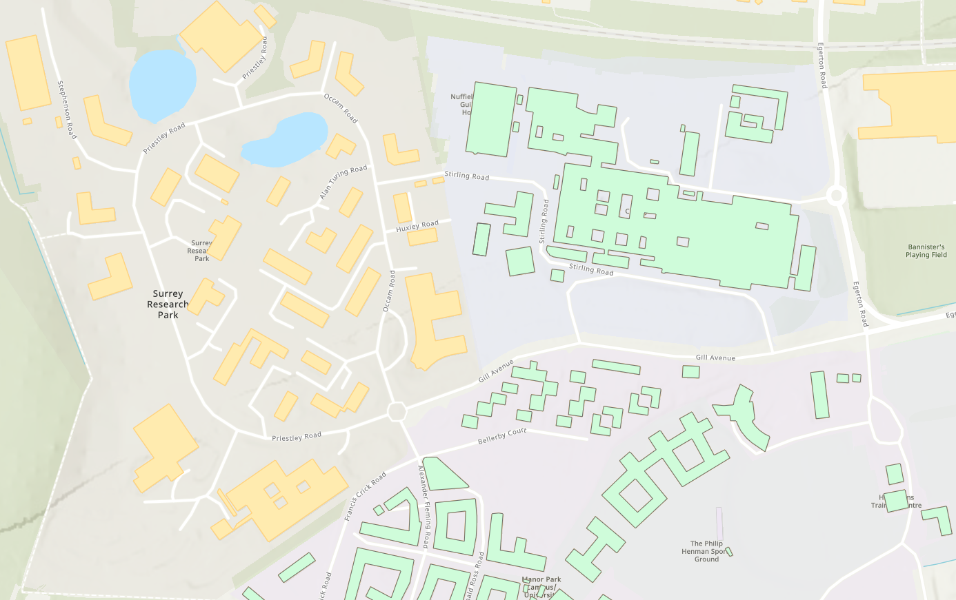
These feature services are useful to understand the location and extent of key sites such as schools and hospitals. It also helps with analysing data in relation to these sites. Read more about other use cases for these datasets in our blog.
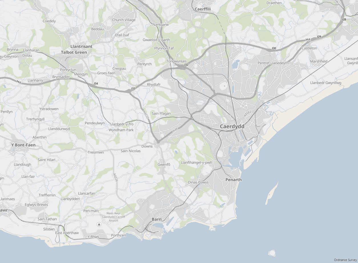
Localise your maps with GB Local Names basemaps
Improving accessibility remains a key focus for Esri UK. One of our most recent additions to the ArcGIS Living Atlas are the new GB Local Names basemaps using data supplied by the Ordnance Survey. You can find these localised maps in the popular basemap styles such as GB Cartographic, Topographic and Light Grey.
The labels in these basemaps are in local language providing Welsh, Scottish Gaelic and local English names where they are available. These basemaps provide a great backdrop and help enhance the localisation of your GIS work. Another bonus is that you can also customise the content and symbology of these basemaps using Esri’s vector tile style editor to really make the map your own.
The move to vector basemaps
As of July 2021, raster basemaps including OS Open Carto, Background, Greyscale and Greyscale Labels have entered mature support. These four services will no longer be updated but will remain available to use. As an alternative, there are a range of new GB vector basemaps available to use including GB Cartographic, Light Grey and more which are all available on the ArcGIS Living Atlas. This move is to help optimise the performance and personalisation of basemaps for our users.
If you are an ArcGIS Online organisation administrator, you should update your basemap gallery to use the new Esri vector basemaps. Read this article to find out more.
For more information on which services are no longer updated and suggested vector basemap alternatives, see our blog.
People
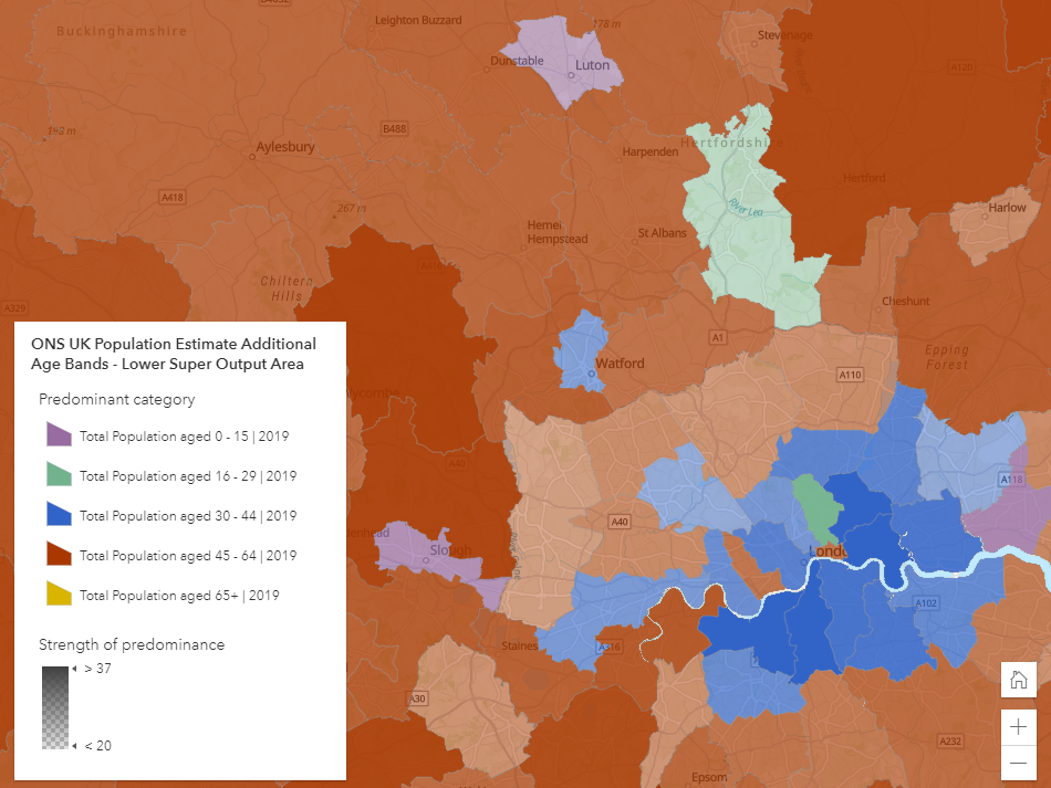
Learn about the demographics of England and Wales
Population estimates are one of the most widely used national demographic datasets. In the spirit of Census Day 2021 back in March, we at Esri UK curated the Office for National Statistics Mid-year Population Estimates for England and Wales and have made this available in the ArcGIS Living Atlas.
The seven feature layers record mid-year population estimates for England and Wales for a selection of administrative and census areas. Population estimates are calculated for the years 2012-2019 and are broken down into age range and gender. This is a valuable addition to the ArcGIS Living Atlas because of the insights these datasets can provide for demographic research. Use these datasets to help you answer questions like “how has the population changed over the years?” and “what is the age/gender structure of the population?”
Environment
Explore the UK’s geology
The British Geological Survey (BGS) is the UK’s premier provider of authoritative geoscientific data and we are delighted to have welcomed three of their datasets into the ArcGIS Living Atlas.
First is the UK Modern Earthquakes which shows the location of UK earthquakes recorded between 1956 to present day. Second, we have the UK Historical Earthquakes which shows the location of earthquakes within the UK from 1382 to 1970. Lastly, the GB Single Onshore Borehole Index (SOBI) is an index of over one million records of boreholes, shafts and wells that have been recorded during drilling and site investigations.
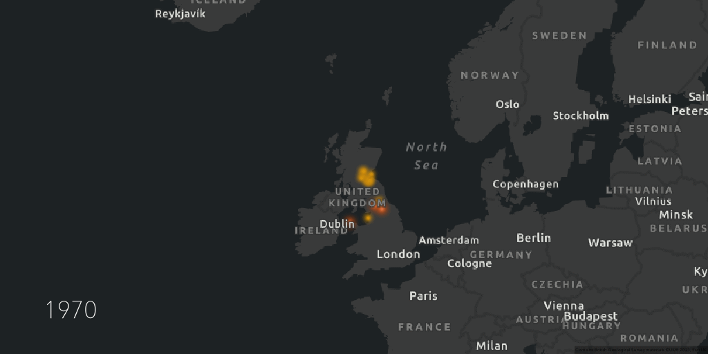
The addition of these datasets means it’s now easier than ever to integrate authoritative and ready to use geological data across ArcGIS. You can use them to understand the latest earthquake activity or even complete site investigations from the comfort of your desk. Read more about the different use cases of these datasets in this blog.
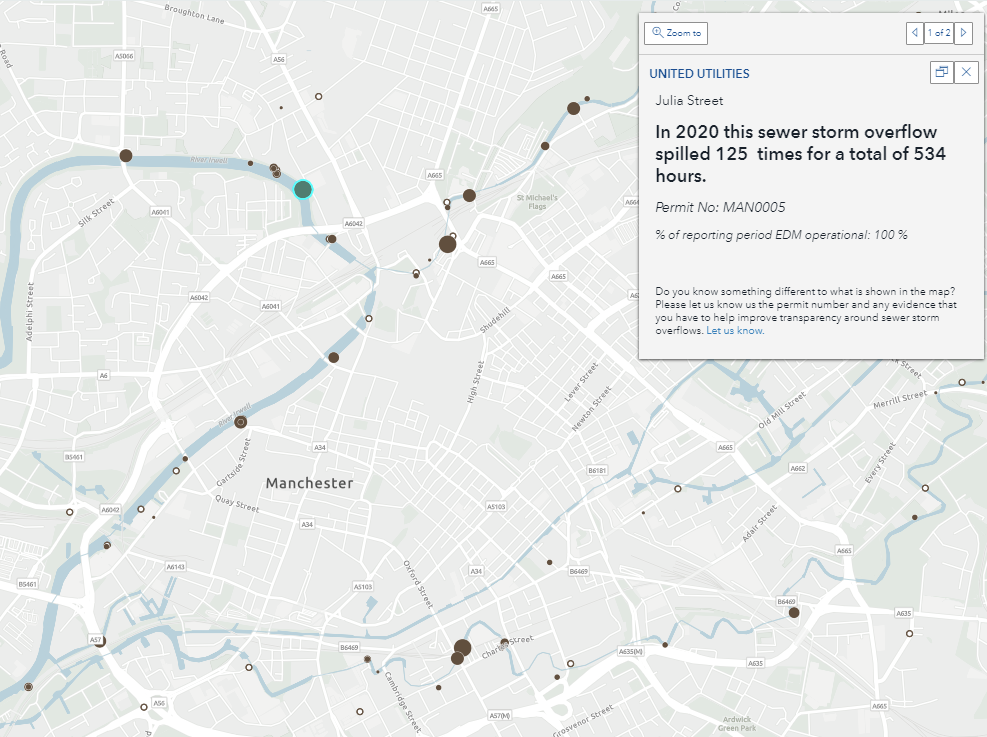
Find out if your river is fit to play in
The Rivers Trust have contributed three datasets to the ArcGIS Living Atlas to raise awareness of the sewage pollution problem in the UK. As part of their #TogetherforRivers campaign, these datasets give the location of sewage overflows, the spill duration (hours per year) and what river it was discharging into. These datasets cover England and Wales and spans a monitoring period between 2018 to 2020.
As a result of the datasets popularity, The Rivers Trust have also created a web application, ‘Is My River Fit To Play In’, which is also available in the ArcGIS Living Atlas. This interactive map shows where the sewerage network discharges treated effluent and overflows of untreated effluent and storm water into rivers. Not only does this application show the location of sewage overflows but also their spill duration in 2020. Explore the map for yourself and find out how clean your local river is.
Esri’s 2020 Land Cover map
One of Esri’s flagship project this year was the release of the 2020 Global Land Cover map which is available in the ArcGIS Living Atlas. Produced in partnership with Microsoft, this dataset is a global map of land use/land cover for the year 2020. With a resolution of 10-metres, it is our highest resolution land cover map yet. The map is derived from European Space Agency Sentinel-2 imagery and was developed using machine learning algorithms by Impact Observatory. The result is a composite of 10 land cover predictions including: water, flooded vegetation, trees, crops, built areas, snow/ice and more.
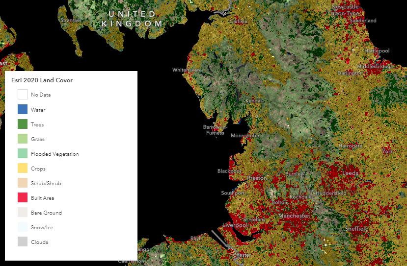
This detailed, global land cover map can help improve understanding of food security, planning, water modelling and resource management. If you want to find out more about this dataset, check out this webpage and StoryMap.
Esri 2050 Land Cover maps
Following on from the 2020 Land Cover launch, Esri have also released a series of maps, Esri Land Cover 2050, which are available in the ArcGIS Living Atlas. This series was created in collaboration with Clark Labs at Clark University and uses decades of satellite observation data from the European Space Agency’s Climate Change Initiative. The datasets are divided into three categories: the first depicts land cover classification for 2050, the second shows vulnerability to change by 2050 and third is land cover change from 2018 to 2050.
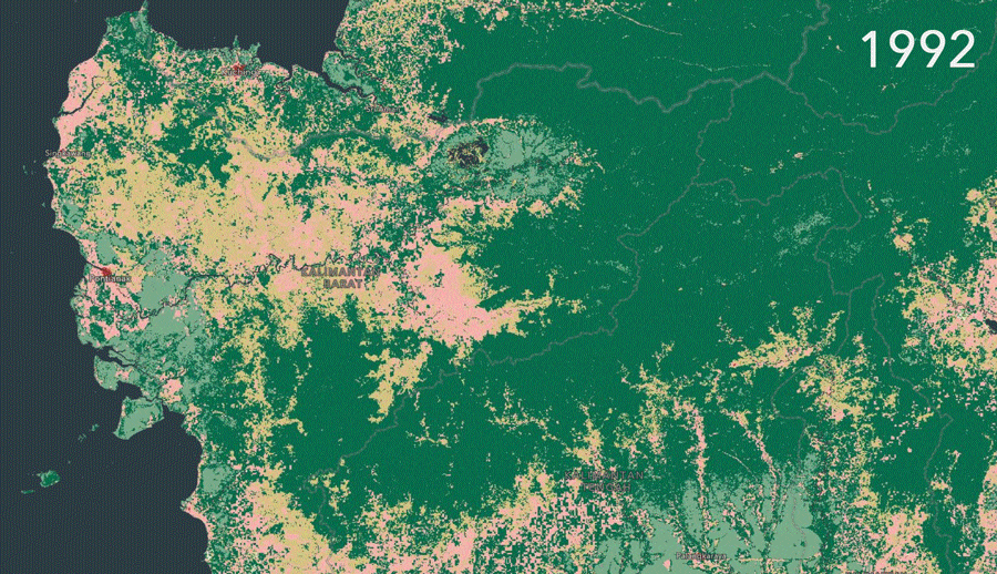
These maps hope to raise awareness of human-induced environmental change and helps to identify areas that are most vulnerable to human activities. Explore and combine the 2050 Land Cover maps series with other authoritative resources like the Esri 2020 Land Cover map. You can read more about the series here.
Deep learning models
Automate feature digitisation and extraction with just a click of a button
There are now 20+ pre-trained deep learning models available in the ArcGIS Living Atlas. These models have been pre-trained by Esri on large volumes of data and can be used to automate digitising and extract features from imagery and point cloud datasets. There are a range of models to choose from, from Building Footprints Extraction, Road Extraction and Land Cover Classification. These AI models are available to use in ArcGIS Pro, ArcGIS Online (with the newly released ArcGIS Image for ArcGIS Online) and in ArcGIS Enterprise with ArcGIS Image Server. The availability of these services mean you too can integrate machine learning in your analysis with just a click of a button.
If you want to see these models in action, check out our ‘Machine Learning Made Easy?’ blog.
ArcGIS Living Atlas StoryMap Collections
The perfect resources for ArcGIS Living Atlas newbies
Finally, as Data Curator for Esri UK I have recently published two StoryMap collections to introduce the ArcGIS Living Atlas to GIS novices, students and new Esri users.
The first collection, Introducing the ArcGIS Living Atlas of the World, is a step-by-step guide on how to use the website. It covers what the ArcGIS Living Atlas is, how to add datasets to a map, how to contribute data and a bit about deep learning tools and apps. This is a great resource for those starting out in their ArcGIS Living Atlas journey and want to find out more about how to navigate the website and its content.
The second collection is a shameless My Top ArcGIS Living Atlas Things. This StoryMap series gives a sneak peak of my top 5 Living Atlas features, datasets and apps. I also reveal some useful tips and tricks to help you make the most of the authoritative data on there. This is useful for those who want a quick overview of the best bits of the ArcGIS Living Atlas to get an idea of what it can offer.
Now you’re all up to date…
Why not visit the ArcGIS Living Atlas of the World to explore the thousands of authoritative content at your fingertips and to find out more about how you can contribute to the website.
To keep up to date with other ArcGIS Living Atlas news, check out Esri’s blog and follow our dedicated Twitter account. Join Esri Community to connect with other ArcGIS Living Atlas users and share ideas, solutions and collaborate to solve problems with GIS.
If you or your organisation have datasets that you feel would be a valuable addition to the platform or for any ArcGIS Living Atlas queries, please get in touch with: DataCurator@esriuk.com.