Tag Archives: Risk
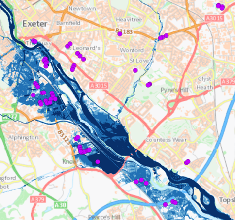
Analysing JBA Flood Maps in ArcGIS
Flooding poses an extreme threat to people’s livelihoods. Heavy rain and storm events cause surrounding rivers and coasts to become inundated with water, bringing a wealth of social, environmental and economic impacts. With floods of greater intensity predicted across much … Continue reading

National Trust
We are proactively reducing the risks from falling trees and branches, to protect our visitors, volunteers, staff and property, using a solution we developed with Esri’s ArcGIS.
Continue Reading
Dublin Airport
Our expanding use of ArcGIS throughout Dublin Airport is helping us to operate efficiently, improve the management of airfield risks, comply with aviation industry regulations and make better informed decisions to give passengers a safe and positive experience.
Continue Reading
Sompo Canopius
Our underwriters now receive up to date information on natural catastrophes and can make more incisive decisions to protect our business profitability
Continue Reading
Willis Group
We can make real-time information from a disaster zone available to our analysts in London so they can provide well-informed advice to our clients
Continue Reading
Aviva
The ability to spatially analyse data means we understand our customers a lot better and sharing this insight with staff helps drive competitive advantage
Continue Reading
Willis
Our corporate clients now have access to a wealth of information to help them manage global risks and take steps to minimise potential losses
Continue Reading