Blog Archives

University of Northampton
ArcGIS has given us greater insight, helping us to further tailor our marketing and attract higher numbers of applicants to our university
Given the increasing competitiveness between universities to attract new undergraduates, the University of Northampton has started to use Esri’s ArcGIS platform to help it improve its marketing. This innovative use of GIS helps the university to promote the value of its courses and increase applications from prospective new students.
The Customer
The University of Northampton is situated in the heart of England and offers a range of courses at undergraduate and postgraduate level.
ArcGIS reveals where existing students originate from, helping the university to understand where best to target its future marketing activities
GIS helps to show prospective new students where they might find employment and what their prospects might be following graduation
The university uses ArcGIS to identify local areas of deprivation and encourage disadvantaged children to go to university
The Challenge
Universities in England and Wales are facing up to one of the biggest changes in higher education in decades. Students now have to pay tuition fees of up to £9,000 per year, and this huge financial consideration is deterring many young people from continuing their education. Indeed, in the autumn of 2012, there was a 12% decline in student enrolments across the UK. As a result, many universities failed to fill their courses and suffered a reduction in funding.
The University of Northampton was quick to realise that the introduction of tuition fees would necessitate a dramatic shift in the way that it promoted itself to prospective new students.
Firstly, the university recognised that it would need to further target its marketing activities more precisely towards those students most likely to choose Northampton to help it increase applications. Analysis of postcodes from applicants had been undertaken, however, analysis of enrolled students had not been undertaken. Furthermore, there had not been any opportunities to monitor changes to the location of enrolled students over time.
Secondly, the university was being asked to contribute towards economic reports relating to graduate employment of students from Northamptonshire. It was recognised that this report would also demonstrate the quality of the University’s education to prospective students and reassure them that they would be able to work in graduate-level employment afterwards. The university is currently named England’s top university for employability.
Using GIS, we were able to allocate our ambassadors strategically to help raise the aspirations of pupils in the most deprived parts of the County
Emily Fletcher – Business Intelligence Officer, The University of Northampton
The Solution
Like many further and higher education institutions in the UK, the University of Northampton teaches geographic information system (GIS) skills to its students. Every year, as many as 80 undergraduates and 20 postgraduates are introduced to GIS as part of Environmental Science, Geography and Waste Management courses, and the university has a site-wide licence to use Esri’s ArcGIS software for this purpose.
Emily Fletcher, a Business Intelligence Officer within the Office of the Vice Chancellor, discovered that she could also employ ArcGIS for research and business intelligence purposes, at no additional cost. In the first instance, she used ArcGIS Desktop to create a map showing precisely where enrolled students come from. This project provided conclusive evidence that many of the university’s enrolled students come from Northamptonshire. However, it also revealed that pockets of students originate from locations further afield.
Every year the university undertakes a survey to ascertain the destination of leavers. Fletcher used this survey information to create a GIS application that displays students’ home towns, where they subsequently obtained jobs after graduation and whether those jobs are graduate-level positions. These maps are used in a variety of ways to inform students about job prospects, as well as supply data to Northamptonshire County Council for use in economic reports.
Finally, Fletcher has also used ArcGIS Desktop to plot the locations of Northamptonshire’s primary schools against the National Index of Multiple Deprivation and highlight those schools in the poorest areas of the town and County. Students then visited these primary schools to talk to children about university life. “Using GIS, we were able to allocate our ambassadors strategically to help raise the aspirations of pupils in the most deprived parts of the County,” Fletcher says.
ArcGIS has given us greater insight, which will help us further tailor our marketing and attract higher numbers of applicants to our university
Emily Fletcher – Business Intelligence Officer, The University of Northampton
The Benefits
The use of ArcGIS has given the University of Northampton a deeper level of intelligence about its applicants and students. For example, it will be able to foster links with schools and colleges in areas where, historically, young people have tended to select Northampton. “ArcGIS has provided the University with an opportunity to pictorially capture where our students originate” says Fletcher. “It has given us greater insight, which will help us further tailor our marketing and attract higher numbers of applicants to our university.”
In addition, the University of Northampton has gained a great deal of value from being able to analyse the results of its annual leavers’ survey using GIS. While information about students’ destinations had always been available in the past, this information is now displayed clearly on interactive maps. Prospective students can therefore easily see where past students have moved to and whether they have obtained graduate-level employment. This helps them to understand the value that they will gain from an education at the University of Northampton.
Finally, the use of GIS is helping the University of Northampton to target its ambassadorial activities more precisely to those areas of greatest need or relevance. The UK Government seeks to raise the attainment of young people from deprived areas, and the university can now clearly demonstrate how it is supporting this national agenda.


Veolia Water
Being able to integrate with web services of all types is a key advantage because we can easily share information with partners, the public and regulators.
Replacing two legacy systems, Veolia Water deployed Esri’s ArcGIS to create a single, integrated GIS for over 600 employees. This enterprise-wide GIS strategy is increasing the efficiency of business processes and leading to long term cost savings, as well as improvements in customer service.
The Customer
Veolia Water UK relies on geographic information systems (GIS) to supply over 900 million litres of fresh drinking water to 3.5 million customers every day, using around 16,000 km of water mains.
ArcGIS gives all employees a single, accurate, up-to-date view of assets, leading to better decision making
Customer service is improved as the organisation can respond to leaks more quickly and work more efficiently
Veolia Water expects to secure ROI in enterprise-wide GIS in less than five years
The Challenge
Veolia had two main legacy GIS applications, which were no longer supported, making it difficult to adapt to changing business requirements.
Most significantly, the company had no single source of up-to-date spatial data, contributing to poor data quality, data duplication and other inefficiencies. “We had to reduce the risk of making operational decisions based on information that wasn’t absolutely correct”, says Steve Andersen, Works Systems Manager. “At the same time, we wanted to become more efficient in the way that we worked.”
By having consistent data and ArcGIS tools in place throughout our organisation, we will be able to improve many business processes
Steve Anderson – Works Systems Manager
The Solution
Working closely with Veolia’s own staff, Esri designed and implemented the new corporate GIS solution, including extensive data cleansing and knowledge transfer to key Veolia users.
The solution was delivered in three phases, over twelve months. The first and most significant phase was the single central spatial database, created using ArcGIS Server, running on an Oracle database, and accessed via a web browser.
In phase two, Veolia extended database access to over 600 users, with a bespoke web page for each distinct group of users. This reduced unnecessary complexity, making it easy for users to find the tools they needed. In addition, the existing field-based GIS was upgraded to use the new database.
Deploying Esri’s ArcGIS Desktop software to provide full-featured GIS to over 50 specialist users was the final phase.
As our business grows, we will be able to achieve more with the same number of people. In the future, I see huge gains in efficiency across the entire business
Steve Anderson – Works Systems Manager
The Benefits
For the first time, Veolia has a fully integrated and centralised GIS:
One version of the truth
“Our network is a living thing that can change in nature at a moment’s notice”, says Andersen, and now the current status of all network assets is visible to all users, at all times.
More efficient business processes
“By having consistent data and ArcGIS tools in place throughout our organisation, we will be able to improve many business processes”, says Andersen. New automated processes include updating water leakage schematics whenever the central database is updated.
Long term cost savings
Andersen believes that “Veolia Water UK anticipates getting return on its investment within five years and hopes to benefit financially far greater than this into the future.”
Improved customer service
Responses to issues such as leaks are quicker, and there are new browser-based tools. For example, the conveyancing department can supply solicitors and home movers with a map, clearly showing the water main nearest to a property.
Reduced risk
Veolia now has a fully supported solution that can link to external systems and expand to meet changing requirements. In addition, ArcGIS improves the accuracy of street works, thus minimising the risk of corrective measures and fines.
Better decision making
Employees now trust the data, without the overhead of weekly data refreshes, the risk of basing decisions on out-of-date information, or field staff wasting time returning to the depot between jobs. Furthermore, “it was very difficult for us to distinguish between what was in the ground and what was proposed”, admits Andersen, but, “we are now much more able to show proposed pipe lines for new housing developments on the system. This helps the management team to make good long term investment decisions.”
Improved information sharing
ArcGIS makes it easier for Veolia to share information with other water authorities, external partners, public bodies, regulators (OfWat and DWI) and government departments. Flexibility to integrate map feeds from the internet and feed out its own information is crucial. “Being able to integrate with web services of all types is a key advantage,” says Evan Quick, GIS Manager.

Worcestershire Community Safety Partnerships
ArcGIS makes it easy for us to collaborate with our partners to share data and create web maps. Understanding where to focus our resources is helping to reduce crime.
Established by Worcestershire County Council, the Worcestershire Community Safety Partnerships (CSPs) bring together representatives from local councils, the police, fire service, probation service, chamber of commerce and voluntary organisations. The groups use Esri’s ArcGIS platform to share information, gain new insight into crime and plan local crime reduction initiatives.
The Customer
Worcestershire County Council serves more than half a million people in approximately 240,000 households. It delivers a wide range of services, in conjunction with six district councils, and is one of the highest performing councils in the country.
ArcGIS draws together information from multiple organisations to highlight problem local areas and reveal concerning trends in crime and anti-social behaviour
Partners can easily interpret the data displayed in ArcGIS, which helps them to implement effective measures to protect local people and properties
The Bromsgrove CSP used ArcGIS to identify that criminal damage occurred in main streets, at specific times, and took subsequent steps to successfully address the problem
The Challenge
The Crime and Disorder act of 1998 requires councils to establish formal partnerships with other local agencies and organisations to implement local crime reduction initiatives. Worcestershire has four Community Safety Partnerships (CSPs), involving representatives from the police, fire service, probation service, chamber of commerce, district and county councils, and voluntary organisations, such as Neighbourhood Watch.
CSPs are required to produce Crime and Disorder Audits every two to three years. “We found it very challenging”, explains David Onions, Research Manager, Worcestershire County Council. “The newly formed CSPs didn’t have the complete range of analytical skills or the capacity to pull together reports of the depth and quality they may otherwise have desired.” Consequently, the CSP sought support from the Research & Intelligence (R&I) Unit at Worcestershire County Council to help produce audits more effectively, and with more detailed analysis and visual representations.
The newly formed CSPs didn’t have the complete range of analytical skills or the capacity to pull together reports of the depth and quality they may otherwise have desired
David Onions – Research Manager, Worcestershire County Council
The Solution
Worcestershire had recently decided to migrate to Esri’s ArcGIS across the entire council, so it used it to support CSPs too. Onions recalls: “It made it possible for us to make data more accessible to our partners. The selection of ArcGIS also gave us a range of new tools – such as the ability to create web-based maps – that we foresaw would be very advantageous for our work with external organisations.”
Geographical Information Systems (GIS) adds value in other ways. Emily Humphreys, Partnership Data Analyst working for Bromsgrove CSP, explains: “At each monthly CSP Tasking Meeting, a different issue is selected, which we then examine in depth. GIS plays a key role in these meetings, as it draws together data from multiple sources to highlight problem areas.” CrimeAnalyst is used to map the exact location of crimes, analyse the geographic nature of related incidents, understand the types of crime, and identify hotspots, revealing complex trends in place, time and movement across enforcement areas.
The ability to define and analyse bespoke areas is especially useful, e.g. to study crime and anti-social behaviour in a housing estate that does not fall within existing boundaries, such as wards or districts.
As well as highlighting problem areas, GIS helps CSPs monitor their performance and assess the impact of initiatives by comparing incidents before and after changes in tactics and facilities.
ArcGIS provides Worcestershire’s CSPs with an invaluable visual aid. Different partners may have limited experience of interpreting data. Through the use of ArcGIS, partners are much more likely to interpret the data correctly and take it on board
David Onions – Research Manager, Worcestershire County Council
The Benefits
Over the last four years, recorded crime in Worcestershire has reduced by around 30%. Furthermore, the rate of fall has been four to five times faster than in most other areas. Although many factors are involved, Worcestershire County Council is convinced that the success of its CSPs has been a major factor. This view is supported by The Jill Dando Institute, which recognised the work of Worcestershire CSPs as National Best Practice.
“The success and failure of a CSP hinges on how well the different partners accept the data and work together to act upon it”, Onions explains. “ArcGIS provides Worcestershire’s CSPs with an invaluable visual aid. Different partners may have limited experience of interpreting data. Through the use of ArcGIS, partners are much more likely to interpret the data correctly and take it on board.”
Bromsgrove CSP demonstrated that criminal damage incidents followed the main streets away from the town centre after pubs and clubs closed. After reviewing and discussing the map-based evidence, new taxi ranks were sited closer to the town centre. This helped disperse people from the town centre more quickly, reducing incidents of criminal damage immediately after closing time.
An increase in numbers of young people gathering in parks on Friday nights was also noted. Bromsgrove CSP combined multiple datasets to demonstrate that this was affecting many council departments and local partners: noise complaints, vandalism, and health risks for other park users (broken glass), for example. To address this, neighbourhood wardens were engaged to disperse large groups, and new facilities for young people were opened.
As the CSPs have gained confidence and expertise in GIS, they have begun to use data from more agencies and organisations. This not only increases the possibilities for identifying trends, but “It helps to strengthen the involvement and the commitment of the different partners”, says Onions. “When they see their own data in a map format, used in conjunction with that of the police and council, for example, they can see how they fit into the partnership and what value they add.”
Because GIS makes it easy for everyone to see what is happening… it enables us to focus on specific issues and make decisions about what we can do, as a partnership, to ease the situation
Emily Humphreys – Partnership Data Analyst
The Future
The council wants to take full advantage of ArcGIS to make data and reports available to partners in a range of formats most appropriate to each. “As the economic conditions deteriorate, it is likely that incidents of crime may increase”, observes Onions. “Our challenge now is to continue to monitor and manage this situation through the CSPs and implement initiatives with our partners that will enable us to maintain our low crime rate.”


Worcestershire County Council
Custom-made web mapping services drives innovation across the council, delivering better services for citizens in a more cost effective way.
In the rural county of Worcestershire, Esri’s ArcGIS platform is used extensively to help deliver better services for citizens, in the most cost-effective way. The council uses custom-made web mapping services to deliver specific GIS-based solutions to multiple internal departments, as well as partners and the general public.
The Customer
Worcestershire is a predominantly rural county in the West Midlands. The county council formed the Worcestershire Hub in partnership with its six district councils, as the first point of contact for council services.
One award-winning GIS-based solution, Encompass, enables the council to work more efficiently in the management of rights of way
ArcGIS has been used to create a map of heat loss in the county, which helps educate citizens about the importance of insulation and informs fuel poverty measures
Another GIS-based initiative, Total Place, helps the local authority to work more cohesively with voluntary organisations across the county
The Challenge
The council wanted new and innovative ways to work with partner agencies, councils and the public, to deliver better services in a cost-effective way.
We wanted to see how we could make better use of our collective properties
Hayley Miles – Land Terrier Officer
The Solution
Geography is the common denominator of council activities, so a central database now stores Geographical Information System (GIS) data that is used in the back office systems and custom-made web pages that underpin many projects: The 3,000 miles of footpaths, bridleways and byways were managed by separate teams. “Some used spreadsheets; others used a database. It was very difficult to get a single view of all rights of way information”, observes Philippa Jaine, Countryside Access GIS Management Officer. A new back office system, Encompass, now stores eight categories of data for every right of way, centrally.
Worcestershire is a pilot member of Total Place, UK-wide initiative to help local public service and voluntary organisations work more cohesively. “We wanted to see how we could make better use of our collective properties”, says Hayley Miles, Land Terrier Officer. Data from Total Place stakeholders was uploaded into the GIS. “We then worked with our GIS team to create a simple, secure web interface to this data, which each of our partners could access.”
“Warmer Worcestershire” was launched to tackle fuel poverty by enabling residents to see how much heat their property is losing. “Our GIS team created the map by overlaying a thermal night-time image of the county onto an Ordnance Survey map”, says Heather Lammas, Assistant Sustainability Officer.
The council had been accessing social care information as tables and lists from its Frameworki database, but it was difficult to cross reference this data and make decisions quickly in emergencies. The GIS team created an interface between Frameworki and its GIS. Individuals with care needs are now shown on an interactive, printable, map that is used to co-ordinate multi-agency responses.
I think the sheer variety of GIS-enabled projects we are working on at the council is testament to our belief in Esri technology and the benefits it can have in terms of public service delivery
Mark Smith – Worcestershire County Council’s GIS Team
The Benefits
The council works closely with districts to use resources and deliver services more effectively, and is sharing more information with the public online.
“ArcGIS Server is very reliable for us. It also makes it very easy to develop web interfaces”, says Mark Smith of the GIS team. “All the web applications we’ve built refer to the same core set of data, which ensures no duplication and that our work is accurate… We’ve also made it possible to edit this data on the fly. So if one person makes a change, a user of another application can be sure they’re using that same, updated data.”
Developing web-based interfaces is quick, cost-effective and flexible, without the additional licensing costs of developing desktop solutions. The council shares map data with districts through Web Mapping Services (WMS): “We simply broadcast it. It allows applications and other organisations to consume our maps and data without the need for further development”, explains Smith. The benefits are impressive and award-winning:
Encompass won the 2010 Innovation and Best Practice (Local Public Services) Award from the Association for Geographic Information. “Now we can see everything that relates to a right of way in a single location”, confirms Jaine. This means “we never do something like dig up a path one month only to have to re-dig it up the next”.
With Total Place, “We’ve identified opportunities for co-location of police and fire stations”, says Miles. “And by seeing where all available training facilities are, both public and private, it’s easy to share them and save costs or improve service.”
“Warmer Worcestershire” was an instant success, with a survey showing a quarter of respondents had heard of the project, of whom 30% had then insulated their loft, 21% had cavity wall insulation and 6.5% applied for heating grants. Emergency Planning Officer Mike Warner explains that the integration between Frameworki and GIS means “We can brief the right people very quickly. We can plan how we might handle something… We’re now partnering with other councils to show them how they can create the same system that we have.”
The council is using online GIS to inform and serve the public better: Staff and residents can view and log the precise location of problems. “Thanks to GIS access via the website, council staff can focus on other tasks”, says Smith.
“My Local Area” gives a simple, web-based view of everything in a locality, including reported faults, schools, leisure facilities, and areas of environmental importance.
In 2009, the council generated a live map of election results. “This is a perfect application of GIS, as it really made election progress easy to follow”, says Smith.
Local map data is now available online, overlaying new and old data. “Some of this data is hundreds of years old”, says Smith. “Putting it online through GIS aids research into our past, and shows clearly how these locations have developed over time.”

West Coast Group
Data captured by our field surveyors automatically updates the central GIS every day, improving our vegetation management process by around 20%
Field-based surveyors at West Coast Group now use a mobile GIS solution from Esri to help them survey trees and bushes growing in close proximity to electricity cables. The automated process has improved the organisation’s efficiency by 20%, helping it to deliver a better service for its customers.
The Customer
The West Coast Group of Companies is a specialist provider of energy services based in Wales. It provides services to UK electricity network operators through an experienced team of planners, surveyors, engineers and environmental managers.
Use of ArcGIS Mobile enables field-based surveyors to spend up to one day less per week in the office and therefore complete more tree surveys
ArcGIS automatically sends completed survey reports to planners at the end of each day, so there is no longer a delay of three weeks to get reports
The organisation can now alert its customers far more quickly to issues that might impact on public safety or cause a power outage
The Challenge
Electricity network providers in the UK have a statutory duty to ensure that trees and other vegetation do not come into contact with overhead power lines. As a statutory requirement the network providers take their responsibilities extremely seriously because trees can damage electricity cables, causing power cuts and risks to public safety.
West Coast Group carries out vegetation management services on behalf of a number of UK electricity network providers. It conducts on-site surveys of over 3500 km of electricity circuits per year.
Historically planners at West Coast Group would photocopy paper maps and mark sections of power line using a highlighter pen. The company’s surveyors would then take these paper maps into the field, take photographs and manually fill in forms to indicate any vegetation that required cutting or felling. These forms were returned to the office where they were collated and keyed into the back office system to create jobs.
West Coast Group had been using geographic information system (GIS) technology elsewhere in its business for a number of years and realised that it could use GIS to simplify, automate and accelerate this process. Using Esri’s ArcGIS Server and ArcGIS for Mobile solutions, it designed and developed a sophisticated new application that has transformed the way in which it delivers vegetation management services for its clients.
We estimate that we have improved the overall efficiency of our vegetation management process by around 20%
Nathan Caley – IT Manager, West Coast Group
The Solution
Planners in West Coast Group’s offices now upload the locations of its clients’ electricity network into ArcGIS, where they are displayed on digital Ordnance Survey maps. The planners then use an electronic highlighter to mark those sections of electricity circuit that are due to be surveyed. The map sections are subsequently sent electronically to the company’s surveyors, enabling these mobile employees to no longer have to go into the office to collect their jobs lists and paper maps.
In the field, West Coast Group’s surveyors view the highlighted circuits on toughened, portable tablet computers. A workflow within a mobile GIS application then guides the surveyors through each required stage in the surveying process. They enter details on the location of trees within the vicinity of overhead power lines, calculating distances, and requirements for road closures, circuit outages, etc. Surveyors also take pictures using the tablet computers and these images are entered directly into the GIS-based reports, attached to specific locations.
At the end of each day, the surveyors synchronise their tablets with the central system, passing their GIS-based survey reports direct to the planners. Icons within the GIS solution clearly show the planners which poles and lines have been surveyed, the locations of trees requiring work, circuit outages, network resilience issues and more. Armed with this information, planners can efficiently group maintenance tasks, allocate jobs and resources to works teams.
In the past, there were often considerable differences between the reports produced by our surveyors, because different people had different styles and approaches. GIS has given us greater consistency in data captured and the criteria applied
Nathan Caley – IT Manager, West Coast Group
The Benefits
The development of this innovative GIS solution has enabled West Coast Group to save money, work more productively and deliver a far more efficient service to its clients.
Surveyors spend up to a day a week less time in the office, as they no longer have to go in to collect maps and drop off reports. The company’s administrators also save considerable amounts of time, as they no longer have to enter survey reports into the back office systems. In the past, a lot of time used to be absorbed in the office trying to match up photographs with locations, whereas now photographs are automatically assigned to the correct jobs. Nathan Caley, IT manager at West Coast Group says: “We estimate that we have improved the overall efficiency of our vegetation management process by around 20%.”
Previously planners within West Coast Group had to wait for around three weeks to receive survey reports, but they now receive them the very next day. Consequently, if trees have grown too close to the overhead power lines, they can alert the client more quickly and dispatch works teams directly to the sites. This faster response helps West Coast Group’s clients to provide a safer and more reliable service for their customers.
Use of GIS has also led to improvements in the accuracy and consistency of West Coast Group’s surveys. “In the past, there were often considerable differences between the reports produced by our surveyors, because different people had different styles and approaches,” explains Caley. “GIS has given us greater consistency in data captured and the criteria applied.”
West Coast Group believes that its use of GIS is enabling it to deliver a very high quality service to existing and new clients. “Our vegetation management solution gives us a unique selling point that other utility service providers just don’t have,” Caley says.

Saxon Weald
A number of solutions have been deployed that have significantly improved the efficiency of maintenance activities and saving £124,000 per year
This Sussex and Hampshire-based housing association has calculated that it saves at least £124,000 a year from its use of GIS. It has deployed a range of solutions from Esri UK, which have significantly improved the efficiency of its maintenance activities while presenting more incisive management information.
The Customer
Saxon Weald Homes Limited (Saxon Weald) is a housing association managing over 5,000 properties across Sussex and Hampshire. It aims to improve the quality of life for residents and manages housing for general needs, retirement and shared ownership.
Esri’s ArcGIS platform saves £60,000 a year from more accurate maintenance contracts, £40,0000 a year from improved tree works and £24,000 a year from consolidated invoicing
Saxon Weald is able to operate more efficiently, as it no longer needs to conduct as many property visits to gather information and data
ArcGIS gives the organisation more incisive management information, which it uses to help plan strategically for the future
The Challenge
When Saxon Weald became independent of the local authority, it inherited 175 land titles. Each had a grounds maintenance liability, but “we didn’t know explicitly how much ground we were responsible for, what it was and where it was… we discovered that we were routinely cutting grass that didn’t belong to us, while missing out grass that did”, explains Justin Chamberlin, GIS Manager.
A better way of managing and maintaining its assets was needed, but “our old solution didn’t hold attribute data behind the maps”, recalls Chamberlin. “We therefore couldn’t record information such as how frequently grounds maintenance teams were required to visit each location.”
ArcGIS helps us to identify issues that we wouldn’t otherwise be aware of and direct services towards people who need it
Justin Chamberlin – GIS Manager
The Solution
Saxon Weald deployed ArcMap geographic information system (GIS) with the ProductivitySuite Housing extension. Staff quickly converted paper plans into digital maps, making it easier to view and interpret the data. GIS was then extended to managing boundaries, properties, liabilities, grounds maintenance, and disabled access, for which Saxon Weald upgraded to ArcGIS Server, with GIS for Housing. A dedicated, virtualised server provides all staff with access to central geographic data, via the intranet. GIS for Housing was specifically designed to help housing associations meet the needs of tenants and neighbourhoods, and comply with legislation. It includes tools such as Amenity Manager (for comparing contractor costs) and a Boundary T Marking tool.
ArcGIS is a critical business system, managing more than just property and land; social and demographic information, such as anti-social behaviour, is recorded and analysed too. “ArcGIS helps us to identify issues that we wouldn’t otherwise be aware of and direct services towards people who need it”, says Chamberlin.
We expect to save a further £40,000 by better managing the maintenance of trees and in addition to the quantifiable, cashable benefits, there are also high-level, strategic benefits that are just as valuable
Justin Chamberlin – GIS Manager
The Benefits
Saving at least £124,000
By precisely calculating its land assets and maintenance requirements, Saxon Weald negotiated more competitive service contracts and reduced direct costs by £60,000. “We expect to save a further £40,000 by better managing the maintenance of trees”, says Chamberlin.
ArcGIS helped identify land parcels that were not needed, but had a maintenance obligation; by selling these, Saxon Weald got cash and reduced maintenance costs. Another GIS-enabled process saves an estimated £24,000 a year by reducing the time to generate separate invoices for rent and services. “This process used to take us about three weeks. With ArcGIS, it now takes about ten minutes”, says Chamberlin.
Time savings
Staff can collate local service information (banks, schools, bus stops etc) for prospective tenants, without site visits, and architects’ CAD drawings are imported into ArcGIS and used to map floor layouts and communal corridors. “We can produce accurate Lease Plans that are recognised by the Land Registry without reference to external agencies”, explains Chamberlin. Aerial photography is invaluable, too. “I could look at aerial photography to get an indicative view of where footpaths are and then plot them directly onto our property maps – and do all that sitting in the office”, says Chamberlin.
Efficient working practices
Interfacing ArcGIS with the existing document management system means easy retrieval of internal floor plans, pictures and other documents about a property on a map. “We can get the answers we need in no time at all”, says Chamberlin. “In addition to the quantifiable, cashable benefits, there are also high-level, strategic benefits that are just as valuable.”
Better management information
Housing associations are legally obliged to risk assess all their trees. Saxon Weald equips its tree surveyors with hand-held GPS devices for recording assessments against precise locations, and the data is analysed to schedule maintenance. “This helps us to forecast the required spend two years in advance”, says Chamberlin. Similar processes reduce emergency call-outs (previously around 12,000 per year, at about £150 each) by scheduling proactive property maintenance. Properties with rent arrears are highlighted so staff can visit when they are in the area, and analysis shows where there are problems and which collection strategies work best.
Evangelising GIS
Saxon Weald promotes GIS to other associations, partly via www.Gi4housing.com, and the Audit Commission declared its use of GIS ‘best practice’. Chamberlin concludes: “We are so convinced of the benefits of using ArcGIS that we want to raise the profile of GIS in the housing sector.”

The Queen’s Diamond Jubilee Beacons
To commemorate the Queen’s Diamond Jubilee, Esri UK created an interactive web map to help half a million people find their nearest beacon.
To commemorate the Queen’s Diamond Jubilee, over 4,200 beacons were lit around the UK and across the Commonwealth. Esri UK used ArcGIS to create an interactive web map to publicise this unique occasion and help over half a million people find their nearest beacon.
The Customer
For centuries, beacons have been lit across Britain to mark significant, historic occasions. In 1897, a chain of beacons burned nationally to commemorate the Diamond Jubilee of HM Queen Victoria, so it was only fitting for a similar event to be organised as part of the celebrations to mark the Diamond Jubilee of HM Queen Elizabeth II in June 2012.
The web-based map developed by Esri UK displayed the locations of 4,200 beacons, making it easy for people to find the ones nearest to them and get involved
Esri UK published the map online and shared through social media to help promote the event; the map was viewed by over 500,000 people
The event was a huge success and the Queen’s Pageantmaster applauded the role played by Esri UK
The Challenge
The organisers of the Queen’s Diamond Jubilee celebrations initially aspired to light at least 2012 beacons, across the UK, Channel Islands, Isle of Man, Commonwealth and Overseas UK Territories. In fact, more than 4000 beacons were prepared for the occasion, including a chain of 60 beacons along the length of Hadrian’s Wall.
Jim Sibbald an account manager at Esri UK was one of many thousands of individuals who was keen to see the spectacle of the beacons and wanted to find out about beacon sites close to where he lived. With his experience of working with geographic information system (GIS) technology, he immediately recognised that it would be highly beneficial if there were an online map, indicating the precise locations of all beacons across the UK.
Sibbald explains: “While looking for my nearest beacon, I came up with the idea of Esri UK assisting by displaying a map of the beacons. I felt certain that an interactive map would help to promote the nationwide beacons and encourage more people to go to see these symbols of celebration in their own localities.”

ArcGIS Online map showing Beacon locations across the world
The Solution
With the backing of Esri UK’s senior management, Sibbald approached Bruno Peek OBE MVO OPR, Pageantmaster for The Queen’s Diamond Jubilee Beacons, and put forward his suggestion. The proposal was accepted.
Esri UK created the map using Esri’s ArcGIS.com solution, a web-based GIS application that enables users to quickly and easily create sophisticated online maps, containing multiple layers of data, with just an internet browser and web connection. All data is hosted in the cloud.
In this case, the solution enabled the Pageantmaster to use Beacon data provided by event organisers across the UK to quickly create an attractive and informative interactive map, embedded within the official website.
Esri UK then helped the event’s organisers to publicise the map using a press release, Twitter, Facebook, online advertising and an email campaign. Esri UK also created a ‘map my tweet’ map to show the locations of tweets relating to the beacons. As a result of all this activity, the map was promoted by leading news media including BBC News, ITV News, The Mirror, The Telegraph and several national radio stations.
Esri UK provided us with a unique map for The Queen’s Diamond Jubilee Beacons and I applaud the teams’ efforts
Bruno Peek – Pageantmaster for The Queen’s Diamond Jubilee Beacons
The Benefits
Esri UK’s Diamond Jubilee Beacons map was up and running in time for the launch of the official Diamond Jubilee Beacons web site. It featured prominently on the front page of the site, providing visitors with a very easy way to search for and find events close to their homes. All people had to do was enter their postcode and the map would automatically zoom into their area and show the locations of nearby beacons. The map displayed not only the beacons in the UK, but also those around the world from Canada and the Falkland Islands to Kenya and Australia.
The map proved very popular with members of the public. Indeed, in the lead up to the event, Esri UK’s Diamond Jubilee Beacon map received more than half a million visits. ArcGIS Online can instantaneously scale up to meet high demand and, at its peak, the Diamond Jubilee Beacon map received over 1,000 visitors per minute. This huge number of visitors is a clear indication of how valuable the online map was, for people around the country.
On the evening of 4th June 2012, around 4200 beacons burned across the UK, from Unst, the most northerly inhabited island of Scotland, to Jersey. Flames lit up the huge historic sites of Lindisfarne Priory and Dover Castle, as well as the smallest church in regular use in Ireland. Beacons also topped the highest peaks of England, Scotland, Wales and Northern Ireland. “It was an honour to support The Queen’s Diamond Jubilee Beacons,” says Sibbald. “I believe that the online map will have helped many more people to actively enjoy their local beacon ceremony – by enabling them to find out where to go or by helping them to identify beacons they could see.”
The organisers of the The Queen’s Diamond Jubilee Beacons were very appreciative of the role that Esri UK played in helping to make the event such a huge success. “I am delighted at the work that Esri UK undertook,” says Peek. “Esri UK provided us with a unique map for The Queen’s Diamond Jubilee Beacons and I applaud the teams’ efforts.”

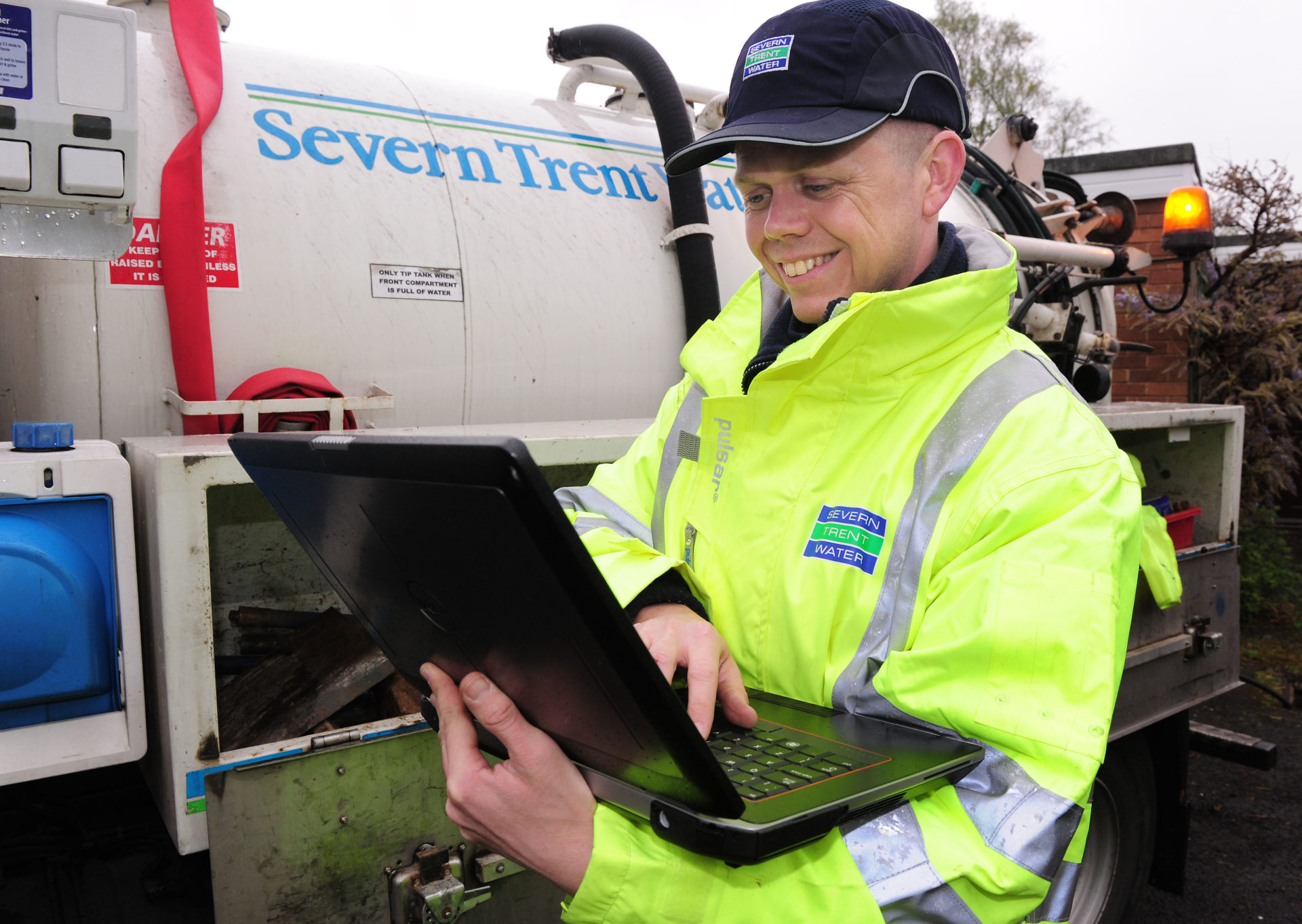
Severn Trent Water: Training
Cost-effective and convenient on-site training has helped employees undertake their job functions and helped discover new ways of working.
After taking the decision to upgrade a critical asset management system, Severn Trent Water asked Esri UK to train 30 employees in the use of this new GIS-based application. Esri UK delivered a bespoke, on-site course that boosted user competence and will help improve data accuracy.
The Customer
Severn Trent Water is one of the largest utility companies in the UK, delivering fresh water and providing sewerage services. It serves over eight million customers from the Bristol Channel to the Humber and from mid-Wales to the East Midlands.
Employees learned how to use the new GIS to undertake their job functions and discovered improved, ‘best practice’ ways of working
The thorough training has minimised potential for human error and consequently deliver the highest quality asset records
Esri UK’s cost-effective and convenient training was delivered on-site for 30 employees
The Challenge
Severn Trent Water first deployed geographic information system (GIS) technology 12 years ago to help it manage its water mains and sewer records. Over time, it gradually extended its use of GIS throughout its organisation and used Esri’s ArcGIS software to create a corporate GIS platform, known internally as GIS in Severn Trent (GISST). Today, GISST delivers asset data, map views and geospatial analysis capabilities to over 4,500 employees and underpins almost all of the organisation’s core business processes. “We cannot operate without GIS now,” says Severn Trent Water’s GIS manager Steve Allen.
One of the organisation’s most important GIS applications is GISSTupdate. This pivotal solution is used by the business to create records of underground pipework and other assets, as well as update records whenever assets are replaced. The information captured and maintained using GISSTupdate flows throughout the entire organisation and is used by everyone from senior managers to field-based engineers. It is therefore absolutely essential for employees to be able to use GISSTupdate effectively to create highly accurate records.
In October 2011, new legislation came into effect requiring water companies to take over responsibility for private drains and sewers across the UK. Severn Trent Water anticipated that its network of assets could increase by a massive 68%, from 54,000 km to 91,000 km, as a direct result of this act of parliament. To help it capture data about all of these new assets, the organisation decided to upgrade its GISSTupdate application and migrate it to the latest version of Esri’s ArcGIS technology.
Given the criticality of the GISST update application to the business, Severn Trent Water wanted to make sure that its employees could use the new GIS confidently and proficiently. It therefore called upon Esri UK to deliver a bespoke programme of training for over thirty people.
We cannot operate without GIS now
Steve Allen – GIS Manager, Severn Trent Water
The Solution
There was just a three-week window for the training to take place, so the course programme and schedule had to be meticulously planned. A certified trainer from Esri UK spent several days on site, assessing the current level of competency within the team, seeing how the legacy system was used and identifying skills gaps. He then devised a bespoke training programme, covering ArcGIS Desktop 10.0 and the ArcFM extension. The course materials were also tailored specifically for Severn Trent Water and included screen shots from both the legacy GISSTupdate application and the new one to aid understanding.
In total, over 30 employees received training in how to use the new solution. The courses were tailored to meet the needs of different people within the team, who ranged from new employees and temporary staff to highly experienced ‘power-users’. Some employees received two days of training, while others received up to four days of training, depending on their ability level and job requirements.
The training was delivered onsite, at Severn Trent Water’s offices, and incorporated lots of exercises, which gave users the opportunity to test their understanding and practice their skills. These exercises, as well as examples used in the training, were all based on Severn Trent Water’s own business data, which made them much more meaningful for the attendees.
The training has helped us to find and reinforce best practice ways of working
Steve Allen – GIS Manager, Severn Trent Water
The Benefits
Esri UK delivered the training on schedule, within the three week migration period stipulated by the business. When the new GISSTupdate application went live, all employees in the team were able to perform their tasks competently. “The training has helped us to find and reinforce best practice ways of working,” Allen says. “Esri UK helped employees to understand why they needed to do activities in a certain way and how the software works.”
The company’s investment in thorough training will help to minimise human errors and ensure that asset records are created and updated accurately. “Data quality is very important in our business,” explains Allen. “We need accurate records not just to show us where our assets are, but also to support all our business planning activities and investment decisions. Having accurate asset information helps us develop our business and deliver a reliable and good service for our customers.”
The training provided by Esri UK was very cost effective for Severn Trent Water, because it enabled the company to provide highly relevant, customised training for less than the cost of sending 30 employees on standard courses. The company also saved money by eliminating the need to reimburse employees’ travel and accommodation expenses.
Allen believes that Severn Trent Water gained added value for money from the high quality, bespoke GISSTupdate training materials developed by Esri UK. “We can use these resources ourselves in house, to train new employees in the future,” he says.

Sellafield Ltd
From a small capital investment in Esri GIS solutions, we anticipate making multi-million pound savings over the course of the project.
At the world’s most complex nuclear facility, the strategic planning team uses Esri’s ArcGIS platform to help plan and manage hundreds of simultaneous decommissioning projects that will take 110 years to complete. ArcGIS is contributing to multi-million pound cost savings, while helping Sellafield to reduce risk.
The Customer
Sellafield Ltd is the company responsible for safely decommissioning the Sellafield site on behalf of the Nuclear Decommissioning Authority. Located in West Cumbria, Sellafield is the world’s most complex nuclear facility and has been at the centre of Britain’s civil nuclear history ever since its beginnings in the 1940s.
Sellafield is minimising costs across all project phases by using ArcGIS to improve forward planning and site management
ArcGIS is used to plot the locations of hazards and improve site safety by relocating employees away from potential danger
ArcGIS helps to minimise the risks of delays and budget overruns in a project with an anticipated duration of more than one hundred years
The Challenge
The Strategic Planning team at Sellafield Ltd makes decisions that shape the evolution of the site. It selects the location of buildings and facilities, plans the timing of construction and demolition and organises the routing of transport and facilities. In order to safely decommission hundreds of nuclear plants, hazardous storage facilities and buildings, as well as vast stretches of contaminated land; the team needs to arrange the construction of new transportation and utility networks and over 300 new buildings over the remaining lifetime of the site.
To do all this on a congested 2.5 km2 site containing 1400 buildings, 55 km of transport infrastructure and 330 km of pipes is difficult enough; but add to that the safety issues associated with 200 nuclear facilities, the logistical challenges presented by 70 separate business units and a planning horizon of 110 years – then the huge magnitude of the undertaking becomes apparent.
Without a coordinated view of the site, Sellafield Ltd realised that it might not be able to manage and develop its facilities in the most time and cost efficient way. The Strategic Planning team was concerned that buildings and utilities might be constructed to suit one purpose, without taking into account the needs of adjacent and subsequent developments. This in turn might lead to protracted projects, delays and unnecessary costs.
From a very small capital investment in Esri GIS solutions, we anticipate making multi-million pound savings over the course of the project
Computer Aided Engineering (CAE) Capability Leader – Sellafield Ltd
The Solution
The Strategic Planning team at Sellafield Ltd decided to address the challenges by consolidating information from many sources into a single planning system. They acquired Esri’s ArcGIS Desktop solution and the Tracking Analyst extension enabling them to analyse information relative to time and location.
The Geographic Information System (GIS) solution gives the Strategic Planning team the ability to visualise the entire Sellafield site at different stages in the project, monitor the progress of each decommissioning programme, plot the locations of proposed developments, maintain assets and view animated timelines. The team can represent existing and planned buildings on the site at different points in time and plan site usage many years into the future. The system enables planners to take into account concurrent and adjacent activities, previous land use, potential contaminations, site congestion, the proximity of dependent facilities, the cost of transporting materials, the utility infrastructure and other planned developments.
We would find it difficult now to manage a project of this scale and duration without ArcGIS
Computer Aided Engineering (CAE) Capability Leader – Sellafield Ltd
Benefits
ArcGIS is helping Sellafield Ltd to minimise costs across all project phases. In the design and development stage, the solution helps managers to reduce site location time from many weeks to a few days. Managers have visibility of multiple projects (which can be both concurrent and consecutive) across the site. Managers can group projects together to make more cost effective use of contractors, land and utility resources. They can also plan more strategically and select sites that are close to existing rail and pipe networks to reduce both construction and on-going operating costs.
“The cost of construction is only around 10-25% of the total lifetime cost of the building,” says the CAE Leader. “A large proportion of the rest of the cost stems from transportation and the cost of providing utilities. Therefore, if we can locate a building close to other dependent facilities or combine requirements, we can reduce the whole lifetime cost by up to 10%.”
ArcGIS delivers accurate, up-to-date information about the entire site, over the entire duration of the project. “ArcGIS enables us to understand the future better,” says the CAE Leader. “We can look forwards and see when one project is in a critical phase and plan neighbouring and dependent projects around that, so that they don’t interfere with each other. Once you use ArcGIS to display the sequence of plants and their activities, you can see disconnects in logic and coordinate the timing of multiple projects much more effectively to reduce risk.”
Two of the potential risks faced by Sellafield Ltd are that: a) the project will exceed near term and long term budgets; and b) the project will overrun its near term and long term deadlines. The organisation anticipates that its use of ArcGIS minimises these risks, by helping it to keep its massive 110-year project on schedule and on budget.
Some areas of the Sellafield site are contaminated and there are also a wide range of other safety hazards. Sellafield has been able to use ArcGIS to plot hazard locations and show their proximity to people at work. The CAE Leader explains: “There are a small number of people who need to work near the hazards, but there are many others who don’t. Because we now have a better spatial awareness of where the hazards are and where our people are, it is easy for us to make decisions about relocating them.”
Sellafield Ltd has fifteen directorates and over seventy operational units. ArcGIS provides Sellafield Ltd with a central source of data and tools that facilitate closer collaboration between these groups. “ArcGIS is enabling us to improve planning efficiency and coordinate the activities of over seventy business units more effectively,” says the CAE Leader. “It is helping us to achieve a much more collaborative way of working. We would find it difficult now to manage a project of this scale and duration without ArcGIS.”
Severn Trent Water: Utilities
Updates made by mobile engineers are immediately visible to 4,500 employees resulting in faster resolution of service issues and less disruption for the public.
Severn Trent Water is systematically improving the quality of its asset data using a mobile GIS solution from Esri UK. With more complete and accurate records, it can deliver better customer services, optimise its business performance and operate more efficiently.
Updates made in the field by mobile engineers are immediately visible to all the company’s 4,500 employees
Less duplication of tasks and more consistent, reliable data improves internal efficiency
Improved data leads to better decision making, faster resolution of service issues and less disruption for the public
The Challenge
In the water industry, effective asset management is a critical business priority. The industry regulator Ofwat monitors service performance very closely, and there is a direct correlation between asset failures and service failures which, inevitably, lead to poor customer satisfaction. It is therefore absolutely imperative for water utilities to have accurate, complete asset data, so that they can repair asset defects quickly, as well as invest wisely in asset replacement programmes to reduce the risk and frequency of service issues.
Severn Trent Water was determined to enhance the quality of its asset data and took the decision to completely transform its approach to data collection and verification. The company had previously digitised its records of underground water mains and sewers, back in 2000. However, for decades beforehand, it had relied on paper-based asset maps updated by hand. “As our original paper-based records weren’t that precise, many of our digital records didn’t have the accuracy and completeness that we needed” explains Steve Allen, GIS manager at Severn Trent Water.
In 2011, following the introduction of the Private Drains and Sewers Act, Severn Trent Water took on responsibility for an additional 37,000 km of underground pipes, giving it a water mains and sewerage network long enough to stretch around the globe three times. Most of these ‘transferred assets’ were either poorly recorded or not mapped at all, so it became even more imperative for the company to implement an effective approach to improving the quality of its asset data.
Our new GISSTmobile app now makes it really simple for our mobile engineers to confirm records when they are right, correct records if they are wrong and collect records if they are missing
Steve Allen – GIS Manager, Severn Trent Water
The Solution
For many years, Severn Trent Water has used geographic information system (GIS) technology from Esri UK as the basis of its corporate GIS platform, known internally as GISST (GIS in Severn Trent). The company decided to use Esri’s ArcGIS Mobile technology to give its 1,000 mobile engineers the ability to confirm, correct and collect asset data in the field for the first time.
The new solution, GISSTmobile, was introduced as part of a ‘Stop the Rot’ campaign that explained the vital importance of data accuracy to employees. “Our new GISSTmobile app now makes it really simple for our mobile engineers to confirm records when they are right, correct records if they are wrong and collect records if they are missing,” explains Allen. “In the past, even if our mobile engineers knew that our central asset records were wrong it wasn’t easy for them to make corrections in the field.”
When engineers use GISSTmobile to verify existing records or make small asset amendments, these ‘black-line’ changes are directly transferred into the company’s central asset register without any manual intervention if they pass some pre-determined quality rules. In other cases, such as when new assets are listed, ‘red-line’ changes are marked in the field and then checked by a centralised team. All updates made by mobile engineers – both proposed and accepted – are immediately visible to all the company’s 4,500 employees.
Having better data is contributing to Severn Trent Water’s household customers continuing to receive the lowest average combined water and sewerage bills in England and Wales
Steve Allen – GIS Manager, Severn Trent Water
The Benefits
Severn Trent Water is being rewarded for its commitment to data quality with a number of different business benefits including:
Strong business performance
With improved information about the locations and condition of its assets, Severn Trent Water can make better decisions about where and when to invest in upgrades, to balance customer expectations, regulatory requirements, CAPEX and OPEX. “Having better data is contributing to Severn Trent Water’s household customers continuing to receive the lowest average combined water and sewerage bills in England and Wales,” says Allen. “In 2017, companies will be able to compete to supply water services to non-household customers for the first time, and our improved asset data puts us in a strong position to capitalise on this opportunity.”
Better customer service
Having more complete and trustworthy asset data enables Severn Trent Water to respond more quickly to unexpected issues, such as burst pipes and sewer blockages, and provide a high standard of service for its customer base of 7.7 million people. The organisation is better able to deliver quality drinking water, prevent sewer floods and achieve the Outcome Delivery Incentives (ODIs) set by OFWAT to deliver on customer expectations.
Avoidance of unnecessary costs
Severn Trent Water can now rely on its asset data to help avoid the costs associated with unnecessary excavations, by digging holes in the correct location, the first time.. By using its data to make more informed strategic decisions about asset replacements, the company can also prevent potential asset failures from occurring and avoid the added cost and inconvenience of emergency repairs.
Improved internal efficiency
Finally, Severn Trent Water has improved its operational efficiency, as asset updates are no longer ‘double-handled’. 12,000 updates a month are made directly into the database with no intervention. Allen adds, “Employees right across the business can work more productively, as they are all looking at the same ‘Common Operational Picture’ and can have complete confidence in the accuracy of this data.”